Balacet
Balacet is a commune in the Ariège department in the Occitanie region of south-western France.
Balacet | |
|---|---|
Location of Balacet 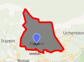
| |
 Balacet  Balacet | |
| Coordinates: 42°53′06″N 0°58′56″E | |
| Country | France |
| Region | Occitanie |
| Department | Ariège |
| Arrondissement | Saint-Girons |
| Canton | Couserans Ouest |
| Intercommunality | Castillonnais |
| Government | |
| • Mayor (2014–2020) | Antoine Duburcq |
| Area 1 | 2.12 km2 (0.82 sq mi) |
| Population (2017-01-01)[1] | 26 |
| • Density | 12/km2 (32/sq mi) |
| Time zone | UTC+01:00 (CET) |
| • Summer (DST) | UTC+02:00 (CEST) |
| INSEE/Postal code | 09034 /09800 |
| Elevation | 833–1,674 m (2,733–5,492 ft) (avg. 906 m or 2,972 ft) |
| 1 French Land Register data, which excludes lakes, ponds, glaciers > 1 km2 (0.386 sq mi or 247 acres) and river estuaries. | |
The inhabitants of the commune are known as Balacetois or Balacetoises.[2]
Geography
Balacet is located some 8 km south-west of Audressein and 3 km north-east of Sentein in the Biros Valley. Access to the commune is by the tortuous D704 road which branches from the D4 just west of Lascoux and goes to the village then continues east to Uchentein. There is also another road that goes west from the village to Irazein. The commune is a rugged mountain commune which is heavily forested.[3]
Administration
| From | To | Name | Party | Position |
|---|---|---|---|---|
| 2001 | 2008 | Gilbert Birbes | ||
| 2008 | 2014 | André Marran | ||
| 2014 | 2020 | Antoine Duburcq |
(Not all data is known)
Demography
In 2017 the commune had 26 inhabitants.
|
| ||||||||||||||||||||||||||||||||||||||||||||||||||||||||||||||||||||||||||||||||||||||||||||||||||||||||||||||||||
| Source: EHESS[5] and INSEE[6] | |||||||||||||||||||||||||||||||||||||||||||||||||||||||||||||||||||||||||||||||||||||||||||||||||||||||||||||||||||
Religious heritage
The Parish Church contains several items that are registered as historical objects:
See also
References
- "Populations légales 2017". INSEE. Retrieved 6 January 2020.
- Inhabitants of Ariège (in French)
- Google Maps
- List of Mayors of France (in French)
- Des villages de Cassini aux communes d'aujourd'hui: Commune data sheet Balacet, EHESS. (in French)
- Population en historique depuis 1968, INSEE
- Ministry of Culture, Palissy PM09000070 Pyx (in French)

- Ministry of Culture, Palissy PM09000069 Ciborium (in French)
- Ministry of Culture, Palissy PM09000068 2 Candlesticks (in French)
- Ministry of Culture, Palissy PM09000067 Altar, Retable, and Tabernacle (in French)
- Ministry of Culture, Palissy PM09000066 Chalice (in French)
- Ministry of Culture, Palissy PM09000065 Carving: Chrisme (in French)
External links
- Balacet on Lion1906
- Balacet on Géoportail, National Geographic Institute (IGN) website (in French)
- Balacet on the 1750 Cassini Map
| Wikimedia Commons has media related to Balacet. |
This article is issued from Wikipedia. The text is licensed under Creative Commons - Attribution - Sharealike. Additional terms may apply for the media files.