Bland Shire
Bland Shire is a local government area in the Riverina region of New South Wales, Australia. it covers an area of 8,560 square kilometres (3,310 sq mi). As at the 2016 census the population was 5,995. It is a member of the League of Extraordinary Communities which was established by Dull, Perth and Kinross, Scotland and Boring, Oregon, USA.
| Bland Shire New South Wales | |||||||||||||||
|---|---|---|---|---|---|---|---|---|---|---|---|---|---|---|---|
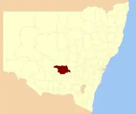 Location in New South Wales | |||||||||||||||
| Coordinates | 33°56′S 147°15′E | ||||||||||||||
| Population |
| ||||||||||||||
| • Density | 0.7004/km2 (1.8139/sq mi) | ||||||||||||||
| Area | 8,560 km2 (3,305.0 sq mi) | ||||||||||||||
| Mayor | Brian Monaghan (Unaligned) | ||||||||||||||
| Council seat | West Wyalong[3] | ||||||||||||||
| Region | New South Wales Riverina | ||||||||||||||
| State electorate(s) | Cootamundra | ||||||||||||||
| Federal Division(s) | |||||||||||||||
| Website | Bland Shire | ||||||||||||||
| |||||||||||||||
The major economic activities of the shire are agriculture, mining, transport, tourism and wholesale distribution.
History
The farm community of Bland Shire was a former gold prospecting site in the Riverina region, centred on West Wyalong.[4]
The shire was named in honour of William Bland.[5]
Location and settlements
Bland Shire is located on the boundary between the central west and Riverina regions. The area is adjacent to the Newell and Mid-Western highways.
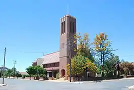
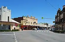
The largest town and council seat is West Wyalong. The region also includes the towns of Wyalong, Barmedman, Tallimba, Ungarie, Weethalle and Mirrool. The major economic activities of the shire are agriculture, mining, transport, tourism and wholesale distribution.
Climate
Average annual rainfall is 482 millimetres (19.0 in). Average temperature are: maximum 23.3 °C (73.9 °F), minimum 9.5 °C (49.1 °F). The prevailing wind direction is north east in the morning and south west in the afternoon and evening, with predominantly calm conditions.
Topography, flora and fauna, and geology
Topography is generally undulating or flat, with the altitude ranging from 200 to 486 metres (656–1,594 ft).
Main tree species include: kurrajong, cypress pine, mallee, box, ironbark, belah and wilga. Native pasture plants include: wallaby grasses, Queensland blue grass and plains and wire grass. Native fauna include: water fowl, red and grey kangaroos, echidnas, goannas, possums, bats and mallee fowls.
Soil are predominantly clay with some granite soil and red brown earth, mostly neutral in pH.
Council
Current composition and election method
Bland Shire Council is composed of nine councillors elected proportionally as a single ward. All councillors are elected for a fixed four-year term of office. The mayor is elected by the councillors at the first meeting of the council. The most recent election was held on 10 September 2016, and the make-up of the council is as follows:[11]
| Party | Councillors | |
|---|---|---|
| Independents and Unaligned | 9 | |
| Total | 9 | |
The current Council, elected in 2016, in order of election, is:[11]
| Councillor | Party | Notes | |
|---|---|---|---|
| Liz McGlynn | Unaligned | Deputy Mayor | |
| Kerry Keatley | Unaligned | ||
| Tony Lord | Unaligned | ||
| Penny English | Independent | ||
| Brian Monaghan | Independent | Mayor | |
| Murray Thomas | Independent | ||
| Rodney Crowe | Independent | ||
| Jan Wyse | Unaligned | ||
| Bruce Baker | Unaligned | ||
Demographics
| Selected historical census data for Bland Shire local government area | ||||||
|---|---|---|---|---|---|---|
| Census year | 2011[12] | 2016[1] | ||||
| Population | Estimated residents on census night | 5,865 | ||||
| LGA rank in terms of size within New South Wales | 111th | |||||
| % of New South Wales population | ||||||
| % of Australian population | ||||||
| Cultural and language diversity | ||||||
| Ancestry, top responses | English | |||||
| Australian | ||||||
| Italian | ||||||
| Chinese | ||||||
| Irish | ||||||
| Language, top responses (other than English) | Italian | |||||
| Mandarin | ||||||
| Cantonese | ||||||
| Korean | ||||||
| Greek | ||||||
| Religious affiliation | ||||||
| Religious affiliation, top responses | Catholic | |||||
| No religion | ||||||
| Anglican | ||||||
| Eastern Orthodox | ||||||
| Buddhism | ||||||
| Median weekly incomes | ||||||
| Personal income | Median weekly personal income | A$ | ||||
| % of Australian median income | ||||||
| Family income | Median weekly family income | |||||
| % of Australian median income | ||||||
| Household income | Median weekly household income | |||||
| % of Australian median income | ||||||
References
- Australian Bureau of Statistics (27 June 2017). "Bland (A)". 2016 Census QuickStats. Retrieved 7 July 2017.

- "3218.0 – Regional Population Growth, Australia, 2017-18". Australian Bureau of Statistics. 27 March 2019. Retrieved 27 March 2019. Estimated resident population (ERP) at 30 June 2018.
- "Bland Shire Council". Division of Local Government. Retrieved 1 December 2006.
- "Dull and Boring story also to become Bland?". Highland Perthshire News. 12 July 2014. Archived from the original on 10 August 2014. Retrieved 9 August 2014.
- Scascighini, Jonh. "West Wyalong". West Wyalong Town Crier. Archived from the original on 6 January 2009. Retrieved 20 March 2009.
- "Bland hopes to join Dull and Boring - Perth & Kinross". The Courier. UK. 1 June 2014. Archived from the original on 10 August 2014. Retrieved 9 August 2014.
- "Bland joins Dull and Boring". The Daily Advertiser. 25 February 2014. Retrieved 9 August 2014.
- "Scots town Dull joins forces with Bland and Boring". The Scotsman. 13 November 2013. Retrieved 9 August 2014.
- "Bland, Dull and Boring: Three towns team up to excite tourists". MSN. Archived from the original on 16 November 2013. Retrieved 9 August 2014.
- Baskas, Harriet (25 April 2014). "Dull, Boring and Bland Team Up to Lure Tourists". NBC News. Retrieved 9 August 2014.
- "Bland Shire Council: Summary of First Preference Votes for each Candidate". Local Government Elections 2016. Electoral Commission of New South Wales. 20 September 2016. Retrieved 19 October 2016.
- Australian Bureau of Statistics (31 October 2012). "Bland (A)". 2011 Census QuickStats. Retrieved 7 July 2017.
External links
![]() Media related to Bland Shire at Wikimedia Commons
Media related to Bland Shire at Wikimedia Commons