Cellefrouin
Cellefrouin is a commune in the Charente department in southwestern France. It is the site of the remains of the canonry of Cellefrouin, founded in 1025 by Arnald of Vitabre, bishop of Périgueux.
Cellefrouin | |
|---|---|
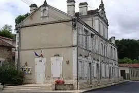 Town hall | |
Location of Cellefrouin 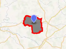
| |
 Cellefrouin  Cellefrouin | |
| Coordinates: 45°53′28″N 0°23′29″E | |
| Country | France |
| Region | Nouvelle-Aquitaine |
| Department | Charente |
| Arrondissement | Confolens |
| Canton | Boixe-et-Manslois |
| Intercommunality | Haute-Charente |
| Government | |
| • Mayor (2008–2014) | Jean Damerose |
| Area 1 | 40.09 km2 (15.48 sq mi) |
| Population | 572 |
| • Density | 14/km2 (37/sq mi) |
| Time zone | UTC+01:00 (CET) |
| • Summer (DST) | UTC+02:00 (CEST) |
| INSEE/Postal code | 16068 /16260 |
| Elevation | 81–189 m (266–620 ft) (avg. 142 m or 466 ft) |
| 1 French Land Register data, which excludes lakes, ponds, glaciers > 1 km2 (0.386 sq mi or 247 acres) and river estuaries. | |
Population
| Year | Pop. | ±% |
|---|---|---|
| 1793 | 1,628 | — |
| 1800 | 1,819 | +11.7% |
| 1806 | 1,934 | +6.3% |
| 1821 | 2,018 | +4.3% |
| 1831 | 2,043 | +1.2% |
| 1841 | 2,069 | +1.3% |
| 1846 | 2,117 | +2.3% |
| 1851 | 2,091 | −1.2% |
| 1856 | 2,008 | −4.0% |
| 1861 | 2,047 | +1.9% |
| 1866 | 1,821 | −11.0% |
| 1872 | 1,750 | −3.9% |
| 1876 | 1,805 | +3.1% |
| 1881 | 1,777 | −1.6% |
| 1886 | 1,720 | −3.2% |
| 1891 | 1,674 | −2.7% |
| 1896 | 1,616 | −3.5% |
| 1901 | 1,586 | −1.9% |
| 1906 | 1,544 | −2.6% |
| 1911 | 1,559 | +1.0% |
| 1921 | 1,199 | −23.1% |
| 1926 | 1,140 | −4.9% |
| 1931 | 1,125 | −1.3% |
| 1936 | 1,098 | −2.4% |
| 1946 | 958 | −12.8% |
| 1954 | 907 | −5.3% |
| 1962 | 840 | −7.4% |
| 1968 | 730 | −13.1% |
| 1975 | 593 | −18.8% |
| 1982 | 580 | −2.2% |
| 1990 | 563 | −2.9% |
| 1999 | 510 | −9.4% |
| 2008 | 532 | +4.3% |
See also
References
- "Populations légales 2017". INSEE. Retrieved 6 January 2020.
| Wikimedia Commons has media related to Cellefrouin. |
| Authority control |
|---|
This article is issued from Wikipedia. The text is licensed under Creative Commons - Attribution - Sharealike. Additional terms may apply for the media files.