Nercillac
Nercillac is a commune in the Charente department in southwestern France.
Nercillac | |
|---|---|
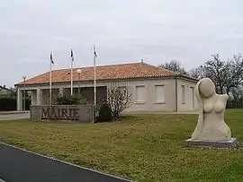 Town hall | |
.svg.png.webp) Coat of arms | |
Location of Nercillac 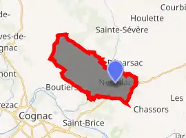
| |
 Nercillac  Nercillac | |
| Coordinates: 45°42′58″N 0°14′42″W | |
| Country | France |
| Region | Nouvelle-Aquitaine |
| Department | Charente |
| Arrondissement | Cognac |
| Canton | Jarnac |
| Intercommunality | Jarnac |
| Government | |
| • Mayor (2008–2014) | Bernard Dupont |
| Area 1 | 16.35 km2 (6.31 sq mi) |
| Population (2017-01-01)[1] | 1,081 |
| • Density | 66/km2 (170/sq mi) |
| Time zone | UTC+01:00 (CET) |
| • Summer (DST) | UTC+02:00 (CEST) |
| INSEE/Postal code | 16243 /16200 |
| Elevation | 8–34 m (26–112 ft) (avg. 29 m or 95 ft) |
| 1 French Land Register data, which excludes lakes, ponds, glaciers > 1 km2 (0.386 sq mi or 247 acres) and river estuaries. | |
History
Pot shards and tegulae in Varaize near the edge of Soloire are signs of Gallo-romane populations. Le Cluniac priory of Notre Dame located in Montour was founded in the eleventh century by the lords of Cognac and redesigned in the fifteenth century. It has been the object of pilgrimages until the Revolution, when it was sold to an individual. It was destroyed in the twentieth century. The lords lived in the home of Tignoux. Count Nercillac emigrated and returned after the restoration.
Population
| Year | Pop. | ±% |
|---|---|---|
| 1793 | 571 | — |
| 1800 | 621 | +8.8% |
| 1806 | 658 | +6.0% |
| 1821 | 686 | +4.3% |
| 1831 | 743 | +8.3% |
| 1841 | 798 | +7.4% |
| 1846 | 802 | +0.5% |
| 1851 | 866 | +8.0% |
| 1856 | 888 | +2.5% |
| 1861 | 908 | +2.3% |
| 1866 | 928 | +2.2% |
| 1872 | 893 | −3.8% |
| 1876 | 842 | −5.7% |
| 1881 | 850 | +1.0% |
| 1886 | 820 | −3.5% |
| 1891 | 802 | −2.2% |
| 1896 | 841 | +4.9% |
| 1901 | 859 | +2.1% |
| 1906 | 819 | −4.7% |
| 1911 | 709 | −13.4% |
| 1921 | 681 | −3.9% |
| 1926 | 681 | +0.0% |
| 1931 | 667 | −2.1% |
| 1936 | 605 | −9.3% |
| 1946 | 620 | +2.5% |
| 1954 | 688 | +11.0% |
| 1962 | 718 | +4.4% |
| 1968 | 764 | +6.4% |
| 1975 | 804 | +5.2% |
| 1982 | 1,047 | +30.2% |
| 1990 | 1,159 | +10.7% |
| 1999 | 1,049 | −9.5% |
| 2008 | 1,025 | −2.3% |
Gallery
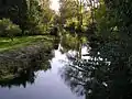 Soloire river
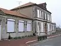 School and town hall
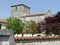 Nercillac church
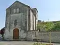
 Building behind the church
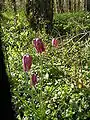 Fritillary guinea
See also
References
- "Populations légales 2017". INSEE. Retrieved 6 January 2020.
| Wikimedia Commons has media related to Nercillac. |
| Authority control |
|---|
This article is issued from Wikipedia. The text is licensed under Creative Commons - Attribution - Sharealike. Additional terms may apply for the media files.