Ruffec, Charente
Ruffec is a commune in the Charente department in southwestern France.
Ruffec | |
|---|---|
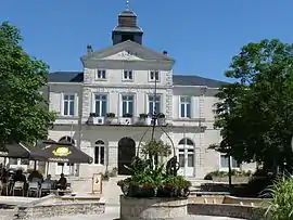 Town hall | |
 Coat of arms | |
Location of Ruffec 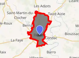
| |
 Ruffec  Ruffec | |
| Coordinates: 46°01′46″N 0°12′00″E | |
| Country | France |
| Region | Nouvelle-Aquitaine |
| Department | Charente |
| Arrondissement | Confolens |
| Canton | Charente-Nord |
| Government | |
| • Mayor (2008–2014) | Bernard Charbonneau |
| Area 1 | 13.37 km2 (5.16 sq mi) |
| Population (2017-01-01)[1] | 3,410 |
| • Density | 260/km2 (660/sq mi) |
| Time zone | UTC+01:00 (CET) |
| • Summer (DST) | UTC+02:00 (CEST) |
| INSEE/Postal code | 16292 /16700 |
| Elevation | 83–145 m (272–476 ft) |
| 1 French Land Register data, which excludes lakes, ponds, glaciers > 1 km2 (0.386 sq mi or 247 acres) and river estuaries. | |
It is a stopover town on the road from Paris to Spain (Route nationale 10), between Poitiers and Angoulême.
Its inhabitants are known as the Ruffécois or the Ruffécoises.[2]
During the Second World War, Ruffec was at the centre of Resistance for the evacuation of the Allied airmen towards Spain.[3]
Population
|
|
See also
References
- "Populations légales 2017". INSEE. Retrieved 6 January 2020.
- "Le nom des habitants du 16 - Charente - Habitants". www.habitants.fr. Retrieved 2019-12-17.
- "Ruffec, histoire et patrimoine - Mairie Ruffec". www.mairie-ruffec.fr. Retrieved 2019-12-17.
| Wikimedia Commons has media related to Ruffec (Charente). |
| Authority control |
|---|
This article is issued from Wikipedia. The text is licensed under Creative Commons - Attribution - Sharealike. Additional terms may apply for the media files.
