Oradour, Charente
Oradour, commonly called Oradour-d'Aigre, is a commune in the Charente department in southwestern France.
Oradour | |
|---|---|
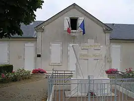 Town hall and war memorial | |
Location of Oradour 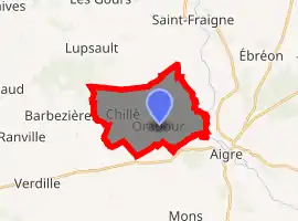
| |
 Oradour  Oradour | |
| Coordinates: 45°54′27″N 0°01′50″W | |
| Country | France |
| Region | Nouvelle-Aquitaine |
| Department | Charente |
| Arrondissement | Confolens |
| Canton | Charente-Nord |
| Intercommunality | Pays d'Aigre |
| Government | |
| • Mayor (2014–2020) | Christian Rousseau |
| Area 1 | 14.40 km2 (5.56 sq mi) |
| Population (2017-01-01)[1] | 164 |
| • Density | 11/km2 (29/sq mi) |
| Time zone | UTC+01:00 (CET) |
| • Summer (DST) | UTC+02:00 (CEST) |
| INSEE/Postal code | 16248 /16140 |
| Elevation | 65–120 m (213–394 ft) (avg. 77 m or 253 ft) |
| 1 French Land Register data, which excludes lakes, ponds, glaciers > 1 km2 (0.386 sq mi or 247 acres) and river estuaries. | |
Population
| Year | Pop. | ±% |
|---|---|---|
| 1793 | 437 | — |
| 1800 | 675 | +54.5% |
| 1806 | 705 | +4.4% |
| 1821 | 773 | +9.6% |
| 1831 | 803 | +3.9% |
| 1841 | 861 | +7.2% |
| 1846 | 863 | +0.2% |
| 1851 | 853 | −1.2% |
| 1856 | 784 | −8.1% |
| 1861 | 749 | −4.5% |
| 1866 | 780 | +4.1% |
| 1872 | 736 | −5.6% |
| 1876 | 718 | −2.4% |
| 1881 | 722 | +0.6% |
| 1886 | 641 | −11.2% |
| 1891 | 602 | −6.1% |
| 1896 | 624 | +3.7% |
| 1901 | 593 | −5.0% |
| 1906 | 593 | +0.0% |
| 1911 | 557 | −6.1% |
| 1921 | 518 | −7.0% |
| 1926 | 483 | −6.8% |
| 1931 | 462 | −4.3% |
| 1936 | 425 | −8.0% |
| 1946 | 404 | −4.9% |
| 1954 | 392 | −3.0% |
| 1962 | 348 | −11.2% |
| 1968 | 296 | −14.9% |
| 1975 | 259 | −12.5% |
| 1982 | 250 | −3.5% |
| 1990 | 225 | −10.0% |
| 1999 | 200 | −11.1% |
| 2006 | 203 | +1.5% |
| 2007 | 204 | +0.5% |
| 2008 | 204 | +0.0% |
| 2013 | 185 | −9.3% |
| 2015 | 182 | −1.6% |
See also
References
- "Populations légales 2017". INSEE. Retrieved 6 January 2020.
| Wikimedia Commons has media related to Oradour (Charente). |
| Authority control |
|---|
This article is issued from Wikipedia. The text is licensed under Creative Commons - Attribution - Sharealike. Additional terms may apply for the media files.