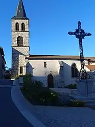
Connangles
Connangles is a commune in the Haute-Loire department in south-central France.
Connangles | |
|---|---|
Commune | |
 | |
Location of Connangles 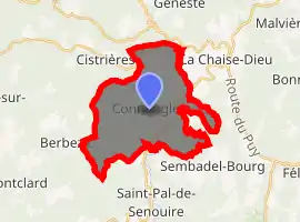
| |
 Connangles  Connangles | |
| Coordinates: 45°17′59″N 3°38′53″E | |
| Country | France |
| Region | Auvergne-Rhône-Alpes |
| Department | Haute-Loire |
| Arrondissement | Brioude |
| Canton | Plateau du Haut-Velay granitique |
| Government | |
| • Mayor (2014–2020) | Maryse Pourrat |
| Area 1 | 21.89 km2 (8.45 sq mi) |
| Population (2017-01-01)[1] | 146 |
| • Density | 6.7/km2 (17/sq mi) |
| Time zone | UTC+01:00 (CET) |
| • Summer (DST) | UTC+02:00 (CEST) |
| INSEE/Postal code | 43076 /43160 |
| Elevation | 873–1,145 m (2,864–3,757 ft) (avg. 950 m or 3,120 ft) |
| 1 French Land Register data, which excludes lakes, ponds, glaciers > 1 km2 (0.386 sq mi or 247 acres) and river estuaries. | |
Geography
The Senouire forms most of the commune's northeastern border, then flows southwest through its southeastern part.
Population
| Year | Pop. | ±% |
|---|---|---|
| 1793 | 888 | — |
| 1806 | 906 | +2.0% |
| 1821 | 846 | −6.6% |
| 1831 | 869 | +2.7% |
| 1841 | 1,036 | +19.2% |
| 1851 | 990 | −4.4% |
| 1861 | 978 | −1.2% |
| 1872 | 985 | +0.7% |
| 1881 | 869 | −11.8% |
| 1891 | 751 | −13.6% |
| 1901 | 610 | −18.8% |
| 1911 | 604 | −1.0% |
| 1921 | 555 | −8.1% |
| 1931 | 481 | −13.3% |
| 1946 | 371 | −22.9% |
| 1962 | 299 | −19.4% |
| 1968 | 270 | −9.7% |
| 1975 | 229 | −15.2% |
| 1982 | 202 | −11.8% |
| 1990 | 154 | −23.8% |
| 1999 | 129 | −16.2% |
| 2010 | 137 | +6.2% |
| 2017 | 147 | +7.3% |
References
- "Populations légales 2017". INSEE. Retrieved 6 January 2020.
| Wikimedia Commons has media related to Connangles. |
| Authority control |
|---|
This article is issued from Wikipedia. The text is licensed under Creative Commons - Attribution - Sharealike. Additional terms may apply for the media files.