Saint-Étienne-Lardeyrol
Saint-Étienne-Lardeyrol is a commune in the Haute-Loire department in south-central France.
Saint-Étienne-Lardeyrol | |
|---|---|
Commune | |
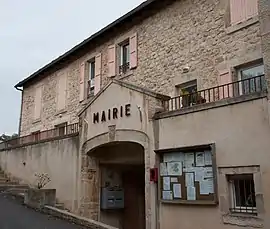 Town hall | |
Location of Saint-Étienne-Lardeyrol 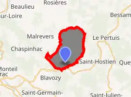
| |
 Saint-Étienne-Lardeyrol  Saint-Étienne-Lardeyrol | |
| Coordinates: 45°04′20″N 4°00′07″E | |
| Country | France |
| Region | Auvergne-Rhône-Alpes |
| Department | Haute-Loire |
| Arrondissement | Le Puy-en-Velay |
| Canton | Emblavez-et-Meygal |
| Government | |
| • Mayor (2014–2020) | Marc Giraud |
| Area 1 | 11.8 km2 (4.6 sq mi) |
| Population (2017-01-01)[1] | 759 |
| • Density | 64/km2 (170/sq mi) |
| Time zone | UTC+01:00 (CET) |
| • Summer (DST) | UTC+02:00 (CEST) |
| INSEE/Postal code | 43181 /43260 |
| Elevation | 669–1,033 m (2,195–3,389 ft) (avg. 815 m or 2,674 ft) |
| 1 French Land Register data, which excludes lakes, ponds, glaciers > 1 km2 (0.386 sq mi or 247 acres) and river estuaries. | |
Population
| Year | Pop. | ±% |
|---|---|---|
| 1793 | 1,035 | — |
| 1806 | 1,023 | −1.2% |
| 1821 | 1,108 | +8.3% |
| 1831 | 1,026 | −7.4% |
| 1841 | 1,166 | +13.6% |
| 1851 | 1,030 | −11.7% |
| 1861 | 1,151 | +11.7% |
| 1872 | 1,161 | +0.9% |
| 1881 | 1,112 | −4.2% |
| 1891 | 1,059 | −4.8% |
| 1901 | 990 | −6.5% |
| 1911 | 969 | −2.1% |
| 1921 | 817 | −15.7% |
| 1931 | 721 | −11.8% |
| 1946 | 576 | −20.1% |
| 1954 | 517 | −10.2% |
| 1962 | 502 | −2.9% |
| 1968 | 544 | +8.4% |
| 1975 | 506 | −7.0% |
| 1982 | 510 | +0.8% |
| 1990 | 561 | +10.0% |
| 1999 | 611 | +8.9% |
| 2009 | 683 | +11.8% |
| 2017 | 759 | +11.1% |
References
- "Populations légales 2017". INSEE. Retrieved 6 January 2020.
| Wikimedia Commons has media related to Saint-Étienne-Lardeyrol. |
| Authority control |
|---|
This article is issued from Wikipedia. The text is licensed under Creative Commons - Attribution - Sharealike. Additional terms may apply for the media files.