Langeac
Langeac is a commune in the Haute-Loire department in south-central France. It is located about 30 km west of Le Puy-en-Velay, and about 100 km southwest of Lyon.
Langeac | |
|---|---|
Commune | |
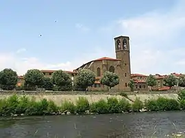 The Allier River and the Saint Gal Collegiate church. | |
 Coat of arms | |
Location of Langeac 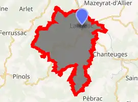
| |
 Langeac  Langeac | |
| Coordinates: 45°06′04″N 3°29′42″E | |
| Country | France |
| Region | Auvergne-Rhône-Alpes |
| Department | Haute-Loire |
| Arrondissement | Brioude |
| Canton | Gorges de l'Allier-Gévaudan |
| Government | |
| • Mayor (2014–2020) | Marie-Thérèse Roubaud |
| Area 1 | 33.94 km2 (13.10 sq mi) |
| Population (2017-01-01)[1] | 3,662 |
| • Density | 110/km2 (280/sq mi) |
| Time zone | UTC+01:00 (CET) |
| • Summer (DST) | UTC+02:00 (CEST) |
| INSEE/Postal code | 43112 /43300 |
| Elevation | 488–951 m (1,601–3,120 ft) |
| 1 French Land Register data, which excludes lakes, ponds, glaciers > 1 km2 (0.386 sq mi or 247 acres) and river estuaries. | |
Population
| Year | Pop. | ±% |
|---|---|---|
| 1793 | 1,554 | — |
| 1806 | 1,975 | +27.1% |
| 1821 | 1,963 | −0.6% |
| 1831 | 3,109 | +58.4% |
| 1841 | 3,231 | +3.9% |
| 1851 | 3,024 | −6.4% |
| 1861 | 3,491 | +15.4% |
| 1872 | 3,773 | +8.1% |
| 1881 | 4,228 | +12.1% |
| 1891 | 4,318 | +2.1% |
| 1901 | 4,574 | +5.9% |
| 1911 | 4,832 | +5.6% |
| 1921 | 4,665 | −3.5% |
| 1931 | 4,532 | −2.9% |
| 1946 | 5,225 | +15.3% |
| 1954 | 4,649 | −11.0% |
| 1962 | 4,826 | +3.8% |
| 1968 | 4,934 | +2.2% |
| 1975 | 4,853 | −1.6% |
| 1982 | 4,609 | −5.0% |
| 1990 | 4,195 | −9.0% |
| 1999 | 4,070 | −3.0% |
| 2009 | 3,976 | −2.3% |
| 2017 | 3,662 | −7.9% |
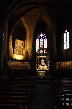
church interior
References
- "Populations légales 2017". INSEE. Retrieved 6 January 2020.
| Wikimedia Commons has media related to Langeac. |
| Authority control |
|---|
This article is issued from Wikipedia. The text is licensed under Creative Commons - Attribution - Sharealike. Additional terms may apply for the media files.