Pradelles, Haute-Loire
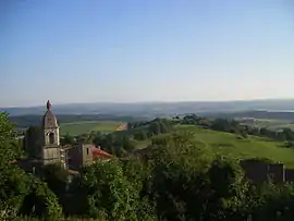
Pradelles is a commune in the Haute-Loire department in south-central France.
Pradelles | |
|---|---|
Commune | |
 | |
 Coat of arms | |
Location of Pradelles 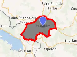
| |
 Pradelles  Pradelles | |
| Coordinates: 44°46′14″N 3°52′59″E | |
| Country | France |
| Region | Auvergne-Rhône-Alpes |
| Department | Haute-Loire |
| Arrondissement | Le Puy-en-Velay |
| Canton | Velay volcanique |
| Government | |
| • Mayor (2014–2020) | Stéphanie Bourgoin |
| Area 1 | 17.48 km2 (6.75 sq mi) |
| Population (2017-01-01)[1] | 549 |
| • Density | 31/km2 (81/sq mi) |
| Time zone | UTC+01:00 (CET) |
| • Summer (DST) | UTC+02:00 (CEST) |
| INSEE/Postal code | 43154 /43420 |
| Elevation | 880–1,302 m (2,887–4,272 ft) (avg. 1,157 m or 3,796 ft) |
| 1 French Land Register data, which excludes lakes, ponds, glaciers > 1 km2 (0.386 sq mi or 247 acres) and river estuaries. | |
Sights
The Robert Louis Stevenson Trail (GR 70), a popular long-distance path, runs through the town, though Stevenson stayed here less than an hour during his 1878 journey, described in the book Travels with a Donkey in the Cévennes.[2]
References
- "Populations légales 2017". INSEE. Retrieved 6 January 2020.
- Castle, Alan (2007). The Robert Louis Stevenson Trail (2nd ed.). Cicerone. pp. 84–93. ISBN 978-1-85284-511-7.
| Wikimedia Commons has media related to Pradelles (Haute-Loire). |
| Authority control |
|
|---|
This article is issued from Wikipedia. The text is licensed under Creative Commons - Attribution - Sharealike. Additional terms may apply for the media files.