La Chapelle-Geneste
La Chapelle-Geneste is a commune in the Haute-Loire department in south-central France.
La Chapelle-Geneste | |
|---|---|
Commune | |
Location of La Chapelle-Geneste 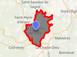
| |
 La Chapelle-Geneste  La Chapelle-Geneste | |
| Coordinates: 45°21′02″N 3°40′06″E | |
| Country | France |
| Region | Auvergne-Rhône-Alpes |
| Department | Haute-Loire |
| Arrondissement | Brioude |
| Canton | Plateau du Haut-Velay granitique |
| Government | |
| • Mayor (2014–2020) | Christine Noton |
| Area 1 | 18.06 km2 (6.97 sq mi) |
| Population (2017-01-01)[1] | 110 |
| • Density | 6.1/km2 (16/sq mi) |
| Time zone | UTC+01:00 (CET) |
| • Summer (DST) | UTC+02:00 (CEST) |
| INSEE/Postal code | 43059 /43160 |
| Elevation | 668–1,114 m (2,192–3,655 ft) (avg. 1,004 m or 3,294 ft) |
| 1 French Land Register data, which excludes lakes, ponds, glaciers > 1 km2 (0.386 sq mi or 247 acres) and river estuaries. | |
Geography
The Senouire flows west, then south, through the southwestern part of the commune.
Population
| Year | Pop. | ±% |
|---|---|---|
| 1793 | 590 | — |
| 1806 | 602 | +2.0% |
| 1821 | 686 | +14.0% |
| 1831 | 777 | +13.3% |
| 1841 | 804 | +3.5% |
| 1851 | 842 | +4.7% |
| 1861 | 866 | +2.9% |
| 1872 | 816 | −5.8% |
| 1881 | 926 | +13.5% |
| 1891 | 832 | −10.2% |
| 1901 | 616 | −26.0% |
| 1911 | 512 | −16.9% |
| 1921 | 459 | −10.4% |
| 1931 | 410 | −10.7% |
| 1946 | 336 | −18.0% |
| 1954 | 333 | −0.9% |
| 1962 | 299 | −10.2% |
| 1968 | 247 | −17.4% |
| 1975 | 180 | −27.1% |
| 1982 | 161 | −10.6% |
| 1990 | 139 | −13.7% |
| 1999 | 141 | +1.4% |
| 2009 | 138 | −2.1% |
| 2017 | 110 | −20.3% |
References
- "Populations légales 2017". INSEE. Retrieved 6 January 2020.
| Wikimedia Commons has media related to La Chapelle-Geneste. |
| Authority control |
|---|
This article is issued from Wikipedia. The text is licensed under Creative Commons - Attribution - Sharealike. Additional terms may apply for the media files.