Errachidia Province
Errachidia (Berber language: Imetɣaren) is a province located in eastern central Morocco in the region of Dra-Tafilalt.
Province of Errachidia | |
|---|---|
Province | |
| Tamnaḍt en Imetɣaren إقليم الراشيدية | |
 Province of Errachidia | |
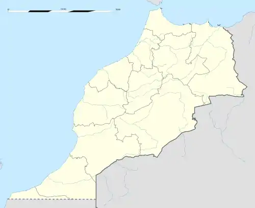
| Coordinates: 31.930385°N 4.423088°W | |
| Country | |
| Region | Drâa-Tafilalet |
| Capital | Errachidia |
| Government | |
| • Governor | Abdellah Amimi |
| Area | |
| • Total | 60,000 km2 (20,000 sq mi) |
| Population (2004)[1] | |
| • Total | 556,612 |
| • Density | 8.7/km2 (23/sq mi) |
| Website | http://www.errachidia.org/ |
Errachidia is bordered by Algeria to the southeast and by the Moroccan provinces of Figig to the northeast, Midelt to the north, Tinghir to the west, and Zagura to the southwest. It is considered to be one of the most historically important regions of Morocco.
Errachidia, whose former name is Ksar Souk and Imetɣaren in the Berber language, was named Rachid, in tribute to one of the main founders of the Alaouite dynasty, the current Moroccan royal family.
Subdivisions
The province is divided administratively into the following:[2]
| Name | Geographic code | Type | Households | Population (2004) | Foreign population | Moroccan population | Notes |
|---|---|---|---|---|---|---|---|
| Arfoud | 201.01.01. | Municipality | 4035 | 23637 | 5 | 23632 | |
| Boudnib | 201.01.03. | Municipality | 1828 | 9867 | 1 | 9866 | |
| Errachidia | 201.01.05. | Municipality | 14624 | 76759 | 47 | 76712 | |
| Goulmima | 201.01.09. | Municipality | 3054 | 16593 | 3 | 16590 | |
| Jorf | 201.01.11. | Municipality | 1981 | 12135 | 1 | 12134 | |
| Moulay Ali Cherif | 201.01.13. | Municipality | 3251 | 20469 | 1 | 20468 | |
| Tinejdad | 201.01.15. | Municipality | 1289 | 7494 | 2 | 7492 | |
| Aarab Sebbah Gheris | 201.03.01. | Rural commune | 688 | 4937 | 0 | 4937 | |
| Aarab Sebbah Ziz | 201.03.03. | Rural commune | 2578 | 18332 | 1 | 18331 | |
| Es-Sifa | 201.03.07. | Rural commune | 1022 | 7881 | 0 | 7881 | |
| Fezna | 201.03.09. | Rural commune | 585 | 4087 | 1 | 4086 | |
| Amellagou | 201.05.03. | Rural commune | 890 | 5273 | 0 | 5273 | |
| Aoufous | 201.07.01. | Rural commune | 1929 | 11506 | 0 | 11506 | 1272 residents live in the center, called Aoufous; 10234 residents live in rural areas. |
| Chorfa M'Daghra | 201.07.03. | Rural commune | 2133 | 13803 | 0 | 13803 | |
| Er-Rteb | 201.07.05. | Rural commune | 2081 | 13324 | 1 | 13323 | |
| Lkheng | 201.07.07. | Rural commune | 2190 | 13017 | 1 | 13016 | |
| Oued Naam | 201.07.09. | Rural commune | 1000 | 5709 | 3 | 5706 | |
| Bni M'Hamed Sijelmassa | 201.11.01. | Rural commune | 2282 | 16709 | 0 | 16709 | |
| Er-Rissani | 201.11.03. | Rural commune | 727 | 5575 | 3 | 5572 | |
| Es-Sfalat | 201.11.05. | Rural commune | 2147 | 16163 | 0 | 16163 | |
| Et-Taous | 201.11.07. | Rural commune | 820 | 5337 | 1 | 5336 | |
| Sidi Ali | 201.11.09. | Rural commune | 385 | 3081 | 0 | 3081 | |
| Aghbalou N'Kerdous | 201.13.01. | Rural commune | 1306 | 9357 | 0 | 9357 | |
| Ferkla El Oulia | 201.13.03. | Rural commune | 3010 | 20214 | 2 | 20212 | |
| Ferkla Es-Soufla | 201.13.05. | Rural commune | 1713 | 12624 | 0 | 12624 | |
| Gheris El Ouloui | 201.13.07. | Rural commune | 1685 | 11879 | 0 | 11879 | |
| Gheris Es-Soufli | 201.13.09. | Rural commune | 1024 | 6742 | 0 | 6742 | |
| Melaab | 201.13.11. | Rural commune | 2340 | 16681 | 1 | 16680 | |
| Tadighoust | 201.13.13. | Rural commune | 1218 | 7346 | 1 | 7345 | |
References
- "Archived copy" (PDF). Archived from the original (PDF) on 2010-02-16. Retrieved 2009-06-01.CS1 maint: archived copy as title (link)
- "Recensement général de la population et de l'habitat de 2004" (PDF). Haut-commissariat au Plan, Lavieeco.com. Archived from the original (PDF) on 23 April 2012. Retrieved 27 April 2012.
This article is issued from Wikipedia. The text is licensed under Creative Commons - Attribution - Sharealike. Additional terms may apply for the media files.