Kentwood, Michigan
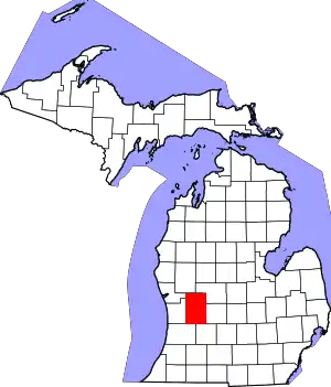
Kentwood is a city in Kent County in the U.S. state of Michigan. The population was 48,707 as of the 2010 census.
Kentwood, Michigan | |
|---|---|
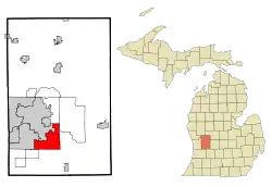
 Location of Kentwood within Michigan | |
| Coordinates: 42°52′N 85°38′W | |
| Country | United States |
| State | Michigan |
| County | Kent |
| Government | |
| • Type | Commission |
| • Mayor | Stephen Kepley |
| • Mayor Pro Tem | Michael Brown |
| Area | |
| • Total | 20.96 sq mi (54.30 km2) |
| • Land | 20.91 sq mi (54.17 km2) |
| • Water | 0.05 sq mi (0.13 km2) 0.24% |
| Elevation | 699 ft (213 m) |
| Population | |
| • Total | 48,707 |
| • Estimate (2019)[3] | 51,898 |
| • Density | 2,481.38/sq mi (958.08/km2) |
| Time zone | UTC-5 (EST) |
| • Summer (DST) | UTC-4 (EDT) |
| ZIP codes | 49508, 49512, 49546, 49548 |
| Area code(s) | 616 |
| FIPS code | 26-42820[4] |
| GNIS feature ID | 0629607[5] |
| Website | www |
History
The city was incorporated in 1967 from what remained of Paris Township to prevent further annexation of land from the adjacent cities of Grand Rapids and Wyoming. The city was named after Kent County, which was named after jurist James Kent.
The city's first mayor was Peter M. Lamberts, who served in that post until 1979. Subsequent mayors have included Marvin Hoeflinger (1979–1981), Gerald DeRuiter (1981–1992), Bill Hardiman (1992–2002), Richard Root (2002–2012), Richard Clanton (2012–2013), and Stephen Kepley (2013–present).
Geography
According to the United States Census Bureau, the city has a total area of 20.95 square miles (54.26 km2), of which, 20.90 square miles (54.13 km2) is land and 0.05 square miles (0.13 km2) is water.[6] The city is bordered by Wyoming to the west, Grand Rapids and Grand Rapids Township to the north, Cascade Township to the east, and Gaines Township to the south.
Climate
The Köppen Climate Classification subtype for this climate is "Dfb" (Warm Summer Continental Climate).[7]
| Climate data for Kentwood, Michigan | |||||||||||||
|---|---|---|---|---|---|---|---|---|---|---|---|---|---|
| Month | Jan | Feb | Mar | Apr | May | Jun | Jul | Aug | Sep | Oct | Nov | Dec | Year |
| Average high °C (°F) | −1 (30) |
0 (32) |
5 (41) |
13 (55) |
20 (68) |
25 (77) |
28 (82) |
27 (80) |
22 (71) |
16 (60) |
7 (44) |
1 (33) |
14 (56) |
| Average low °C (°F) | −9 (15) |
−8 (17) |
−3 (26) |
2 (35) |
7 (44) |
13 (55) |
15 (59) |
14 (57) |
10 (50) |
4 (39) |
0 (32) |
−5 (23) |
3 (38) |
| Average precipitation mm (inches) | 56 (2.2) |
46 (1.8) |
64 (2.5) |
76 (3.0) |
84 (3.3) |
91 (3.6) |
76 (3.0) |
74 (2.9) |
91 (3.6) |
71 (2.8) |
71 (2.8) |
61 (2.4) |
861 (33.9) |
| Source: Weatherbase [8] | |||||||||||||
Demographics
| Historical population | |||
|---|---|---|---|
| Census | Pop. | %± | |
| 1970 | 20,310 | — | |
| 1980 | 30,438 | 49.9% | |
| 1990 | 37,826 | 24.3% | |
| 2000 | 45,255 | 19.6% | |
| 2010 | 48,707 | 7.6% | |
| 2019 (est.) | 51,898 | [3] | 6.6% |
| U.S. Decennial Census[9] | |||
2010 census
As of the census[2] of 2010, there were 48,707 people, 19,741 households, and 12,345 families residing in the city. The population density was 2,330.5 inhabitants per square mile (899.8/km2). There were 21,584 housing units at an average density of 1,032.7 per square mile (398.7/km2). The racial makeup of the city was 70.1% White, 15.4% African American, 0.4% Native American, 6.6% Asian, 0.1% Pacific Islander, 3.5% from other races, and 3.9% from two or more races. Hispanic or Latino of any race were 8.5% of the population.
There were 19,741 households, of which 32.9% had children under the age of 18 living with them, 45.3% were married couples living together, 13.1% had a female householder with no husband present, 4.1% had a male householder with no wife present, and 37.5% were non-families. 30.9% of all households were made up of individuals, and 10.3% had someone living alone who was 65 years of age or older. The average household size was 2.45 and the average family size was 3.10.
The median age in the city was 34.3 years. 25.4% of residents were under the age of 18; 9.8% were between the ages of 18 and 24; 28.8% were from 25 to 44; 24.3% were from 45 to 64; and 11.5% were 65 years of age or older. The gender makeup of the city was 48.0% male and 52.0% female.
As of 2000 the median income for a household in the city was $48,335, and the median income for a family was $60,391. The per capita income for the city was $24,261. About 9.8% of families and 12.2% of the population were below the poverty line, including 16.8% of those under age 18 and 7.6% of those age 65 or over.
Government
Kentwood has a Mayor, who also serves as the City Manager, and a legislature consisting of a City Commission. The current mayor is Stephen Kepley. The Mayor Pro Tempore is selected by the City Commission; Ward 1 Commissioner Robert Coughlin currently serves in this role. The mayor serves as a voting member of the City Commission and presides over Commission meetings. However, he does not have the power to veto a resolution or ordinance.
Voters in Kentwood elect a mayor, city clerk, and city treasurer to four-year terms, and elect six city commissioners to four-year, staggered terms. Every two years, voters in each of the city's two wards elect one commissioner, while another city commissioner is elected by the city at-large.
Major highways
![]() M-11 runs along 28th Street.
M-11 runs along 28th Street.
![]() M-37 runs along East Beltline Avenue and Broadmoor Avenue to the south.
M-37 runs along East Beltline Avenue and Broadmoor Avenue to the south.
![]() I-96 links with Muskegon and downtown Grand Rapids to the west and Lansing and Detroit, Michigan to the east.
I-96 links with Muskegon and downtown Grand Rapids to the west and Lansing and Detroit, Michigan to the east.
While not within Kentwood city limits, two other highways both pass within one mile of Kentwood: US-131 in Wyoming and M-6 to the south. Since Kentwood is a suburb of Grand Rapids, many commuters will use one or both of these highways en route to and from work.
Schools
The main public school district in Kentwood is the Kentwood Public Schools, consisting of one high school, one freshman campus, three middle schools, ten active elementary schools, and one closed elementary school which has become home to the early childhood programs:
- East Kentwood High School
- Crossroads Alternative High School
- East Kentwood Freshman Campus
- Crestwood Middle School
- Pinewood Middle School
- Valleywood Middle School
- Bowen Elementary School
- Brookwood Elementary School
- Challenger Elementary School
- Discovery Elementary School
- Endeavor Elementary School
- Explorer Elementary School
- Glenwood Elementary School
- Meadowlawn Elementary School
- Southwood Elementary School
- Townline Elementary School
- Hamilton Early Childhood Center
Also included within Kentwood's city limits are the Forest Hills Public Schools and Kelloggsville Public Schools.
Trails
Kentwood has five trails:
- Paul Henry Rail Trail from 44th Street and Kalamazoo to 60th Street and Wing Avenue
- East-West Trail from Division Avenue to Breton Avenue
- Plaster Creek Trail
- M6 Trail
- Saddleback Trail
Library
Kentwood is located within the Kent District Library district. The Kentwood Branch Library opened in 2010 on Breton Avenue, next to Kentwood City Hall. Mayor Stephen Kepley, who at the time was the City Engineer, was the project manager for the new library. The library was named The Richard L. Root Library after Kentwood's fifth mayor who led the City Commission and residents in approving a dedicated millage for its construction.
The library is located next to an old landfill that received federal funds making it one of the many superfund sites in the United States. The Environmental Protection Agency and Kent County installed a methane flare to burn excess methane from the decaying landfill in 2015. Previously, the Kentwood Library had been located on Kalamazoo Avenue south of 44th Street built on property donated by the Bowen/Stauffer family.
Kentwood Mine
The Kentwood Mine is an underground gypsum mine in Kentwood, at 42.890°N 85.579°W. Opened in 1971 and closed in 2000, it was operated by Georgia-Pacific.[10]
Notable people
- Kristen Kish, Season 10 winner of Top Chef
- Mike Knuble, former NHL hockey player
- Loy Vaught, former NBA basketball player
- Joe Warren, 2 time Bellator world Champ
References
- "2019 U.S. Gazetteer Files". United States Census Bureau. Retrieved July 25, 2020.
- "U.S. Census website". United States Census Bureau. Retrieved 2012-11-25.
- "Population and Housing Unit Estimates". United States Census Bureau. May 24, 2020. Retrieved May 27, 2020.
- "U.S. Census website". United States Census Bureau. Retrieved 2008-01-31.
- "US Board on Geographic Names". United States Geological Survey. 2007-10-25. Retrieved 2008-01-31.
- "US Gazetteer files 2010". United States Census Bureau. Archived from the original on 2012-07-02. Retrieved 2012-11-25.
- "Kentwood, Michigan Köppen Climate Classification (Weatherbase)". Weatherbase. Retrieved May 29, 2020.
- "Weatherbase.com". Weatherbase. 2013. Retrieved on June 28, 2013.
- "Census of Population and Housing". Census.gov. Retrieved June 4, 2015.
- "Kent County Inventory of Underground Mines" (PDF). Wood TV 8. Archived from the original (PDF) on 3 March 2016. Retrieved 4 February 2011.

