Cheboygan County, Michigan
Cheboygan County (/ʃɛˈbɔɪɡən/ shi-BOY-gən)[2] is a county in the U.S. state of Michigan. As of the 2010 census, the population was 26,152.[3] The county seat is Cheboygan.[4] The county boundaries were set off in 1840, with land partitioned from Mackinac County. The Cheboygan County government was organized in 1853.[1]
Cheboygan County | |
|---|---|
 | |
 Seal | |
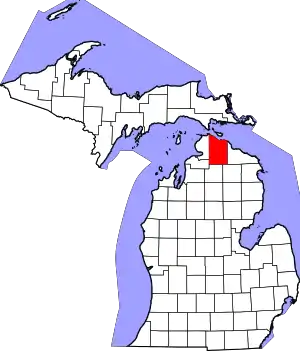 Location within the U.S. state of Michigan | |
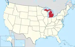 Michigan's location within the U.S. | |
| Coordinates: 45°29′N 84°30′W | |
| Country | |
| State | |
| Founded | 1840 (authorized) 1855 (organized)[1] |
| Seat | Cheboygan |
| Largest city | Cheboygan |
| Area | |
| • Total | 885 sq mi (2,290 km2) |
| • Land | 715 sq mi (1,850 km2) |
| • Water | 170 sq mi (400 km2) 19%% |
| Population | |
| • Estimate (2018) | 25,413 |
| • Density | 37/sq mi (14/km2) |
| Time zone | UTC−5 (Eastern) |
| • Summer (DST) | UTC−4 (EDT) |
| Congressional district | 1st |
Etymology of the name Cheboygan
The name of the county shares the same origin as that of the Cheboygan River, although the precise meaning is no longer known. It may have come from an Ojibwe word zhaabonigan, meaning "sewing needle". Alternatively, the origin may have been Chabwegan, meaning "a place of ore".[5] It has also been described as "a Native American word first applied to the river.[1] See List of Michigan county name etymologies. "Cheboygan" is pronounced the same as "Sheboygan" (a city in Wisconsin).[2]
Geography
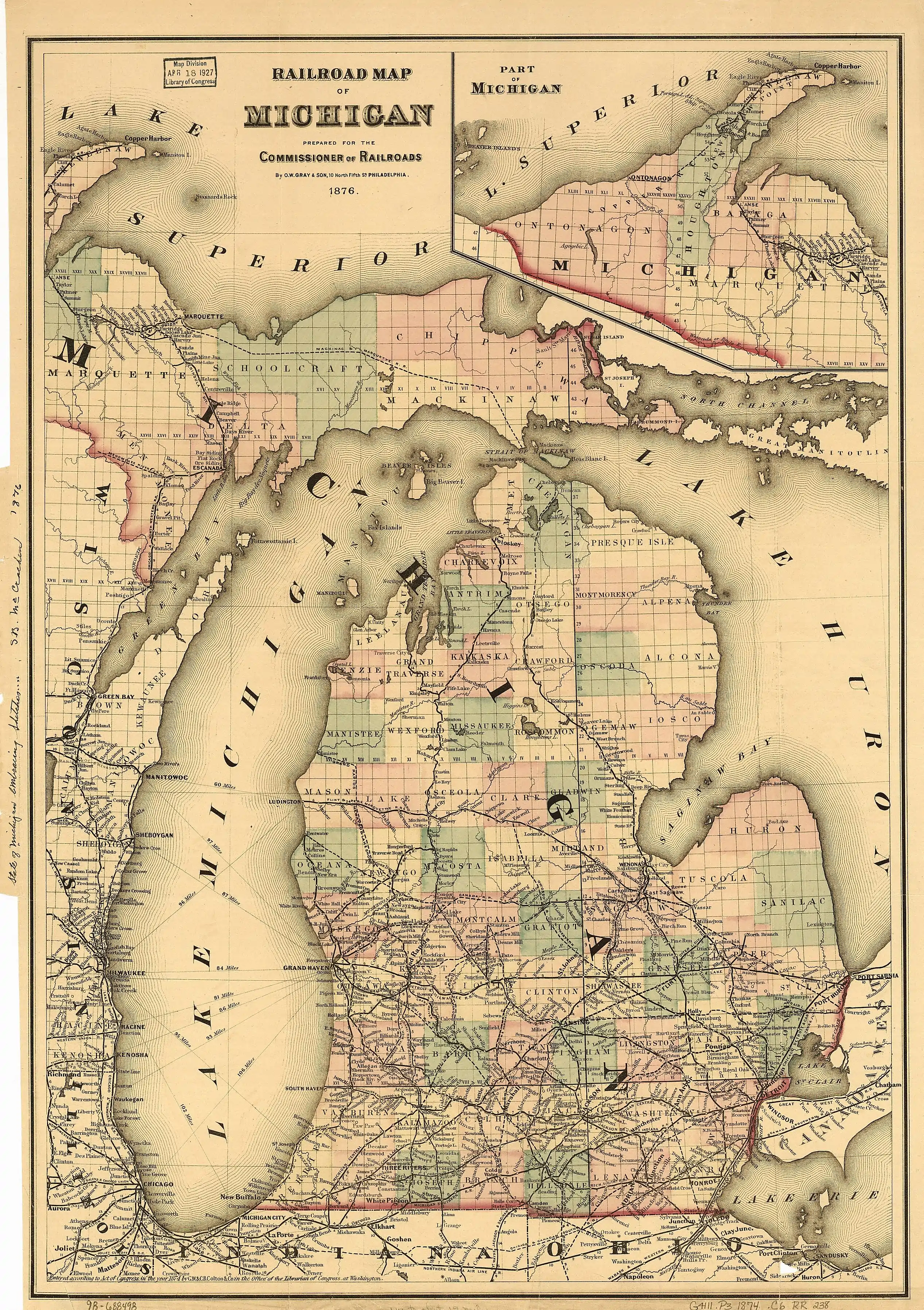
According to the U.S. Census Bureau, the county has a total area of 885 square miles (2,290 km2), of which 715 square miles (1,850 km2) is land and 170 square miles (440 km2) (19%) is water.[6] The county is considered to be part of Northern Michigan.
Adjacent counties
- Mackinac County - north
- Presque Isle County - east
- Montmorency County - southeast
- Otsego County - south
- Charlevoix County - southwest
- Emmet County - west
Transportation
Cheboygan County-designated highways
 C-58
C-58 C-64
C-64 C-66
C-66 F-05
F-05
Airports
- Cheboygan County Airport, located in Cheboygan, is a private airport. There are no commercial airline airports in Cheboygan County but the nearest ones are Alpena County Regional Airport, Chippewa County International Airport (Sault Ste. Marie, MI), and Cherry Capital Airport (Traverse City). Delta Air Lines schedules flights daily out of the Pellston Regional Airport.
Demographics
| Historical population | |||
|---|---|---|---|
| Census | Pop. | %± | |
| 1860 | 517 | — | |
| 1870 | 2,196 | 324.8% | |
| 1880 | 6,524 | 197.1% | |
| 1890 | 11,986 | 83.7% | |
| 1900 | 15,516 | 29.5% | |
| 1910 | 17,872 | 15.2% | |
| 1920 | 13,991 | −21.7% | |
| 1930 | 11,502 | −17.8% | |
| 1940 | 13,644 | 18.6% | |
| 1950 | 13,731 | 0.6% | |
| 1960 | 14,550 | 6.0% | |
| 1970 | 16,573 | 13.9% | |
| 1980 | 20,649 | 24.6% | |
| 1990 | 21,398 | 3.6% | |
| 2000 | 26,448 | 23.6% | |
| 2010 | 26,152 | −1.1% | |
| 2018 (est.) | 25,413 | [7] | −2.8% |
| US Decennial Census[8] 1790-1960[9] 1900-1990[10] 1990-2000[11] 2010-2018[3] | |||
As of the 2000 United States Census,[12] there were 26,448 people, 10,835 households, and 7,573 families in the county. The population density was 37 people per square mile (14/km2). There were 16,583 housing units at an average density of 23 per square mile (9/km2). The racial makeup of the county was 94.80% White, 0.25% Black or African American, 2.55% Native American, 0.20% Asian, 0.02% Pacific Islander, 0.15% from other races, and 2.05% from two or more races. 0.76% of the population were Hispanic or Latino of any race. 21.4% were of German, 10.4% English, 10.0% French, 9.5% Polish, 9.2% American and 8.9% Irish ancestry. 97.7% spoke English as their first language.
There were 10,835 households, out of which 28.60% had children under the age of 18 living with them, 58.00% were married couples living together, 8.60% had a female householder with no husband present, and 30.10% were non-families. 25.80% of all households were made up of individuals, and 11.80% had someone living alone who was 65 years of age or older. The average household size was 2.41 and the average family size was 2.87.
The county population contained 23.70% under the age of 18, 6.20% from 18 to 24, 25.80% from 25 to 44, 26.30% from 45 to 64, and 17.90% who were 65 years of age or older. The median age was 41 years. For every 100 females there were 98.30 males. For every 100 females age 18 and over, there were 96.50 males.
The median income for a household in the county was $33,417, and the median income for a family was $38,390. Males had a median income of $30,054 versus $20,682 for females. The per capita income for the county was $18,088. About 8.70% of families and 12.20% of the population were below the poverty line, including 17.90% of those under age 18 and 7.10% of those age 65 or over.
Government
Cheyboygan County has tended to vote Republican through the years. Since 1884 its voters have selected the Republican Party nominee in 71% (24 of 34) of the national elections.
| Year | Republican | Democratic | Third Parties |
|---|---|---|---|
| 2016 | 63.5% 8,683 | 31.5% 4,302 | 5.0% 687 |
| 2012 | 54.6% 7,286 | 43.7% 5,831 | 1.8% 233 |
| 2008 | 49.8% 6,920 | 48.3% 6,720 | 1.9% 261 |
| 2004 | 56.2% 7,798 | 42.8% 5,941 | 1.1% 148 |
| 2000 | 54.0% 6,815 | 43.5% 5,484 | 2.5% 318 |
| 1996 | 39.2% 4,244 | 46.3% 5,018 | 14.5% 1,571 |
| 1992 | 35.6% 3,864 | 41.0% 4,459 | 23.4% 2,541 |
| 1988 | 57.5% 5,395 | 42.0% 3,943 | 0.5% 42 |
| 1984 | 64.0% 6,053 | 35.5% 3,358 | 0.4% 41 |
| 1980 | 52.5% 5,221 | 39.6% 3,938 | 8.0% 795 |
| 1976 | 55.1% 4,894 | 43.7% 3,880 | 1.2% 104 |
| 1972 | 59.1% 4,529 | 39.0% 2,985 | 1.9% 148 |
| 1968 | 49.6% 3,422 | 41.2% 2,840 | 9.2% 637 |
| 1964 | 36.7% 2,342 | 63.1% 4,028 | 0.2% 11 |
| 1960 | 56.2% 3,817 | 43.8% 2,977 | 0.0% 2 |
| 1956 | 69.6% 4,379 | 30.3% 1,910 | 0.1% 7 |
| 1952 | 69.5% 4,385 | 30.1% 1,900 | 0.4% 24 |
| 1948 | 62.3% 3,184 | 36.1% 1,842 | 1.6% 83 |
| 1944 | 57.5% 2,943 | 41.9% 2,141 | 0.6% 32 |
| 1940 | 55.9% 3,646 | 43.8% 2,856 | 0.3% 21 |
| 1936 | 43.0% 2,584 | 50.2% 3,016 | 6.8% 409 |
| 1932 | 39.7% 2,309 | 59.0% 3,431 | 1.2% 71 |
| 1928 | 60.3% 2,743 | 39.2% 1,784 | 0.4% 19 |
| 1924 | 64.2% 2,683 | 23.8% 994 | 12.1% 505 |
| 1920 | 63.5% 2,472 | 32.9% 1,281 | 3.7% 142 |
| 1916 | 51.2% 1,576 | 45.1% 1,389 | 3.7% 115 |
| 1912 | 27.7% 896 | 30.3% 981 | 42.0% 1,359 |
| 1908 | 58.9% 2,053 | 34.6% 1,205 | 6.5% 225 |
| 1904 | 70.1% 2,572 | 26.7% 979 | 3.2% 118 |
| 1900 | 59.1% 2,092 | 39.5% 1,398 | 1.4% 51 |
| 1896 | 48.8% 1,576 | 50.1% 1,617 | 1.2% 37 |
| 1892 | 44.3% 1,094 | 49.5% 1,224 | 6.2% 153 |
| 1888 | 45.7% 1,110 | 50.9% 1,237 | 3.5% 84 |
| 1884 | 45.3% 777 | 52.3% 897 | 2.3% 40 |
Cheyboygan County operates the County jail, maintains rural roads, operates the major local courts, records deeds, mortgages, and vital records, administers public health regulations, and participates with the state in the provision of social services. The county board of commissioners controls the budget and has limited authority to make laws or ordinances. In Michigan, most local government functions – police and fire, building and zoning, tax assessment, street maintenance etc. – are the responsibility of individual cities and townships.
Elected officials
- Prosecuting Attorney: Daryl P. Vizina
- Sheriff: Dale V. Clarmont
- County Clerk/Register of Deeds: Karen Brewster
- County Treasurer: Buffy Jo Werdon
- Drain Commissioner: Cameron Cavitt
- County Surveyor: James H. Granger
(information as of September 2018)
Communities
City
- Cheboygan (county seat)
Villages
- Mackinaw City (part)
- Wolverine
Census-designated place
Other unincorporated communities
Townships
- Aloha Township
- Beaugrand Township
- Benton Township
- Burt Township
- Ellis Township
- Forest Township
- Grant Township
- Hebron Township
- Inverness Township
- Koehler Township
- Mackinaw Township
- Mentor Township
- Mullett Township
- Munro Township
- Nunda Township
- Tuscarora Township
- Walker Township
- Waverly Township
- Wilmot Township
Cheboygan County had another township called Maple Grove Township which became part of Forest Township in 1942.
Historical markers
There are eight recognized Michigan historical markers in the county:[14]
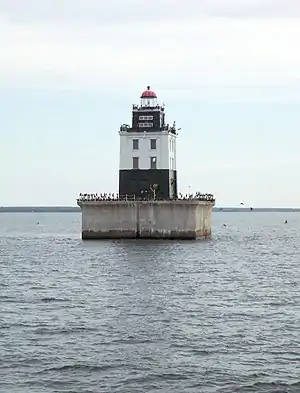
- Forty Mile Point Lighthouse / Graveyard of Ships
- Inland Waterway
- Jacob J. Post House
- Jail and Sheriff's Residence
- Newton-Allaire House
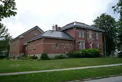
- Old Cheboygan County Courthouse
- St. Bernard Catholic Church
- St. Mary's Church
See also
References
- "Bibliography on Cheboygan County". Clarke Historical Library, Central Michigan University. Retrieved January 19, 2013.
- Merriam-Webster's Geographical Dictionary (3rd ed.). Merriam-Webster. 1997. p. 237. ISBN 9780877795469.
Che•boy•gan \shi-'bȯi-gən\.
- "State & County QuickFacts". US Census Bureau. Archived from the original on July 8, 2011. Retrieved August 27, 2013.
- "Find a County". National Association of Counties. Retrieved June 7, 2011.
- Michigan County names per the Michigan government. Archived July 28, 2009, at the Wayback Machine
- "2010 Census Gazetteer Files". US Census Bureau. August 22, 2012. Archived from the original on November 13, 2013. Retrieved September 19, 2014.
- "Population and Housing Unit Estimates". Retrieved May 17, 2019.
- "US Decennial Census". US Census Bureau. Retrieved September 19, 2014.
- "Historical Census Browser". University of Virginia Library. Retrieved September 19, 2014.
- "Population of Counties by Decennial Census: 1900 to 1990". US Census Bureau. Retrieved September 19, 2014.
- "Census 2000 PHC-T-4. Ranking Tables for Counties: 1990 and 2000" (PDF). US Census Bureau. Retrieved September 19, 2014.
- "U.S. Census website". US Census Bureau. Retrieved January 31, 2008.
- http://uselectionatlas.org/RESULTS
- "Michigan Historical Markers". michmarkers.com. Archived from the original on March 15, 2010. Retrieved January 8, 2008.
External links
- Cheboygan County official site
- "Bibliography on Cheboygan County". Clarke Historical Library, Central Michigan University. Retrieved January 19, 2013.
- Cheboygan County's Historic Bridges
- Enchanted forest, Northern Michigan source for information, calendars, etc.
- YourCheboygan.org, Open forum for community feedback
Places adjacent to Cheboygan County, Michigan | ||||||||||
|---|---|---|---|---|---|---|---|---|---|---|
| ||||||||||
Municipalities and communities of Cheboygan County, Michigan, United States | ||
|---|---|---|
| City | Map of Michigan highlighting Cheboygan County.svg | |
| Villages | ||
| Townships | ||
| CDP | ||
| Other unincorporated communities | ||
| Indian reservations | ||
| Footnotes | ‡This populated place also has portions in an adjacent county or counties | |
| ||
| Central cities | |
|---|---|
| Counties | |
| Geography | |
| Transportation | |
| Economy | |
| Authority control |
|---|