Delta County, Michigan
Delta County is a county in the Upper Peninsula in the U.S. state of Michigan. As of the 2010 census, the population was 37,069.[2] The county seat is Escanaba.[3] The county was surveyed in 1843 and organized in 1861. Its name originates from the Greek letter "delta", which refers to the triangular shape of the original county[1][4] which included segments of Menominee, Dickinson, Iron, and Marquette counties.[5]
Delta County | |
|---|---|
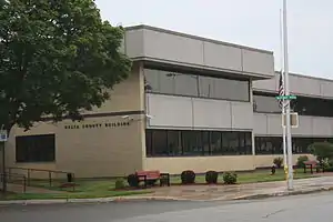 Delta County Courthouse in Escanaba | |
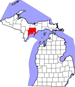 Location within the U.S. state of Michigan | |
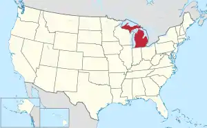 Michigan's location within the U.S. | |
| Coordinates: 45°47′N 86°52′W | |
| Country | |
| State | |
| Founded | March 9, 1843 (authorized) 1861 (organized)[1] |
| Seat | Escanaba |
| Largest city | Escanaba |
| Area | |
| • Total | 1,991 sq mi (5,160 km2) |
| • Land | 1,171 sq mi (3,030 km2) |
| • Water | 820 sq mi (2,100 km2) 41%% |
| Population | |
| • Estimate (2018) | 35,857 |
| • Density | 32/sq mi (12/km2) |
| Time zone | UTC−5 (Eastern) |
| • Summer (DST) | UTC−4 (EDT) |
| Congressional district | 1st |
Delta County comprises the Escanaba, MI Micropolitan Statistical Area.
Geography
According to the U.S. Census Bureau, the county has a total area of 1,991 square miles (5,160 km2), of which 1,171 square miles (3,030 km2) is land and 820 square miles (2,100 km2) (41%) is water.[6] It is the fifth-largest county in Michigan by land area.
Adjacent counties
- Alger County, Michigan (north)
- Schoolcraft County, Michigan (east)
- Leelanau County, Michigan (southeast)
- Door County, Wisconsin (south/CST Border)
- Menominee County, Michigan (west/CST Border)
- Marquette County, Michigan (northwest)
National protected area
- Hiawatha National Forest (part)
Demographics
| Historical population | |||
|---|---|---|---|
| Census | Pop. | %± | |
| 1860 | 1,172 | — | |
| 1870 | 2,542 | 116.9% | |
| 1880 | 6,812 | 168.0% | |
| 1890 | 15,330 | 125.0% | |
| 1900 | 23,881 | 55.8% | |
| 1910 | 30,108 | 26.1% | |
| 1920 | 30,909 | 2.7% | |
| 1930 | 32,280 | 4.4% | |
| 1940 | 34,037 | 5.4% | |
| 1950 | 32,913 | −3.3% | |
| 1960 | 34,298 | 4.2% | |
| 1970 | 35,924 | 4.7% | |
| 1980 | 38,947 | 8.4% | |
| 1990 | 37,780 | −3.0% | |
| 2000 | 38,520 | 2.0% | |
| 2010 | 37,069 | −3.8% | |
| 2018 (est.) | 35,857 | [7] | −3.3% |
| US Decennial Census[8] 1790-1960[9] 1900-1990[10] 1990-2000[11] 2010-2018[2] | |||
The 2010 United States Census[12] indicates Delta County had population of 37,069. This decrease of 1,451 people from the 2000 United States Census represents a 3.8% population decrease during that 10-year period. In 2010 there were 15,992 households and 10,381 families in the county. The population density was 31.7 per square mile (12.2 per km2). There were 20,214 housing units at an average density of 17.3 per square mile (6.7 per km2). 94.7% of the population were White, 2.4% Native American, 0.4% Asian, 0.2% Black or African American, 0.2% of some other race and 2.1% of two or more races. 0.9% were Hispanic or Latino (of any race). 20.8% were of French, French Canadian or Cajun, 15.5% German, 10.3% Swedish and 7.6% Irish ancestry.[13]
There were 15,992 households, out of which 25.5% had children under the age of 18 living with them, 51.7% were husband and wife families, 8.8% had a female householder with no husband present, 35.1% were non-families, and 29.8% were made up of individuals. The average household size was 2.28 and the average family size was 2.80.
The county population contained 20.9% under age of 18, 7.3% from 18 to 24, 21.1% from 25 to 44, 31.6% from 45 to 64, and 19.1% who were 65 years of age or older. The median age was 46 years. 49.5% of the population were male, and 50.5% of the population female.
The 2010 American Community Survey 3-year estimate[12] indicates the median income for a household in the county was $40,967 and the median income for a family was $49,557. Males had a median income of $28,702 versus $15,093 for females. The per capita income for the county was $21,751. About 2.4% of families and 13.2% of the population were below the poverty line, including 17.4% of those under the age 18 and 8.5% of those age 65 or over.
Transportation
Major highways
 US 2 – runs east–west through the lower part of the county. Enters from Schoolcraft County east of Garden Corners and runs west to intersection with US41 at Rapid River.
 US 41 – runs north–south through central part of the county. Enters from Alger County at Trenary and runs south to Rapid River, then SW along Lake Michigan shore to SW corner of county.
 M-35 – enters from Marquette County at NW corner of Delta County. Runs SE to intersection with US41 at Gladstone.
 M-69 – runs east–west across SW tip of county. Enters from Menominee County at Schaffer and runs SE to intersection with US41 west of Narenta.
 M-183 – runs from south tip of county at Sac Bay, NE to intersection with US2 at Garden Corners.[14]
Airport
The county is served by Delta County Airport (KESC), southwest of Escanaba. It provides scheduled airline service to Detroit.
Government
Delta County was reliably Republican after the American Civil War, and until Franklin Roosevelt's New Deal. Since 1932, the Democratic Party nominee has carried the county vote in 15 of the 22 national presidential elections through 2016.
| Year | Republican | Democratic | Third Parties |
|---|---|---|---|
| 2020 | 62.4% 13,207 | 35.9% 7,606 | 1.7% 354 |
| 2016 | 59.8% 11,121 | 34.6% 6,436 | 5.6% 1,037 |
| 2012 | 52.6% 9,534 | 46.0% 8,330 | 1.5% 266 |
| 2008 | 46.0% 8,763 | 52.3% 9,974 | 1.7% 327 |
| 2004 | 50.3% 9,680 | 48.8% 9,381 | 0.9% 177 |
| 2000 | 51.2% 8,871 | 46.0% 7,970 | 2.7% 475 |
| 1996 | 36.7% 5,925 | 53.0% 8,561 | 10.3% 1,664 |
| 1992 | 33.6% 6,027 | 46.7% 8,387 | 19.8% 3,548 |
| 1988 | 44.3% 7,114 | 55.3% 8,891 | 0.4% 60 |
| 1984 | 52.8% 8,952 | 46.8% 7,934 | 0.3% 56 |
| 1980 | 46.0% 8,146 | 47.9% 8,475 | 6.1% 1,071 |
| 1976 | 45.9% 7,809 | 53.0% 9,027 | 1.2% 197 |
| 1972 | 48.1% 7,647 | 50.4% 8,003 | 1.5% 236 |
| 1968 | 40.6% 5,829 | 54.5% 7,821 | 5.0% 714 |
| 1964 | 30.6% 4,434 | 69.3% 10,046 | 0.2% 27 |
| 1960 | 44.8% 6,460 | 55.0% 7,924 | 0.2% 29 |
| 1956 | 54.3% 7,766 | 45.4% 6,489 | 0.3% 45 |
| 1952 | 51.8% 7,488 | 47.9% 6,921 | 0.3% 49 |
| 1948 | 42.9% 5,414 | 55.0% 6,943 | 2.2% 276 |
| 1944 | 41.2% 5,213 | 58.3% 7,375 | 0.4% 56 |
| 1940 | 41.2% 6,218 | 58.3% 8,802 | 0.5% 81 |
| 1936 | 32.8% 4,527 | 64.9% 8,954 | 2.3% 310 |
| 1932 | 35.7% 4,386 | 59.9% 7,363 | 4.4% 536 |
| 1928 | 49.6% 5,420 | 49.6% 5,419 | 0.8% 91 |
| 1924 | 49.8% 4,761 | 4.9% 463 | 45.3% 4,330 |
| 1920 | 65.4% 4,938 | 26.3% 1,985 | 8.3% 627 |
| 1916 | 59.7% 3,088 | 34.5% 1,781 | 5.8% 300 |
| 1912 | 25.4% 1,111 | 24.4% 1,066 | 50.3% 2,201 |
| 1908 | 71.7% 3,243 | 24.3% 1,097 | 4.1% 183 |
| 1904 | 79.9% 3,332 | 15.8% 658 | 4.3% 181 |
| 1900 | 70.9% 3,081 | 27.9% 1,210 | 1.2% 52 |
| 1896 | 67.8% 2,774 | 30.2% 1,237 | 2.0% 80 |
| 1892 | 54.3% 1,769 | 43.3% 1,412 | 2.4% 77 |
| 1888 | 54.2% 1,587 | 45.5% 1,332 | 0.4% 11 |
| 1884 | 66.1% 1,201 | 33.5% 609 | 0.3% 6 |
Delta County operates the County jail, maintains rural roads, operates the major local courts, records deeds, mortgages, and vital records, administers public health regulations, and participates with the state in the provision of social services. The county board of commissioners controls the budget and has limited authority to make laws or ordinances. In Michigan, most local government functions – police and fire, building and zoning, tax assessment, street maintenance etc. – are the responsibility of individual cities and townships.
Elected officials
- Prosecuting Attorney: Brett Gardner
- Sheriff: Edward Oswald
- County Clerk/Register of Deeds: Nancy Przewrocki
- County Treasurer: Tom Sabor
- Drain Commissioner: George Maciejewski
- County Surveyor: Mel Davis
- Circuit Court Judge: John B. Economopoulos
- District Court Judge: Steven C. Parks
- Probate Court Judge: Perry R. Lund
(information as of September 2018)[16]
Communities
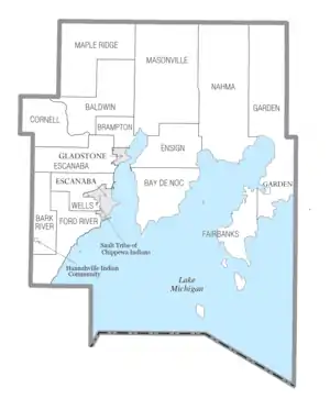
Village
Civil townships
Unincorporated communities
- Bark River
- Brampton
- Chaison
- Fairport
- Fayette
- Ford River[14]
- Garden Corners
- Harris
- Hyde[14]
- Isabella
- Island View[14]
- Kipling[14]
- Lake Bluff[14]
- Maplewood[14]
- Nahma
- Narenta
- Perkins
- Perronville
- Rapid River
- Riverland[14]
- Rock
- St. Nicholas[14]
- Schaffer
- Wells[14]
- West Gladstone
Indian reservations
- A small section of the Hannahville Indian Community, which has most of its territory in neighboring Menominee County to the west, extends into Bark River Township.
- The Sault Tribe of Chippewa Indians occupies a very small portion in the southwest city limits of Escanaba.
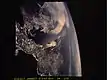
From space
Astronauts aboard multiple space shuttles and space stations have photographed the county.
| Select astronaut photography of Delta County | |||
               | |||
See also
References
- "Bibliography on Delta County". Clarke Historical Library, Central Michigan University. Retrieved July 6, 2013.
- "State & County QuickFacts". US Census Bureau. Retrieved August 27, 2013.
- "Find a County". National Association of Counties. Retrieved June 7, 2011.
- Gannett, Henry (1905). The Origin of Certain Place Names in the United States. Govt. Print. Off. p. 103.
- Names of Michigan Counties (accessed July 28, 2009)
- "2010 Census Gazetteer Files". US Census Bureau. August 22, 2012. Archived from the original on November 13, 2013. Retrieved September 21, 2014.
- "Population and Housing Unit Estimates". Retrieved May 16, 2019.
- "US Decennial Census". US Census Bureau. Retrieved September 21, 2014.
- "Historical Census Browser". University of Virginia Library. Retrieved September 21, 2014.
- "Population of Counties by Decennial Census: 1900 to 1990". US Census Bureau. Retrieved September 21, 2014.
- "Census 2000 PHC-T-4. Ranking Tables for Counties: 1990 and 2000" (PDF). US Census Bureau. Retrieved September 21, 2014.
- "U.S. Census website". US Census Bureau. Retrieved July 6, 2013.
- Data Access and Dissemination Systems (DADS). "U.S. Census website".
- Delta County MI Google Maps (accessed 16 September 2018)
- US Election Atlas
- "Delta County Directory". Retrieved September 16, 2018.
External links
- Delta County government website
- Delta County Profile, Sam M Cohodas Regional Economist
- "Bibliography on Delta County". Clarke Historical Library, Central Michigan University.
Places adjacent to Delta County, Michigan | ||||||||||
|---|---|---|---|---|---|---|---|---|---|---|
| ||||||||||
Municipalities and communities of Delta County, Michigan, United States | ||
|---|---|---|
| Cities | Map of Michigan highlighting Delta County.svg | |
| Village | ||
| Townships | ||
| Unincorporated communities | ||
| Ghost town | ||
| Indian reservations | ||
| Footnotes | ‡This populated place also has portions in an adjacent county or counties | |
| ||
| Central cities | |
|---|---|
| Counties | |
| Geography | |
| Transportation | |
| Economy | |

| Authority control |
|---|