St. Joseph County, Michigan
St. Joseph County is a county located in the U.S. state of Michigan, on the central southern border with Indiana. As of the 2010 United States Census, the population was 61,295.[2] The county seat is Centreville.[3]
Saint Joseph County | |
|---|---|
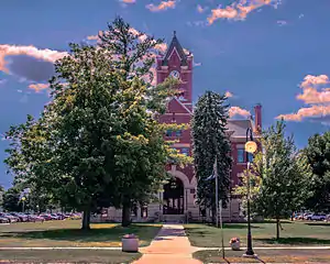 St. Joseph County Courthouse in Centreville | |
Seal | |
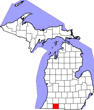 Location within the U.S. state of Michigan | |
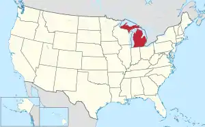 Michigan's location within the U.S. | |
| Coordinates: 41°55′N 85°32′W | |
| Country | |
| State | |
| Founded | 1829[1] |
| Named for | Fort St. Joseph |
| Seat | Centreville |
| Largest city | Sturgis |
| Area | |
| • Total | 521 sq mi (1,350 km2) |
| • Land | 501 sq mi (1,300 km2) |
| • Water | 20 sq mi (50 km2) 3.9%% |
| Population | |
| • Estimate (2018) | 61,043 |
| • Density | 122/sq mi (47/km2) |
| Time zone | UTC−5 (Eastern) |
| • Summer (DST) | UTC−4 (EDT) |
| Congressional district | 6th |
French colonists in the late 17th century were the first Europeans to explore this territory, and they named the St. Joseph River for the patron saint of New France.[1] This area was not part of the United States until after the American Revolutionary War. After the Treaty of Chicago was signed in 1821, regional tribes of the indigenous peoples ceded much land to the United States, opening the area for American settlement. The county was set off and organized by the Michigan Territory legislature in 1829; it was named for the river.[1]
St. Joseph County comprises the Sturgis, MI Micropolitan Statistical Area and is included in the Kalamazoo-Battle Creek-Portage, MI Combined Statistical Area.
History
This area was settled by members of the three Algonquian-speaking tribes of the Council of Three Fires: the Potawatomi, Odawa, and Chippewa (known as Ojibwa in Canada). French explorers in a party led by Father Hennepin came upriver from Lake Michigan in 1679. A Jesuit mission was established near where the French later built Fort St. Joseph, and they named the waterway as the St. Joseph River.
After the United States and tribal representatives made the 1821 Treaty of Chicago, much of the land in this region was ceded by the tribes to Michigan Territory, so more settlers came from Detroit, Monroe and later from New England and upstate New York. The first were ethnic French. The Godfroy brothers of Detroit built a trading post south of the river, near the later Marantette House site. They appointed Frances Mouton as an agent to trade with the natives of the Nottawaseepe (sippi) settlement. They had another post nearby where Patrick Marantette, also from Detroit, first worked as an agent. He ended up settling in and marrying Mouton's daughter Francis. Theirs was the first marriage in the settlement, and their daughter the first European American born here, in 1836.
Geography
According to the U.S. Census Bureau, the county has a total area of 521 square miles (1,350 km2), of which 501 square miles (1,300 km2) is land and 20 square miles (52 km2) (3.9%) is water.[4] It is the fourth-smallest county in Michigan by total area. The entire county lies in the Saint Joseph River watershed.
Adjacent counties
- Van Buren County – northwest
- Kalamazoo County – north
- Calhoun County – northeast
- Branch County – east
- LaGrange County, Indiana – south
- Elkhart County, Indiana – southwest
- Cass County – west
Major highways
 US 12 – runs east–west across lower portion of the county. Passes White Pigeon and Sturgis.
 US 131 – runs north–south through the western portion of the county. Passes Three Rivers, Constantine, White Pigeon.
 Bus. US 131 – runs north–south through eastern Three Rivers - length 1.6 mile (2.6 km).
 M-60 – runs ENE through the upper portion of the county. Passes Three Rivers, Parkville, Mendon, Leonidas.
 M-66 – enters SE portion of county from Star Mill, Indiana. Runs north to intersection with M60, two miles (3 km) east of Mendon.
 M-86 – runs east–west through center of the county. Enters at Colon, passes Nella and Centreville to intersection with M60 at Three Rivers.
 M-103 – enters SW tip of county; runs north 2 miles (3 km) to intersection with US12 near west county line.
 M-216 – enters NW portion of county from Marcellus. Runs east to intersection with US131 four miles (6 km)north of Three Rivers.
Demographics
| Historical population | |||
|---|---|---|---|
| Census | Pop. | %± | |
| 1830 | 1,313 | — | |
| 1840 | 7,068 | 438.3% | |
| 1850 | 12,725 | 80.0% | |
| 1860 | 21,262 | 67.1% | |
| 1870 | 26,275 | 23.6% | |
| 1880 | 26,626 | 1.3% | |
| 1890 | 23,356 | −12.3% | |
| 1900 | 23,889 | 2.3% | |
| 1910 | 25,499 | 6.7% | |
| 1920 | 26,818 | 5.2% | |
| 1930 | 30,618 | 14.2% | |
| 1940 | 31,749 | 3.7% | |
| 1950 | 35,071 | 10.5% | |
| 1960 | 42,332 | 20.7% | |
| 1970 | 47,392 | 12.0% | |
| 1980 | 56,083 | 18.3% | |
| 1990 | 58,913 | 5.0% | |
| 2000 | 62,422 | 6.0% | |
| 2010 | 61,295 | −1.8% | |
| 2018 (est.) | 61,043 | [5] | −0.4% |
| US Decennial Census[6] 1790-1960[7] 1900-1990[8] 1990-2000[9] 2010-2018[2] | |||
The 2010 census indicates St. Joseph County had a 2010 population of 61,295. This decrease of -1,127 people from the 2000 United States Census represents a -1.8% population change (decrease) in that decade. In 2010 there were 23,244 households and 16,275 families in the county. The population density was 122.4 per square mile (47.3 square kilometers). There were 27,778 housing units at an average density of 55.5 per square mile (21.4 per km2). The racial and ethnic makeup of the county was 88.0% White, 2.5% Black or African American, 0.4% Native American, 0.7% Asian, 6.6% Hispanic or Latino, 0.1% from other races, and 1.8% from two or more races.
There were 23,244 households, out of which 33.0% had children under the age of 18 living with them, 52.6% were husband and wife families, 11.7% had a female householder with no husband present, 30.0% were non-families, and 24.8% were made up of individuals. The average household size was 2.60 and the average family size was 3.08.
The county population contained 25.9% under age of 18, 8.1% from 18 to 24, 23.8% from 25 to 44, 27.4% from 45 to 64, and 14.9% who were 65 years of age or older. The median age was 39 years. For every 100 females there were 97.9 males. For every 100 females age 18 and over, there were 95.9 males.
The 2010 American Community Survey 3-year estimate indicates the median income for a household in the county was $43,964 and the median income for a family was $52,600. Males had a median income of $30,517 versus $16,388 for females. The per capita income for the county was $19,737. About 1.8% of families and 16.3% of the population were below the poverty line, including 22.3% of those under the age 18 and 12.3% of those age 65 or over.[10]
Government
St. Joseph County has long been reliably Republican. Since 1884, the Republican Party nominee has carried 79% of the elections (27 of 34).
| Year | Republican | Democratic | Third Parties |
|---|---|---|---|
| 2020 | 64.8% 18,127 | 33.1% 9,262 | 2.1% 592 |
| 2016 | 62.1% 14,884 | 31.4% 7,526 | 6.5% 1,557 |
| 2012 | 55.4% 12,978 | 43.1% 10,112 | 1.5% 355 |
| 2008 | 50.0% 12,886 | 47.8% 12,322 | 2.2% 563 |
| 2004 | 60.8% 15,340 | 38.2% 9,648 | 1.0% 251 |
| 2000 | 58.6% 12,906 | 38.9% 8,574 | 2.5% 544 |
| 1996 | 47.0% 9,764 | 41.0% 8,529 | 12.0% 2,501 |
| 1992 | 41.0% 9,836 | 32.6% 7,817 | 26.4% 6,318 |
| 1988 | 64.8% 13,084 | 34.7% 7,017 | 0.5% 95 |
| 1984 | 72.3% 15,405 | 27.2% 5,795 | 0.5% 96 |
| 1980 | 63.2% 13,631 | 29.3% 6,318 | 7.5% 1,621 |
| 1976 | 61.1% 11,784 | 37.9% 7,306 | 1.1% 205 |
| 1972 | 69.2% 12,438 | 28.5% 5,119 | 2.4% 431 |
| 1968 | 59.2% 10,445 | 30.7% 5,413 | 10.1% 1,787 |
| 1964 | 44.0% 7,307 | 55.9% 9,284 | 0.2% 32 |
| 1960 | 69.1% 12,337 | 30.5% 5,445 | 0.4% 65 |
| 1956 | 74.1% 12,328 | 25.5% 4,242 | 0.4% 64 |
| 1952 | 72.2% 12,191 | 26.7% 4,509 | 1.1% 187 |
| 1948 | 65.7% 8,166 | 31.6% 3,928 | 2.8% 342 |
| 1944 | 69.5% 9,785 | 30.1% 4,235 | 0.5% 69 |
| 1940 | 66.3% 10,025 | 33.4% 5,045 | 0.3% 45 |
| 1936 | 51.9% 7,160 | 43.8% 6,048 | 4.4% 601 |
| 1932 | 43.8% 5,626 | 53.8% 6,917 | 2.4% 309 |
| 1928 | 76.1% 8,781 | 23.4% 2,698 | 0.6% 67 |
| 1924 | 65.4% 6,633 | 26.1% 2,649 | 8.4% 855 |
| 1920 | 66.6% 6,035 | 30.1% 2,725 | 3.3% 303 |
| 1916 | 45.0% 3,132 | 51.3% 3,567 | 3.7% 260 |
| 1912 | 19.0% 1,224 | 37.1% 2,388 | 43.9% 2,820 |
| 1908 | 52.9% 3,466 | 42.3% 2,770 | 4.8% 312 |
| 1904 | 59.8% 3,649 | 35.7% 2,176 | 4.5% 277 |
| 1900 | 48.2% 3,178 | 49.8% 3,283 | 2.0% 134 |
| 1896 | 43.8% 3,184 | 54.5% 3,968 | 1.7% 124 |
| 1892 | 43.9% 2,824 | 38.0% 2,441 | 18.1% 1,163 |
| 1888 | 48.4% 3,372 | 46.1% 3,217 | 5.5% 383 |
| 1884 | 46.9% 3,261 | 51.1% 3,554 | 2.0% 139 |
The county government operates the jail, operates the major local courts, records deeds, mortgages, and vital records, administers public health regulations, and participates with the state in the provision of social services. The county board of commissioners controls the and has limited authority to make laws or ordinances. In Michigan, most local government functions – police and fire, building and zoning, tax assessment, street maintenance, etc. – are the responsibility of individual cities and townships.
Elected officials
- 1st District Commissioner: Allen Balog
- 2nd District Commissioner: Kathy Pangle
- 3rd District Commissioner: Dennis Allen
- 4th District Commissioner: Daniel Czajkowski
- 5th District Commissioner: Ken Malone
- Prosecuting Attorney: John McDonough
- Sheriff: Bradley Balk
- County Clerk/Register of Deeds: Lindsay Oswald
- County Treasurer: Judith Ratering
- Drain Commissioner: Jeffrey Wenzel
- County Surveyor: David Mostrom
- 45th Circuit Court Judge: Paul Stutesman
- 3B District Court Judge: Robert Pattison
- 3B District Court Judge: Jeffrey Middleton
- Probate Court Judge: David Tomlinson
(Information current as of July 2019)
Communities
Cities
Villages
- Burr Oak
- Centreville (county seat)
- Colon
- Constantine
- Mendon
- White Pigeon
See also
References
- "Bibliography on St. Joseph County". Clarke Historical Library, Central Michigan University. Retrieved January 29, 2013.
- "State & County QuickFacts". US Census Bureau. Retrieved August 29, 2013.
- "Find a County". National Association of Counties. Retrieved June 7, 2011.
- "2010 Census Gazetteer Files". US Census Bureau. August 22, 2012. Archived from the original on November 13, 2013. Retrieved September 28, 2014.
- "Population and Housing Unit Estimates". Retrieved May 11, 2019.
- "US Decennial Census". US Census Bureau. Retrieved September 28, 2014.
- "Historical Census Browser". University of Virginia Library. Retrieved September 28, 2014.
- "Population of Counties by Decennial Census: 1900 to 1990". US Census Bureau. Retrieved September 28, 2014.
- "Census 2000 PHC-T-4. Ranking Tables for Counties: 1990 and 2000" (PDF). US Census Bureau. Retrieved September 28, 2014.
- "U.S. Census website". US Census Bureau. Retrieved March 11, 2012.
- Leip, David. "Dave Leip's Atlas of US Presidential Elections".
External links
- St. Joseph County website
- "Bibliography on St. Joseph County". Clarke Historical Library, Central Michigan University.
Places adjacent to St. Joseph County, Michigan | ||||||||||
|---|---|---|---|---|---|---|---|---|---|---|
| ||||||||||
Municipalities and communities of St. Joseph County, Michigan, United States | ||
|---|---|---|
| Cities | Map of Michigan highlighting Saint Joseph County.svg | |
| Villages | ||
| Townships | ||
| Unincorporated communities | ||
| ||

| Authority control |
|---|