Lilyvale, Queensland (Toowoomba Region)
Lilyvale is a locality in the Toowoomba Region local government area on the Darling Downs in southern Queensland, Australia. At the 2016 Australian Census, Lilyvale recorded a population of 55.[1] A prominent hill in the north of the area remains mostly vegetated and reaches elevations above 590 m. A second hill in the southeast rises to around 570 m. The rest of Lilyvale has been cleared for agricultural purposes.
| Lilyvale Queensland | |||||||||||||||
|---|---|---|---|---|---|---|---|---|---|---|---|---|---|---|---|
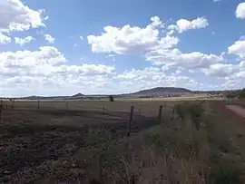 Fields along Kingsthorpe Haden Road, 2014 | |||||||||||||||
 Lilyvale | |||||||||||||||
| Coordinates | 27°22′S 151°49′E | ||||||||||||||
| Population | 55 (2016 census)[1] | ||||||||||||||
| Postcode(s) | 4352 | ||||||||||||||
| LGA(s) | Toowoomba Region | ||||||||||||||
| State electorate(s) | Condamine | ||||||||||||||
| Federal Division(s) | Groom | ||||||||||||||
| |||||||||||||||
History
The Downs Co-operative Dairy Association opened a cheese factory at Lilyvale in 1926.[2]
References
- Australian Bureau of Statistics (27 June 2017). "Lilyvale (Toowoomba - Qld) (State Suburb)". 2016 Census QuickStats. Retrieved 25 March 2018.

- "The Downs Co-operative Dairy Association Limited Factory (former) (entry 602596)". Queensland Heritage Register. Queensland Heritage Council. Retrieved 15 August 2015.
This article is issued from Wikipedia. The text is licensed under Creative Commons - Attribution - Sharealike. Additional terms may apply for the media files.