Rangeville, Queensland
Rangeville is a residential locality in Toowoomba in the Toowoomba Region, Queensland, Australia.[2] In the 2016 census, Rangeville had a population of 8,312 people.[1]
| Rangeville Toowoomba, Queensland | |||||||||||||||
|---|---|---|---|---|---|---|---|---|---|---|---|---|---|---|---|
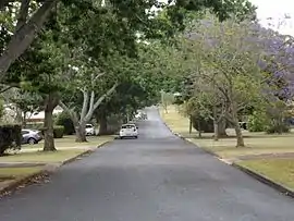 Maker Street, 2014 | |||||||||||||||
 Rangeville | |||||||||||||||
| Coordinates | 27.5847°S 151.9911°E | ||||||||||||||
| Population | 8,312 (2016 census)[1] | ||||||||||||||
| • Density | 1,014/km2 (2,625/sq mi) | ||||||||||||||
| Postcode(s) | 4350 | ||||||||||||||
| Area | 8.2 km2 (3.2 sq mi) | ||||||||||||||
| Time zone | AEST (UTC+10:00) | ||||||||||||||
| Location | 5 km (3 mi) SE of Toowoomba CBD | ||||||||||||||
| LGA(s) | Toowoomba Region | ||||||||||||||
| State electorate(s) | Toowoomba South | ||||||||||||||
| Federal Division(s) | Groom | ||||||||||||||
| |||||||||||||||
Geography
Rangeville is located 5 kilometres (3 mi) south-east of the Toowoomba city centre.
The suburb's eastern boundary is along the top of the Great Dividing Range and is home to four reserves:
- Table Top Mountain (or Mt Tabletop[3] Tabletop Mountain[4] and formerly One Tree Hill) is accessible via two routes: Stevenson Street dirt carpark, or drive to the base of the mountain dirt carpark via South Street and Table Top Drive.[5][6] The mountain was the site of the Battle of One Tree Hill in September 1843, in which a group of Aboriginal Australians under the warrior Multuggerah ambushed and routed a group of 18 armed men.[3][7]
- Picnic Point Park, which has several lookouts, a restaurant and a bar. At Picnic Point a 150-foot flagpole was erected as part of the Q150 celebrations.[8]
- McKnight Park.
- J. E. Duggan Park, named for former Labor Opposition leader, Jack Duggan, who represented the local area for over 30 years. The western boundary along East Creek is home to the Toowoomba Bicentennial Waterbird Habitat.
History
As closer settlement moved further along the range from Toowoomba, the suburb appears to have been named Rangeville to distinguish it from The Range, which was the general term for the area along the Great Dividing Range.[9]
The Range State School opened on 1 July 1909. In December 1909 it was renamed Rangeville State School.[10]
In 1955 William Brennan, Roman Catholic Bishop of Toowoomba, invited the Christian Brothers to establish a boys' school in eastern Toowoomba. Three brothers were appointed and arrived in October 1955. The foundation stone for the school was laid on 15 December 1955. St Joseph's College opened in 1956 offering schooling from Year 4 to Year 12 with an initial enrolment of 116 boys. The official opening was held in September 1956 and was conducted by Bishop Brennan and James Duhig, Roman Catholic Archbishop of Brisbane. The Christian Brothers ceased operating the school in 1983. Other changes at that time was to phase out the primary school and make the school secondary only. The school also offered enrolment to girls.[10][11]
Heritage listings
Rangeville has a number of heritage-listed sites, including:
Education
Rangeville State School is a government primary (early childhood – 6) school for boys and girls at 32A High Street (27.5830°S 151.9783°E).[15][16] In 2017, the school had an enrolment of 732 students with 58 teachers (51 full-time equivalent) and 32 non-teaching staff (23 full-time equivalent).[17] It includes a special education program.[15][18]
St Joseph's College is a Catholic secondary (7–12) school for boys and girls at 54 James Street (27.5715°S 151.9701°E).[15][19] In 2017, the school had an enrolment of 801 students with 64 teachers (61 full-time equivalent) and 39 non-teaching staff (31 full-time equivalent).[17]
References
- Australian Bureau of Statistics (27 June 2017). "Rangeville (SSC)". 2016 Census QuickStats. Retrieved 20 October 2018.

- "Rangeville – locality in Toowoomba Region (entry 48049)". Queensland Place Names. Queensland Government. Retrieved 1 December 2019.
- Kerkhove, Ray (19 August 2017). "Battle of One Tree Hill and Its Aftermath". Retrieved 5 August 2020. Note: Dr Ray Kerkhove, owner of this site, is a reputable historian. See here and here.
- Amos, Alfred (1945). "Tabletop Mountain from Picnic Point, Toowoomba, Queensland, August 1945 [picture]" (Photo).
- "Rangeville - Table Top Mountain Bushland Reserve". Home. 23 July 2020. Retrieved 5 August 2020.
- ccalcino (5 June 2014). "Table Top Mtn: How to climb our natural treasure". Chronicle. Retrieved 5 August 2020.
- Marr, David (14 September 2019). "Battle of One Tree Hill: remembering an Indigenous victory and a warrior who routed the whites". the Guardian. Retrieved 5 August 2020.
- "Aussie flag flies high over Picnic Point". The Chronicle. 14 January 2009. Archived from the original on 10 November 2014. Retrieved 9 November 2014.
- "Rangeville (entry 48049)". Queensland Place Names. Queensland Government. Retrieved 4 June 2011.
- Queensland Family History Society (2010), Queensland schools past and present (Version 1.01 ed.), Queensland Family History Society, ISBN 978-1-921171-26-0
- "Our History". St Joseph's College. Retrieved 6 December 2019.
- "Geeumbi (entry 600867)". Queensland Heritage Register. Queensland Heritage Council. Retrieved 15 July 2013.
- "Rodway (entry 600868)". Queensland Heritage Register. Queensland Heritage Council. Retrieved 9 November 2014.
- "Picnic Point and adjacent Parkland (entry 601205)". Queensland Heritage Register. Queensland Heritage Council. Retrieved 15 July 2013.
- "State and non-state school details". Queensland Government. 9 July 2018. Archived from the original on 21 November 2018. Retrieved 21 November 2018.
- "Rangeville State School". Archived from the original on 2 May 2012. Retrieved 21 November 2018.
- "ACARA School Profile 2017". Archived from the original on 22 November 2018. Retrieved 22 November 2018.
- "Rangeville SS - Special Education Program". Archived from the original on 2 May 2012. Retrieved 21 November 2018.
- "St Joseph's College". Archived from the original on 11 November 2018. Retrieved 21 November 2018.
External links
| Wikimedia Commons has media related to Rangeville, Queensland. |
- "Rangeville". Queensland Places. Centre for the Government of Queensland, University of Queensland.