Motley, Queensland
Motley is a rural locality in the Toowoomba Region, Queensland, Australia.[2] In the 2016 census, Motley had a population of 9 people.[1]
| Motley Queensland | |||||||||||||||
|---|---|---|---|---|---|---|---|---|---|---|---|---|---|---|---|
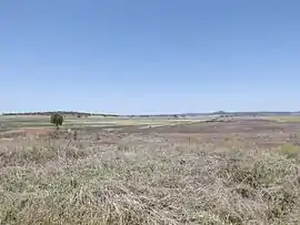 Fields along Toowoomba Cecil Plains Road, 2014 | |||||||||||||||
 Motley | |||||||||||||||
| Coordinates | 27.5436°S 151.6144°E | ||||||||||||||
| Population | 9 (2016 census)[1] | ||||||||||||||
| • Density | 1.50/km2 (3.88/sq mi) | ||||||||||||||
| Postcode(s) | 4356 | ||||||||||||||
| Area | 6.0 km2 (2.3 sq mi) | ||||||||||||||
| Time zone | AEST (UTC+10:00) | ||||||||||||||
| LGA(s) | Toowoomba Region | ||||||||||||||
| State electorate(s) | Condamine | ||||||||||||||
| |||||||||||||||
Geography
Motley is on the Darling Downs.
History
The locality takes its name from a former railway station, which in turn was assigned on 5 August 1915 by the Queensland Railways Department derived from the parish name.[2]
Motley State School opened on 14 August 1922 and closed on 14 July 1936.[3]
References
- Australian Bureau of Statistics (27 June 2017). "Motley (SSC)". 2016 Census QuickStats. Retrieved 20 October 2018.

- "Motley – locality in Toowoomba Region (entry 48006)". Queensland Place Names. Queensland Government. Retrieved 17 November 2019.
- Queensland Family History Society (2010), Queensland schools past and present (Version 1.01 ed.), Queensland Family History Society, ISBN 978-1-921171-26-0
This article is issued from Wikipedia. The text is licensed under Creative Commons - Attribution - Sharealike. Additional terms may apply for the media files.