Harlaxton, Queensland
Harlaxton is a locality in the Toowoomba Region, Queensland, Australia.[2] In the 2016 census, Harlaxton had a population of 2,547 people.[1] Traditionally a rural area, most of the locality is now residential.
| Harlaxton Toowoomba, Queensland | |||||||||||||||
|---|---|---|---|---|---|---|---|---|---|---|---|---|---|---|---|
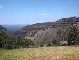 View eastwards from Gilmour Court, 2014 | |||||||||||||||
 Harlaxton | |||||||||||||||
| Coordinates | 27.5305°S 151.955°E | ||||||||||||||
| Population | 2,547 (2016 census)[1] | ||||||||||||||
| • Density | 509/km2 (1,319/sq mi) | ||||||||||||||
| Postcode(s) | 4350 | ||||||||||||||
| Area | 5.0 km2 (1.9 sq mi) | ||||||||||||||
| Time zone | AEST (UTC+10:00) | ||||||||||||||
| Location | 4 km (2 mi) N of Toowoomba | ||||||||||||||
| LGA(s) | Toowoomba Region | ||||||||||||||
| State electorate(s) | Toowoomba North | ||||||||||||||
| Federal Division(s) | Groom | ||||||||||||||
| |||||||||||||||
Geography
Harlaxton is located 4 kilometres (2 mi) north of the Toowoomba city centre.
History
The locality's name originates from Harlaxton House, probably named for Harlaxton in Lincolnshire, England, and built in 1869 in what is now Munro Street as the residence of Francis Thomas Gregory. Gregory was an explorer in Western Australia, before moving to Queensland in 1862, serving as Commissioner of Crown Lands and an appointed Member of the Queensland Legislative Council from 1874 until his death in 1888. The home was later used as the summer residence for Lord Lamington who served as Governor of Queensland from 1896 until 1901. A Harlaxton railway station was built for his use at the site (on the Main line railway).[3][4] The house is in a deteriorating condition, partly due to blasts from the neighbouring quarries.[5]
Harlaxton State School opened on 2 September 1901.[6]
Downlands Sacred Heart College was established on 1 March 1931 by the Missionaries of the Sacred Heart as a boarding school for boys.[6] The school had an initial enrolment of 68 students. In 1971 the school accepted day students, both boys and girls. From 1993 girls were also accepted as boarders, enabling siblings to attend the same school.[7][8]
Holy Trinity Anglican Church was dedicated on 2 October 1966 by Archbishop Strong. It closed circa 1982.[9]
In the 2016 census, Harlaxton had a population of 2,547 people.[1]
Heritage listings
Harlaxton has a number of heritage-listed sites, including:
- 6 Munro Street: Harlaxton House[4]
- Tyson Manor
Education
Harlaxton State School is a government primary (Prep-6) school for boys and girls at 110 Ruthven Street (27.5398°S 151.9545°E).[10][11] In 2017, the school had an enrolment of 130 students with 13 teachers (11 full-time equivalent) and 19 non-teaching staff (10 full-time equivalent).[12]
Downlands College is a Catholic primary and secondary (5-12) day and boarding school for boys and girls at 72 Ruthven Street (27.5353°S 151.9576°E).[10][13] In 2017, the school had an enrolment of 770 students with 70 teachers (68 full-time equivalent) and 49 non-teaching staff (35 full-time equivalent).[12]
Features and facilities
Harlaxton has a history as an industrial centre. Apart from the quarries, the suburb is home to the Willowburn railway marshalling yard and the original Darling Downs Bacon Company established as a co-operative in 1911 (later KR Castlemaine).
Harlaxton is also home to the Toowoomba Cricket Club and the Toowoomba Bears rugby union club, as well as the Willowburn Sports Club (soccer).
Demographics
According to the 2016 census of Population, there were 2,547 people in Harlaxton.
- Aboriginal and Torres Strait Islander people made up 7.2% of the population.
- 81.1% of people were born in Australia.
- 86.9% of people spoke only English at home.
- The most common responses for religion were No Religion 24.9%, Catholic 21.3% and Anglican 15.6%.[1]
Harlaxton is the most socio-economically disadvantaged suburb in Toowoomba; at the 2006 census, residents had a median individual income of $366, compared with $448 for the Toowoomba statistical district, and a median family income of $881 compared to $1,116.[14] The suburb had a SEIFA score of 903, placing it below all other suburbs in the district.[15]
Politics
In the 2004 federal election and again in the 2010 election, the booth at Harlaxton North was the only booth in the Division of Groom to record a Labor two-party preferred majority.[16]
References
- Australian Bureau of Statistics (27 June 2017). "Harlaxton (SSC)". 2016 Census QuickStats. Retrieved 20 October 2018.

- "Harlaxton – locality in Toowoomba Region (entry 50198)". Queensland Place Names. Queensland Government. Retrieved 17 November 2019.
- "Harlaxton – railway station in the Toowoomba Region (entry 15397)". Queensland Place Names. Queensland Government. Retrieved 28 September 2017.
- "Harlaxton House (entry 600839)". Queensland Heritage Register. Queensland Heritage Council. Retrieved 15 July 2013.
- Burley, Lacey (18 September 2008). "Complaints alert EPA to state of Harlaxton House". Toowoomba Chronicle. Archived from the original on 29 September 2011. Retrieved 4 June 2011.
- Queensland Family History Society (2010), Queensland schools past and present (Version 1.01 ed.), Queensland Family History Society, ISBN 978-1-921171-26-0
- "Our History & Ethos". Downlands College. Archived from the original on 7 March 2019. Retrieved 29 November 2019.
- "Boarding Choice". Downlands College. Archived from the original on 7 March 2019. Retrieved 29 November 2019.
- "Closed Churches". Anglican Church of Southern Queensland. Archived from the original on 3 April 2019. Retrieved 24 February 2019.CS1 maint: unfit URL (link)
- "State and non-state school details". Queensland Government. 9 July 2018. Archived from the original on 21 November 2018. Retrieved 21 November 2018.
- "Harlaxton State School". Archived from the original on 9 August 2012. Retrieved 21 November 2018.
- "ACARA School Profile 2017". Archived from the original on 22 November 2018. Retrieved 22 November 2018.
- "Downlands College". Archived from the original on 27 October 2018. Retrieved 21 November 2018.
- Australian Bureau of Statistics (25 October 2007). "Toowoomba (QLD) (Statistical District)". 2006 Census QuickStats. Retrieved 5 June 2011.
- Australian Bureau of Statistics (25 March 2009). "2033.0.55.001 – Census of Population and Housing: Socio-Economic Indexes for Areas (SEIFA), Australia – Data only, 2006". Archived from the original on 29 June 2011. Retrieved 5 June 2011.
- Australian Electoral Commission (9 September 2010). "Qld Division – Groom – Two Candidate Preferred by Polling Place (2010)". Archived from the original on 2 June 2011. Retrieved 5 June 2011.; Australian Electoral Commission (9 November 2005). "Qld Division – Groom – Two Candidate Preferred by Polling Place (2004)". Retrieved 5 June 2011.
External links
| Wikimedia Commons has media related to Harlaxton, Queensland. |
- "Harlaxton". Queensland Places. Centre for the Government of Queensland, University of Queensland.