Cabarlah, Queensland
Cabarlah is a town and locality in the Toowoomba Region, Queensland, Australia.[2][3] At the 2016 census, Cabarlah had a population of 1,075.[1]
| Cabarlah Queensland | |||||||||||||||
|---|---|---|---|---|---|---|---|---|---|---|---|---|---|---|---|
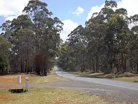 New England Highway, 2014 | |||||||||||||||
 Cabarlah | |||||||||||||||
| Coordinates | 27°26′09″S 151°59′44″E | ||||||||||||||
| Population | 1,075 (2016 census)[1] | ||||||||||||||
| Postcode(s) | 4352 | ||||||||||||||
| Location | 15 km (9 mi) N of Toowoomba | ||||||||||||||
| LGA(s) | Toowoomba Region | ||||||||||||||
| State electorate(s) | |||||||||||||||
| Federal Division(s) | Groom | ||||||||||||||
| |||||||||||||||
Geography
Cabarlah is approximately 15 kilometres (9.3 mi) north of the Toowoomba city centre and has an area of approximately 20 km². It is situated on the Great Divide with views to the east of the Lockyer Valley through to Brisbane and to the west across the Darling Downs. Traditionally the area has been used for farming however in recent years the expansion of the Toowoomba Regional Council has led to acreage and other residential development.[4]
History
In the 1860s to 1883 the area was called Five-Mile Camp. The name Cabarlah was used after Crows Nest railway line (from Toowoomba to Crows Nest) was built. It is thought that the name Cabarlah derived from an Aboriginal expression describing the ring-tailed possum.[5] However, a 1930 newspaper article claims it is a “Native name of the mountains in the neighbourhood”.[6]
The Queensland Government set aside land for the Geham Cemetery (now the Cabarlah Cemetery) on 11 September 1878. Trustees were appointed on 2 January 1880 with the first burials occurring in 1881.[7]
Cabarlah Post Office opened on 1 July 1927 (a receiving office had been open from 1884).[8]
The Cabarlah Community School opened in Wirraglen Road, Highfields, in January 2006. It used the Reggio Emilia teaching philosophy. In March 2008 it was closed when the Queensland Government's Non-State Schools Accreditation Board refused to accredit the school, claiming it did not meet the requirements of the Education (Accreditation of Non-State Schools) Act 2001. Although the school appealed the decision, the Queensland Education Minister, Rod Weldford, upheld the board's decision.[9]
Military history
The Borneo Barracks are west of the New England Highway at Cabarlah (27.4436°S 151.9787°E). The barracks were originally established as a World War I training area.[10]
Since the Second World War, Cabarlah has also had a significant role as a base for the Australian Army. It was home to elements of the 7th Brigade early in the war. Later in the war it became a hub for signals and other training. Cabarlah is now home to the 7th Signal Regiment (Electronic Warfare) and other Australian Defence Force signals facilities.[11]
St Martin's Anglican Church was opened at the Cabarlah Barracks in 1959 but closed circa 1961.[12]
Population
In the 2016 Census, there were 1,075 people in Cabarlah. 83.6% of people were born in Australia and 93.2% of people only spoke English at home. The most common responses for religion were No Religion 26.3%, Catholic 22.5% and Anglican 18.2%.[1]
Facilities
The Cabarlah Golf Club is located at Borneo Barracks. It is open to the public, but visitors must present their drivers licence for identification to enter the site.[13]
The Cabarlah Cemetery is located at 10148 New England Highway (27.4512°S 151.9876°E). It is operated by the Toowoomba Regional Council.[7]
References
- Australian Bureau of Statistics (27 June 2017). "Cabarlah (State Suburb)". 2016 Census QuickStats. Retrieved 3 October 2018.

 Material was copied from this source, which is available under a Creative Commons Attribution 4.0 International License.
 - "Cabarlah – town (entry 5605)". Queensland Place Names. Queensland Government. Retrieved 5 April 2017.
- "Cabarlah – locality (entry 49267)". Queensland Place Names. Queensland Government. Retrieved 5 April 2017.
- "Cabarlah". Tourism Queensland. Retrieved 16 September 2010.
- "Cabarlah | Queensland Places". queenslandplaces.com.au. Retrieved 5 April 2017.
- "NOMENCLATURE OF QUEENSLAND.—69 - (Compiled from Records in the Oxley Memorial Library) - The Courier-Mail (Brisbane, Qld. : 1933 - 1954) - 18 Dec 1935". Trove. Retrieved 5 April 2017.
- "Location, open hours and interment options for all Toowoomba Regional Council cemeteries". Toowoomba Regional Council. Retrieved 5 April 2017.
- Premier Postal History. "Post Office List". Premier Postal Auctions. Retrieved 10 May 2014.
- Searle, Susan (11 March 2008). "School shuts after failing government examination". Toowoomba Chronicle. Retrieved 5 April 2017.
- "BORNEO BARRACKS, CABARLAH, QUEENSLAND" (PDF). Department of Defence. Australian Government. Retrieved 5 April 2017.
- "Defence cools talk of Cabarlah closure". ABC News. 7 May 2009. Retrieved 16 September 2010.
- Anglican Church of Southern Queensland. "Closed Churches". Archived from the original on 3 April 2019. Retrieved 3 April 2019.
- "Welcome to the Cabarlah Golf Course". Carbalah Golf Course. Retrieved 5 April 2017.
Further reading
- Jeffrey Richelson and Desmond Ball. The ties that bind: intelligence cooperation between the UKUSA countries. Allen & Unwin. 1985. ISBN 0-04-327092-1. (re Defence Signals Directorate and other ADF installations).
History of Cabarlah Wiki: https://sites.google.com/site/historyofcabarlah/home
External links
![]() Media related to Cabarlah, Queensland at Wikimedia Commons
Media related to Cabarlah, Queensland at Wikimedia Commons