Linthorpe, Queensland
Linthorpe is a rural locality in the Toowoomba Region, Queensland, Australia.[2] In the 2016 census, Linthorpe had a population of 440 people.[1]
| Linthorpe Queensland | |||||||||||||||
|---|---|---|---|---|---|---|---|---|---|---|---|---|---|---|---|
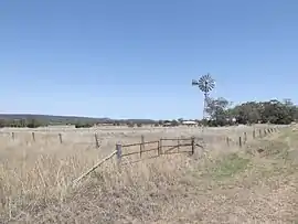 Fields and windmill along Biddeston Linthorpe Road, 2014 | |||||||||||||||
 Linthorpe | |||||||||||||||
| Coordinates | 27.5711°S 151.6555°E | ||||||||||||||
| Population | 440 (2016 census)[1] | ||||||||||||||
| • Density | 4.06/km2 (10.51/sq mi) | ||||||||||||||
| Postcode(s) | 4356 | ||||||||||||||
| Area | 108.4 km2 (41.9 sq mi) | ||||||||||||||
| Time zone | AEST (UTC+10:00) | ||||||||||||||
| LGA(s) | Toowoomba Region | ||||||||||||||
| State electorate(s) | Condamine | ||||||||||||||
| Federal Division(s) | Groom | ||||||||||||||
| |||||||||||||||
Geography
Linthorpe is on the Darling Downs.
Mount Haystack, Majuba Hill and Dummies Mountain are all located in Linthorpe.
The Gore Highway marks the southern boundary of Linthorpe.
History
Motley Provisional School opened on 12 March 1900 and closed on 20 May 1960. In January 1901 it was renamed Linthorpe Provisional School. On 1 Jan 1909 it became Linthorpe State School. The school closed in 1960.[3]
References
- Australian Bureau of Statistics (27 June 2017). "Linthorpe (SSC)". 2016 Census QuickStats. Retrieved 20 October 2018.

- "Linthorpe – locality in Toowoomba Region (entry 49193)". Queensland Place Names. Queensland Government. Retrieved 17 November 2019.
- Queensland Family History Society (2010), Queensland schools past and present (Version 1.01 ed.), Queensland Family History Society, ISBN 978-1-921171-26-0
This article is issued from Wikipedia. The text is licensed under Creative Commons - Attribution - Sharealike. Additional terms may apply for the media files.