West Haldon, Queensland
West Haldon is a locality split between Toowoomba Region and Lockyer Valley Region in Queensland, Australia.[2][3] In the 2016 census, West Haldon had a population of 62 people.[1]
| West Haldon Queensland | |||||||||||||||
|---|---|---|---|---|---|---|---|---|---|---|---|---|---|---|---|
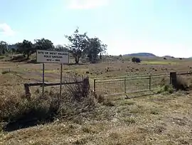 Former polo ground, 2014 | |||||||||||||||
 West Haldon | |||||||||||||||
| Coordinates | 27.7830°S 152.0855°E | ||||||||||||||
| Population | 62 (2016 census)[1] | ||||||||||||||
| • Density | 0.650/km2 (1.683/sq mi) | ||||||||||||||
| Postcode(s) | 4359 | ||||||||||||||
| Area | 95.4 km2 (36.8 sq mi) | ||||||||||||||
| Time zone | AEST (UTC+10:00) | ||||||||||||||
| LGA(s) | |||||||||||||||
| State electorate(s) | |||||||||||||||
| Federal Division(s) | |||||||||||||||
| |||||||||||||||
Geography
West Haldon is in South East Queensland.
The southern boundary roughly follows the watershed of Lockyer Creek.
History
West Haldon Provisional School opened on 7 April 1896. On 1 January 1909 it became West Haldon State School. It closed on 18 September 1949.[4]
References
- Australian Bureau of Statistics (27 June 2017). "West Haldon (SSC)". 2016 Census QuickStats. Retrieved 20 October 2018.

- "West Haldon – locality in Toowoomba Region (entry 48090)". Queensland Place Names. Queensland Government. Retrieved 17 November 2019.
- "West Haldon – locality in Lockyer Valley Region (entry 44997)". Queensland Place Names. Queensland Government. Retrieved 16 November 2019.
- Queensland Family History Society (2010), Queensland schools past and present (Version 1.01 ed.), Queensland Family History Society, ISBN 978-1-921171-26-0
This article is issued from Wikipedia. The text is licensed under Creative Commons - Attribution - Sharealike. Additional terms may apply for the media files.