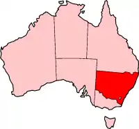
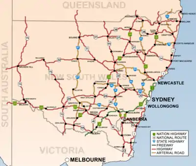
List of road routes in New South Wales
Road routes in New South Wales assist drivers navigating roads in urban, rural, and scenic areas of the state. Today, all numbered routes in the state are allocated a letter (M, A, B or D) in addition to a one- or -two digit number, with 'M' routes denoting motorways, 'A' routes denoting routes of national significance, 'B' routes denoting routes of state significance, and 'D' for Detour routes of a major motorway. The route system includes the officially designated highways, urban and intercity motorways and arterial roads, and important cross-state roads that have not been declared highways.
History
Route numbers have been allocated to NSW roads since 1955. National Route 1 ('Highway 1') was one of the best known numbered national routes, likely because of its fame for circumnavigating the continent. The insignia of national routes was a five-sided black and white shield, chosen as it is the shape of the Australian national coat of arms.
To supplement the national route number system, three ring roads were introduced to Sydney in 1964.[1] These were numbered 1, 3 and 5, with relatively (but not proportionately) increasing radii. While they were officially decommissioned in 1974, some old ring road 3 signs remained posted into the 1980s, and ring road 1 signs into the 1990s.
In 1973, a system of freeway numbering was introduced to the state to complement the national routes and ring roads. The shields were replicas of the red, white and blue U.S. Interstate Highway shields, and were numbered F1 to F8:
 : Warringah Freeway, and its never-built extensions
 : reserved for the Castlereagh Freeway, a corridor similar to today's M2 Hills Motorway but not signed
 : Sydney–Newcastle Freeway (now Pacific Motorway), and the never-built Lane Cove Valley Expressway and North Western Expressway, not signed anywhere except here where the sign still remains in 2020
 : Western part of today's M4 Western Motorway (formerly Western Freeway)
 : the freeway section of National Highway 31 (now Hume Motorway)
 : Southern Freeway (now Princes Motorway), Captain Cook Bridge and its never-built extensions to the Sydney CBD
 : reserved for a corridor along the alignment of the Cahill Expressway, Eastern Distributor and Bondi Junction Bypass but not signed
 : a section of Wollongong's Northern Distributor (now Memorial Drive)[2]
Most of these routes were replaced with other numbers over the decades, and by the 1990s, only the F1, F3 and F6 were still marked as such, with simpler, green-on-white shields. None of these shields remain, but the F3 and F6 are still usually called by those names until 2013.
In 1974, the National Highway network was defined, which in New South Wales included the Hume Highway (Now ![]() Hume Motorway North of Berrima), Federal Highway, Barton Highway, Sydney-Newcastle Freeway (now
Hume Motorway North of Berrima), Federal Highway, Barton Highway, Sydney-Newcastle Freeway (now ![]() Pacific Motorway) and New England Highway.[3] National highways were marked with the same shield as the national routes, except for their green and gold colour and the word 'national' added across the top.
Pacific Motorway) and New England Highway.[3] National highways were marked with the same shield as the national routes, except for their green and gold colour and the word 'national' added across the top.
Also in 1974, the three ring roads, 1, 3 and 5, were decommissioned and replaced by new State Routes, which had the same shields as the new freeways but without the red crest. Scores of other State Routes were also designated across New South Wales, marking out urban arterial routes and secondary rural highways. They were allocated as follows:
- 11, 33 and 55: Respectively replaced ring roads 1, 3 and 5. In 1988, state route 77 was commissioned as an additional primary circumferential route.
- 12-76: Greater Sydney. Even numbers were radial while odd numbers were circumferential, roughly increasing in value anticlockwise around the City. Exceptions were State Route 31 (which replaced Metroad 5 when the South Western Motorway was extended easterly; Metroad 5 was a replacement of the metropolitan part of National Highway 31) and state route 60 (which is in Wollongong). Routes 36, 40, 56, 68 and 69 extended beyond the bounds of Greater Sydney. While most State Routes still appear on maps and in street directories, they were haphazardly removed and covered up in Sydney in 1998 and 2004, leaving only routes 29, 31, 40, 44, 54, 56, 60 and 69.
- 78-99: Rural Areas. There was no discernible pattern with these routes. State route 83 was commissioned in 1979 and state route 89 was commissioned in 1980.
- 111, 121-124, 128, 131-133, 135: Greater Newcastle. 111 was added in 1988 following National Highway 1's relocation to the F3 Freeway.
- 151, 153, 155 and 157: Greater Wollongong, in addition to state routes 60, 68, 69 and 88.
- 2: In 2008, Queensland's State route 2 from the Gold Coast was extended a short distance into far northern NSW and remains the only official state route today in 2020.
In 1993, Sydney's Metroad system was introduced, with its prominent, blue-on-white hexagonal shields. There were initially six metroads: Metroad 1 replaced National Route 1 within the metropolitan area, Metroad 2 replaced parts of State Routes 28 and 30 (and was subsequently absorbed by the M2 Hills Motorway), Metroad 3 replaced State Route 33 (once Ring Road 3), Metroad 4 replaced the F4 Freeway and the metropolitan part of National Route 32, Metroad 5 replaced part of the metropolitan part of National Highway 31 and Metroad 7 replaced State Route 77. Later, Metroad 6 replaced State Route 45, Metroad 9 replaced the metropolitan part of State Route 69 and Metroad 10 replaced State Route 14 south of Mona Vale. There was never a Metroad 8. Many theories have been made that it was reserved for the Westlink M7 or the Cross City Tunnel but it was never confirmed.
In 2013, the state replaced its entire system of National Routes, National Highways and Metroads with an alphanumeric route numbering system.[4] All numbered routes are allocated a letter (M, A or B) in addition to its number, with 'M' routes denoting motorways, 'A' routes denoting routes of national significance, and 'B' routes denoting routes of state significance. Instead of shields, the route numbers are displayed as yellow text on green rectangular background outlined in white. Now all old routes have changed except for 1 (State Route 2 to be with QLD) The changeover to alphanumeric routes was announced from March 2013 and signs were updated between May and December 2013, either by removing old "shield" coverplates installed on newer signs, or installing new alphanumeric coverplates on old shielded signs.[5] In 2020, the styling of the markers was modified to remove the white border, aligning with all other states and territories except the ACT.[6]
Alphanumeric Routes
M routes
The Roads and Maritime Services define M routes as "motorway standard roads".[7] In practice, this means roads allocated an M route are usually at least dual-carriageway motorways with at least two lanes in each direction.
| Route | Component roads | From | Via | To | Length | Notes |
|---|---|---|---|---|---|---|
M1 |
Pacific Motorway (Byron Bay-Ballina Bypass) |
NSW/QLD Border | Woodburn | 127 km (79 mi) | - continues north as - continues south as Note: uncertainty still exists over which parts are officially classified | |
| Pacific Motorway (Maclean-Grafton Bypass) |
Woombah | Glenugie | 62 km (39 mi) | |||
| Pacific Motorway (Woolgoolga Bypass) |
Dirty Creek | Korora | 35 km (22 mi) | |||
| Pacific Motorway (Nambucca-Macksville Bypass) |
Raleigh | Warrell Creek | 42 km (26 mi) | |||
| Pacific Motorway (Clybucca-Kempsey Bypass) |
Eungai Creek | Thrumster | 79 km (49 mi) | |||
| Pacific Motorway | Beresfield | Wahroonga | 127 km (79 mi) | - continues north as - continues south as | ||
| Artarmon | Mascot | 62 km (39 mi) | - continues north as - continues south as - tolled on Sydney Harbour Tunnel (southbound only), Eastern Distributor and Military Road E-ramp. | |||
| Princes Motorway | Waterfall | Albion Park Rail | 55 km (34 mi) | - continues north as - continues south as | ||
M2 |
Baulkham Hills | Artarmon | 25 km (16 mi) | - continues north as - tolled | ||
M4 |
Glenbrook | Ashfield | 49 km (30 mi) | - continues east as - tolled between Parramatta and Ashfield | ||
M5 |
Edmondson Park | Mascot | 29 km (18 mi) | Tolled separately between Moorebank and Beverly Hills (M5 South-West), and on M5 East | ||
M7 |
Westlink M7 | Edmondson Park | Baulkham Hills | 40 km (25 mi) | Tolled | |
M8 |
M8 Motorway | Beverly Hills | Arncliffe | St Peters | 10 km (6 mi) | Tolled |
M15 |
Hunter Expressway | Lower Belford | Cameron Park | 26 km (16 mi) | - continues north as - continues east as | |
M23 |
Federal Highway | Yarra | NSW/ACT Border | 55 km (34 mi) | Continues west as | |
M31 |
Edmondson Park | NSW/VIC Border | 513 km (319 mi) | Continues south as | ||
A routes
The Roads and Maritime Services define A routes as "routes of national significance".[7]
| Route | Component roads | From | Via | To | Length | Notes |
|---|---|---|---|---|---|---|
A1 |
Pacific Highway | Woodburn | Woombah | 34 km (21 mi) | - continues north as - continues south as Note: uncertainty still exists over which parts are officially classified | |
| Pacific Highway | Glenugie | Dirty Creek | 25 km (16 mi) | |||
| Pacific Highway | Korora | Raleigh | 29 km (18 mi) | |||
| Pacific Highway | Warrell Creek | Eungai Creek | 14 km (9 mi) | |||
|
Thrumster | Beresfield | 223 km (139 mi) | - continues north as - continues south as - concurrencies: with | ||
| Pacific Highway | Wahroonga | Artarmon | 13.5 km (8 mi) | - continues north as - continues south as - concurrency with | ||
|
Mascot | Waterfall | 32 km (20 mi) | - continues north as - continues south as | ||
| Princes Highway | Albion Park Rail | NSW/VIC border | 420 km (261 mi) | - continues north as - continues south as | ||
A2 |
Windsor | Seven Hills | 22.8 km (14 mi) | Continues east as | ||
A3 |
|
Mona Vale | Blakehurst | 51 km (32 mi) | ||
A4 |
|
Haberfield | Pyrmont | Sydney | 10.8 km (7 mi) | - continues west as - to be retracted further east (currently being replaced by |
A6 |
|
Carlingford | Engadine | 41 km (25 mi) | ||
A8 |
|
Mona Vale | North Sydney | 22.8 km (14 mi) | ||
A9 |
|
Windsor | Campbelltown | 63 km (39 mi) | ||
A15 |
New England Highway | NSW/QLD border | Lower Belford | 540 km (336 mi) | - continues north as - continues east as - concurrency with | |
|
Cameron Park | Newcastle West | 16.4 km (10 mi) | - allocation rerouted from New England Highway, Pacific Highway and Industrial Drive (replaced by - continues west as - concurrency with | ||
A20 |
Sturt Highway | NSW/VIC border | Tarcutta | 597 km (371 mi) | - continues west as - concurrency with | |
A22 |
Liverpool | Glebe | 31 km (19 mi) | |||
A25 |
Barton Highway | Yass | Murrumbateman | NSW/ACT border | 40 km (25 mi) | Continues south as |
A28 |
Edmondson Park | Wahroonga | 41 km (25 mi) | Concurrency with | ||
A32 |
NSW/SA border | Lapstone | 1,146 km (712 mi) | Continues west as | ||
A34 |
|
Liverpool | Newtown | 26 km (16 mi) | ||
A36 |
Princes Highway | Glebe | Kogarah | 11.3 km (7 mi) | ||
A37 |
|
Sandgate | Bennetts Green | 16.4 km (10 mi) | Concurrency with | |
A38 |
|
North Ryde | Dee Why | 17.8 km (11 mi) | Concurrency with | |
A39 |
Newell Highway | NSW/QLD border | NSW/VIC border | 1,057 km (657 mi) | - continues north as - continues south as - concurrencies: with | |
A40 |
|
Seven Hills | Rozelle | 27.3 km (17 mi) | Concurrency with | |
A41 |
Bathurst | Table Top | 422 km (262 mi) | Concurrency with | ||
A43 |
|
Greta | Halloran | 109 km (68 mi) | Allocation extended west along New England Highway, Pacific Highway and Industrial Drive (replacing | |
A44 |
|
Leonay | Haberfield | 50 km (31 mi) | To be extended further east (currently replacing | |
A48 |
Illawarra Highway | Sutton Forest | Albion Park Rail | 62 km (39 mi) | ||
A49 |
Central Coast Highway | Doyalson | Kariong | 50 km (31 mi) | ||
Routes of state significance (B routes)
Note: If a road with the same name is separated that means it is a road with the same name that you have to make turns on to continue on that road.
| Route[8] | Component roads | From | Via | To | Length | Region | Notes | |
|---|---|---|---|---|---|---|---|---|
| km | mi | |||||||
B23 To Rockton (NSW/VIC Border) |
Monaro Highway | Williamsdale (NSW/ACT Border) | Cooma | 76 | 47 | Southern | Enters NSW as Formerly It has the same number as the Dual numbered with the Continues as | |
| Monaro Highway | Cooma | Steeple Flat | 46.2 | 29 | Southern | |||
| Monaro Highway | Steeple Flat | Bombala | 40.9 | 25 | Southern | |||
| Monaro Highway | Bombala | Bombala | 0.35 | 0 | Southern | |||
| Monaro Highway | Bombala | Bombala | 2.3 | 1 | Southern | |||
| Monaro Highway | Bombala | Rockton (NSW/VIC Border) | 39.9 | 25 | Southern | |||
B23 To Williamsdale (NSW/ACT Border) |
Monaro Highway | Rockton (NSW/VIC Border) | Bombala | 39.9 | 25 | Southern | Enters NSW as Dual numbered with the It has the same number as the Formerly Continues as | |
| Monaro Highway | Bombala | Bombala | 2.3 | 1 | Southern | |||
| Monaro Highway | Bombala | Bombala | 0.3 | 0 | Southern | |||
| Monaro Highway | Bombala | Steeple Flat | 40.9 | 25 | Southern | |||
| Monaro Highway | Steeple Flat | Cooma | 46.3 | 29 | Southern | |||
| Monaro Highway | Cooma | Williamsdale (NSW/ACT Border) | 76 | 47 | Southern | |||
B51 To Willow Tree |
Kamilaroi Highway | Narrabri | Boggabri | 54.2 | 34 | Western | ||
| Kamilaroi Highway | Boggabri | Gunnedah | 40 | 25 | Western | Dual numbered with the | ||
| Kamilaroi Highway | Gunnedah | Quirindi | 79.5 | 49 | Western | |||
| Kamilaroi Highway | Quirindi | Willow Tree | 14.4 | 9 | Western | |||
B51 To Narrabri |
Kamilaroi Highway | Willow Tree | Quirindi | 14.4 | 9 | Western | ||
| Kamilaroi Highway | Quirindi | Gunnedah | 79.4 | 49 | Western | Dual numbered with the | ||
| Kamilaroi Highway | Gunnedah | Boggabri | 40 | 25 | Western | |||
| Kamilaroi Highway | Boggabri | Narrabri | 54.2 | 34 | Western | |||
B52 To Queanbeyan West (NSW/ACT Border) |
Kings Highway | North Batemans Bay | Braidwood | 58.4 | 36 | Southern | ||
| Kings Highway | Braidwood | Braidwood | 0.95 | 1 | Southern | |||
| Kings Highway | Braidwood | Bungendore | 47.7 | 30 | Southern | |||
| Kings Highway | Bungendore | Bungendore (NSW/ACT Border) | 7.9 | 5 | Southern | Continues as | ||
| Kings Highway | Carwoola (NSW/ACT Border) | Queanbeyan West (NSW/ACT Border) | 12.4 | 8 | Southern | The | ||
B52 To North Batemans Bay |
Kings Highway | Crestwood (NSW/ACT Border) | Carwoola (NSW/ACT Border) | 12.4 | 8 | Southern | Continues as | |
| Kings Highway | Bungendore (NSW/ACT Border) | Bungendore | 7.9 | 5 | Southern | Continues as | ||
| Kings Highway | Bungendore | Braidwood | 47.7 | 30 | Southern | |||
| Kings Highway | Braidwood | Braidwood | 0.95 | 1 | Southern | |||
| Kings Highway | Braidwood | North Batemans Bay | 58.4 | 36 | Southern | |||
B53 To Wallsend |
|
Morisset | Wallsend | 35.4 | 22 | Hunter and Central Coast | ||
B53 To To Morisset |
|
Wallsend | Morisset | 35.5 | 22 | Hunter and Central Coast | ||
B55 To Marrangaroo |
Castlereagh Highway | Angledool (NSW/QLD Border) | Gilgandra | 343 | 213 | Western | Enters NSW as Dual numbered with the | |
| Castlereagh Highway | Gilgandra | Gilgandra | 0.12 | 0 | Western | |||
| Castlereagh Highway | Gilgandra | Gilgandra | 1.2 | 1 | Western | Dual numbered with the | ||
| Castlereagh Highway | Gilgandra | Mendooran | 50.1 | 31 | Western | |||
| Castlereagh Highway | Mendooran | Mendooran | 0.7 | 0 | Western | |||
| Castlereagh Highway | Mendooran | Dunedoo | 38 | 24 | Western | |||
| Castlereagh Highway | Dunedoo | Dunedoo | 9.7 | 6 | Western | Dual numbered with the | ||
| Castlereagh Highway | Dunedoo | Gulgong | 43 | 27 | Western | |||
| Castlereagh Highway | Gulgong | Mudgee | 27.7 | 17 | Western | |||
| Castlereagh Highway | Mudgee | Mudgee | 0.95 | 1 | Western | |||
| Castlereagh Highway | Mudgee | Marrangaroo | 117 | 73 | Western | |||
| Castlereagh Highway | Marrangaroo | Marrangaroo | 0.29 | 0 | Western | |||
B55 To Angledool (NSW/QLD Border) |
Castlereagh Highway | Marrangaroo | Marrangaroo | 0.29 | 0 | Western | ||
| Castlereagh Highway | Marrangaroo | Mudgee | 117 | 73 | Western | |||
| Castlereagh Highway | Mudgee | Mudgee | 0.95 | 1 | Western | |||
| Castlereagh Highway | Mudgee | Gulgong | 27.7 | 17 | Western | |||
| Castlereagh Highway | Gulgong | Dunedoo | 43 | 27 | Western | |||
| Castlereagh Highway | Dunedoo | Dunedoo | 9.7 | 6 | Western | Dual numbered with the | ||
| Castlereagh Highway | Dunedoo | Mendooran | 38 | 24 | Western | |||
| Castlereagh Highway | Mendooran | Mendooran | 0.7 | 0 | Western | |||
| Castlereagh Highway | Mendooran | Gilgandra | 50.1 | 31 | Western | |||
| Castlereagh Highway | Gilgandra | Gilgandra | 1.2 | 1 | Western | Dual numbered with the | ||
| Castlereagh Highway | Gilgandra | Gilgandra | 0.12 | 0 | Western | |||
| Castlereagh Highway | Gilgandra | Angledool (NSW/QLD Border) | 343 | 213 | Western | Dual numbered with the Continues as | ||
B56 To Coonabarabran |
Oxley Highway | Port Macquarie | Sancrox | Bendemeer | 231 | 144 | Northern | |
| Oxley Highway | Bendemeer | Tamworth | 40.7 | 25 | Northern | Dual numbered with the | ||
| Oxley Highway | Tamworth | West Tamworth | 2.8 | 2 | Northern | |||
| Oxley Highway | West Tamworth | Gunnedah | 71.1 | 44 | Northern | |||
| Oxley Highway | Gunnedah | Gunnedah | 0.8 | 0 | Northern | Dual numbered with the | ||
| Oxley Highway | Gunnedah | Gunnedah | 1.5 | 1 | Northern | |||
| Oxley Highway | Gunnedah | Gunnedah | 0.45 | 0 | Northern | |||
| Oxley Highway | Gunnedah | Coonabarabran | 100 kilometres (62 mi) | Northern, Western | ||||
B56 To Port Macquarie |
Oxley Highway | Coonabarabran | Gunnedah | 100 kilometres (62 mi) | Western, Northern | |||
| Oxley Highway | Gunnedah | Gunnedah | 0.45 | 0 | Northern | |||
| Oxley Highway | Gunnedah | Gunnedah | 1.5 | 1 | Northern | Dual numbered with the | ||
| Oxley Highway | Gunnedah | Gunnedah | 0.8 | 0 | Northern | |||
| Oxley Highway | Gunnedah | West Tamworth | 71 | 44 | Northern | |||
| Oxley Highway | West Tamworth | Tamworth | 2.8 | 2 | Northern | |||
| Oxley Highway | Tamworth | Bendemeer | 40.7 | 25 | Northern | Dual numbered with the | ||
| Oxley Highway | Bendemeer | Sancrox | Port Macquarie | 231 | 144 | Northern | ||
B57 To Charlestown |
The Esplanade | Speers Point | Speers Point | 3.2 | 2 | Hunter and Central Coast | ||
|
Speers Point | Charlestown | 5.2 | 3 | Hunter and Central Coast | |||
| Charlestown Road | Charlestown | Charlestown | 1.1 | 1 | Hunter and Central Coast | |||
B57 To Speers Point |
Charlestown Road | Charlestown | Charlestown | 1.1 | 1 | Hunter and Central Coast | ||
|
Charlestown | Warners Bay | 5.2 | 3 | Hunter and Central Coast | |||
| The Esplanade | Warners Bay | Speers Point | 3.2 | 2 | Hunter and Central Coast | |||
B58 To East Albury |
Riverina Highway | Deniliquin | Finley | 57.2 | 36 | South Western | ||
| Riverina Highway | Finley | Finley | 0.18 | 0 | South Western | Dual numbered with the | ||
| Riverina Highway | Finley | Berrigan | 21.5 | 13 | South Western | |||
| Riverina Highway | Berrigan | Coreen | 55 | 34 | South Western | |||
| Riverina Highway | Coreen | Hopefield | 17.4 | 11 | South Western | |||
| Riverina Highway | Hopefield | Howlong | 20.8 | 13 | South Western | |||
| Riverina Highway | Howlong | Albury | 29 | 18 | South Western | |||
| Riverina Highway | Albury | Albury | 0.28 | 0 | South Western | |||
| Riverina Highway | Albury | Albury | 0.24 | 0 | South Western | |||
| Riverina Highway | Albury | Albury | 1.2 | 1 | South Western | |||
| Riverina Highway | Albury | Albury | 1.2 | 1 | South Western | |||
| Riverina Highway | Albury | East Albury | 0.28 | 0 | South Western | |||
B58 To Deniliquin |
Riverina Highway | East Albury | Albury | 0.26 | 0 | South Western | ||
| Riverina Highway | Albury | South Albury | 1.2 | 1 | South Western | |||
| Riverina Highway | South Albury | South Albury | 1.2 | 1 | South Western | |||
| Riverina Highway | South Albury | Albury | 0.23 | 0 | South Western | |||
| Riverina Highway | Albury | Albury | 0.26 | 0 | South Western | |||
| Riverina Highway | Albury | Howlong | 29 | 18 | South Western | |||
| Riverina Highway | Howlong | Hopefield | 20.8 | 13 | South Western | |||
| Riverina Highway | Hopefield | Coreen | 17.4 | 11 | South Western | |||
| Riverina Highway | Coreen | Berrigan | 55 | 34 | South Western | |||
| Riverina Highway | Berrigan | Finley | 21.5 | 13 | South Western | |||
| Riverina Highway | Finley | Finley | 0.18 | 0 | South Western | Dual numbered with the | ||
| Riverina Highway | Finley | Deniliquin | 57.2 | 36 | South Western | |||
B59 To Bowenfels |
|
Vineyard | Richmond | 9.2 | 6 | Sydney | ||
| East Market Street | Richmond | Richmond | 0.19 | 0 | Sydney | |||
|
Richmond | Kurrajong
Bilpin |
Lithgow | 78.8 | 49 | Sydney, Western | ||
| Lithgow Street | Lithgow | Lithgow | 0.84 | 1 | Western | |||
| Main Street | Lithgow | Bowenfels | 1.6 | 1 | Western | |||
B59 To Vineyard |
Main Street | Bowenfels | Lithgow | 1.6 | 1 | Western | ||
| Lithgow Street | Lithgow | Lithgow | 0.84 | 1 | Western | |||
|
Lithgow | Kurrajong
Bilpin |
Richmond | 78.8 | 49 | Western, Sydney | ||
| East Market Street | Richmond | Richmond | 0.19 | 0 | Sydney | |||
|
Richmond | Vineyard | 9.2 | 6 | Sydney | |||
B60 To Tenterfield |
Bruxner Highway | West Ballina | South Lismore | 28.8 | 18 | Northern | ||
| Bruxner Highway | South Lismore | Casino | 28.9 | 18 | Northern | |||
| Bruxner Highway | Casino | Casino | 1.5 | 1 | Northern | Dual numbered with the | ||
| Bruxner Highway | Casino | Tenterfield | 126 | 78 | Northern | |||
B60 To West Ballina |
Bruxner Highway | Tenterfield | Casino | 126 | 78 | Northern | ||
| Bruxner Highway | Casino | Casino | 1.5 | 1 | Northern | Dual numbered with the | ||
| Bruxner Highway | Casino | South Lismore | 29 | 18 | Northern | |||
| Bruxner Highway | South Lismore | West Ballina | 28.8 | 18 | Northern | |||
B62 To Lismore |
Hinterland Way | Ewingsdale | Bangalow | 5.8 | 4 | Northern | ||
| Granuaille Road | Bangalow | Bangalow | 1.6 | 1 | Northern | |||
|
Bangalow | Lismore | 32.2 | 20 | Northern | |||
B62 To Ewingsdale |
|
Lismore | Bangalow | 32.2 | 20 | Northern | ||
| Granuaille Road | Bangalow | Bangalow | 1.5 | 1 | Northern | |||
| Hinterland Way | Bangalow | Ewingsdale | 5.9 | 4 | Northern | |||
B63 To Nelson Bay |
|
Adamstown Heights | Mayfield | 8.2 | 5 | Hunter and Central Coast | ||
| Industrial Drive | Mayfield | Mayfield West | 1 | 1 | Hunter and Central Coast | Dual numbered with the | ||
|
Mayfield West | Kooragang | 4.9 | 3 | Hunter and Central Coast | |||
|
Kooragang | Nelson Bay | 45.6 | 28 | Hunter and Central Coast | |||
B63 To Adamstown Heights |
|
Nelson Bay | Kooragang | 45.5 | 28 | Hunter and Central Coast | ||
|
Kooragang | Mayfield West | 4.9 | 3 | Hunter and Central Coast | |||
| Industrial Drive | Mayfield West | Mayfield | 1 | 1 | Hunter and Central Coast | Dual numbered with the | ||
|
Mayfield | Adamstown Heights | 8.2 | 5 | Hunter and Central Coast | |||
B64 To Hay |
Mid Western Highway | Cowra | Caragabal | 122 | 76 | South Western | ||
| Mid Western Highway | Caragabal | Hay | 291 | 181 | South Western | Dual numbered with the | ||
B64 To Cowra |
Mid Western Highway | Hay | Caragabal | 291 | 181 | South Western | Dual numbered with the | |
| Mid Western Highway | Caragabal | Cowra | 122 | 76 | South Western | |||
B65 To Croom |
Maddens Plains | Fairy Meadow | 13.5 | 8 | Southern | Has Motorway significance in the Southern 4km and the Northern 3km of Memorial Drive | ||
| Memorial Drive (On/Off Ramp) | Fairy Meadow | North Wollongong | 0.4 | 0 | Southern | |||
| Princes Highway | North Wollongong | North Wollongong | 0.65 | 0 | Southern | |||
| Bourke Street | North Wollongong | North Wollongong | 0.6 | 0 | Southern | |||
|
North Wollongong | Spring Hill | 7 | 4 | Southern | |||
|
Cringila | Croom | 17 | 11 | Southern | |||
B65 To Maddens Plains |
|
Croom | Cringila | 16.9 | 11 | Southern | ||
|
Cringila | North Wollongong | 7 | 4 | Southern | |||
| Bourke Street | North Wollongong | Wollongong | 0.65 | 0 | Southern | |||
| Princes Highway | Wollongong | North Wollongong | 0.8 | 0 | Southern | |||
| Memorial Drive (On/Off Ramp) | North Wollongong | Fairy Meadow | 0.35 | 0 | Southern | |||
| Memorial Drive | Fairy Meadow | Bulli | 7.9 | 5 | Southern | Has Motorway significance in the Southern 4km and the Northern 3km. | ||
| Princes Highway | Bulli | Bulli | 0.091 | 0 | Southern | |||
| Princes Highway | Bulli | Maddens Plains | 5.7 | 4 | Southern | |||
B68 To Cessnock |
|
Beresfield | Kurri Kurri | 18 | 11 | Hunter and Central Coast | Dual numbered with the | |
|
Kurri Kurri | Weston | 2.1 | 1 | Hunter and Central Coast | |||
| Station Street | Weston | Weston | 0.11 | 0 | Hunter and Central Coast | |||
|
Weston | Cessnock | 10.7 | 7 | Hunter and Central Coast | |||
B68 To Beresfield |
|
Cessnock | Weston | 10.7 | 7 | Hunter and Central Coast | ||
| Station Street | Weston | Weston | 0.11 | 0 | Hunter and Central Coast | |||
|
Weston | Kurri Kurri | 2.1 | 1 | Hunter and Central Coast | |||
|
Kurri Kurri | Beresfield | 18.4 | 11 | Hunter and Central Coast | Dual numbered with the | ||
B69 To Campbelltown |
Appin Road | Cataract | Appin | 18.5 | 11 | Southern | ||
| Appin Road | Appin | Campbelltown | 14.7 | 9 | Southern | |||
| Narellan Road | Campbelltown | Campbelltown | 2.6 | 2 | Sydney | |||
B69 To Cataract |
Narellan Road | Campbelltown | Bradbury | 2.5 | 2 | Sydney | ||
| Appin Road | Bradbury | Appin | 14.7 | 9 | Southern | |||
| Appin Road | Appin | Cataract | 17.4 | 11 | Southern | |||
B70 To Noraville |
|
Jilliby | Noraville | 14.3 | 9 | Hunter and Central Coast | ||
B70 To Jilliby |
|
Noraville | Jilliby | 14.3 | 9 | Hunter and Central Coast | ||
B71 To Nyngan |
Mitchell Highway | Enngonia (NSW/QLD Border) | North Bourke | 131 | 81 | Western | Enters NSW as | |
| Mitchell Highway | North Bourke | Bourke | 5.5 | 3 | Western | |||
| Mitchell Highway | Bourke | Bourke | 0.7 | 0 | Western | |||
| Mitchell Highway | Bourke | Bourke | 0.6 | 0 | Western | |||
| Mitchell Highway | Bourke | Nyngan | 202 | 126 | Western | |||
B71 To Enngonia (NSW/QLD Border) |
Mitchell Highway | Nyngan | Bourke | 202 | 126 | Western | ||
| Mitchell Highway | Bourke | Bourke | 0.6 | 0 | Western | |||
| Mitchell Highway | Bourke | Bourke | 0.7 | 0 | Western | |||
| Mitchell Highway | Bourke | North Bourke | 5.5 | 3 | Western | |||
| Mitchell Highway | North Bourke | Enngonia (NSW/QLD Border) | 131 | 81 | Western | Continues as | ||
B72 To Stony Creek |
Snowy Mountains Highway | Mundarlo | Adelong | 27.7 | 17 | Southern | ||
| Snowy Mountains Highway | Adelong | Pine Valley | 194 | 121 | Southern | |||
| Snowy Mountains Highway | Pine Valley | Cooma | 7.1 | 4 | Southern | |||
| Snowy Mountains Highway | Cooma | Stony Creek | 105 | 65 | Southern | Dual numbered with the | ||
B72 To Mundarlo |
Snowy Mountains Highway | Stony Creek | Cooma | 105 | 65 | Southern | Dual numbered with the | |
| Snowy Mountains Highway | Cooma | Pine Valley | 7 | 4 | Southern | |||
| Snowy Mountains Highway | Pine Valley | Adelong | 194 | 121 | Southern | |||
| Snowy Mountains Highway | Adelong | Mundarlo | 27.7 | 17 | Southern | |||
B73 To Bomaderry |
Old Hume Highway | Aylmerton | Mittagong | 6.2 | 4 | Southern | ||
|
Mittagong | Bowral | 5.6 | 3 | Southern | |||
|
Bowral | Fitzroy Falls | 21.4 | 13 | Southern | |||
|
Fitzroy Falls | Bomaderry | 35.7 | 22 | Southern | |||
B73 To Alpine |
|
Bomaderry | Fitzroy Falls | 35.7 | 22 | Southern | ||
|
Fitzroy Falls | Bowral | 21.4 | 13 | Southern | |||
|
Bowral | Mittagong | 5.6 | 3 | Southern | |||
| Old Hume Highway | Mittagong | Alpine | 6.6 | 4 | Southern | |||
B74 To Long Jetty |
Wyong Road | Mardi | Long Jetty | 11.7 | 7 | Hunter and Central Coast | ||
B74 To Mardi |
Wyong Road | Bateau Bay | Mardi | 11.7 | 7 | Hunter and Central Coast | ||
B75 To Moama (NSW/VIC Border) |
Cobb Highway | Wilcannia | Deniliquin | 493 | 306 | Western, South Western | ||
| Cobb Highway | Deniliquin | Deniliquin | 2 | 1 | South Western | |||
| Cobb Highway | Deniliquin | Deniliquin | 1.7 | 1 | South Western | |||
| Cobb Highway | Deniliquin | Moama (NSW/VIC Border) | 74 | 46 | South Western | Continues as | ||
B75 To Deniliquin |
Cobb Highway | Moama (NSW/VIC Border) | Deniliquin | 74.1 | 46 | South Western | Enters NSW as | |
| Cobb Highway | Deniliquin | Deniliquin | 1.7 | 1 | South Western | |||
| Cobb Highway | Deniliquin | Deniliquin | 2 | 1 | South Western | |||
| Cobb Highway | Deniliquin | Wilcannia | 493 | 306 | South Western, Western | |||
B76 To Bourke |
Big River Way | Tyndale | South Grafton | 30.7 | 19 | Northern | Formerly | |
| Big River Way | South Grafton | South Grafton | 0.35 | 0 | Northern | Dual numbered with the | ||
| Gwydir Highway | South Grafton | Glen Innes | 158 | 98 | Northern | |||
| Gwydir Highway | Glen Innes | Glen Innes | 0.2 | 0 | Northern | Dual numbered with the | ||
| Gwydir Highway | Glen Innes | Inverell | 67 | 42 | Northern | |||
| Gwydir Highway | Inverell | Moree | 139 | 86 | Northern, Western | |||
| Gwydir Highway | Moree | Moree | 2.3 | 1 | Western | Dual numbered with the | ||
| Gwydir Highway | Moree | Moree | 1.5 | 1 | Western | |||
| Gwydir Highway | Moree | Moree | 1.5 | 1 | Western | |||
| Gwydir Highway | Moree | Moree | 0.24 | 0 | Western | |||
| Gwydir Highway | Moree | Collarenebri | 138 | 86 | Western | |||
| Gwydir Highway | Collarenebri | Walgett | 59.8 | 37 | Western | |||
| Castlereagh Highway | Walgett | Walgett | 14.4 | 9 | Western | Dual numbered with the | ||
| Kamilaroi Highway | Walgett | Walgett | 6.7 | 4 | Western | |||
| Kamilaroi Highway | Walgett | Brewarrina | 118 | 73 | Western | |||
| Kamilaroi Highway | Brewarrina | Brewarrina | 8.2 | 5 | Western | |||
| Kamilaroi Highway | Brewarrina | Bourke | 97 | 60 | Western | |||
B76 To Tyndale |
Kamilaroi Highway | Bourke | Brewarrina | 97 | 60 | Western | ||
| Kamilaroi Highway | Brewarrina | Brewarrina | 8.2 | 5 | Western | |||
| Kamilaroi Highway | Brewarrina | Walgett | 118 | 73 | Western | |||
| Kamilaroi Highway | Walgett | Walgett | 6.7 | 4 | Western | |||
| Castlereagh Highway | Walgett | Walgett | 14.4 | 9 | Western | Dual numbered with the | ||
| Gwydir Highway | Walgett | Collarenebri | 59.8 | 37 | Western | |||
| Gwydir Highway | Collarenebri | Moree | 138 | 86 | Western | |||
| Gwydir Highway | Moree | Moree | 0.24 | 0 | Western | |||
| Gwydir Highway | Moree | Moree | 1.5 | 1 | Western | |||
| Gwydir Highway | Moree | Moree | 1.6 | 1 | Western | |||
| Gwydir Highway | Moree | Moree | 2.3 | 1 | Western | Dual numbered with the | ||
| Gwydir Highway | Moree | Inverell | 139 | 86 | Northern, Western | |||
| Gwydir Highway | Inverell | Glen Innes | 67 | 42 | Northern | |||
| Gwydir Highway | Glen Innes | Glen Innes | 0.19 | 0 | Northern | Dual numbered with the | ||
| Gwydir Highway | Glen Innes | South Grafton | 158 | 98 | Northern | |||
| Big River Way | South Grafton | South Grafton | 0.35 | 0 | Northern | Dual numbered with the | ||
| Big River Way | South Grafton | Tyndale | 30.7 | 19 | Northern | Formerly | ||
B78 To Armidale |
Waterfall Way | Raleigh | Hernani | 77.7 | 48 | Northern | ||
| Waterfall Way | Hernani | Ebor | 13.1 | 8 | Northern | |||
| Waterfall Way | Ebor | Armidale | 74.3 | 46 | Northern | |||
| Waterfall Way | Armidale | Armidale | 1 | 1 | Northern | |||
| Waterfall Way | Armidale | Armidale | 3.7 | 2 | Northern | |||
B78 To Raleigh |
Waterfall Way | Armidale | Armidale | 3.7 | 2 | Northern | ||
| Waterfall Way | Armidale | Armidale | 1 | 1 | Northern | |||
| Waterfall Way | Armidale | Ebor | 74.3 | 46 | Northern | |||
| Waterfall Way | Ebor | Hernani | 13.1 | 8 | Northern | |||
| Waterfall Way | Hernani | Raleigh | 77.7 | 48 | Northern | |||
B79 To Tibooburra (NSW/QLD Border) |
Silver City Highway | Buronga | Curlwaa | 23.6 | 15 | South Western | ||
| Silver City Highway | Curlwaa | Wentworth | 6.2 | 4 | South Western | |||
| Silver City Highway | Wentworth | Wentworth | 0.5 | 0 | South Western | |||
| Silver City Highway | Wentworth | Broken Hill | 263 | 163 | South Western, Western | |||
| Silver City Highway | Broken Hill | Broken Hill | 3.8 | 2 | Western | |||
| Silver City Highway | Broken Hill | Broken Hill | 1.4 | 1 | Western | Dual numbered with the | ||
| Silver City Highway | Broken Hill | Broken Hill | 1.8 | 1 | Western | |||
| Silver City Highway | Broken Hill | Tibooburra (NSW/QLD Border) | 383 | 238 | Western | |||
B79 To Buronga |
Silver City Highway | Tibooburra (NSW/QLD Border) | Broken Hill | 383 | 238 | Western | ||
| Silver City Highway | Broken Hill | Broken Hill | 1.8 | 1 | Western | |||
| Silver City Highway | Broken Hill | Broken Hill | 1.4 | 1 | Western | Dual numbered with the | ||
| Silver City Highway | Broken Hill | Broken Hill | 3.8 | 2 | Western | |||
| Silver City Highway | Broken Hill | Wentworth | 263 | 163 | Western, South Western | |||
| Silver City Highway | Wentworth | Wentworth | 0.5 | 0 | South Western | |||
| Silver City Highway | Wentworth | Curlwaa | 6.2 | 4 | South Western | |||
| Silver City Highway | Curlwaa | Buronga | 23.6 | 15 | South Western | |||
B81 To Molong |
Lachlan Valley Way | Bowning | Boorowa | 46.5 | 29 | Western | ||
| Lachlan Valley Way | Boorowa | Cowra | 72.8 | 45 | Western, South Western | |||
| Mid Western Highway | Cowra | Cowra | 0.5 | 0 | South Western | Dual numbered with the | ||
| Lachlan Street | Cowra | Cowra | 0.052 | 0 | South Western | |||
|
Cowra | Canowindra | 31.9 | 20 | South Western | |||
| Canowindra Road | Canowindra | Canowindra | 0.23 | 0 | South Western | |||
|
Canowindra | Cudal | 34.7 | 22 | South Western, Western | |||
| The Escort Way | Cudal | Molong | 11.5 | 7 | Western | |||
| Peabody Road | Molong | Molong | 15.8 | 10 | Western | |||
| Wellington Street | Molong | Molong | 0.55 | 0 | Western | |||
| Edward Street | Molong | Molong | 0.85 | 1 | Western | |||
B81 To Bowning |
Edward Street | Molong | Molong | 0.85 | 1 | Western | ||
| Wellington Street | Molong | Molong | 0.55 | 0 | Western | |||
| Peabody Road | Molong | Molong | 15.8 | 10 | Western | |||
| The Escort Way | Molong | Cudal | 11.5 | 7 | Western | |||
|
Cudal | Canowindra | 34.7 | 22 | Western, South Western | |||
| Canowindra Road | Canowindra | Canowindra | 0.23 | 0 | South Western | |||
|
Canowindra | Cowra | 31.9 | 20 | South Western | |||
| Lachlan Street | Cowra | Cowra | 0.052 | 0 | South Western | |||
| Mid Western Highway | Cowra | Cowra | 0.5 | 0 | South Western | Dual numbered with the | ||
| Lachlan Valley Way | Cowra | Boorowa | 72.8 | 45 | South Western | |||
| Lachlan Valley Way | Boorowa | Bowning | 46.5 | 29 | South Western | |||
B82 To Greta |
|
Cooranbong | Mulbring | 15 | 9 | Hunter and Central Coast | ||
|
Mulbring | Kearsley | 8.4 | 5 | Hunter and Central Coast | |||
|
Kearsley | Aberdare | 2.4 | 1 | Hunter and Central Coast | |||
| Aberdare Road | Aberdare | Cessnock | 2.3 | 1 | Hunter and Central Coast | |||
| Vincent Street | Cessnock | Cessnock | 0.9 | 1 | Hunter and Central Coast | |||
| Wollombi Road | Cessnock | Cessnock | 0.093 | 0 | Hunter and Central Coast | |||
|
Cessnock | Branxton | 20.2 | 13 | Hunter and Central Coast | |||
| Wine Country Drive | Branxton | Greta | 1.2 | 1 | Hunter and Central Coast | This road was rerouted in 2014 when the Continues as | ||
B82 To Cooranbong |
Wine Country Drive | Greta | Branxton | 1.2 | 1 | Hunter and Central Coast | ||
|
Branxton | Cessnock | 20.1 | 12 | Hunter and Central Coast | |||
| Wollombi Road | Cessnock | Cessnock | 0.095 | 0 | Hunter and Central Coast | |||
| Vincent Street | Cessnock | Cessnock | 0.9 | 1 | Hunter and Central Coast | |||
| Aberdare Road | Cessnock | Aberdare | 2.3 | 1 | Hunter and Central Coast | |||
|
Aberdare | Kearsley | 2.4 | 1 | Hunter and Central Coast | |||
|
Kearsley | Mulbring | 8.5 | 5 | Hunter and Central Coast | |||
|
Mulbring | Cooranbong | 15 | 9 | Hunter and Central Coast | |||
B83 To Somersby |
Pacific Highway | Wahroonga | Hornsby | 1.6 | 1 | Sydney | Dual numbered with the | |
| Pacific Highway | Hornsby | Hornsby | 1.3 | 1 | Sydney | |||
| Pacific Highway | Hornsby | Hornsby | 0.065 | 0 | Sydney | |||
| Pacific Highway | Hornsby | Asquith | 1.2 | 1 | Sydney | |||
| Pacific Highway | Asquith | Cowan | 10.2 | 6 | Sydney | |||
| Pacific Highway | Cowan | Calga | 28.9 | 18 | Sydney, Hunter and Central Coast | |||
| Pacific Highway | Calga | Mooney Mooney Creek | 0.26 | 0 | Hunter and Central Coast | |||
| Old Pacific Highway | Mooney Mooney Creek | Somerby | 10.5 | 7 | Hunter and Central Coast | |||
| Wisemans Ferry Road | Somerby | Somersby | 0.85 | 1 | Hunter and Central Coast | |||
B83 To Wahroonga |
Wisemans Ferry Road | Somersby | Somersby | 0.8 | 0 | Hunter and Central Coast | Dual numbered with the | |
| Old Pacific Highway | Somersby | Calga | 10.5 | 7 | Hunter and Central Coast | |||
| Pacific Highway | Calga | Calga | 0.25 | 0 | Hunter and Central Coast | |||
| Pacific Highway | Calga | Cowan | 28.8 | 18 | Hunter and Central Coast, Sydney | |||
| Pacific Highway | Cowan | Hornsby | 11.3 | 7 | Sydney | |||
| Pacific Highway | Hornsby | Hornsby | 0.065 | 0 | Sydney | |||
| Pacific Highway | Hornsby | Hornsby | 1.3 | 1 | Sydney | |||
| Pacific Highway | Hornsby | Wahroonga | 1.6 | 1 | Sydney | |||
B84 To Dubbo |
Golden Highway | Whittingham | Mount Thorley | 10 | 6 | Hunter and Central Coast | ||
| Golden Highway | Mount Thorley | Mount Thorley | 3.4 | 2 | Hunter and Central Coast | |||
| Golden Highway | Mount Thorley | Mount Thorley | 0.24 | 0 | Hunter and Central Coast | |||
| Golden Highway | Mount Thorley | Denman | 50.9 | 32 | Hunter and Central Coast | |||
| Golden Highway | Denman | Dubbo | 249 | 155 | Hunter and Central Coast, Western | Dual numbered with the | ||
B84 To Whittingham |
Golden Highway | Dubbo | Denman | 249 | 155 | Western, Hunter and Central Coast | Dual numbered with the | |
| Golden Highway | Denman | Mount Thorley | 50.6 | 31 | Hunter and Central Coast | |||
| Golden Highway | Mount Thorley | Mount Thorley | 0.6 | 0 | Hunter and Central Coast | |||
| Golden Highway | Mount Thorley | Mount Thorley | 3.2 | 2 | Hunter and Central Coast | |||
| Golden Highway | Mount Thorley | Whittingham | 10 | 6 | Hunter and Central Coast | |||
B85 To Old Junee |
Goldfields Way | Wyalong | Old Junee | 116 | 72 | South Western | ||
B85 To Wyalong |
Goldfields Way | Old Junee | Wyalong | 116 | 72 | South Western | ||
B87 To Bourke |
Kidman Way | Bundure | Darlington Point | 80.9 | 50 | Western | ||
| Kidman Way | Darlington Point | Darlington Point | 0.23 | 0 | Western | Dual numbered with the | ||
| Kidman Way | Darlington Point | Darlington Point | 4 | 2 | Western | |||
| Kidman Way | Darlington Point | Griffith | 32.8 | 20 | Western | |||
| Kidman Way | Griffith | Griffith | 1.2 | 1 | Western | |||
| Kidman Way | Griffith | Griffith | 0.55 | 0 | Western | |||
| Kidman Way | Griffith | Hillston | 109 | 68 | Western | |||
| Kidman Way | Hillston | Hillston | 0.6 | 0 | Western | |||
| Kidman Way | Hillston | Cobar | 254 | 158 | Western | |||
| Kidman Way | Cobar | Cobar | 0.5 | 0 | Western | Dual numbered with the | ||
| Kidman Way | Cobar | Cobar | 0.65 | 0 | Western | |||
| Kidman Way | Cobar | Bourke | 159 | 99 | Western | |||
B87 To Bundure |
Kidman Way | Bourke | Cobar | 159 | 99 | Western | ||
| Kidman Way | Cobar | Cobar | 0.65 | 0 | Western | |||
| Kidman Way | Cobar | Cobar | 0.5 | 0 | Western | Dual numbered with the | ||
| Kidman Way | Cobar | Hillston | 254 | 158 | Western | |||
| Kidman Way | Hillston | Hillston | 0.6 | 0 | Western | |||
| Kidman Way | Hillston | Griffith | 109 | 68 | Western | |||
| Kidman Way | Griffith | Griffith | 0.5 | 0 | Western | |||
| Kidman Way | Griffith | Griffith | 1.2 | 1 | Western | |||
| Kidman Way | Griffith | Darlington Point | 32.8 | 20 | Western | |||
| Kidman Way | Darlington Point | Darlington Point | 4 | 2 | Western | |||
| Kidman Way | Darlington Point | Darlington Point | 0.23 | 0 | Western | Dual numbered with the | ||
| Kidman Way | Darlington Point | Bundure | 80.9 | 50 | Western | |||
B88 To Cataract |
Picton Road | Wilton | Cataract | 28.1 | 17 | Southern | ||
B88 To Wilton |
Picton Road | Cataract | Wilton | 28 | 17 | Southern | ||
B89 To Belmont |
|
West Wallsend | Warners Bay | 14.1 | 9 | Hunter and Central Coast | ||
|
Warners Bay | Belmont | 8.9 | 6 | Hunter and Central Coast | |||
B89 To West Wallsend |
|
Belmont | Warners Bay | 9 | 6 | Hunter and Central Coast | ||
|
Warners Bay | West Wallsend | 14.2 | 9 | Hunter and Central Coast | |||
B91 To Dairy Flat (NSW/QLD Border) |
Glenulgie | Grafton | 16 | 10 | Northern | Dual numbered with the Big River Way was formerly | ||
| Summerland Way | Grafton | Grafton | 0.9 | 1 | Northern | |||
| Summerland Way | Grafton | Grafton | 1.5 | 1 | Northern | |||
| Summerland Way | Grafton | Casino | 99.6 | 62 | Northern | Dual numbered with the | ||
| Summerland Way | Casino | Lindesay Creek | 85.1 | 53 | Northern | |||
| Summerland Way | Lindesay Creek | Dairy Flat (NSW/QLD Border) | 9.4 | 6 | Northern | Continues as There is a bit of confusion of whether | ||
B91 To Glenugie |
Summerland Way | Dairy Flat (NSW/QLD Border) | Lindesay Creek | 9.4 | 6 | Northern | Enters NSW as There is a bit of confusion of whether | |
| Summerland Way | Lindesay Creek | Casino | 85.1 | 53 | Northern | |||
| Summerland Way | Casino | Grafton | 99.6 | 62 | Northern | Dual numbered with the | ||
| Summerland Way | Grafton | Grafton | 1.5 | 1 | Northern | |||
| Summerland Way | Grafton | Grafton | 0.9 | 1 | Northern | |||
| South Grafton | Glenugie | 16.8 | 10 | Northern | Dual numbered with the Big River Way was formerly | |||
B94 To Griffith |
Burley Griffin Way | Bowning | Binalong | 18.3 | 11 | South Western | ||
| Burley Griffin Way | Binalong | Temora | 112 | 70 | South Western | |||
| Burley Griffin Way | Temora | Temora | 0.45 | 0 | South Western | |||
| Burley Griffin Way | Temora | Beckom | 46.1 | 29 | South Western | |||
| Burley Griffin Way | Beckom | Ardlethan | 18.4 | 11 | South Western | Dual numbered with the | ||
| Burley Griffin Way | Ardlethan | Yoogali | 80.9 | 50 | South Western | |||
| Irrigation Way | Yoogali | Griffith | 3.4 | 2 | South Western | |||
B94 To Bowning |
Irrigation Way | Griffith | Yoogali | 3.4 | 2 | South Western | ||
| Burley Griffin Way | Yoogali | Ardlethan | 80.9 | 50 | South Western | |||
| Burley Griffin Way | Ardlethan | Beckom | 18.4 | 11 | South Western | Dual numbered with the | ||
| Burley Griffin Way | Beckom | Temora | 46.1 | 29 | South Western | |||
| Burley Griffin Way | Temora | Temora | 0.45 | 0 | South Western | |||
| Burley Griffin Way | Temora | Binalong | 112 | 70 | South Western | |||
| Burley Griffin Way | Binalong | Bowning | 18.3 | 11 | South Western | |||
B95 To Warialda |
Fossickers Way | Tamworth | Tamworth | 0.45 | 0 | Northern | ||
| Fossickers Way | Tamworth | Tamworth | 0.24 | 0 | Northern | |||
| Fossickers Way | Tamworth | Manilla | 44.3 | 28 | Northern | |||
| Fossickers Way | Manilla | Bingara | 106 | 66 | Northern | |||
| Fossickers Way | Bingara | Bingara | 0.45 | 0 | Northern | |||
| Fossickers Way | Bingara | Warialda | 37.8 | 23 | Northern | |||
B95 To Tamworth |
Fossickers Way | Warialda | Bingara | 37.8 | 23 | Northern | ||
| Fossickers Way | Bingara | Bingara | 0.45 | 0 | Northern | |||
| Fossickers Way | Bingara | Manilla | 106 | 66 | Northern | |||
| Fossickers Way | Manilla | Tamworth | 44.3 | 28 | Northern | |||
| Fossickers Way | Tamworth | Tamworth | 0.25 | 0 | Northern | |||
| Fossickers Way | Tamworth | Tamworth | 0.45 | 0 | Northern | |||
Unofficial route | ||||||||
Detour Routes (D routes)
D routes are only used in New South Wales. These are Detour Routes if a major Motorway is closed or if you want to avoid the Motorway. However, there are only two of them in NSW. The first D route was D5 which was commissioned in 2006.[12] The next D route to be signed was D1, mainly because there are many turns to avoid the M1 Pacific Motorway in the Central Coast. The third proposed D route was going to be D31 however, after that RMS standards changed, and all the signs just say "D". Therefore, there will be no more new D routes in NSW.
| Route | Component roads | From | Via | To | Length | RMS Classified Region | Notes | |
|---|---|---|---|---|---|---|---|---|
| km | mi | |||||||
D1 To Wahroonga |
Pacific Highway | Doyalson | Watanobbi | 12.9 | 8 | Hunter and Central Coast | ||
| Pacific Highway | Watanobbi | Ourimbah | 11.3 | 7 | Hunter and Central Coast | |||
| Pacific Highway | Ourimbah | Wyoming | 8.2 | 5 | Hunter and Central Coast | |||
| Manns Road | Wyoming | Narara | 0.18 | 0 | Hunter and Central Coast | |||
| Manns Road | Narara | West Gosford | 4.5 | 3 | Hunter and Central Coast | |||
| Central Coast Highway | West Gosford | Somersby | 4.7 | 3 | Hunter and Central Coast | Dual numbered with the | ||
| Wisemans Ferry Road | Somersby | Somersby | 0.8 | 0 | Hunter and Central Coast | Dual numbered with the | ||
| Old Pacific Highway | Somersby | Calga | 10.5 | 7 | Hunter and Central Coast | |||
| Pacific Highway | Calga | Calga | 0.25 | 0 | Hunter and Central Coast | |||
| Pacific Highway | Calga | Cowan | 28.8 | 18 | Hunter and Central Coast, Sydney | |||
| Pacific Highway | Cowan | Hornsby | 11.3 | 7 | Sydney | |||
| Pacific Highway | Hornsby | Hornsby | 0.065 | 0 | Sydney | |||
| Pacific Highway | Hornsby | Hornsby | 1.3 | 1 | Sydney | |||
| Pacific Highway | Hornsby | Wahroonga | 1.6 | 1 | Sydney | |||
D1 To Doyalson |
Pacific Highway | Wahroonga | Hornsby | 1.6 | 1 | Sydney | Dual numbered with the | |
| Pacific Highway | Hornsby | Hornsby | 1.3 | 1 | Sydney | |||
| Pacific Highway | Hornsby | Hornsby | 0.065 | 0 | Sydney | |||
| Pacific Highway | Hornsby | Asquith | 1.2 | 1 | Sydney | |||
| Pacific Highway | Asquith | Cowan | 10.2 | 6 | Sydney | |||
| Pacific Highway | Cowan | Calga | 28.9 | 18 | Sydney, Hunter and Central Coast | |||
| Pacific Highway | Calga | Mooney Mooney Creek | 0.26 | 0 | Hunter and Central Coast | |||
| Old Pacific Highway | Mooney Mooney Creek | Somerby | 10.5 | 7 | Hunter and Central Coast | |||
| Wisemans Ferry Road | Somerby | Somersby | 0.85 | 1 | Hunter and Central Coast | |||
| Central Coast Highway | Somersby | West Gosford | 4.6 | 3 | Hunter and Central Coast | Dual numbered with the | ||
| Manns Road | West Gosford | Narara | 4.5 | 3 | Hunter and Central Coast | |||
| Manns Road | Narara | Wyoming | 0.18 | 0 | Hunter and Central Coast | |||
| Pacific Highway | Wyoming | Ourimbah | 8.2 | 5 | Hunter and Central Coast | |||
| Pacific Highway | Ourimbah | Watanobbi | 11.4 | 7 | Hunter and Central Coast | |||
| Pacific Highway | Watanobbi | Doyalson | 12.9 | 8 | Hunter and Central Coast | |||
D5 To Arncliffe |
King Georges Road | Beverly Hills | Beverly Hills | 1.2 | 1 | Sydney | Dual numbered with the | |
| Stoney Creek Road | Beverly Hills | Bexley | 4 | 2 | Sydney | |||
|
Bexley | Arncliffe | 2.9 | 2 | Sydney | |||
| West Botany Street | Arncliffe | Arncliffe | 0.13 | 0 | Sydney | |||
| Marsh Street | Arncliffe | Arncliffe | 0.15 | 0 | Sydney | |||
D5 To Beverly Hills |
General Holmes Drive | Mascot | Kyeemagh | 1.2 | 1 | Sydney | Dual numbered with the | |
| Bestic Street | Kyeemagh | Rockdale | 1.2 | 1 | Sydney | |||
| West Botany Street | Rockdale | Arncliffe | 1.2 | 1 | Sydney | |||
|
Arncliffe | Bexley | 2.9 | 2 | Sydney | |||
| Stoney Creek Road | Bexley | Beverly Hills | 4 | 2 | Sydney | |||
| King Georges Road | Beverly Hills | Beverly Hills | 1.2 | 1 | Sydney | Dual numbered with the | ||
Tourist Drives
Southern Highlands Tourist Drives
| Route | Component Roads | From | Via | To | km | mi | notes |
|---|---|---|---|---|---|---|---|
Tourist Drive 3 |
Old Hume Highway
Avon Dam Road |
Picton | Avon Dam | 18.1 | 11.2 | ||
Tourist Drive 7 |
Berry | Kangaroo Valley | |||||
Tourist Drive 8 |
Goulburn | Lake Bathurst, Tarago, Bugendore | Federal Highway | ||||
Tourist Drive 12 |
Camden Bypass
Old Hume Highway/Remembrance Driveway |
Camden | Bargo | 42.9 | 26.6 | ||
| Old Hume Highway | Bargo | Alpine | 14.9 | 9.2 | |||
Tourist Drive 14 |
Old Hume Highway
Bowral Road Moss Vale Road |
Mittagong | Bowral, Moss Vale | Sutton Forrest | 28 | 17 | |
Tourist Drive 15 |
Illawarra Highway | Moss Vale | Moss Vale | 3.7 | 2.3 | ||
| Nowra Road | Moss Vale | Moss Vale | 1 | 0.6 | |||
| Nowra Road | Moss Vale | Fitzroy Falls | 11 | 6.8 | |||
| Sheepwash Road | Fitzroy Falls | Avoca | 7.5 | 4.6 | |||
| Illawarra Highway | Avoca | Robertson | 10.6 | 6.6 | |||
| Kangaloon Road | Robertson | Glenquarry | 15.3 | 9.5 | |||
| Kangaloon Road | Glenquarry | Bowral | 8.8 | 5 | |||
Tourist Drive 16 |
Goulburn | Marulan, Tallong, Wingello,
Bundanoon, Exeter, Sutton Forrest |
Moss Vale | 75 | 46.6 | ||
Tourist Drive 17 |
Mittagong | Berrima | Moss Vale |
https://images.bookeasy.com.au/website/images/southernhighlands/Southern%20Highlands%20Drive%20Map%202015%20-%20website.pdf - See all Southern Highlands Tourist Drives from 14 - 17
South Coast Tourist Drives
| Route | Component Roads | From | To | Length | Notes | |
|---|---|---|---|---|---|---|
| km | mi | |||||
|
Grand Pacific Drive |
Farnell Avenue
Audley Road Sir Bertram Stevens Drive Lady Wakehurst Drive |
Loftus | Stanwell Park | 39.8 km (24.7 mi) | ||
| Lawrence Hargrave Drive | Stanwell Park | Bulli | 17.4 km (10.8 mi) | |||
| Memorial Drive | Bulli | Fairy Meadow | 8.3 km (5.2 mi) | |||
Tourist Drive 4 |
Jervis Bay Road | Falls Creek | Huskisson | 7.6 | 4.7 | |
| Huskission Road | Huskisson | Huskisson | 3.4 | 2.1 | ||
Tourist Drive 5 |
||||||
Tourist Drive 6 |
Shoalhaven Heads | |||||
Tourist Drive 9 |
Jamberoo Road | Kiama | Jamberoo | 8.1 km (5.0 mi) | ||
| Churchill Street | Jamberoo | Jamberoo | 900 m (3,000 ft) | |||
| Jamberoo Mountain Road | Jamberoo | Robertson | 24 km (15 mi) | |||
Tourist Drive 13 |
Taralga Road | Goulburn | Richland | 55.6 km (34.5 mi) | ||
| Route | From | To | Notes |
|---|---|---|---|
|
Grand Pacific Drive |
Sutherland | Nowra | |
| Bombaderry | Berry | ||
| Shoalhaven Heads | Gerringong | ||
Tourist Drive 7 |
Berry | Kangaroo Valley | |
Tourist Drive 8 |
Bombaderry | Albion Park | |
| Kiama | Robertson | ||
| Waterfall | Croom | Decommissioned, no longer signed | |
Tourist Drive 13 |
Goulburn | Wombeyan Caves |
Macleay Valley Coast
| Route | From | To | Notes |
|---|---|---|---|
| Glenthorne | 12 Mile Creek | [13] | |
| Sancrox | Manning River | [14] | |
| Kempsey | South Bellimbopinni | ||
| Yarrahapini | Stewarts Point | ||
| Whittingham | Dubbo | Shares the same route as |
New England High Country
| Route | From | To | Notes |
|---|---|---|---|
Tourist Drive 17 |
Armidale | Loop route | |
| Armidale | Uralla | [15] | |
| Uralla | Bendemeer | [16] | |
Tourist Drive 25 |
Tamworth | Willow Tree | |
Tourist Drive 27 |
Whittingham | Dubbo | Shares the same route as |
Wollombi/ Hunter Region
| Route | Component Roads | From | Via | To | Length | Notes |
|---|---|---|---|---|---|---|
Hunter Tourist Circuit |
Newcastle | Merriwa
Taree |
Newcastle | Decommissioned, no longer signed
Loop Route | ||
Tourist Drive 33 |
Peats Ridge Road
George Downs Drive Great North Road |
Calga | Wollombi | 68.1 km (42.3 mi) | ||
| Wollombi Road | Wollombi | Cessnock | 29.0 km (18.0 mi) | |||
| Wine Country Drive | Cessnock | Branxton | 20.1 km (12.5 mi) |
Northern NSW Tourist Drives
| Route | Component roads | From. | To. | Length | Notes | ||
|---|---|---|---|---|---|---|---|
| km | mi | ||||||
Tourist Drive 24 |
|
Lismore | Bangalow | 32.2 | 20 | ||
| Granuaille Road | Bangalow | Bangalow | 1.5 | 1 | |||
| Hinterland Way | Bangalow | Ewingsdale | 5.9 | 4 | |||
Tourist Drive 32 |
Terania Street
Nimbin Road Cullen Street Blue Knob Road Nimbin Road |
North Lismore | Mount Burell | 42.1 | 28.1 | ||
| Kyogle Road
Riverview Street |
Mount Burell | Murwillumbah | 35.9 | 22.3 | |||
Tourist Drive 34 |
|||||||
Tourist Drive 36 |
|||||||
Tourist Drive 40 |
Tweed Valley Way
Brunswick Vally Way |
Childerah | Brunswick Valley | 48.4 | 30.1 | ||
Tourist Drive 42 |
Tomewin Road | Tomewin (NSW/QLD Border) | Kynnumboon | 10.3 | 6.4 | ||
other tourist drives
| Route | From | To | Notes |
|---|---|---|---|
Tourist Drive 3 |
Kyogle | [17] Multiple routes | |
| Raleigh | Grafton via |
||
| MacLean | Grafton | ||
| Woodburn | Broadwater via Evans Head | [18] | |
Tourist Drive 28 |
Wardell | Knockrow | [19] |
Tourist Drive 34 |
QLD Border | Murwillumbah | |
| Chillingham | Byagum |
Blue Mountains
| Route | Component Roads | From | To | Length | Notes |
|---|---|---|---|---|---|
Tourist Drive 1 |
Jenolan Caves Road
Edith Road Ross Street |
Hartley | Oberon | 74.4 kilometres (46.2 mi) | |
| Carrington Avenue
O'Connell Road Littlebourne Street |
Oberon | Kelso | 42.6 kilometres (26.5 mi) | ||
Blue Mountains Drive |
Leura Mall | Katoomba | Katoomba | ||
| Cliff Drive
Echo Point Road Lurine Street Waratah Street |
Katoomba | Katoomba | |||
| Katoomba Street | Katoomba | Katoomba | |||
| Bathurst Road | Katoomba | Katoomba | |||
| Parke Street | Katoomba | Katoomba |
Bellingen Shire Council
| Route | Component roads | From. | To. | Length | Notes | |
|---|---|---|---|---|---|---|
| km | mi | |||||
Tourist Drive 16 |
Giinagay Way | Urunga | Urunga | 5.2 | 3.2 | Bellingen Shire Council |
| Hungry Head Road
Morgo Street |
Urunga | Urunga | 5.7 | 3.5 | Bellingen Shire Council | |
| Bellingen Street | Urunga | Urunga | 1 | 0.6 | Bellingen Shire Council | |
Snowy Mountains - See here or here
| Route | From | To | Notes |
|---|---|---|---|
| Sovereign Inn | Cooma | [20] There isn't much info on this route. | |
| Snowy Mountains | See above |
Hornsby and Hawkesbury Tourist Drives
| Route | From | To | Notes |
|---|---|---|---|
| Hornsby | Dural. | Decommissioned, no longer signed | |
| Richmond | Penrith | Decommissioned, no longer signed | |
| Pennant Hills | Richmond | Decommissioned, no longer signed |
Future Road Routes
| Route | Component Roads | From | To | Length | Region | Notes | |
|---|---|---|---|---|---|---|---|
| km | mi | ||||||
M6 |
Southconnex M6 Motorway (Sydney) | Arncliffe | Kogarah | 4 | 2.5 | Sydney | M6 Southconnex Motorway (F6 extension) - Arncliffe to Kogarah through a tunnel. Planned to open in 2025. |
M12 |
M12 Motorway (Sydney) | Sydney | M12 Motorway (Sydney) - Cecil Hills to Luddenham. Planned to open in 2025 one year before the airport opens. | ||||
Future Extensions of Current Road Routes
| Route | Component Roads | From | To | Length | Region | Notes | |
|---|---|---|---|---|---|---|---|
| km | mi | ||||||
M1 |
Princes Motorway | Albion Park Rail | Oak Flats | Southern | |||
M4 |
M4 East | Haberfield | Rozelle | Sydney | |||
M8 |
Westconnex M8 Motorway, Western Harbour Tunnel & Beaches Link | St Peters | Balgowah | Sydney | |||
| Route Number | Road Names | Commissioned (expected) |
|---|---|---|
M1 |
M1 Pacific Motorway - Upgrades and duplications to parts of the Pacific Highway from Black Hill to Ballina, which will make the road Motorway Grade. Some stages will open in 2020 while some other stages will open later or are still in planning. M1 Princes Motorway - Upgrades and duplications to parts of the Princes Highway from Albion Park Rail to Timbilica, which will make the road Motorway Grade. Some stages will open in 2022 while some stages are in very early stages of planning and are unlikely to open for a long time. | 2022 - ? |
M4 |
M4 East Tunnel - Extension of the M4 East Tunnel from Haberfield to Rozelle. Planned to finish in 2023. It may even go to the M1 Warringah Freeway as the A4 East of Rozelle is Motorway grade. | 2023 |
M8 |
Westconnex M8 Motorway, Western Harbour Tunnel & Beaches Link - Extension of the M8 Motorway from St Peters to Rozelle. Planned to finish in 2023. Western Harbour Tunnel & Beaches Link from Rozelle to Balgowlah. Planned to finish in 2026. | 2023/2026 |
M15 |
New England Highway - Extension of the M15 from Lower Belford to Whittingham after the Belford to Golden Highway upgrade is complete. | 2022 |
A44 |
Victoria Road, City West Link, Dobroyd Parade - Extension of the A44 to Rozelle after the M4 East Tunnel is extended from Haberfield to Rozelle. Planned to finish in 2023. | 2023 |
Decommissioned or aborted Alphanumeric Road Routes
A7 |
Up until 2013, RMS planned to make Pennant Hills Road A7 until Northconnex opens. We know this because many government documents before 2013 state A7 Pennant Hills Road. However, the M2/M7 duplex confused motorists on which toll they're paying, which led them to cutting the M7 short and continuing A28 up to Wahroonga |
|---|---|
A11 |
Pacific Highway (Wahroonga) - Removed, was numbered A11 in preparation for the opening of NorthConnex but was removed shortly after when RMS decided NorthConnex wasn't going to have an alphanumeric route number |
A31 |
Hume Highway - Now M31 as it is now a Motorway grade road. |
A46 |
Newcastle Link Road - Now A15 to support Hunter Expressway |
B80 |
Monaro Highway - Now B23 to remain the same with Victoria |
Queensland State Routes
| Route | Component roads | From | To | Length | Region | Notes | |
|---|---|---|---|---|---|---|---|
| km | mi | ||||||
| Gold Coast Highway | Tweed Heads West (NSW/QLD Border) | Tweed Heads West | 1.1 | 1 | Northern | Enters NSW as | |
| Gold Coast Highway | Tweed Heads West | Tweed Heads West (NSW/QLD Border) | 1.1 | 1 | Northern | Continues into QLD as | |
Former NSW Metroads (As of 2012)
| Route | Component roads | From | Via | To | Length | RMS Classified Region | Notes | |
|---|---|---|---|---|---|---|---|---|
| km | mi | |||||||
Metroad 1 To Waterfall |
Pacific Highway (Australia) | Wahroonga | Pymble | Artarmon | 13.5 | 8 | Sydney | Now |
| Gore Hill Freeway (On Ramp) | Artarmon | Artarmon | 0.55 | 0 | Sydney | Now | ||
| Gore Hill Freeway | Artarmon | Artarmon | 0.85 | 1 | Sydney | |||
| Artarmon | Mascot | 19.6 | 12 | Sydney | ||||
|
Mascot | Monterey | 3 | 2 | Sydney | Now | ||
| President Avenue | Monterey | Kogarah | 1.6 | 1 | Sydney | |||
| Princes Highway | Kogarah | Blakehurst | 3.7 | 2 | Sydney | |||
| Princes Highway | Blahehurst | Kirrawee | 8.1 | 5 | Sydney | |||
| Princes Highway | Kirrawee | Waterfall | 16 | 10 | Sydney | |||
Metroad 1 To Wahroonga |
Princes Highway | Waterfall | Sutherland | 15.6 | 10 | Sydney | Now | |
| Princes Highway | Sutherland | Blakehurst | 8.1 | 5 | Sydney | |||
| Princes Highway | Blakehurst | Kogarah | 3.7 | 2 | Sydney | |||
| President Avenue | Kogarah | Brighton-Le-Sands | 1.6 | 1 | Sydney | |||
|
Brighton-Le-Sands | Mascot | 3.1 | 2 | Sydney | |||
| Mascot | Artarmon | 19.5 | 12 | Sydney | Now | |||
| Gore Hill Freeway | Artarmon | Artarmon | 0.95 | 1 | Sydney | |||
| Gore Hill Freeway (Off Ramp) | Artarmon | Lane Cove North | 0.55 | 0 | Sydney | |||
| Pacific Highway | Lane Cove North | Pymble | Wahroonga | 13.6 | 8 | Sydney | Now | |
Metroad 2 To Windsor |
Artarmon | Epping | Baulkham Hills | 24.5 | 15 | Sydney | Now | |
| M2 Hills Motorway (On/Off Ramp) | Baulkham Hills | Seven Hills | 0.65 | 0 | Sydney | Also known as Abbott Road.
Now | ||
| Seven Hills | Bella Vista
Rouse Hill Box Hill Vineyard |
Windsor | 22.8 | 14 | Sydney | Now | ||
Metroad 2 To Artarmon |
Windsor | Vineyard
Box Hill Rouse Hill Bella Vista |
Baulkham Hills | 22.8 | 14 | Sydney | Now partially | |
| M2 Hills Motorway (On Ramp) | Baulkham Hills | Baulkham Hills | 0.95 | 1 | Sydney | Also known as Abbott Road.
Now has no route number. | ||
| Baulkham Hills | Epping | Artarmon | 24.2 | 15 | Sydney | Now | ||
Metroad 3 to Blakehurst |
|
Mona Vale | Blakehurst | 51 | 32 | Sydney | Motorway grade on Mona Vale Road from Belrose to St Ives for 5.4km.
Now | |
Metroad 3 to Mona Vale |
|
Blakehurst | Mona Vale | 51 | 32 | Sydney | Motorway grade on Mona Vale Road from St Ives to Belrose for 5.4km.
Now | |
Metroad 4 To Glenbrook |
Millers Point | Sydney | 1.1 | 1 | Sydney | Now | ||
|
Sydney | Ashfield | 7.4 | 5 | Sydney | Now partially | ||
| Great Western Highway | Ashfield | Strathfield | 3.5 | 2 | Sydney | Now Also known as Parramatta Road | ||
| M4 Western Motorway | Strathfield | Parramatta
Penrith |
Glenbrook | 45.9 | 29 | Sydney | Now partially has no route number and partially | |
Metroad 4 To Millers Point |
M4 Western Motorway | Glenbrook | Parramatta
Penrith |
North Strathfield | 45.9 | 29 | Sydney | Now partially |
| Great Western Highway | North Strathfield | Haberfield | 3.5 | 2 | Sydney | Now Also known as Parramatta Road | ||
|
Haberfield | Sydney | 7.2 | 4 | Sydney | Now partially | ||
| Western Distributor | Sydney | Millers Point | 2.1 | 1 | Sydney | Now | ||
Metroad 5 To Mascot |
Mount Annan | Liverpool | Mascot | 45.1 | 28 | Sydney | Now partially The M31 Hume Motorway was formerly the Hume Highway. | |
Metroad 5 To Campbelltown |
Mascot | Liverpool
Edmondson Park |
Campbelltown | 45.1 | 28 | Sydney | Now partially The M31 Hume Motorway was formerly the Hume Highway. | |
Metroad 6 To Engadine |
Cumberland Highway | Beecroft | Carlingford | 2.5 | 2 | Sydney | Also known as Pennant Hills Road.
Now | |
| Marsden Road | Carlingford | Dundas Valley | 2.5 | 2 | Sydney | Now | ||
|
Dundas Valley | Dundas Valley | 1 | 1 | Sydney | |||
|
Dundas Valley | Sydney Olympic Park | Auburn | 6.1 | 4 | Sydney | ||
|
Auburn | Lidcome
Bankstown |
Lucas Heights | 25.8 | 16 | Sydney | ||
| Heathcote Road | Lucas Heights | Engadine | 5.5 | 3 | Sydney | |||
Metroad 6 To Carlingford |
Heathcote Road | Heathcote | Lucas Heights | 5.5 | 3 | Sydney | Now | |
|
Lucas Heights | Bankstown | Auburn | 25.8 | 16 | Sydney | ||
|
Auburn | Sydney Olympic Park | Dundas Valley | 6.1 | 4 | Sydney | ||
|
Dundas Valley | Dundas Valley | 1 | 1 | Sydney | |||
| Marsden Road | Dundas Valley | Carlingford | 2.5 | 2 | Sydney | |||
| Cumberland Highway | Carlingford | Carlingford | 2.5 | 2 | Sydney | Also known as Pennant Hills Road.
Now | ||
Metroad 7 To Beecroft |
Cumberland Highway | Wahroonga | Beecroft | 8.2 | 5 | Sydney | Also known as Pennant Hills Road.
Now | |
Metroad 7 To Wahroonga |
Cumberland Highway | Beecroft | Wahroonga | 8.2 | 5 | Sydney | Also known as Pennant Hills Road.
Now | |
Metroad 9 To Windsor |
|
Campbelltown | Cranebrook | 49 | 30 | Sydney | Now Was realigned after the Metroad System was abolished. | |
| The Northern Road | Cranebrook | Londonderry | 7.7 | 5 | Sydney | |||
| Richmond Road | Londonderry | Londonderry | 0.26 | 0 | Sydney | |||
|
Londonderry | Windsor | 5.4 | 3 | Sydney | |||
Metroad 9 To Campbelltown |
|
Windsor | South Windsor | 5.4 | 3 | Sydney | Now Was realigned after the Metroad System was abolished. | |
| Richmond Road | South Windsor | Windsor Downs | 0.26 | 0 | Sydney | |||
| The Northern Road | Windsor Downs | Llandilo | 7.7 | 5 | Sydney | |||
|
Llandilo | Campbelltown | 49 | 30 | Sydney | |||
Metroad 10 To Mona Vale |
|
Cammeray | Mosman | Mona Vale | 22.8 | 14 | Sydney | Now |
Metroad 10 To North Sydney |
|
Mona Vale | Mosman | North Sydney | 22.8 | 14 | Sydney | Now |
Former National Highways
| Route | Component roads | From | Via | To | Length | RMS Classified Region | Notes | |
|---|---|---|---|---|---|---|---|---|
| km | mi | |||||||
National Highway 1 To Wahroonga |
M1 Pacific Motorway | Beresfield | Morisset
Gosford |
Wahroonga | 127 | 79 | Hunter and Central Coast, Sydney | Formerly the F3 Freeway.
Now |
| M1 Pacific Motorway (Off Ramp) | Wahroonga | Wahroonga | 0.29 | 0 | Sydney | Formerly the F3 Freeway.
Now | ||
National Highway 1 To Black Hill |
M1 Pacific Motorway (Off Ramp) | Wahroonga | Wahroonga | 0.35 | 0 | Sydney | Formerly the F3 Freeway.
Now | |
| M1 Pacific Motorway | Wahroonga | Gosford
Morisset |
Beresfield | 127 | 79 | Sydney, Hunter and Central Coast, | Formerly the F3 Freeway.
Now | |
National Highway 15 To Beresfield |
New England Highway | Jennings (NSW/QLD Border) | Tamworth | 317 | 197 | Northern | Now | |
| New England Highway | Tamworth | South Tamworth | 2.4 | 1 | Northern | Now | ||
| New England Highway | South Tamworth | Muswellbrook | 154 | 96 | Northern, Hunter and Central Coast | Now | ||
| New England Highway | Muswellbrook | Singleton
Lower Belford |
Beresfield | 106 | 66 | Hunter and Central Coast | Now partially | |
National Highway 15 To Jennings (NSW/QLD Border) |
New England Highway | Beresfield | Lower Belford
Singleton |
Muswellbrook | 106 | 66 | Hunter and Central Coast | Now partially |
| New England Highway | Muswellbrook | South Tamworth | 154 | 96 | Hunter and Central Coast, Northern | Now | ||
| New England Highway | South Tamworth | Tamworth | 2.4 | 1 | Northern | Now | ||
| New England Highway | Tamworth | Jennings (NSW/QLD Border) | 317 | 197 | Northern | Now | ||
National Highway 20 To Buronga (NSW/VIC Border) |
Sturt Highway | Tarcutta | Tarcutta | 0.22 | 0 | South Western | Now | |
| Sturt Highway | Tarcutta | Gillenbah | 139 | 86 | South Western | |||
| Sturt Highway | Gillenbah | Balranald | 300 | 186 | South Western | |||
| Sturt Highway | Balranald | Euston | 80.3 | 50 | South Western | |||
| Sturt Highway | Euston | Buronga | 75.9 | 47 | South Western | |||
| Sturt Highway | Buronga | Buronga (NSW/VIC Border) | 1.6 | 1 | South Western | |||
National Highway 20 To Tarcutta |
Sturt Highway | Buronga (NSW/VIC Border) | Buronga | 1.6 | 1 | South Western | Now | |
| Sturt Highway | Buronga | Euston | 75.9 | 47 | South Western | |||
| Sturt Highway | Euston | Balranald | 80.2 | 50 | South Western | |||
| Sturt Highway | Balranald | Gillenbah | 300 | 186 | South Western | |||
| Sturt Highway | Gillenbah | Tarcutta | 139 | 86 | South Western | |||
| Sturt Highway | Tarcutta | Tarcutta | 0.22 | 0 | South Western | |||
National Highway 23 To Sutton (NSW/ACT Border) |
Federal Highway | Yarra | Sutton (NSW/ACT Border) | 66.2 | 41 | Southern | Now | |
National Highway 23 To Yarra |
Federal Highway | Sutton (NSW/ACT Border) | Yarra | 65.7 | 41 | Southern | Now | |
National Highway 25 To Wallaroo (NSW/ACT Border) |
Barton Highway | Yass | Wallaroo (NSW/ACT Border) | 41.5 | 26 | Southern | Now | |
National Highway 25 To Yass |
Barton Highway | Wallaroo (NSW/ACT Border) | Yass | 41.1 | 26 | Southern | Now | |
National Highway 31 To South Albury (NSW/VIC Border) |
Campbelltown | Yass | South Albury (NSW/VIC Border) | 497 | 309 | Sydney, Southern, South Western | The M31 Hume Motorway was formerly the Hume Highway.
Now | |
National Highway 31 To Mount Annan |
South Albury (NSW/VIC Border) | Yass | Mount Annan | 497 | 309 | South Western, Southern, Sydney | The M31 Hume Motorway was formerly the Hume Highway.
Now | |
National Highway 39 To Tocumwal (NSW/VIC Border) |
Newell Highway | Boggabilla (NSW/QLD Border) | Boggabilla | 7.4 | 5 | Northern | Now | |
| Newell Highway | Boggabilla | Narrabri | 214 | 133 | Northern, Western | |||
| Newell Highway | Narrabri | Narrabri | 0.85 | 1 | Western | |||
| Newell Highway | Narrabri | Coonabarabran | 114 | 71 | Western | |||
| Newell Highway | Coonabarabran | Gilgandra | 99.2 | 62 | Western | |||
| Newell Highway | Gilgandra | Dubbo | 64.2 | 40 | Western | |||
| Newell Highway | Dubbo | Parkes | 119 | 74 | Western | |||
| Newell Highway | Parkes | Parkes | 1.6 | 1 | Western | |||
| Newell Highway | Parkes | Forbes | 31.7 | 20 | Western, South Western | |||
| Newell Highway | Forbes | West Wyalong | 105 | 65 | South Western | |||
| Newell Highway | West Wyalong | Gillenbah | 137 | 85 | South Western | |||
| Newell Highway | Gillenbah | Gillenbah | 0.8 | 0 | South Western | |||
| Newell Highway | Gillenbah | Jerilderie | 106 | 66 | South Western | |||
| Newell Highway | Jerilderie | Tocumwal (NSW/VIC Border) | 56.3 | 35 | South Western | |||
National Highway 39 To Boggabilla (NSW/QLD Border) |
Newell Highway | Tocumwal (NSW/VIC Border) | Jerilderie | 56.3 | 35 | South Western | Now | |
| Newell Highway | Jerilderie | Gillenbah | 106 | 66 | South Western | |||
| Newell Highway | Gillenbah | Gillenbah | 0.8 | 0 | South Western | |||
| Newell Highway | Gillenbah | West Wyalong | 137 | 85 | South Western | |||
| Newell Highway | West Wyalong | Forbes | 105 | 65 | South Western | |||
| Newell Highway | Forbes | Parkes | 31.7 | 20 | South Western, Western | |||
| Newell Highway | Parkes | Parkes | 1.6 | 1 | Western | |||
| Newell Highway | Parkes | Dubbo | 119 | 74 | Western | |||
| Newell Highway | Dubbo | Gilgandra | 64.2 | 40 | Western | |||
| Newell Highway | Gilgandra | Coonabarabran | 99.2 | 62 | Western | |||
| Newell Highway | Coonabarabran | Narrabri | 114 | 71 | Western | |||
| Newell Highway | Narrabri | Narrabri | 0.8 | 0 | Western | |||
| Newell Highway | Narrabri | Boggabilla | 214 | 133 | Western, Northern | |||
| Newell Highway | Boggabilla | Boggabilla (NSW/QLD Border) | 7.4 | 5 | Northern | |||
Former National Routes
| Route | Component roads | From | Via | To | Length | Region | Commissioned Year | Decommissioned Year | Notes | ||
|---|---|---|---|---|---|---|---|---|---|---|---|
| km | mi | ||||||||||
National Route 1 To Timbilica (NSW/VIC Border) |
Pacific Highway | Cobaki Lakes (NSW/QLD Border) | Hexham | 668 | 415 | Northern, Hunter and Central Coast | 2013 | Now partially | |||
| New England Highway | Hexham | Beresfield | 4.2 | 3 | Hunter and Central Coast | 2013 | Now | ||||
| John Renshaw Drive | Beresfield | Beresfield | 1.3 | 1 | Hunter and Central Coast | 2013 | Now | ||||
| Princes Highway
Princes Highway |
Waterfall | Moruya | 258 | 160 | Southern | 2013 | Now partially | ||||
| Princes Highway | Moruya | Millingandi | 145 | 90 | Southern | 2013 | Now | ||||
| Princes Highway | Millingandi | Pambula | 6.9 | 4 | Southern | 2013 | |||||
| Princes Highway | Pambula | Eden | 18.7 | 12 | Southern | 2013 | |||||
| Princes Highway | Eden | Timbilica (NSW/VIC Border) | 47.8 | 30 | Southern | 2013 | |||||
National Alternative Route 1 |
Jersey Street North
Bridge Road George Street |
Asquith | Hornsby | 2 | 1.4 | Sydney | 1973/74 | 1989 | Now | ||
National Alternative Route 1 |
Princes Highway | Waterfall | Dapto | 52 | 32 | Southern | 1975 | 1989 | |||
National Route 16 To Euston |
Murray Valley Highway | NSW/VIC Border | Euston | 3 | 2 | South Western | 2013 | Now unmarked | |||
National Route 16 To NSW/VIC Border |
Murray Valley Highway | Euston | NSW/VIC Border | 3 | 2 | South Western | 2013 | Now unmarked | |||
National Route 18 |
Snowy Mountains Highway | Stony Creek | Cooma | 105 | 65 | Southern | 2013 | Dual numbered with the |
|||
| Snowy Mountains Highway | Cooma | Pine Valley | 7 | 4 | Southern | 2013 | |||||
| Snowy Mountains Highway | Pine Valley | Adelong | 194 | 121 | Southern | 2013 | |||||
| Snowy Mountains Highway | Adelong | Mundarlo | 27.7 | 17 | Southern | 2013 | |||||
National Route 23 |
Monaro Highway | Williamsdale (NSW/ACT Border) | Cooma | 76 | 47 | Southern | 2013 | ||||
| Monaro Highway | Cooma | Steeple Flat | 46.2 | 29 | Southern | 2013 | |||||
| Monaro Highway | Steeple Flat | Bombala | 40.9 | 25 | Southern | 2013 | |||||
| Monaro Highway | Bombala | Bombala | 0.35 | 0 | Southern | 2013 | |||||
| Monaro Highway | Bombala | Bombala | 2.3 | 1 | Southern | 2013 | |||||
| Monaro Highway | Bombala | Rockton (NSW/VIC Border) | 39.9 | 25 | Southern | 2013 | |||||
National Route 24 |
Mid Western Highway | Bathurst | Cowra | 105 | 65 | Western, South Western | 2013 | Dual numbered with the |
|||
| Mid Western Highway | Cowra | Caragabal | 122 | 76 | South Western | 2013 | |||||
| Mid Western Highway | Caragabal | Hay | 291 | 181 | South Western | 2013 | Dual numbered with the |
||||
National Route 32 |
Great Western Highway | Glenbrook | Bathurst | 142 | 88 | Sydney, Western | 2013 | ||||
| Great Western Highway | Bathurst | Bathurst | 1.6 | 1 | Western | 2013 | |||||
| Mitchell Highway | Bathurst | Orange | 54.4 | 34 | Western | 2013 | |||||
| Mitchell Highway | Orange | Wellington | 98.4 | 61 | Western | 2013 | |||||
| Mitchell Highway | Wellington | Wellington | 0.24 | 0 | Western | 2013 | |||||
| Mitchell Highway | Wellington | Narromine | 89 | 55 | Western | 2013 | |||||
| Mitchell Highway | Narromine | Nyngan | 126 | 78 | Western | 2013 | |||||
| Mitchell Highway | Nyngan | Nyngan | 0.15 | 0 | Western | 2013 | |||||
| Mitchell Highway | Nyngan | Nyngan | 1.1 | 1 | Western | 2013 | |||||
| Barrier Highway | Nyngan | Broken Hill | 585 | 364 | Western | 2013 | Dual numbered with the | ||||
| Barrier Highway | Broken Hill | Broken Hill | 1.2 | 1 | Western | 2013 | Dual numbered with the | ||||
| Barrier Highway | Broken Hill | Broken Hill (NSW/SA Border) | 47.7 | 30 | Western | 2013 | |||||
National Route 34 |
Oxley Highway | Coonabarabran | Gunnedah | 100 | 62 | Western, Northern | 2013 | ||||
| Oxley Highway | Gunnedah | Gunnedah | 0.45 | 0 | Northern | 2013 | |||||
| Oxley Highway | Gunnedah | Gunnedah | 1.5 | 1 | Northern | 2013 | Dual numbered with the | ||||
| Oxley Highway | Gunnedah | Gunnedah | 0.8 | 0.5 | Northern | 2013 | |||||
| Oxley Highway | Gunnedah | West Tamworth | 71 | 44 | Northern | 2013 | |||||
| Oxley Highway | West Tamworth | Tamworth | 2.8 | 2 | Northern | 2013 | |||||
| Oxley Highway | Tamworth | Bendemeer | 40.7 | 25 | Northern | 2013 | Dual numbered with the | ||||
| Oxley Highway | Bendemeer | Sancrox | Port Macquarie | 231 | 144 | Northern | 2013 | ||||
National Route 37 |
|||||||||||
National Route 38 |
|||||||||||
National Route 41 |
Olympic Highway | Table Top | Culcairn | 30.7 | 19 | 19 | 2013 | ||||
| Olympic Highway | Culcairn | Culcairn | 0.17 | 0 | 0 | 2013 | |||||
| Olympic Highway | Culcairn | Moorong | 72.5 | 45 | 45 | 2013 | |||||
| Olympic Highway | Moorong | Wagga Wagga | 2.8 | 2 | 2 | 2013 | Dual numbered with the | ||||
| Olympic Highway | Wagga Wagga | Old Junee | 33.3 | 21 | 21 | 2013 | |||||
| Olympic Highway | Old Junee | Junee | 7.5 | 5 | 5 | 2013 | |||||
| Olympic Highway | Junee | Junee | 0.7 | 0 | 0 | 2013 | |||||
| Olympic Highway | Junee | Junee | 0.11 | 0 | 0 | 2013 | |||||
| Olympic Highway | Junee | Bethungra | 29 | 18 | 18 | 2013 | |||||
| Olympic Highway | Bethungra | Bethungra | 0.4 | 0 | 0 | 2013 | |||||
| Olympic Highway | Bethungra | Cootamundra | 23 | 14 | 14 | 2013 | |||||
| Olympic Highway | Cootamundra | Cootamundra | 0.16 | 0 | 0 | 2013 | |||||
| Olympic Highway | Cootamundra | Cootamundra | 1.6 | 1 | 1 | 2013 | |||||
| Olympic Highway | Cootamundra | Young | 47.1 | 29 | 29 | 2013 | |||||
| Olympic Highway | Young | Young | 0.085 | 0 | 0 | 2013 | |||||
| Olympic Highway | Young | Young | 1.6 | 1 | 1 | 2013 | |||||
| Olympic Highway | Young | Cowra | 69.2 | 43 | 43 | 2013 | |||||
| Mid Western Highway | Cowra | Bathurst | 105 | 65 | 65 | 2013 | Dual numbered with the | ||||
National Route 44 |
Bruxner Highway | West Ballina | South Lismore | 28.8 | 18 | Northern | 2013 | ||||
| Bruxner Highway | South Lismore | Casino | 28.9 | 18 | Northern | 2013 | |||||
| Bruxner Highway | Casino | Casino | 1.5 | 1 | Northern | 2013 | Dual numbered with the | ||||
| Bruxner Highway | Casino | Tenterfield | 126 | 78 | Northern | 2013 | |||||
National Route 48 |
Illawarra Highway | Albion Park Rail | Albion Park | 2.7 | 2 | Southern | 2013 | ||||
| Illawarra Highway | Albion Park | Moss Vale | 45.9 | 29 | Southern | 2013 | |||||
| Illawarra Highway | Moss Vale | Sutton Forest | 13.6 | 8 | Southern | 2013 | |||||
National Route 52 |
Kings Highway | Crestwood (NSW/ACT Border) | Carwoola (NSW/ACT Border) | 12.4 | 8 | Southern | 2013 | Continues as | |||
| Kings Highway | Bungendore (NSW/ACT Border) | Bungendore | 7.9 | 5 | Southern | 2013 | Continues as | ||||
| Kings Highway | Bungendore | Braidwood | 47.7 | 30 | Southern | 2013 | |||||
| Kings Highway | Braidwood | Braidwood | 0.95 | 0.6 | Southern | 2013 | |||||
| Kings Highway | Braidwood | North Batemans Bay | 58.4 | 36 | Southern | 2013 | |||||
National Route 55 |
Castlereagh Highway | Angledool (NSW/QLD Border) | Gilgandra | 343 | 213 | Western | 2013 | Enters NSW as Dual numbered with the | |||
| Castlereagh Highway | Gilgandra | Gilgandra | 0.12 | 0 | Western | 2013 | |||||
| Castlereagh Highway | Gilgandra | Gilgandra | 1.2 | 1 | Western | 2013 | Dual numbered with the | ||||
| Castlereagh Highway | Gilgandra | Mendooran | 50.1 | 31 | Western | 2013 | |||||
| Castlereagh Highway | Mendooran | Mendooran | 0.7 | 0.5 | Western | 2013 | |||||
| Castlereagh Highway | Mendooran | Dunedoo | 38 | 24 | Western | 2013 | |||||
| Castlereagh Highway | Dunedoo | Dunedoo | 9.7 | 6 | Western | 2013 | Dual numbered with the | ||||
| Castlereagh Highway | Dunedoo | Gulgong | 43 | 27 | Western | 2013 | |||||
| Castlereagh Highway | Gulgong | Mudgee | 27.7 | 17 | Western | 2013 | |||||
| Castlereagh Highway | Mudgee | Mudgee | 0.95 | 0.6 | Western | 2013 | |||||
| Castlereagh Highway | Mudgee | Marrangaroo | 117 | 73 | Western | 2013 | |||||
| Castlereagh Highway | Marrangaroo | Marrangaroo | 0.29 | 0 | Western | 2013 | |||||
National Route 58 |
Riverina Highway | Deniliquin | Finley | 57.2 | 36 | South Western | 2013 | ||||
| Riverina Highway | Finley | Finley | 0.18 | 0 | South Western | 2013 | Dual numbered with the | ||||
| Riverina Highway | Finley | Berrigan | 21.5 | 13 | South Western | 2013 | |||||
| Riverina Highway | Berrigan | Coreen | 55 | 34 | South Western | 2013 | |||||
| Riverina Highway | Coreen | Hopefield | 17.4 | 11 | South Western | 2013 | |||||
| Riverina Highway | Hopefield | Howlong | 20.8 | 13 | South Western | 2013 | |||||
| Riverina Highway | Howlong | Albury | 29 | 18 | South Western | 2013 | |||||
| Riverina Highway | Albury | Albury | 0.28 | 0 | South Western | 2013 | |||||
| Riverina Highway | Albury | Albury | 0.24 | 0 | South Western | 2013 | |||||
| Riverina Highway | Albury | Albury | 1.2 | 1 | South Western | 2013 | |||||
| Riverina Highway | Albury | Albury | 1.2 | 1 | South Western | 2013 | |||||
| Riverina Highway | Albury | East Albury | 0.28 | 0 | South Western | 2013 | |||||
National Route 75 |
Cobb Highway | Wilcannia | Deniliquin | 493 | 306 | Western, South Western | 2013 | ||||
| Cobb Highway | Deniliquin | Deniliquin | 2 | 1 | South Western | 2013 | |||||
| Cobb Highway | Deniliquin | Deniliquin | 1.7 | 1 | South Western | 2013 | |||||
| Cobb Highway | Deniliquin | Moama (NSW/VIC Border) | 74 | 46 | South Western | 2013 | |||||
National Route 79 |
Silver City Highway | Buronga | Curlwaa | 23.6 | 15 | South Western | 2013 | ||||
| Silver City Highway | Curlwaa | Wentworth | 6.2 | 4 | South Western | 2013 | |||||
| Silver City Highway | Wentworth | Wentworth | 0.5 | 0 | South Western | 2013 | |||||
| Silver City Highway | Wentworth | Broken Hill | 263 | 163 | South Western, Western | 2013 | |||||
| Silver City Highway | Broken Hill | Broken Hill | 3.8 | 2 | Western | 2013 | |||||
| Silver City Highway | Broken Hill | Broken Hill | 1.4 | 1 | Western | 2013 | Dual numbered with the | ||||
| Silver City Highway | Broken Hill | Broken Hill | 1.8 | 1 | Western | 2013 | |||||
| Silver City Highway | Broken Hill | Tibooburra (NSW/QLD Border) | 383 | 238 | Western | 2013 | |||||
Former State Routes (All State Routes)
Below is the list of all former NSW State Routes. Currently only one of them is official whilst there are some remnants of other state routes but not active anymore.
State Routes as at 2012
| Route | Component roads | From | Via | To | Length | Notes | ||
|---|---|---|---|---|---|---|---|---|
| km | mi | |||||||
| Gold Coast Highway | Tweed Heads West (NSW/QLD Border) | Tweed Heads West | 1.1 | 1 | Enters NSW as |
|||
|
Dee Why | Roseville | 12.2 | 8 | ||||
| Pacific Highway | Roseville | Chatswood | 1 | 0.6 | ||||
|
Chatswood | North Ryde | 4.6 | 3 | ||||
| Hume Highway | Liverpool | Haberfield | 24.1 | 15 | ||||
|
Haberfield | Haymarket | 6.3 kilometres (3.9 mi) | |||||
| Victoria Road | Rozelle | Huntleys Point | 4.3 | 3 | East - Replaced by | |||
| Victoria Road | Huntleys Point | Parramatta | 13.7 | 9 | ||||
| James Ruse Drive (On/Off Ramp) | Parramatta | Parramatta | 0.3 kilometres (0.19 mi) | |||||
|
Parramatta | Seven Hills | 9.6 | 6 | ||||
|
Vineyard | Richmond | 9.2 kilometres (5.7 mi) | West - Replaced by | ||||
| East Market Street | Richmond | Richmond | 0.19 kilometres (0.12 mi) | |||||
|
Richmond | Kurrajong
Bilpin |
Lithgow | 78.8 kilometres (49.0 mi) | ||||
| Lithgow Street | Lithgow | Lithgow | 0.84 kilometres (0.52 mi) | |||||
| Main Street | Lithgow | Bowenfels | 1.6 kilometres (0.99 mi) | |||||
| Russell Street | Leonay | Emu Plains | 0.65 | 0 | ||||
| Great Western Highway | Emu Plains | Penrith | 3.8 | 2 | ||||
| Great Western Highway | Penrith | Penrith | 0.16 | 0 | ||||
| Great Western Highway | Penrith | Parramatta | 30.6 | 19 | ||||
| Church Street | Parramatta | Granville | 0.8 | 0.5 | ||||
| Parramatta Road | Granville | Strathfield | 8 | 5 | ||||
| Enmore Road | Newtown | Enmore | 0.75 kilometres (0.47 mi) | |||||
|
Enmore | Hurlstone Park | 4.6 kilometres (2.9 mi) | |||||
|
Hurlstone Park | Liverpool | 20.9 kilometres (13.0 mi) | |||||
| Campbelltown Road,
Moore-Oxley Bypass, Narellan Rd, Gilchrist Dr, Kellicar Rd, Geary St, Menangle Rd, Picton Rd, Menangle St |
Glenfield | Liverpool
Campelltown |
Picton | 53 km (33 mi) | ||||
| Old Princes Hwy,
Princes Highway Memorial Drive Princes Highway |
Waterfall | Yallah | ||||||
| Putty Road | North | |||||||
| Narellan Road | Campbelltown | Bradbury | 2.5 kilometres (1.6 mi) | South | ||||
| Appin Road | Bradbury | Appin | 14.7 kilometres (9.1 mi) | |||||
| Appin Road | Appin | Cataract | 17.4 kilometres (10.8 mi) | |||||
| Waterfall Way | Raleigh | Hernani | 77.7 | 48 | ||||
| Waterfall Way | Hernani | Ebor | 13.1 | 8 | ||||
| Waterfall Way | Ebor | Armidale | 74.3 | 46 | ||||
| Waterfall Way | Armidale | Armidale | 1 | 0.5 | ||||
| Waterfall Way | Armidale | Armidale | 3.7 | 2 | ||||
| Golden Highway | Dubbo | Denman | 249 | 155 | ||||
| Golden Highway | Denman | Mount Thorley | 50.6 kilometres (31.4 mi) | |||||
| Golden Highway | Mount Thorley | Mount Thorley | 0.6 | 0.3 | ||||
| Golden Highway | Mount Thorley | Mount Thorley | 3.2 | 2 | ||||
| Golden Highway | Mount Thorley | Whittingham | 10 | 6 | ||||
| Northern NSW | ||||||||
| Honour Avenue | Hopefield | Corowa | 3.6 km (2.2 mi) | Corowa - Not Official but was signed | ||||
| Federation Way | Corowa | Corowa (NSW/VIC Border) | 0.9 km (0.56 mi) | |||||
| Picton Road | Cataract | Wilton | 28 kilometres (17 mi) | |||||
| Camden Valley Way,
Narellan Road, Camden Bypass, Old Hume Highway, Remembrance Driveway, Argyle Street (Picton), Remembrance Driveway, Old Hume Highway |
Prestons | Alpine | 83 kilometres (52 mi) | Replaced by | ||||
| Orange | Parkes | Condobolin | 198 kilometres (123 mi) | |||||
| Summerland Way | Dairy Flat (NSW/QLD Border) | Lindesay Creek | 9.4 kilometres (5.8 mi) | |||||
| Summerland Way | Lindesay Creek | Casino | 85.1 kilometres (52.9 mi) | |||||
| Summerland Way | Casino | Grafton | 99.6 kilometres (61.9 mi) | |||||
| Summerland Way | Grafton | Grafton | 1.5 kilometres (0.93 mi) | |||||
| Summerland Way | Grafton | Grafton | 0.9 kilometres (0.56 mi) | |||||
| Newcastle Road | Jesmond | Lambton | 1.2 | 0.75 | Road realigned after State Route's were out of favour in NSW | |||
| Croudace Street
Lookout Road Charlestown Road |
Lambton | Bennetts Green | 10.3 | 6 | ||||
| Terry Street
Jamberoo Road |
Albion Park | Albion Park | 1 | 0.6 | ||||
State Routes before 2012
| Route | Component roads | From | Via | To | Length | Notes | |
|---|---|---|---|---|---|---|---|
| km | mi | ||||||
| Bank St,
Pyrmont Bridge Rd, Wattle St, Abercrombie St, Cleveland St, South Dowling St, Boundary St, McLachlan Ave (Neild Ave southbound) |
Pymont | Rushcutters Bay | 7 | 4.3 | |||
| Sydney Rd
Belgrave St Pittwater Rd |
Balgowah | Brookvale | 7 | 4.3 | |||
| Pacific Highway
Falcon St Military Rd Spit Rd Manly Rd Burnt Bridge Ck Deviation Condamine St Pittwater Rd Barrenjoey Rd |
Artamon | Palm Beach | 43 | 27 | |||
| Gardeners Rd,
Kent Rd, Ricketty St, Canal Rd |
Kingsford | St. Peters | 5 | 3.1 | |||
| Great North Rd
Lyons Rd Bayswater St (nbnd)/ Marlborough St (sbnd) Westbourne St Victoria Rd Burns Bay Rd Centennial Ave |
Lane Cove West | Five Dock | 10 | 6.2 | |||
| Sydney Rd
Frenchs Forest Rd Clontarf St Wakehurst Pkwy |
Seaforth | North Narrabeen | 16 | 10 | |||
| Miller St
Strathallen Ave Sailors Bay Rd Eastern Valley Way |
North Sydney | Roseville | 6 | 3.7 | |||
| Concord Rd,
Leicester Ave, Raw Square, Redmyre Rd, The Boulevard, Coronation Pde, Punchbowl Rd |
Rhodes | Ryde,
Strathfield, Punchbowl, Hurstville |
Wiley Park | 10 | 6.2 | ||
| Bradfield Hwy,
Warringah Fwy, Gore Hill Fwy, Longueville Rd, Epping Rd, Beecroft Rd, Carlingford Rd |
Sydney | Carlingford | 22 km (14 mi) | ||||
| Blaxland Rd,
Devlin St, Blaxland Rd, Beecroft Rd, Pennant Hills Rd, Castle Hill Rd, Old Northern Rd, Showground Rd |
Ryde | Epping,
Pennant Hills, Castle Hill |
Kellyville | 20 km (12 mi) | |||
|
Mona Vale | Blakehurst | 53 km (33 mi) | Replaced by Metroad 3 | |||
| Old Northern Rd,
Wisemans Ferry Rd, Peats Ridge Rd |
Baulkham Hills | Somersby | 65 km (40 mi) | ||||
| Prospect Hwy,
Blacktown Rd, Main St, Richmond Rd |
Prospect | Oakhurst | 11 km (6.8 mi) | ||||
| Pennant Hills Road | Beecroft | Carlingford | 2.5 kilometres (1.6 mi) | Replaced by Metroad 6 | |||
| Marsden Road | Carlingford | Dundas Valley | 2.5 kilometres (1.6 mi) | ||||
|
Dundas Valley | Dundas Valley | 1 kilometre (0.62 mi) | ||||
|
Dundas Valley | Sydney Olympic Park | Auburn | 6.1 kilometres (3.8 mi) | |||
|
Auburn | Lidcome
Bankstown |
Lucas Heights | 25.8 kilometres (16.0 mi) | |||
| Heathcote Road | Lucas Heights | Engadine | 5.5 kilometres (3.4 mi) | ||||
| Cabramatta Rd,
Elizabeth Dr, The Northern Rd, Park Rd |
Cabramatta | Wallacia | 32 kilometres (20 mi) | ||||
| Briens Road | Old Toongabbie (Now Constitution Hill) | Granville | 9 kilometres (5.6 mi) | ||||
| James Ruse Dr,
Parramatta Rd, Woodville Rd, Henry Lawson Dr, Forest Rd, Queens Rd, Croydon Rd, Forest Rd |
North Parramatta | Arncliffe | 47 km (29 mi) | ||||
| Cumberland Highway | Pearces Corner | Beecroft
Carlingford North Parramatta Westmead/Northmead Wentworthville Smithfield |
Liverpool | 35 km (22 mi) | |||
Old Ring Roads[22]
https://www.ozroads.com.au/NSW/RouteNumbering/Ring%20Roads/ringroads.htm
| Route | Component roads | From | Via | To | Length | Notes | |
|---|---|---|---|---|---|---|---|
| km | mi | ||||||
Ring Road 1 |
Harris St sb/Wattle St nb,
Regent St sb/Abercrombie St nb, Cleveland St, South Dowling St, Barcom Ave, Boundary St, McLaughaln Ave nb/Neild Ave sb |
Pymont | Rushcutters Bay | ||||
| Ring Road 3 |
|
Mona Vale | Blakehurst | 51 | 32 | ||
| Ring Road 5 |
Pennant Hills Rd
Church St Woodville Rd Henry Lawson Drive Forest Rd (terminating at King Georges Rd) |
Pearces Corner | Hurstville | ||||
Minor arterial roads
- Alpine Way
- Barry Way
- Bathurst-Ilford Road
- Bucketts Way
- Bylong Valley Way
- Camden Valley Way
- Carnarvon Highway
- Cross City Tunnel
- Escort Way
- Goulburn-Oberon Road
- Giinagay Way
- Henry Lawson Way
- Irrigation Way
- Macleay Valley Way
- Murray Valley Highway
- O'Connell Road
- Old Hume Highway
- Putty Road
- Remembrance Drive
- Richmond Road, Sydney
- Thunderbolts Way
- Wombeyan Caves Road
- Yass Valley Way
See also
- Highways in Australia for highways in other states and territories
- Highways in New South Wales for details about officially gazetted highways
- List of road routes in the Australian Capital Territory
- List of road routes in the Northern Territory
- List of road routes in Queensland
- List of road routes in South Australia
- List of road routes in Tasmania
- List of road routes in Victoria
- List of road routes in Western Australia
References
- "Sydney Ring Roads". Ozroads. 28 August 1964. Retrieved 28 September 2013.
- "Northern Distributor". Ozroads. Retrieved 28 September 2013.
- "The National Highway System". Ozroads. 20 September 1974. Retrieved 28 September 2013.
- "Alpha Numeric route numbers - A new Road Numbering System". Transport for NSW - Roads and Maritime. Retrieved 9 June 2020.
- "Implementing a new alpha-numeric road numbering system" (PDF). Roads & Maritime Services. March 2014. Retrieved 21 September 2020.
- "Harmonisation of alpha numeric route markers with Australian Standard AS 1742.15" (PDF). 15 April 2020.
- Roads and Maritime Services. "Alpha Numeric route numbers - A new Road Numbering System". Transport for NSW. Retrieved 1 February 2021.
- "NSW alpha-numeric routes". Ozroads. 1 September 2013. Retrieved 28 September 2013.
- "New grafton Bridge" (PDF).
- "New grafton Bridge" (PDF).
- "Ozroads: The Australian Roads Website". www.ozroads.com.au. Retrieved 8 October 2020.
- "Tourist Drive 2". Manning Valley Tourism. Retrieved 26 September 2020.
- "Tourist Drive 8". Manning Valley Tourism. Retrieved 27 September 2020.
- "Tourist Drive 19" (PDF).
- "Tourist Drive 21" (PDF).
- "Kyogle Tourist Drive 3" (PDF).
- "Tourist Drive 26 – Discover The Richmond Valley". Retrieved 6 October 2020.
- "Tourist Drive 28 Around Ballina". www.weekendnotes.com. Retrieved 6 October 2020.
- "Snowy Mountains". 2013.
- "Google Maps". Google Maps. Retrieved 12 September 2020.
- "Ozroads: Sydney Ring Roads". www.ozroads.com.au. Retrieved 25 October 2020.
Road infrastructure in regional New South Wales | ||
|---|---|---|
| Motorways | ||
| Major highways | ||
| Minor highways |
| |
| Other roads |
| |
| Road bridges (disused/former) |
| |
| Vehicular ferries | ||
| Tunnels | ||