Lower Humbert Covered Bridge
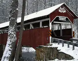
The Lower Humbert Covered Bridge, or the Faidley Covered Bridge, is an 126-foot-6-inch (38.56 m) Burr Arch truss covered bridge that crosses Laurel Hill Creek, in Lower Turkeyfoot Township, Somerset County in the U.S. state of Pennsylvania. It was built in 1891 and was listed on the National Register of Historic Places on December 10, 1980.[2] It is one of the ten remaining covered bridges in Somerset County.
Lower Humbert Covered Bridge | |
|---|---|
 | |
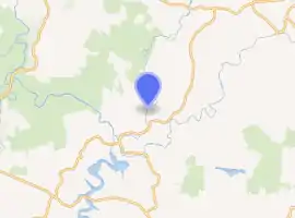
| Coordinates | 39°50′24.5″N 79°19′23″W |
| Carries | Township 312 |
| Crosses | Laurel Hill Creek |
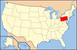
| Locale | Somerset, Pennsylvania, United States |
| Other name(s) | Faidley Covered Bridge |
| Maintained by | Somerset County |
| NBI Number | 557213031230350 |
| Characteristics | |
| Total length | 126.5 ft (38.6 m)[1] |
| Width | 12.3 ft (3.7 m)[1] |
| Height | 8 ft (2.4 m) |
| Load limit | 3 short tons (2.7 t)[2] |
| History | |
| Built | 1891 |
| MPS | Covered Bridges of Somerset County TR |
| NRHP reference No. | 80003638 |
| Added to NRHP | December 10, 1980 |
| Location | |

| |
History
The covered bridge was built in 1891. It was rebuilt in 1991, with extensive reinforcement work done on the abutments.[2] A homemade explosive device caused minor damage to bridge deck in January 2006.[3]
See also
References
- Federal Highway Administration (2007). "Place Name: Lower Turkeyfoot(Township of), Pennsylvania; NBI Structure Number: 557213031230350; Facility Carried: T-390, Covered Bridge Rd; Feature Intersected: Laurel Hill Creek". Nationalbridges.com (Alexander Svirsky). Retrieved April 15, 2009. Note: this is a formatted scrape of the 2006 official website, which can be found here for Pennsylvania: "PA06.txt". Federal Highway Administration. 2006. Retrieved April 15, 2009.
- Evans, Benjamin D.; June R. Evans (2001). Pennsylvania's Covered Bridges: A complete guide. University of Pittsburgh Press. p. 248. ISBN 0-8229-5764-7.
- Associated Press (January 30, 2006). "Explosive causes minor damage to historic covered bridge". Centre Daily Times. State College, PA.
This article is issued from Wikipedia. The text is licensed under Creative Commons - Attribution - Sharealike. Additional terms may apply for the media files.

