National Register of Historic Places listings in Center City, Philadelphia
This is a list of the National Register of Historic Places listings in Center City, Philadelphia.
This is intended to be a complete list of the properties and districts on the National Register of Historic Places in Center City in Philadelphia, Pennsylvania, United States. The locations of National Register properties and districts for which the latitude and longitude coordinates are included below, may be seen in an online map.[1]
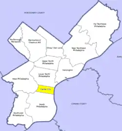
There are 567 properties and districts listed on the National Register in Philadelphia, including 67 National Historic Landmarks. Center City includes 148 of these properties and districts, including 34 National Historic Landmarks; the city's remaining properties and districts are listed elsewhere. Ten historic districts cover almost half of Center City including essentially all the area between the Schuylkill and Delaware Rivers from Chestnut Street on the north to Locust Street on the south. Five other properties in Center City were once listed but have been removed.
Current listings
| [2] | Name on the Register | Image | Date listed[3] | Location | Neighborhood[4] | Description |
|---|---|---|---|---|---|---|
| 1 | 1616 Walnut Street Building |  1616 Walnut Street Building |
October 17, 1983 (#83004247) |
1616 Walnut Street 39°56′59″N 75°10′07″W |
Rittenhouse Square East | |
| 2 | 1900 Rittenhouse Square Apartments |  1900 Rittenhouse Square Apartments |
July 26, 1982 (#82003805) |
1900 South Rittenhouse Square 39°56′55″N 75°10′22″W |
Rittenhouse Square West | |
| 3 | Academy of Music |  Academy of Music |
October 15, 1966 (#66000674) |
Broad and Locust Streets 39°56′53″N 75°09′54″W |
Rittenhouse Square West | Napoleon LeBrun, architect |
| 4 | Adelphi School |  Adelphi School |
September 18, 1978 (#78002441) |
1223–1225 Spring Street 39°57′23″N 75°09′36″W |
Chinatown | |
| 5 | Amalgamated Center |  Amalgamated Center |
December 30, 2008 (#08001269) |
2101–2143 South Street 39°56′43″N 75°10′38″W |
Rittenhouse Square West | |
| 6 | American Baptist Publication Society | 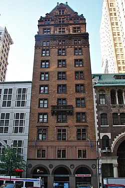 American Baptist Publication Society |
June 27, 1980 (#80003607) |
1420–1422 Chestnut Street 39°57′03″N 75°09′55″W |
Rittenhouse Square East | Frank Miles Day, architect (1896–97). |
| 7 | American Philosophical Society Hall | 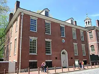 American Philosophical Society Hall |
October 15, 1966 (#66000675) |
104 South 5th Street in Independence Square 39°56′56″N 75°08′59″W |
Independence Mall | |
| 8 | Arch Street Meetinghouse | 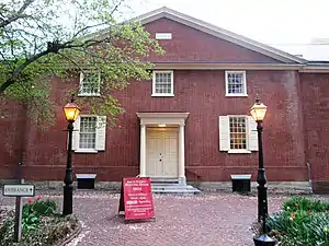 Arch Street Meetinghouse |
May 27, 1971 (#71000716) |
302–338 Arch Street 39°57′07″N 75°08′50″W |
Independence Mall | Designated a National Historic Landmark June 23, 2011 |
| 9 | Arch Street Opera House | 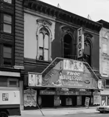 Arch Street Opera House |
June 13, 1978 (#78002442) |
1003–1005 Arch Street 39°57′13″N 75°09′25″W |
Chinatown | Edwin Forrest Durang, architect |
| 10 | Arch Street Presbyterian Church | 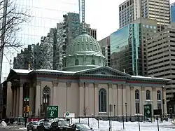 Arch Street Presbyterian Church |
May 27, 1971 (#71000717) |
1726–1732 Arch Street 39°57′16″N 75°10′11″W |
Logan Square | Stephen Decatur Button, architect |
| 11 | Athenaeum of Philadelphia | 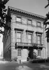 Athenaeum of Philadelphia |
February 1, 1972 (#72001144) |
219 South 6th Street 39°56′48″N 75°09′06″W |
Washington Square East | John Notman, architect |
| 12 | Oliver H. Bair Funeral Home | 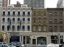 Oliver H. Bair Funeral Home |
November 14, 1982 (#82001542) |
1818–1820 Chestnut Street 39°57′06″N 75°10′16″W |
Rittenhouse Square East | |
| 13 | Belgravia Hotel | 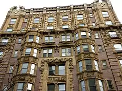 Belgravia Hotel |
November 14, 1982 (#82001543) |
1811 Chestnut Street 39°57′07″N 75°10′15″W |
Rittenhouse Square West | Samuel Webber, architect |
| 14 | Bell Telephone Company Building | 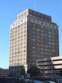 Bell Telephone Company Building |
August 7, 2000 (#00000849) |
1827–1835 Arch Street 39°57′20″N 75°10′15″W |
Logan Square | |
| 15 | John C. Bell House |  John C. Bell House |
April 13, 1982 (#82003807) |
229 South 22nd Street 39°57′00″N 75°10′39″W |
Rittenhouse Square West | Horace Trumbauer, architect |
| 16 | Bellevue Stratford Hotel | 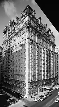 Bellevue Stratford Hotel |
March 24, 1977 (#77001182) |
200 South Broad Street 39°56′57″N 75°09′54″W |
Rittenhouse Square East | G. W. & W. D. Hewitt, architects (1902–04). |
| 17 | Benjamin Franklin Hotel |  Benjamin Franklin Hotel |
April 2, 1982 (#82003808) |
822–840 Chestnut Street 39°56′58″N 75°09′19″W |
Market East | Horace Trumbauer, architect (1925). |
| 18 | Bishop Mackay-Smith House | 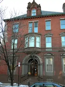 Bishop Mackay-Smith House |
January 25, 1980 (#80003608) |
251 South 22nd Street 39°56′57″N 75°10′40″W |
Rittenhouse Square West | Theophilus P. Chandler, Jr., architect (1903–04). |
| 19 | Board of Education Building |  Board of Education Building |
August 25, 1983 (#83002266) |
21st Street and Benjamin Franklin Parkway 39°57′32″N 75°10′28″W |
Logan Square | Irwin Thornton Catharine, architect (1930). |
| 20 | Boekel Building |  Boekel Building |
February 20, 2003 (#03000078) |
505–515 Vine Street 39°57′23″N 75°08′54″W |
Old City | |
| 21 | Broad Street Historic District |  Broad Street Historic District |
April 6, 1984 (#84003529) |
Roughly bounded by Juniper, Cherry, 15th, and Pine Sts. 39°57′03″N 75°09′51″W |
Center City | |
| 22 | Carpenters' Hall |  Carpenters' Hall |
April 15, 1970 (#70000552) |
310 Chestnut Street 39°56′53″N 75°08′50″W |
Independence Mall | |
| 23 | Cathedral of Saints Peter and Paul |  Cathedral of Saints Peter and Paul |
June 24, 1971 (#71000720) |
18th Street and Benjamin Franklin Parkway 39°57′26″N 75°10′07″W |
Logan Square | Napoleon LeBrun, architect |
| 24 | Center City West Commercial Historic District | 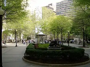 Center City West Commercial Historic District |
January 7, 1988 (#87002203) |
Roughly bounded by Chestnut, 15th, Walnut, Sansom, and 21st Streets; also roughly bounded by the Center City West Historic District, S. 15th, Locust St., and S. Sydenham St. 39°56′45″N 75°10′20″W |
Rittenhouse Square | |
| 25 | Chateau Crillon Apartment House | 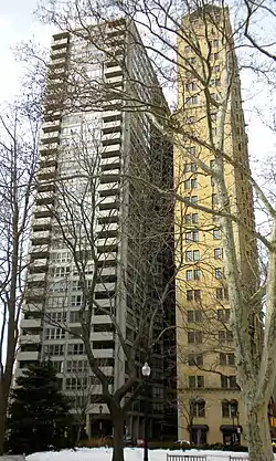 Chateau Crillon Apartment House |
April 25, 1978 (#78002443) |
222 South 19th Street 39°56′57″N 75°10′24″W |
Rittenhouse Square | Horace Trumbauer, architect (1928). |
| 26 | Christ Church |  Christ Church |
April 15, 1970 (#70000553) |
22–26 North 2nd Street 39°57′03″N 75°08′37″W |
Old City | |
| 27 | Christ Church Burial Ground |  Christ Church Burial Ground |
June 24, 1971 (#71000062) |
5th and Arch Streets 39°57′07″N 75°08′53″W |
Independence Mall | |
| 28 | Church of the Holy Trinity | 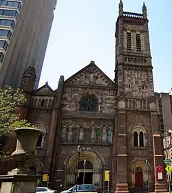 Church of the Holy Trinity |
February 6, 1973 (#73001660) |
19th and Walnut Streets, facing Rittenhouse Square 39°57′01″N 75°10′23″W |
Rittenhouse Square | John Notman, architect |
| 29 | Clinton Street Historic District | 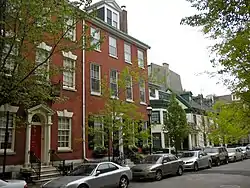 Clinton Street Historic District |
April 26, 1972 (#72001148) |
Bounded by 9th, 11th, Pine, and Cypress Streets 39°56′42″N 75°09′31″W |
Washington Square West | |
| 30 | College of Physicians of Philadelphia | 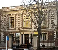 College of Physicians of Philadelphia |
October 6, 2008 (#08001088) |
19 South 22nd Street 39°57′12″N 75°10′36″W |
Rittenhouse Square West | Cope & Stewardson, architects |
| 31 | Edward Drinker Cope House | .jpg.webp) Edward Drinker Cope House |
May 15, 1975 (#75001660) |
2102 Pine Street 39°56′49″N 75°10′36″W |
Rittenhouse Square West | Frank Furness, architect |
| 32 | Drake Hotel | 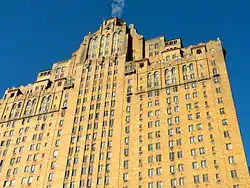 Drake Hotel |
September 18, 1978 (#78002446) |
1512–1514 Spruce Street 39°56′49″N 75°10′03″W |
Rittenhouse Square East | Murphy, Quigley & Co., architects |
| 33 | Drexel and Company Building | 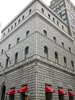 Drexel and Company Building |
February 8, 1980 (#80003610) |
135–143 South 15th Street 39°56′56″N 75°09′56″W |
Rittenhouse Square East | Horace Trumbauer, architect |
| 34 | Drinker's Court |  Drinker's Court |
May 27, 1971 (#71000723) |
236–238 Delancey Street 39°56′36″N 75°08′49″W |
Society Hill | |
| 35 | Thomas Durham School | 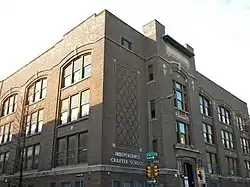 Thomas Durham School |
November 18, 1988 (#88002265) |
1600 Lombard Street 39°56′42″N 75°10′08″W |
Rittenhouse Square East | |
| 36 | East Center City Commercial Historic District |  East Center City Commercial Historic District |
July 5, 1984 (#84003531) |
Roughly bounded by 6th, Juniper, Market and Locust Streets 39°57′05″N 75°09′33″W |
Washington Square | Boundary changes approved May 24, 2018. |
| 37 | Elfreth's Alley Historic District |  Elfreth's Alley Historic District |
October 15, 1966 (#66000681) |
Between 2nd and Front Streets 39°57′10″N 75°08′33″W |
Old City | |
| 38 | Elks Lodge BPOE No. 2 |  Elks Lodge BPOE No. 2 |
August 23, 1984 (#84003535) |
306–320 North Broad Street 39°57′30″N 75°09′46″W |
Callowhill | Replaced by a parking lot |
| 39 | Equitable Trust Building |  Equitable Trust Building |
July 3, 1986 (#86001405) |
1405 Locust Street 39°56′54″N 75°09′54″W |
Rittenhouse Square East | |
| 40 | Estey Hall |  Estey Hall |
October 28, 1983 (#83004244) |
1701 Walnut Street 39°57′00″N 75°10′09″W |
Rittenhouse Square East | Baker & Dallet, architects |
| 41 | Wilson Eyre House | 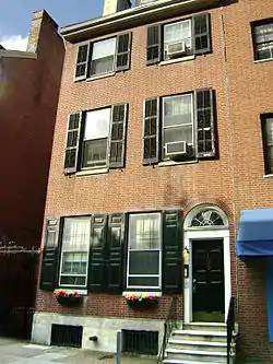 Wilson Eyre House |
April 13, 1977 (#77001183) |
1003 Spruce Street 39°56′47″N 75°09′29″W |
Washington Square West | Wilson Eyre, architect |
| 42 | Fidelity–Philadelphia Trust Company Building |  Fidelity–Philadelphia Trust Company Building |
November 27, 1978 (#78002447) |
123–151 South Broad Street 39°56′59″N 75°09′49″W |
Market East | Zantzinger & Borie, architects |
| 43 | First Bank of the United States |  First Bank of the United States |
May 4, 1987 (#87001292) |
116 South 3rd Street 39°56′53″N 75°08′47″W |
Independence Mall | |
| 44 | First Troop Philadelphia City Cavalry Armory | 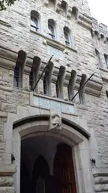 First Troop Philadelphia City Cavalry Armory |
July 24, 2017 (#90000420) |
22 S. 23rd St. 39°57′12″N 75°10′43″W |
Rittenhouse Square West | |
| 45 | First Unitarian Church | 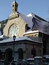 First Unitarian Church |
May 27, 1971 (#71000724) |
2121 Chestnut Street 39°57′09″N 75°10′35″W |
Rittenhouse Square West | Frank Furness, architect (1883–86). |
| 46 | Franklin Institute | 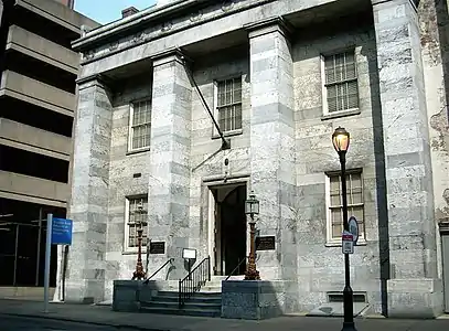 Franklin Institute |
August 1, 1979 (#79002319) |
15 South 7th Street 39°57′01″N 75°09′07″W |
Independence Mall | John Haviland, architect. Now the Atwater Kent Museum. |
| 47 | Franklin Institute Science Museum |  Franklin Institute Science Museum |
January 3, 1985 (#85000039) |
20th St. and the Benjamin Franklin Parkway 39°57′29″N 75°10′23″W |
Logan Square | John T. Windrim, architect (1929–31). |
| 48 | Franklin Square |  Franklin Square |
September 14, 1981 (#81000556) |
Race and 6th Streets 39°57′20″N 75°09′03″W |
Chinatown | |
| 49 | Free Quaker Meetinghouse |  Free Quaker Meetinghouse |
September 22, 1971 (#71000063) |
Southwestern corner of 5th and Arch Streets 39°57′09″N 75°08′55″W |
Independence Mall | |
| 50 | Henry George Birthplace | 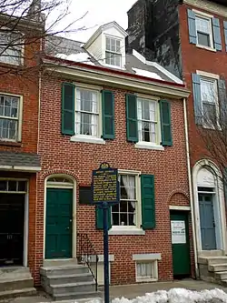 Henry George Birthplace |
April 1, 1983 (#83002268) |
413 South 10th Street 39°56′39″N 75°09′30″W |
Washington Square West | |
| 51 | Girard Group | 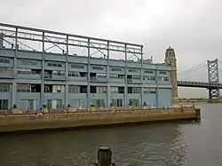 Girard Group |
May 6, 1983 (#83002269) |
Delaware Avenue and Arch Street 39°57′05″N 75°08′22″W |
Penn's Landing | |
| 52 | Globe Ticket Company Building |  Globe Ticket Company Building |
November 1, 1984 (#84000268) |
112 North 12th Street 39°57′11″N 75°09′28″W |
Chinatown | Destroyed to build the Pennsylvania Convention Center |
| 53 | Harris Building |  Harris Building |
August 31, 2001 (#01000928) |
2121–2141 Market Street 39°57′15″N 75°10′34″W |
Logan Square | |
| 54 | Head House Square | 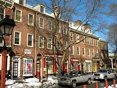 Head House Square |
June 19, 1972 (#72001158) |
Both sides of the 400 block of South 2nd Street 39°56′34″N 75°08′43″W |
Society Hill | |
| 55 | Heywood Chair Factory | 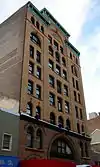 Heywood Chair Factory |
August 23, 1984 (#84003541) |
1010–1014 Race Street 39°57′19″N 75°09′23″W |
Chinatown | Willis G. Hale, architect (1892). |
| 56 | Hill-Physick House | .jpg.webp) Hill-Physick House |
May 27, 1971 (#71000726) |
321 South 4th Street 39°56′39″N 75°08′54″W |
Society Hill | |
| 57 | Hockley Row | 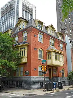 Hockley Row |
April 21, 1983 (#83002272) |
237–241 South 21st Street, 2049 Locust Street 39°56′59″N 75°10′35″W |
Rittenhouse Square West | Frank Furness, architect (1875). |
| 58 | A.J. Holman and Company | 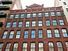 A.J. Holman and Company |
May 17, 1984 (#84003544) |
1222–1226 Arch Street 39°57′14″N 75°09′38″W |
Chinatown | |
| 59 | Houses at 2000–2018 Delancey Street | 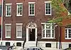 Houses at 2000–2018 Delancey Street |
April 22, 1982 (#82003809) |
2000–2018 Delancey Street 39°56′51″N 75°10′33″W |
Rittenhouse Square West | |
| 60 | Independence National Historical Park | 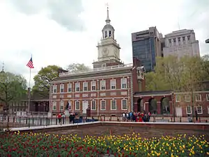 Independence National Historical Park |
October 15, 1966 (#66000683) |
Bounded by Walnut, 6th, Chestnut, and 2nd Streets 39°56′52″N 75°08′53″W |
Independence Mall | |
| 61 | Insurance Company of North America Building | 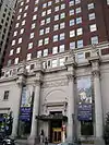 Insurance Company of North America Building |
June 2, 1978 (#78002449) |
1600 Arch Street 39°57′16″N 75°10′02″W |
Logan Square | |
| 62 | Horace Jayne House | 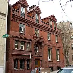 Horace Jayne House |
July 22, 1982 (#82003810) |
320 South 19th Street 39°56′50″N 75°10′23″W |
Rittenhouse Square West | Frank Furness, architect (1895) |
| 63 | Juvenile and Domestic Branches of the Municipal Court |  Juvenile and Domestic Branches of the Municipal Court |
March 31, 2014 (#14000097) |
1801 Vine St. 39°57′34″N 75°10′10″W |
Logan Square | |
| 64 | Thaddeus Kosciuszko National Memorial | 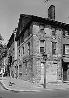 Thaddeus Kosciuszko National Memorial |
December 18, 1970 (#70000068) |
301 Pine Street 39°56′36″N 75°08′51″W |
Society Hill | |
| 65 | Land Title Building | 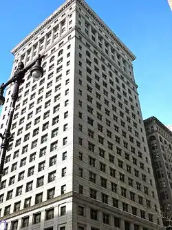 Land Title Building |
December 15, 1978 (#78002450) |
1400 Chestnut Street 39°57′01″N 75°09′52″W |
Market East | Daniel Burnham (1897–1898), Horace Trumbauer (1902), architects. |
| 66 | Larkin-Belber Building | 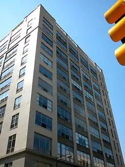 Larkin-Belber Building |
February 27, 2003 (#03000077) |
2200–2218 Arch Street 39°57′21″N 75°10′36″W |
Logan Square | |
| 67 | Dr. Joseph Leidy House |  Dr. Joseph Leidy House |
December 4, 1980 (#80003613) |
1319 Locust Street 39°56′52″N 75°09′50″W |
Washington Square West | Wilson Eyre, architect |
| 68 | J. Peter Lesley House | 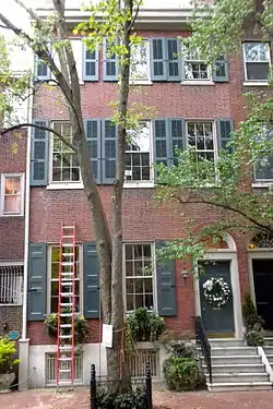 J. Peter Lesley House |
October 12, 1994 (#94001646) |
1008 Clinton Street 39°56′43″N 75°09′31″W |
Washington Square West | |
| 69 | Lits Department Store | 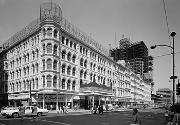 Lits Department Store |
May 15, 1979 (#79002322) |
Market Street between 7th and 8th Streets 39°57′05″N 75°09′10″W |
Independence Mall | |
| 70 | Logan Square | .JPG.webp) Logan Square |
September 14, 1981 (#81000555) |
18th and Race Streets 39°57′28″N 75°10′15″W |
Logan Square | Eyre & McIlvaine, architects. Alexander Stirling Calder, sculptor |
| 71 | Mask and Wig Club of the University of Pennsylvania | 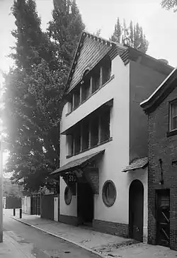 Mask and Wig Club of the University of Pennsylvania |
November 20, 1979 (#79002323) |
310 South Quince Street 39°56′46″N 75°09′37″W |
Washington Square West | Wilson Eyre, architect |
| 72 | Masonic Temple |  Masonic Temple |
May 27, 1971 (#71000727) |
1 North Broad Street 39°57′13″N 75°09′46″W |
Market East | James H. Windrim, architect (1868–73). |
| 73 | Francis McIlvain House | 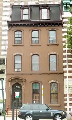 Francis McIlvain House |
November 20, 1979 (#79002324) |
1924 Arch Street 39°57′19″N 75°10′20″W |
Logan Square | |
| 74 | Merchants' Exchange Building | 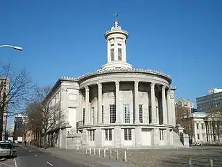 Merchants' Exchange Building |
August 7, 2001 (#01001047) |
143 South 3rd Street 39°56′50″N 75°08′46″W |
Independence Mall | William Strickland, architect |
| 75 | Mikveh Israel Cemetery |  Mikveh Israel Cemetery |
June 24, 1971 (#71000061) |
Northwestern corner of Spruce and Darien Streets 39°56′46″N 75°09′21″W |
Washington Square West | |
| 76 | Clarence B. Moore House |  Clarence B. Moore House |
May 8, 1973 (#73001664) |
1321 Locust Street 39°56′54″N 75°09′53″W |
Washington Square West | Wilson Eyre, architect |
| 77 | Mother Bethel A.M.E. Church | 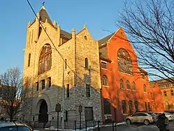 Mother Bethel A.M.E. Church |
March 16, 1972 (#72001166) |
419 South 6th Street 39°56′35″N 75°09′09″W |
Society Hill | |
| 78 | Musical Fund Hall |  Musical Fund Hall |
March 11, 1971 (#71000730) |
808 Locust Street 39°56′49″N 75°09′18″W |
Washington Square West | William Strickland, architect of alterations into concert hall. |
| 79 | Neill-Mauran House | 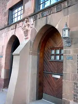 Neill-Mauran House |
June 30, 1980 (#80003614) |
315–317 South 22nd Street 39°56′53″N 75°10′40″W |
Rittenhouse Square West | Wilson Eyre, architect |
| 80 | New Century Guild | 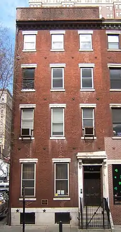 New Century Guild |
November 4, 1993 (#93001611) |
1307 Locust Street 39°56′49″N 75°09′46″W |
Washington Square West | |
| 81 | New Market | 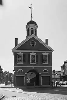 New Market |
November 13, 1966 (#66000686) |
South 2nd Street, between Pine and Lombard Streets 39°56′35″N 75°08′43″W |
Society Hill | Includes oldest firehouse in US (1804) |
| 82 | New York Mutual Life Insurance Company Building | 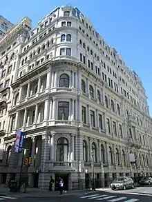 New York Mutual Life Insurance Company Building |
June 6, 1980 (#80003615) |
1001–1005 Chestnut Street 39°57′01″N 75°09′26″W |
Market East | Henry Fernbach, architect (1873–75). |
| 83 | Old City Historic District | 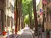 Old City Historic District |
May 5, 1972 (#72000093) |
Old city area including parts of Washington Square East Development Area and Franklin Square East Development Area 39°56′58″N 75°08′44″W |
Old City | |
| 84 | Old Federal Reserve Bank | 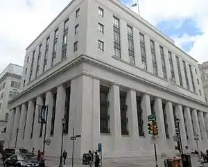 Old Federal Reserve Bank |
June 28, 1979 (#79002325) |
925 Chestnut Street 39°57′01″N 75°09′24″W |
Market East | Paul Cret, architect |
| 85 | Packard Motor Corporation Building | 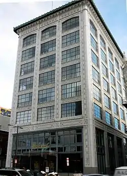 Packard Motor Corporation Building |
February 8, 1980 (#80003616) |
317–321 North Broad Street 39°57′31″N 75°09′41″W |
Callowhill | Albert Kahn, architect (1910). |
| 86 | Park Towne Place |  Park Towne Place |
December 15, 2011 (#11000926) |
2200 Park Towne Place 39°57′40″N 75°10′39″W |
Logan Square | Louis I. Kahn, architect |
| 87 | Penn Towers |  Penn Towers |
December 12, 2012 (#12001045) |
1815 John F. Kennedy Boulevard 39°57′16″N 75°10′14″W |
Logan Square | |
| 88 | Pennsylvania Academy of the Fine Arts |  Pennsylvania Academy of the Fine Arts |
May 27, 1971 (#71000731) |
Southwestern corner of Broad and Cherry Streets 39°57′19″N 75°09′48″W |
Hahnemann | Furness & Hewitt, architects (1871–76). |
| 89 | Pennsylvania Hospital | 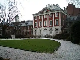 Pennsylvania Hospital |
October 15, 1966 (#66000688) |
8th and Spruce Streets 39°56′41″N 75°09′21″W |
Washington Square West | |
| 90 | Philadelphia City Hall |  Philadelphia City Hall |
December 8, 1976 (#76001666) |
Penn Square, Broad and Market Streets 39°57′08″N 75°09′49″W |
Market East | John McArthur, Jr. (1874–1901), architect |
| 91 | Philadelphia College of Art |  Philadelphia College of Art |
May 27, 1971 (#71000733) |
Northwestern corner of Broad and Pine Streets 39°56′46″N 75°09′56″W |
Rittenhouse Square East | John Haviland, architect (1824–26). Frank Furness, architect of addition (1874–75). |
| 92 | Philadelphia Contributionship | .jpg.webp) Philadelphia Contributionship |
May 27, 1971 (#71000732) |
212 South 4th Street 39°56′48″N 75°08′54″W |
Society Hill | |
| 93 | Philadelphia Racquet Club |  Philadelphia Racquet Club |
August 1, 1979 (#79002326) |
213–225 South 16th Street 39°56′56″N 75°10′05″W |
Rittenhouse Square East | Horace Trumbauer, architect |
| 94 | Philadelphia Savings Fund Society Building |  Philadelphia Savings Fund Society Building |
December 8, 1976 (#76001667) |
Southwestern corner of Market and 12th Streets 39°57′06″N 75°09′38″W |
Market East | George Howe and William Lescaze, architects |
| 95 | Philadelphia School of Occupational Therapy |  Philadelphia School of Occupational Therapy |
June 13, 2003 (#03000528) |
419 South 19th Street 39°56′45″N 75°10′23″W |
Rittenhouse Square West | |
| 96 | Philadelphia Stock Exchange |  Philadelphia Stock Exchange |
August 31, 1982 (#82003812) |
1409–1411 Walnut Street 39°56′59″N 75°09′54″W |
Rittenhouse Square East | Horace Trumbauer, architects |
| 97 | Physicians and Dentists Building |  Physicians and Dentists Building |
November 5, 1987 (#87001968) |
1831–1833 Chestnut Street 39°57′07″N 75°10′17″W |
Rittenhouse Square West | Wilson Brothers & Company, architects |
| 98 | Pitcairn Building |  Pitcairn Building |
January 7, 1988 (#87002209) |
1027 Arch Street 39°57′14″N 75°09′27″W |
Chinatown | G. W. & W. D. Hewitt, architects |
| 99 | Plays and Players |  Plays and Players |
March 14, 1973 (#73001665) |
1714 Delancey Street 39°56′49″N 75°10′14″W |
Rittenhouse Square East | |
| 100 | Portico Row |  Portico Row |
December 16, 1977 (#77001189) |
900–930 Spruce Street 39°56′45″N 75°09′29″W |
Washington Square West | Thomas U. Walter, architect |
| 101 | Princeton Club |  Princeton Club |
December 4, 1980 (#80003617) |
1221–1223 Locust Street 39°56′53″N 75°09′41″W |
Washington Square West | Frank Furness, architect of 1223 Locust (1890). Lindley Johnson, architect of 1221 Locust (1891) |
| 102 | Race Street Friends Meetinghouse |  Race Street Friends Meetinghouse |
November 4, 1993 (#93001610) |
1515 Cherry Street 39°57′21″N 75°09′54″W |
Hahnemann | |
| 103 | Rafsnyder-Welsh House |  Rafsnyder-Welsh House |
February 14, 1980 (#80003618) |
1923 Spruce Street 39°56′53″N 75°10′27″W |
Rittenhouse Square East | |
| 104 | Ramcat Historic District | 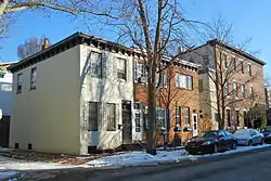 Ramcat Historic District |
January 8, 1986 (#86000055) |
Roughly bounded by Market, 23rd, and Bainbridge Streets, and railroad yards 39°56′55″N 75°10′54″W |
Rittenhouse Square West | |
| 105 | J. Sylvester Ramsey School | 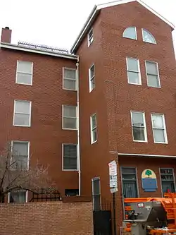 J. Sylvester Ramsey School |
December 1, 1986 (#86003322) |
Pine and Quince Streets 39°56′42″N 75°09′37″W |
Washington Square West | Destroyed see old photo at |
| 106 | Reading Terminal and Trainshed | 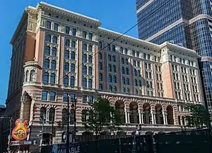 Reading Terminal and Trainshed |
June 30, 1972 (#72001170) |
1115–1141 Market Street 39°57′08″N 75°09′33″W |
Center City | Francis H. Kimball and Wilson Brothers & Company, architects |
| 107 | Reynolds-Morris House | .jpg.webp) Reynolds-Morris House |
December 24, 1967 (#67000020) |
225 South 8th Street 39°56′51″N 75°09′15″W |
Society Hill | |
| 108 | Ringgold Place | 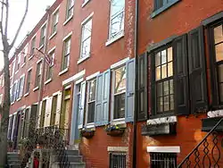 Ringgold Place |
August 29, 1978 (#78002453) |
1900 block of Waverly Street 39°56′46″N 75°10′28″W |
Rittenhouse Square West | |
| 109 | Rittenhouse Historic District |  Rittenhouse Historic District |
August 25, 1983 (#83002277) |
Roughly bounded by Waverly, 15th, Sanson, Ludlow, 23rd, and 25th Streets; also roughly bounded by the Center City West Historic District, South Twenty-first Street, the original Rittenhouse Historic District, and South Seventeenth Street 39°56′54″N 75°10′15″W |
Rittenhouse Square | Second set of boundaries represents a boundary increase of December 27, 2010 |
| 110 | Rittenhouse Square | Rittenhouse Square |
September 14, 1981 (#81000557) |
Rittenhouse Square and 18th Street 39°56′57″N 75°10′20″W |
Rittenhouse Square | |
| 111 | Roberts-Quay House | 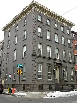 Roberts-Quay House |
November 13, 1976 (#76001668) |
1035–1037 Spruce Street 39°56′47″N 75°09′35″W |
Washington Square West | |
| 112 | Rohm and Haas Corporate Headquarters | 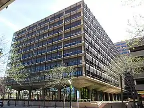 Rohm and Haas Corporate Headquarters |
February 9, 2007 (#07000031) |
100 Independence Mall West 39°57′01″N 75°09′05″W |
Independence Mall | |
| 113 | St. Augustine's Catholic Church | 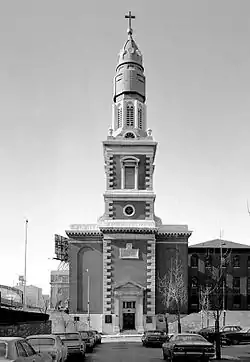 St. Augustine's Catholic Church |
June 15, 1976 (#76001670) |
4th and New Streets 39°57′20″N 75°08′47″W |
Old City | Napoleon LeBrun, architect |
| 114 | St. Clement's Protestant Episcopal Church | 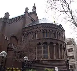 St. Clement's Protestant Episcopal Church |
November 20, 1970 (#70000555) |
Southwestern corner of 20th and Cherry Streets 39°57′23″N 75°10′23″W |
Logan Square | John Notman, architect |
| 115 | St. George's Methodist Church | 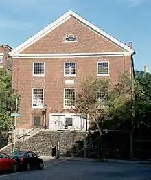 St. George's Methodist Church |
May 27, 1971 (#71000064) |
324 New Street 39°57′19″N 75°08′46″W |
Old City | |
| 116 | St. James Hotel | 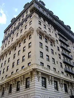 St. James Hotel |
November 13, 1976 (#76001671) |
1226–1232 Walnut Street 39°56′56″N 75°09′43″W |
Rittenhouse Square West | Horace Trumbauer, architect (1901) |
| 117 | St. Mark's Episcopal Church |  St. Mark's Episcopal Church |
April 19, 1982 (#82003815) |
1607–1627 Locust Street 39°56′56″N 75°10′07″W |
Rittenhouse Square East | John Notman, architect |
| 118 | St. Peter's Church | 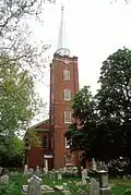 St. Peter's Church |
June 18, 1996 (#96000969) |
Junction of 3rd and Pine Streets 39°56′35″N 75°08′52″W |
Society Hill | |
| 119 | St. Stephen's Episcopal Church | 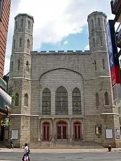 St. Stephen's Episcopal Church |
June 4, 1979 (#79002329) |
19 South 10th Street 39°57′03″N 75°09′24″W |
Market East | William Strickland, architect |
| 120 | Second Bank of the United States | 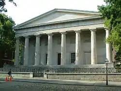 Second Bank of the United States |
May 4, 1987 (#87001293) |
420 Chestnut Street 39°56′55″N 75°08′54″W |
Independence Mall | William Strickland, architect |
| 121 | Smyth Young Field Company Building |  Smyth Young Field Company Building |
December 24, 1992 (#92001720) |
1216–1220 Arch Street 39°57′14″N 75°09′37″W |
Chinatown | |
| 122 | Social Service Building | 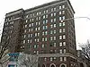 Social Service Building |
February 20, 2002 (#02000063) |
311 South Juniper Street 39°56′46″N 75°09′49″W |
Washington Square West | Horace Trumbauer, architect |
| 123 | Society Hill Historic District |  Society Hill Historic District |
June 23, 1971 (#71000065) |
Bounded on the north by Walnut St., on the south by Lombard St., on the east by the pier line of the Delaware River, and on the west by 8th 39°56′42″N 75°08′58″W |
Society Hill | |
| 124 | Solomon House | 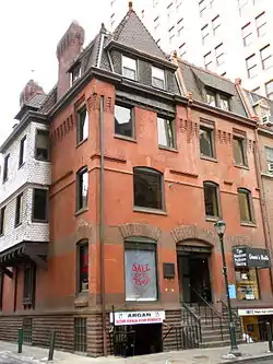 Solomon House |
August 24, 1978 (#78002454) |
130–132 South 17th Street 39°57′02″N 75°10′09″W |
Market East | Frank Furness, architect (1887). |
| 125 | John Stewart Houses | 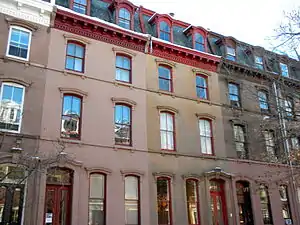 John Stewart Houses |
November 20, 1979 (#79002330) |
1020–1028 Spruce Street 39°56′46″N 75°09′32″W |
Washington Square West | |
| 126 | William Strickland Row | 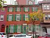 William Strickland Row |
September 14, 1977 (#77001192) |
215–227 South 9th Street 39°56′51″N 75°09′21″W |
Washington Square West | William Strickland, architect |
| 127 | Suburban Station Building | 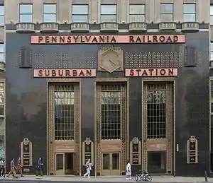 Suburban Station Building |
September 5, 1985 (#85001962) |
1617 John F. Kennedy Boulevard 39°57′15″N 75°10′03″W |
Penn Center | |
| 128 | Thomas Sully Residence | _cropped.jpg.webp) Thomas Sully Residence |
October 15, 1966 (#66000691) |
530 Spruce Street 39°56′42″N 75°09′05″W |
Society Hill | |
| 129 | Sun Oil Building |  Sun Oil Building |
August 25, 1983 (#83002280) |
1608–1610 Walnut Street 39°56′59″N 75°10′05″W |
Rittenhouse Square East | |
| 130 | The Touraine | 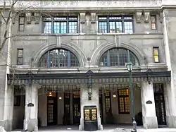 The Touraine |
April 7, 1982 (#82003816) |
1520 Spruce Street 39°56′50″N 75°10′03″W |
Rittenhouse Square East | |
| 131 | Union League of Philadelphia |  Union League of Philadelphia |
June 22, 1979 (#79002331) |
140 South Broad Street 39°56′57″N 75°09′52″W |
Rittenhouse Square East | John Fraser, architect |
| 132 | United States Custom House | 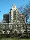 United States Custom House |
May 25, 2011 (#11000310) |
200 Chestnut St. 39°56′53″N 75°08′40″W |
Independence Mall | |
| 133 | US Court House and Post Office Building | 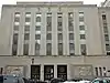 US Court House and Post Office Building |
October 19, 1990 (#90001540) |
900 Market St.[5] 39°57′04″N 75°09′20″W |
Market East | |
| 134 | USS BECUNA (SS–319) | USS BECUNA (SS–319) |
August 29, 1978 (#78002458) |
Penn's Landing, Delaware Avenue, and Spruce Street 39°56′36″N 75°08′29″W |
Penn's Landing | |
| 135 | U.S.S. OLYMPIA | U.S.S. OLYMPIA |
October 15, 1966 (#66000692) |
Pier 40 at foot of Chestnut Street 39°56′36″N 75°08′28″W |
Penn's Landing | |
| 136 | Walnut-Chancellor Historic District |  Walnut-Chancellor Historic District |
December 1, 1980 (#80003605) |
20th-21st, Walnut and Chancellor Streets 39°57′02″N 75°10′33″W |
Rittenhouse Square West | |
| 137 | Walnut Street Theatre |  Walnut Street Theatre |
October 15, 1966 (#66000693) |
9th and Walnut Streets 39°56′54″N 75°09′20″W |
Washington Square West | John Haviland, architect |
| 138 | John Wanamaker Store | 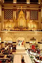 John Wanamaker Store |
June 2, 1978 (#78002459) |
Juniper and Market Streets 39°57′06″N 75°09′44″W |
Market East | Daniel Burnham, architect |
| 139 | Warburton House | 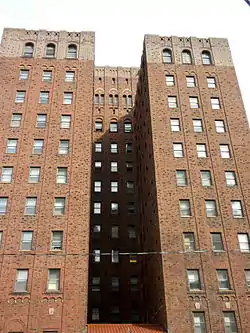 Warburton House |
August 22, 2002 (#02000890) |
1929 Sansom Street 39°57′05″N 75°10′24″W |
Rittenhouse Square East | |
| 140 | The Warwick | 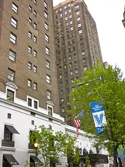 The Warwick |
August 10, 1978 (#78002460) |
1701 Locust Street 39°56′56″N 75°10′10″W |
Rittenhouse Square East | |
| 141 | Washington Square |  Washington Square |
September 14, 1981 (#81000558) |
Locust and 6th Streets 39°56′49″N 75°09′10″W |
Independence Mall | |
| 142 | Washington Square West Historic District |  Washington Square West Historic District |
September 20, 1984 (#84003563) |
Roughly bounded by 8th, Locust, Broad, and Lombard Streets 39°56′44″N 75°09′40″W |
Washington Square West | |
| 143 | Waverly Garage | 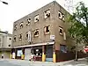 Waverly Garage |
April 17, 2018 (#100002343) |
414-422 S 16th St. 39°56′44″N 75°10′06″W |
||
| 144 | WCAU Studios | 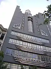 WCAU Studios |
January 27, 1983 (#83002281) |
1618–1622 Chestnut Street 39°57′04″N 75°10′05″W |
Rittenhouse Square East | |
| 145 | Wesley AME Zion Church |  Wesley AME Zion Church |
December 1, 1978 (#78002461) |
1500 Lombard Street 39°56′41″N 75°10′02″W |
Rittenhouse Square East | |
| 146 | Wesley Building |  Wesley Building |
May 10, 1984 (#84003581) |
1701–1709 Arch Street 39°57′18″N 75°10′06″W |
Logan Square | |
| 147 | Witherspoon Building | 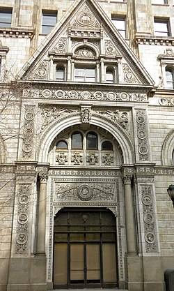 Witherspoon Building |
September 18, 1978 (#78002462) |
1319–1323 Walnut Street 39°56′58″N 75°09′48″W |
Market East | Joseph Miller Huston, architect (1895–97). |
| 148 | Young Men's Christian Association |  Young Men's Christian Association |
December 2, 1980 (#80003624) |
115 North 15th Street 39°57′18″N 75°09′53″W |
Hahnemann |
Former listings
| [2] | Name on the Register | Image | Date listed | Date removed | Location | City or town | Summary |
|---|---|---|---|---|---|---|---|
| 1 | Jayne Estate Building |  Jayne Estate Building |
April 30, 1987 (#87000648) | January 18, 2011 | 2–16 Vine Street 39°57′19″N 75°08′23″W |
Penn's Landing | Demolished |
| 2 | Gilbert Building |  Gilbert Building |
July 17, 1986 (#86001688) | January 18, 2011 | 1315–1329 Cherry Street 39°57′19″N 75°09′42″W |
Chinatown | Demolished for the Pennsylvania Convention Center expansion |
| 3 | Harrison Building |  Harrison Building |
Unspecified (#83002271) | June 27, 1986 | 1001–1023 Filbert Street 39°57′09″N 75°09′25″W |
Market East | Cope & Stewardson, architects; demolished, now the site of the Greyhound Bus terminal |
| 4 | Joseph Sims House | November 14, 1977 (#77001191) | Unknown | 228 S. 9th St. |
Philadelphia | ||
| 5 | Walter M. Steppacher and Brother Shirt Factory | Walter M. Steppacher and Brother Shirt Factory |
March 18, 2004 (#04000193) | January 18, 2011 | 146–150 North 13th Street 39°57′20″N 75°09′39″W |
Chinatown | Demolished for the Pennsylvania Convention Center expansion |
| 6 | Twelfth Street Meetinghouse | 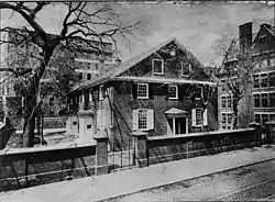 Twelfth Street Meetinghouse |
Unknown (#74002334) | 1974 | 20 S. 12th St. |
Center City, Philadelphia | Delisted after being dismantled and relocated to Newtown, Bucks County, Pennsylvania. |
| 7 | John Wanamaker House | 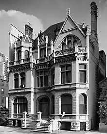 John Wanamaker House |
1978 (#78003441) | 1978 | 2032 Walnut Street 39°57′01″N 75°10′33″W |
Rittenhouse Square | Theophilus P. Chandler, Jr., architect. Demolished following a fire; the facade survives. |
See also
| Wikimedia Commons has media related to National Register of Historic Places in Philadelphia. |
References
- The latitude and longitude information provided in this table was derived originally from the National Register Information System, which has been found to be fairly accurate for about 99% of listings. Some locations in this table may have been corrected to current GPS standards.
- Numbers represent an alphabetical ordering by significant words. Various colorings, defined here, differentiate National Historic Landmarks and historic districts from other NRHP buildings, structures, sites or objects.
- The eight-digit number below each date is the number assigned to each location in the National Register Information System database, which can be viewed by clicking the number.
- "The Political and Community Service Boundaries of Philadelphia" (PDF). Philadelphia City Planning Commission. June 2004. Archived from the original (PDF) on 2011-03-07.
- "Pennsylvania Federal Buildings". U.S. General Services Administration. Retrieved April 7, 2016.
| Topics |  | |
|---|---|---|
| Lists by county |
| |
| Lists by city | ||
| Other lists | ||
| ||