National Register of Historic Places listings in Dauphin County, Pennsylvania
This is a list of the National Register of Historic Places listings in Dauphin County, Pennsylvania.
Location of Dauphin County in Pennsylvania
This is intended to be a complete list of the properties and districts on the National Register of Historic Places in Dauphin County, Pennsylvania, United States. The locations of National Register properties and districts for which the latitude and longitude coordinates are included below, may be seen in a map.[1]
There are 72 properties and districts listed on the National Register in the county. Four sites are further designated as National Historic Landmarks. Three properties were once listed, but have since been removed.
- This National Park Service list is complete through NPS recent listings posted January 29, 2021.[2]
Current listings
| [3] | Name on the Register | Image | Date listed[4] | Location | City or town | Description |
|---|---|---|---|---|---|---|
| 1 | John Ayres House | 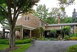 John Ayres House |
September 7, 1979 (#79002215) |
1801 Peter's Mountain Rd.; Northwest of Dauphin on PA 325 40°23′54″N 76°56′52″W |
Middle Paxton Township | |
| 2 | B'Nai Jacob Synagogue | 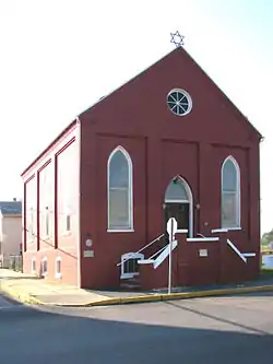 B'Nai Jacob Synagogue |
September 19, 1985 (#85002413) |
Nissley and Water Streets 40°11′48″N 76°44′05″W |
Middletown | |
| 3 | Bridge in Lykens Township No. 1 | 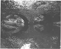 Bridge in Lykens Township No. 1 |
June 22, 1988 (#88000773) |
Legislative Route 22001 over Pine Creek 40°38′38″N 76°41′34″W |
Lykens Township | |
| 4 | Bridge in Lykens Township No. 2 | 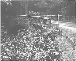 Bridge in Lykens Township No. 2 |
June 22, 1988 (#88000768) |
Legislative Route 22033 over a tributary of Pine Creek 40°37′58″N 76°39′52″W |
Lykens Township | |
| 5 | Bridge in Reed Township | 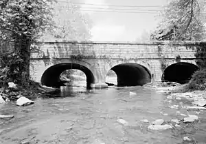 Bridge in Reed Township |
June 22, 1988 (#88000823) |
Legislative Route 1/Township Route 147 over Powell's Creek near Inglenook 40°24′35″N 76°59′06″W |
Reed Township | |
| 6 | Broad Street Market |  Broad Street Market |
December 27, 1974 (#74001780) |
Verbeke Street between 3rd and 6th Streets 40°16′12″N 76°53′17″W |
Harrisburg | |
| 7 | Calver Island |  Calver Island |
January 17, 2007 (#06001256) |
In the Susquehanna River, southeast of Harrisburg[5] 40°12′20″N 76°48′24″W |
Swatara Township | |
| 8 | Simon Cameron House and Bank |  Simon Cameron House and Bank |
November 21, 1976 (#76001634) |
28 and 30 East Main Street 40°11′59″N 76°43′51″W |
Middletown | |
| 9 | Simon Cameron School | 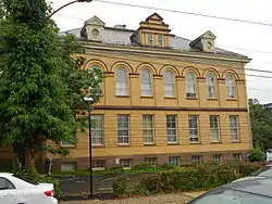 Simon Cameron School |
April 24, 1986 (#86000855) |
1839 Green Street 40°16′32″N 76°53′41″W |
Harrisburg | |
| 10 | Camp Curtin Fire Station | 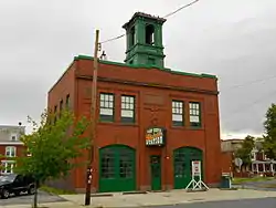 Camp Curtin Fire Station |
August 11, 1981 (#81000541) |
2504 North 6th Street 40°17′13″N 76°53′39″W |
Harrisburg | |
| 11 | Camp Curtin Memorial Methodist Episcopal Church | 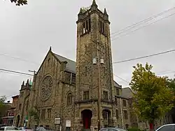 Camp Curtin Memorial Methodist Episcopal Church |
August 5, 2010 (#10000400) |
2221 North 6th Street 40°16′57″N 76°53′29″W |
Harrisburg | |
| 12 | Clemson Island Prehistoric District | 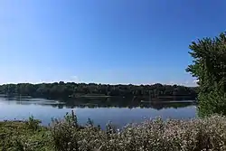 Clemson Island Prehistoric District |
September 17, 1981 (#81000540) |
Southern portion of Clemson Island in the Susquehanna River[6] 40°27′54″N 76°56′45″W |
Halifax Township | |
| 13 | Colonial Theatre | 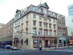 Colonial Theatre |
November 9, 1982 (#82001532) |
3rd and Market Streets 40°15′38″N 76°52′52″W |
Harrisburg | |
| 14 | Conrad and Margaret Allerman House | 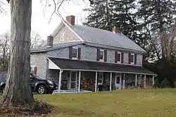 Conrad and Margaret Allerman House |
September 8, 2011 (#11000644) |
1412 Farmhouse Lane 40°14′12″N 76°45′50″W |
Lower Swatara Township | |
| 15 | Dauphin County Bridge No. 27 | August 2, 1993 (#93000720) |
Deibler's Dam Road (Mahantango Creek Road) across Mahantango Creek 40°38′05″N 76°51′23″W |
Mifflin Township | Extends into Lower Mahanoy Township in Northumberland County. Photo shows replacement bridge | |
| 16 | Dauphin County Courthouse | 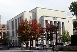 Dauphin County Courthouse |
August 2, 1993 (#93000723) |
Junction of Front and Market Streets 40°15′30″N 76°52′57″W |
Harrisburg | |
| 17 | Derry Session House and Enclosure | 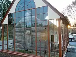 Derry Session House and Enclosure |
November 21, 2006 (#06001061) |
248 East Derry Road 40°17′37″N 76°38′44″W |
Derry Township | |
| 18 | William Donaldson House | 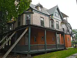 William Donaldson House |
April 26, 1990 (#90000699) |
2005 North 3rd Street 40°16′41″N 76°53′42″W |
Harrisburg | |
| 19 | Fort Hunter Historic District | 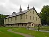 Fort Hunter Historic District |
August 17, 1979 (#79002216) |
U.S. Route 22 at Fort Hunter 40°20′29″N 76°54′30″W |
Susquehanna Township | |
| 20 | GAR Building | 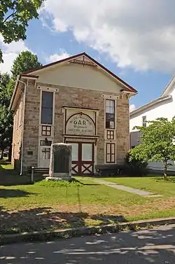 GAR Building |
November 5, 1986 (#86003453) |
626–628 North Second Street 40°34′04″N 76°42′01″W |
Lykens | |
| 21 | German Evangelical Zion Lutheran Church |  German Evangelical Zion Lutheran Church |
November 12, 1975 (#75001637) |
Capital and Herr Streets 40°16′03″N 76°53′09″W |
Harrisburg | |
| 22 | William R. Griffith House |  William R. Griffith House |
October 21, 1976 (#76001631) |
215 North Front Street 40°15′38″N 76°53′09″W |
Harrisburg | |
| 23 | Harris Switch Tower, Pennsylvania Railroad | 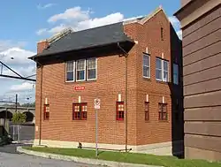 Harris Switch Tower, Pennsylvania Railroad |
August 30, 1994 (#94001056) |
637 Walnut Street 40°15′54″N 76°52′44″W |
Harrisburg | |
| 24 | John Harris Mansion | 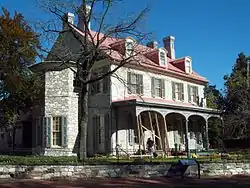 John Harris Mansion |
September 20, 1973 (#73001620) |
219 South Front Street 40°15′24″N 76°52′44″W |
Harrisburg | |
| 25 | Harrisburg 19th Street Armory |  Harrisburg 19th Street Armory |
November 14, 1991 (#91001696) |
1313 South 19th Street 40°15′02″N 76°51′09″W |
Harrisburg | |
| 26 | Harrisburg Cemetery | 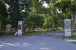 Harrisburg Cemetery |
March 7, 1985 (#85000866) |
13th and Liberty Streets 40°16′19″N 76°51′51″W |
Harrisburg | |
| 27 | Harrisburg Central Railroad Station and Trainshed | Harrisburg Central Railroad Station and Trainshed |
June 11, 1975 (#75001638) |
Aberdeen Street 40°15′43″N 76°52′40″W |
Harrisburg | |
| 28 | Harrisburg Historic District |  Harrisburg Historic District |
January 19, 1976 (#76001632) |
Bounded roughly by Forster, 3rd, Hanna Streets and the Susquehanna River 40°15′33″N 76°52′55″W |
Harrisburg | |
| 29 | Harrisburg Military Post | 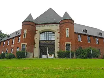 Harrisburg Military Post |
November 29, 1991 (#91001755) |
Junction of 14th and Calder Streets 40°16′44″N 76°52′30″W |
Harrisburg | |
| 30 | Harrisburg Polyclinic Hospital | 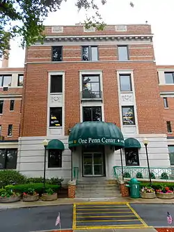 Harrisburg Polyclinic Hospital |
November 12, 2004 (#04001225) |
2601 North 3rd Street 40°17′15″N 76°53′55″W |
Harrisburg | |
| 31 | Harrisburg Technical High School | 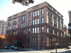 Harrisburg Technical High School |
December 7, 1982 (#82001533) |
423 Walnut Street 40°15′47″N 76°52′50″W |
Harrisburg | |
| 32 | Dr. William Henderson House |  Dr. William Henderson House |
May 14, 1979 (#79002218) |
31 East Main Street 40°15′54″N 76°42′26″W |
Hummelstown | |
| 33 | Henniger Farm Covered Bridge | 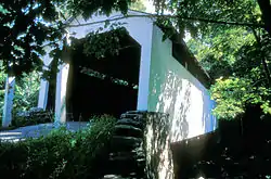 Henniger Farm Covered Bridge |
December 18, 1978 (#78002386) |
Northeast of Elizabethville 40°34′38″N 76°47′03″W |
Washington Township | |
| 34 | Hershey Community Center Building | 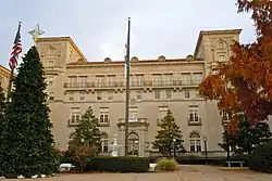 Hershey Community Center Building |
October 15, 1980 (#80003483) |
2 Chocolate Avenue 40°17′07″N 76°38′56″W |
Derry Township | |
| 35 | Milton S. Hershey Mansion | 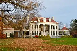 Milton S. Hershey Mansion |
February 7, 1978 (#78002388) |
Mansion Road 40°17′25″N 76°38′39″W |
Derry Township | |
| 36 | Highspire High School | 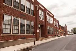 Highspire High School |
April 26, 1990 (#90000703) |
221 Penn Street 40°12′36″N 76°47′27″W |
Highspire | |
| 37 | Hotel Lykens |  Hotel Lykens |
April 25, 2016 (#16000203) |
600 Main St. 40°34′01″N 76°42′01″W |
Lykens | |
| 38 | Israel Building |  Israel Building |
April 25, 2016 (#16000204) |
601 Main St. 40°34′02″N 76°42′01″W |
Lykens | |
| 39 | Keystone Building |  Keystone Building |
September 7, 1979 (#79002217) |
18–22 South 3rd Street 40°15′37″N 76°52′49″W |
Harrisburg | |
| 40 | Keystone Hotel | 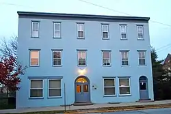 Keystone Hotel |
May 9, 1985 (#85001002) |
40 East Main Street 40°15′57″N 76°42′21″W |
Hummelstown | |
| 41 | Kunkel Building | 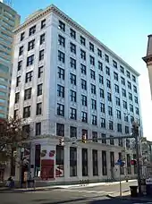 Kunkel Building |
November 9, 1982 (#82001534) |
301 Market Street 40°15′39″N 76°52′51″W |
Harrisburg | |
| 42 | Legislative Route 1 Sycamore Allee | .jpg.webp) Legislative Route 1 Sycamore Allee |
February 7, 2007 (#07000029) |
Legislative Route 1, approximately 1 mile (1.6 km) north and south of Halifax 40°26′51″N 76°56′29″W |
Halifax and Reed Townships | |
| 43 | Market Street Bridge | _HAER_color_1.jpg.webp) Market Street Bridge |
June 22, 1988 (#88000759) |
Market Street/Legislative Route 34 over the Susquehanna River 40°15′27″N 76°53′00″W |
Harrisburg | Extends into Cumberland County |
| 44 | Enoch Matlack House |  Enoch Matlack House |
June 22, 1979 (#79002219) |
250 East Main Street 40°15′57″N 76°42′08″W |
Hummelstown | |
| 45 | Archibald McAllister House | 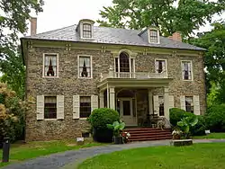 Archibald McAllister House |
June 7, 1976 (#76001633) |
5300 North Front Street in Fort Hunter 40°20′34″N 76°54′37″W |
Susquehanna Township | |
| 46 | Midtown Harrisburg Historic District | 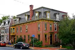 Midtown Harrisburg Historic District |
April 21, 1983 (#83002237) |
Roughly bounded by the Susquehanna River and Forster, Verbeke, and 3rd Streets 40°16′02″N 76°53′26″W |
Harrisburg | |
| 47 | Millersburg Ferry | 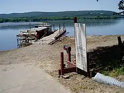 Millersburg Ferry |
August 2, 2006 (#06000663) |
Over the Susquehanna River between Millersburg and Buffalo Township 40°32′39″N 76°58′25″W |
Millersburg | Extends into Buffalo Township in Perry County |
| 48 | Millersburg Passenger Rail Station |  Millersburg Passenger Rail Station |
November 27, 2002 (#02001430) |
127 West Center Street 40°32′25″N 76°57′48″W |
Millersburg | |
| 49 | Mount Pleasant Historic District | 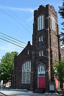 Mount Pleasant Historic District |
January 11, 1985 (#85000079) |
Sylvan Terrace to 19th Street, Market to Brookwood Streets 40°15′44″N 76°51′56″W |
Harrisburg | |
| 50 | Old Downtown Harrisburg Commercial Historic District |  Old Downtown Harrisburg Commercial Historic District |
July 14, 1983 (#83002238) |
Dewberry, Chestnut, Blackberry, and South 3rd Streets 40°15′37″N 76°52′47″W |
Harrisburg | |
| 51 | Old Uptown Harrisburg Historic District | 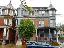 Old Uptown Harrisburg Historic District |
January 4, 1990 (#89002297) |
Roughly bounded by McClay, North 3rd, Reily, North 2nd, and Calder 40°16′26″N 76°53′43″W |
Harrisburg | |
| 52 | William Penn Memorial Museum and State Archives Building |  William Penn Memorial Museum and State Archives Building |
August 1, 2014 (#14000467) |
300 North St. 40°15′57″N 76°53′10″W |
Harrisburg | |
| 53 | Pennsylvania Railroad GG1 Streamlined Electric Locomotive #4859 | 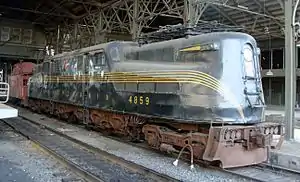 Pennsylvania Railroad GG1 Streamlined Electric Locomotive #4859 |
May 5, 2004 (#04000399) |
Track 5, Harrisburg Transportation Center, Aberdeen Street 40°15′45″N 76°52′40″W |
Harrisburg | |
| 54 | Pennsylvania State Lunatic Hospital | 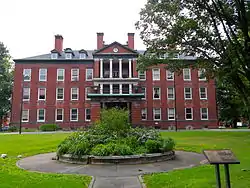 Pennsylvania State Lunatic Hospital |
January 8, 1986 (#86000057) |
Cameron Street 40°16′59″N 76°52′24″W |
Harrisburg | |
| 55 | Quarries of the Hummelstown Brownstone Company | 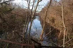 Quarries of the Hummelstown Brownstone Company |
February 27, 2003 (#03000075) |
Roughly north of Brookline Drive, Amber Drive 40°13′48″N 76°41′30″W |
Derry Township | |
| 56 | Charles and Joseph Raymond Houses |  Charles and Joseph Raymond Houses |
August 1, 1979 (#79002221) |
38 and 37 North Union Street 40°11′43″N 76°43′52″W |
Middletown | |
| 57 | Rockville Bridge | 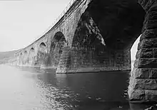 Rockville Bridge |
August 15, 1975 (#75001640) |
0.5 miles (0.80 km) south of Marysville over the Susquehanna River 40°19′59″N 76°54′42″W |
Susquehanna Township | Extends into Perry County |
| 58 | Romberger-Stover House | 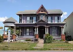 Romberger-Stover House |
August 29, 1980 (#80003481) |
Market Street 40°36′09″N 76°48′42″W |
Berrysburg | |
| 59 | St. Peter's Kierch |  St. Peter's Kierch |
June 18, 1973 (#73001621) |
31 West High Street 40°12′04″N 76°43′56″W |
Middletown | |
| 60 | Salem United Church of Christ |  Salem United Church of Christ |
April 23, 1975 (#75001639) |
231 Chestnut Street 40°15′34″N 76°52′45″W |
Harrisburg | |
| 61 | William Seel Building |  William Seel Building |
December 3, 1980 (#80003482) |
319 Market Street 40°15′41″N 76°52′48″W |
Harrisburg | |
| 62 | Sheffield Apartments |  Sheffield Apartments |
April 26, 1990 (#90000698) |
2003 North 3rd Street 40°16′40″N 76°53′42″W |
Harrisburg | |
| 63 | Shoop Site (36DA20) | February 13, 1986 (#86000241) |
East of Enders[7] 40°29′14″N 76°49′12″W |
Jackson and Wayne Townships | ||
| 64 | Henry Smith Farm |  Henry Smith Farm |
December 22, 1988 (#88003050) |
950 Swatara Creek Road 40°12′46″N 76°42′56″W |
Middletown | |
| 65 | Soldiers and Sailors Memorial Bridge | _HAER_color.jpg.webp) Soldiers and Sailors Memorial Bridge |
June 22, 1988 (#88000761) |
Legislative Route 140/State Street over Legislative Route 130 Spur and Paxton Creek 40°16′02″N 76°52′43″W |
Harrisburg | |
| 66 | Star Barn Complex | 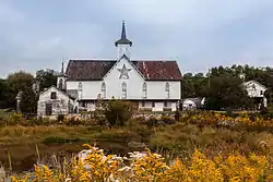 Star Barn Complex |
July 27, 2000 (#00000845) |
Nissley Drive at Pennsylvania Route 283 40°13′25″N 76°46′17″W |
Lower Swatara Township | |
| 67 | Pennsylvania State Capitol Complex | 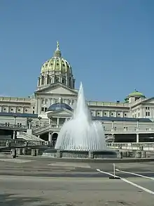 Pennsylvania State Capitol Complex |
September 14, 1977 (#77001162) |
Bounded by 3rd and 7th, North and Walnut Streets 40°15′52″N 76°53′02″W |
Harrisburg | Boundary revised February 27, 2013 to include the Pennsylvania State Capitol and surrounding buildings. |
| 68 | Steelton High School | 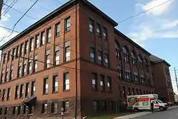 Steelton High School |
September 8, 2011 (#11000645) |
100 South 4th Street 40°14′06″N 76°50′12″W |
Steelton | |
| 69 | Swatara Ferry House |  Swatara Ferry House |
September 27, 1976 (#76001635) |
400 Swatara Street 40°11′29″N 76°43′57″W |
Middletown | |
| 70 | John Todd House | 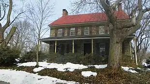 John Todd House |
November 3, 1988 (#88002371) |
South Meadow Lane 40°21′07″N 76°40′15″W |
East Hanover Township | |
| 71 | Walnut Street Bridge | 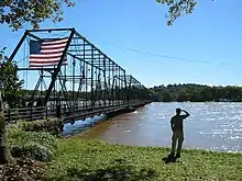 Walnut Street Bridge |
June 5, 1972 (#72001115) |
Walnut Street over the Susquehanna River 40°15′18″N 76°53′19″W |
Harrisburg | |
| 72 | Zion Lutheran Church and Graveyard | 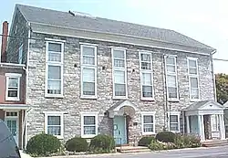 Zion Lutheran Church and Graveyard |
March 29, 1979 (#79002220) |
Rosanna Street 40°15′58″N 76°42′39″W |
Hummelstown |
Former listings
| [3] | Name on the Register | Image | Date listed | Date removed | Location | City or town | Summary |
|---|---|---|---|---|---|---|---|
| 1 | Greenawalt Building | February 24, 1983 (#83002235) | March 10, 1998 | 118-120 Market Street |
Harrisburg | ||
| 2 | Senate Hotel | Unspecified (#82001535) | June 5, 1997 | 122 Market St. |
Harrisburg | ||
| 3 | Telegraph Building | March 3, 1978 (#78002387) | June 27, 1986 | 214-216 Locust Street |
Harrisburg |
See also
| Wikimedia Commons has media related to National Register of Historic Places in Dauphin County, Pennsylvania. |
References
- The latitude and longitude information provided in this table was derived originally from the National Register Information System, which has been found to be fairly accurate for about 99% of listings. Some locations in this table may have been corrected to current GPS standards.
- "National Register of Historic Places: Weekly List Actions". National Park Service, United States Department of the Interior. Retrieved on January 29, 2021.
- Numbers represent an alphabetical ordering by significant words. Various colorings, defined here, differentiate National Historic Landmarks and historic districts from other NRHP buildings, structures, sites or objects.
- The eight-digit number below each date is the number assigned to each location in the National Register Information System database, which can be viewed by clicking the number.
- Location derived from its GNIS feature record; the NRIS lists the site as "Address Restricted
- Location derived from its NRHP nomination form; the NRIS lists the site as "Address Restricted"
- Location derived from its NRHP nomination form; the NRIS lists the site as "Address Restricted"
Municipalities and communities of Dauphin County, Pennsylvania, United States | ||
|---|---|---|
| City | | |
| Boroughs | ||
| Townships | ||
| CDPs | ||
| Unincorporated communities |
| |
| ||
| Topics | 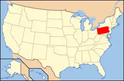 | |
|---|---|---|
| Lists by county |
| |
| Lists by city | ||
| Other lists | ||
| ||
This article is issued from Wikipedia. The text is licensed under Creative Commons - Attribution - Sharealike. Additional terms may apply for the media files.