National Register of Historic Places listings in Centre County, Pennsylvania
This is a list of the National Register of Historic Places listings in Centre County, Pennsylvania.
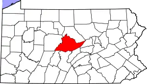
Location of Centre County in Pennsylvania
This is intended to be a complete list of the properties and districts on the National Register of Historic Places in Centre County, Pennsylvania, United States. The locations of National Register properties and districts for which the latitude and longitude coordinates are included below, may be seen in a map.[1]
There are 63 properties and districts listed on the National Register in the county. Another 2 properties were once listed but have been removed.
- This National Park Service list is complete through NPS recent listings posted January 29, 2021.[2]
Current listings
| [3] | Name on the Register | Image | Date listed[4] | Location | Municipality | Description |
|---|---|---|---|---|---|---|
| 1 | Aaronsburg Historic District | 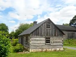 Aaronsburg Historic District |
September 2, 1980 (#80003452) |
Pennsylvania Route 45 in Aaronsburg 40°54′02″N 77°27′10″W |
Haines Township | |
| 2 | Ag Hill Complex | 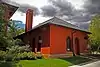 Ag Hill Complex |
January 22, 1979 (#79002191) |
Penn State University campus 40°47′59″N 77°51′54″W |
State College | |
| 3 | William Allison House | .jpg.webp) William Allison House |
April 18, 1977 (#77001146) |
1 mile (1.6 km) west of Spring Mills on Pennsylvania Route 45 40°51′05″N 77°34′55″W |
Gregg Township | |
| 4 | Bucher Ayres Farm | 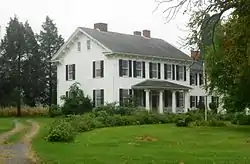 Bucher Ayres Farm |
December 1, 1980 (#80003453) |
Southwest of Pine Grove Mills on Whitehall Road, Pennsylvania Furnace 40°43′21″N 77°57′54″W |
Ferguson Township | |
| 5 | Christian Bechdel II House |  Christian Bechdel II House |
March 1, 1982 (#82003775) |
South of Blanchard on Liberty Road 41°03′31″N 77°36′16″W |
Liberty Township | |
| 6 | William Henry and Clara Singer Beck Farm | August 31, 2017 (#100001570) |
950 Snydertown Rd., southeast of Howard 40°59′13″N 77°34′39″W |
Walker Township | ||
| 7 | Bellefonte Armory | 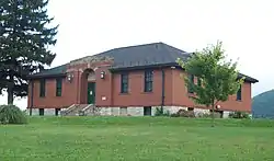 Bellefonte Armory |
December 22, 1989 (#89002068) |
East Bishop Street 40°54′55″N 77°45′25″W |
Bellefonte | |
| 8 | Bellefonte Forge House |  Bellefonte Forge House |
August 20, 1999 (#99001020) |
4098 Axemann Road 40°54′21″N 77°46′41″W |
Spring Township | |
| 9 | Bellefonte Historic District | 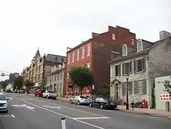 Bellefonte Historic District |
August 12, 1977 (#77001136) |
Roughly bounded by Stony Batter, Ardell Alley, Thomas, Armor, Penn, Ridge and Logan Streets 40°54′48″N 77°46′43″W |
Bellefonte | |
| 10 | Black Moshannon State Park Day Use District |  Black Moshannon State Park Day Use District |
February 12, 1987 (#87000101) |
9 miles (14 km) east of Philipsburg on Pennsylvania Route 504 40°54′57″N 78°03′46″W |
Rush Township | |
| 11 | Black Moshannon State Park Family Cabin District | 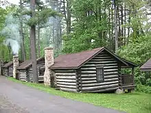 Black Moshannon State Park Family Cabin District |
February 12, 1987 (#87000102) |
9 miles (14 km) east of Philipsburg on Pennsylvania Route 504 40°54′48″N 78°03′45″W |
Rush Township | |
| 12 | Black Moshannon State Park Maintenance District | 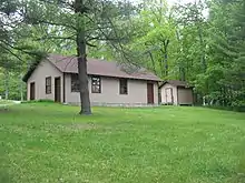 Black Moshannon State Park Maintenance District |
February 12, 1987 (#87000097) |
9 miles (14 km) east of Philipsburg on Pennsylvania Route 504 40°55′15″N 78°04′24″W |
Rush Township | |
| 13 | Boal Mansion | 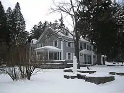 Boal Mansion |
December 4, 1978 (#78002361) |
U.S. Route 322 and Pennsylvania Route 45 in Boalsburg 40°46′44″N 77°48′01″W |
Harris Township | |
| 14 | Boalsburg Historic District | 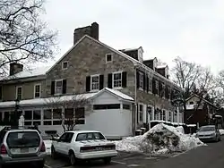 Boalsburg Historic District |
December 12, 1977 (#77001139) |
U.S. Route 322 in Boalsburg 40°46′34″N 77°47′38″W |
Harris Township | |
| 15 | Brockerhoff Hotel | 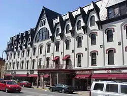 Brockerhoff Hotel |
April 11, 1977 (#77001137) |
High and Allegheny Streets 40°54′42″N 77°46′42″W |
Bellefonte | |
| 16 | Brockerhoff Mill | 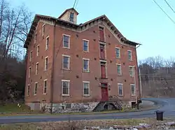 Brockerhoff Mill |
May 1, 1979 (#79002180) |
Southwest of Bellefonte on Pennsylvania Route 550 40°54′01″N 77°47′58″W |
Benner Township | |
| 17 | Camelot | _1.JPG.webp) Camelot |
April 26, 1979 (#79002192) |
520 South Fraser Street 40°47′20″N 77°51′29″W |
State College | |
| 18 | Centre County Courthouse |  Centre County Courthouse |
November 7, 1976 (#76001618) |
High Street 40°54′43″N 77°46′40″W |
Bellefonte | |
| 19 | Centre Furnace Mansion House | 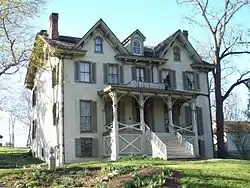 Centre Furnace Mansion House |
December 27, 1979 (#79002193) |
1001 East College Avenue 40°48′23″N 77°50′33″W |
State College | |
| 20 | Centre Mills | 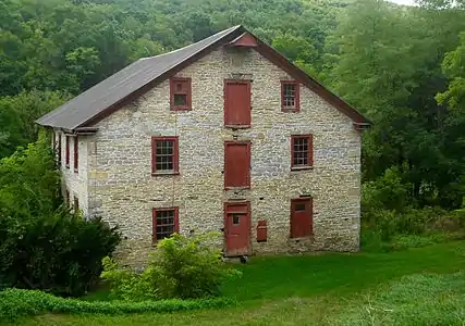 Centre Mills |
December 12, 1976 (#76001621) |
Southwest of Rebersburg off Pennsylvania Route 445 40°55′32″N 77°28′21″W |
Miles Township | |
| 21 | College Heights Historic District | 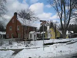 College Heights Historic District |
April 27, 1995 (#95000514) |
Roughly bounded by Holmes Street, Park Avenue, Ridge Avenuie, Sunset Road, Hillcrest Avenue, Woodland Drive and Mitchell Avenue 40°47′57″N 77°52′28″W |
State College | |
| 22 | Curtin Village | 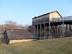 Curtin Village |
March 11, 1971 (#71000687) |
Off U.S. Route 220 40°58′26″N 77°44′33″W |
Boggs Township | |
| 23 | Felix Dale Stone House | 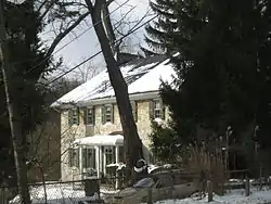 Felix Dale Stone House |
April 20, 1982 (#82003777) |
Pennsylvania Route 871, south of Lemont 40°48′11″N 77°48′49″W |
College Township | |
| 24 | Egg Hill Church | 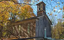 Egg Hill Church |
June 4, 1979 (#79002189) |
Southwest of Spring Mills on Egg Hill Road 40°49′42″N 77°37′32″W |
Potter Township | |
| 25 | Abraham Elder Stone House | 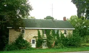 Abraham Elder Stone House |
April 13, 1977 (#77001148) |
Pennsylvania Route 550 at Stormstown 40°47′43″N 78°00′46″W |
Halfmoon Township | |
| 26 | Farmers' High School | 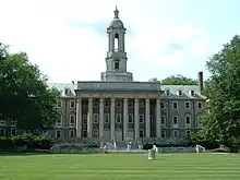 Farmers' High School |
September 11, 1981 (#81000538) |
College Avenue and Atherton Street 40°47′39″N 77°51′55″W |
State College | |
| 27 | Fisher Farm Site | 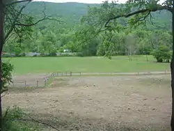 Fisher Farm Site |
March 3, 1982 (#82003781) |
Along U.S. Route 220, straddling a rail line[5] 40°54′15″N 77°52′40″W |
Unionville | |
| 28 | Maj. Jared B. Fisher House |  Maj. Jared B. Fisher House |
September 14, 1977 (#77001147) |
Northeast of Spring Mills on Pennsylvania Route 45 40°51′42″N 77°33′22″W |
Gregg Township | |
| 29 | Gamble Mill | 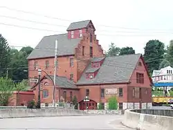 Gamble Mill |
August 1, 1975 (#75001627) |
Dunlap and Lamb Streets 40°54′50″N 77°47′01″W |
Bellefonte | |
| 30 | John Gray House | 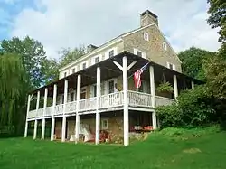 John Gray House |
April 3, 1975 (#75001628) |
East of Port Matilda off Pennsylvania Route 550, south of U.S. Route 220 40°49′28″N 77°58′29″W |
Patton Township | |
| 31 | Andrew Gregg Homestead | 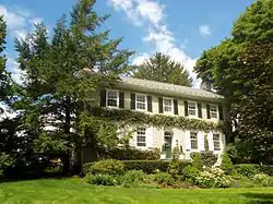 Andrew Gregg Homestead |
July 28, 1977 (#77001141) |
2 miles (3.2 km) east of Centre Hall off Pennsylvania Route 192 40°51′53″N 77°38′22″W |
Potter Township | |
| 32 | Harmony Forge Mansion | 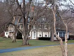 Harmony Forge Mansion |
October 16, 1979 (#79002183) |
South of Milesburg on Pennsylvania Route 144 40°56′05″N 77°47′12″W |
Boggs Township | |
| 33 | Hill House | .jpg.webp) Hill House |
March 28, 1977 (#77001140) |
Tennis Street in Boalsburg 40°46′22″N 77°47′43″W |
Harris Township | |
| 34 | Holmes-Foster-Highlands Historic District | 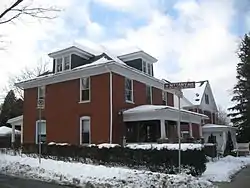 Holmes-Foster-Highlands Historic District |
April 27, 1995 (#95000513) |
Roughly bounded by Buckhout Street, Railroad and Highland Avenues, High and Keller Streets, and Irvin and Prospect Avenues 40°47′31″N 77°51′39″W |
State College | |
| 35 | Houserville Site (36CE65) | 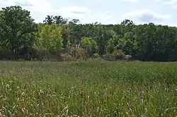 Houserville Site (36CE65) |
March 6, 1986 (#86000401) |
1300 block of East College Avenue, east of State College[6] 40°48′42″N 77°50′04″W |
College Township | |
| 36 | Iddings-Baldridge House | 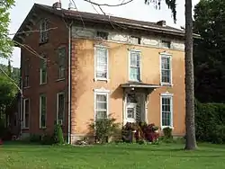 Iddings-Baldridge House |
July 29, 1977 (#77001145) |
Railroad Street 40°56′34″N 77°47′47″W |
Milesburg | |
| 37 | Lemont Historic District | 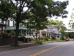 Lemont Historic District |
June 6, 1979 (#79002182) |
Off Pennsylvania Route 26 in Lemont 40°48′37″N 77°49′08″W |
College Township | |
| 38 | Linden Hall Historic District | 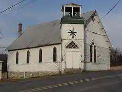 Linden Hall Historic District |
September 5, 1990 (#90001409) |
Rock Hill Road between Linden Hall and Brush Valley Roads in Linden Hall 40°47′52″N 77°45′45″W |
Harris Township | |
| 39 | Logan Furnace Mansion | 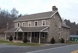 Logan Furnace Mansion |
April 11, 1977 (#77001138) |
3 miles (4.8 km) south of Bellefonte on Pennsylvania Route 144 40°52′38″N 77°45′51″W |
Spring Township | |
| 40 | McAllister-Beaver House | 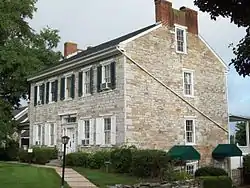 McAllister-Beaver House |
February 24, 1982 (#82003774) |
817 East Bishop Street 40°54′49″N 77°45′52″W |
Bellefonte | |
| 41 | Miles-Humes House | 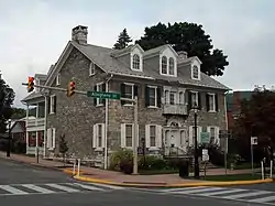 Miles-Humes House |
October 21, 1976 (#76001619) |
203 North Allegheny Street 40°54′48″N 77°46′45″W |
Bellefonte | |
| 42 | Millheim Historic District | 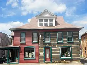 Millheim Historic District |
March 25, 1986 (#86000787) |
Pennsylvania Routes 45 and 445 40°53′34″N 77°28′38″W |
Millheim | |
| 43 | Neff Round Barn | 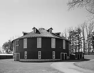 Neff Round Barn |
May 2, 1979 (#79002181) |
South of Centre Hall off Pennsylvania Route 45 40°49′03″N 77°42′06″W |
Potter Township | |
| 44 | Maj. John Neff Homestead | 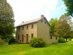 Maj. John Neff Homestead |
April 11, 1977 (#77001142) |
Southwest of Centre Hall 40°49′17″N 77°43′38″W |
Potter Township | |
| 45 | Oak Hall Historic District | 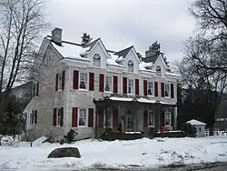 Oak Hall Historic District |
October 25, 1979 (#79002185) |
Pennsylvania Route 871 in Oak Hall 40°47′37″N 77°48′18″W |
College Township | |
| 46 | Penn's Cave and Hotel | 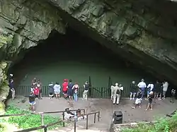 Penn's Cave and Hotel |
April 14, 1978 (#78002363) |
5 miles (8.0 km) east of Centre Hall off Pennsylvania Route 192 40°52′58″N 77°36′36″W |
Gregg Township | |
| 47 | Pennsylvania Match Company | Pennsylvania Match Company |
September 7, 2001 (#01000954) |
367 Phoenix Avenue 40°54′31″N 77°46′59″W |
Bellefonte | |
| 48 | Hardman Philips House |  Hardman Philips House |
September 18, 1978 (#78002364) |
Presquisle and 4th Streets 40°53′48″N 78°13′11″W |
Philipsburg | |
| 49 | Philipsburg Historic District | 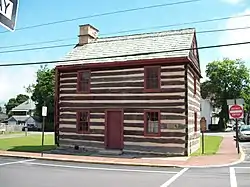 Philipsburg Historic District |
July 22, 1999 (#99000881) |
Roughly bounded by East Presqueisle Street, Hillcrest Drive, Oak, Railroad, Spruce and Laurel Streets 40°54′00″N 78°13′00″W |
Philipsburg | |
| 50 | Simon Pickle Stone House | 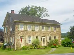 Simon Pickle Stone House |
April 18, 1977 (#77001144) |
Junction of Pennsylvania Routes 192 and 445 at Madisonburg 40°55′24″N 77°30′54″W |
Miles Township | |
| 51 | Potter-Allison Farm | December 6, 1977 (#77001143) |
Southeast of Centre Hall on Pennsylvania Route 144 40°48′06″N 77°37′51″W |
Potter Township | ||
| 52 | Rebersburg Historic District |  Rebersburg Historic District |
December 7, 1979 (#79002188) |
Pennsylvania Route 192 in Rebersburg 40°56′40″N 77°26′35″W |
Miles Township | |
| 53 | Leonard Rhone House | October 31, 1985 (#85003448) |
Off Pennsylvania Route 45 40°48′32″N 77°43′16″W |
Potter Township | ||
| 54 | Rowland Theater | 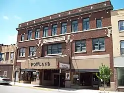 Rowland Theater |
October 18, 1979 (#79002186) |
Front Street 40°53′47″N 78°13′25″W |
Philipsburg | |
| 55 | South Ward School | 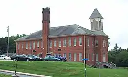 South Ward School |
February 23, 1978 (#78002360) |
Bishop Street 40°54′40″N 77°46′23″W |
Bellefonte | |
| 56 | William Thomas House | 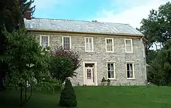 William Thomas House |
November 13, 1976 (#76001620) |
266 North Thomas Street 40°54′54″N 77°47′09″W |
Bellefonte | |
| 57 | Gen. John Thompson House | 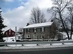 Gen. John Thompson House |
March 29, 1978 (#78002366) |
East Branch Road, east of State College 40°47′25″N 77°49′56″W |
College Township | |
| 58 | Tudek Site | 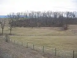 Tudek Site |
February 12, 1982 (#82003778) |
Along Orchard Road, northeast of State College[7] 40°49′01″N 77°51′03″W |
College Township | |
| 59 | Union Church and Burial Ground |  Union Church and Burial Ground |
May 23, 1978 (#78002365) |
East Presqueisle Street 40°53′53″N 78°13′04″W |
Philipsburg | |
| 60 | Unionville Historic District | 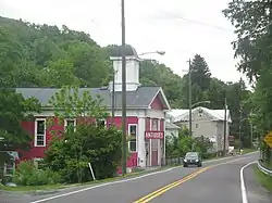 Unionville Historic District |
May 30, 1979 (#79002194) |
U.S. Route 220 and Pennsylvania Route 504 40°54′22″N 77°52′34″W |
Unionville | |
| 61 | Daniel Waggoner Log House and Barn | April 18, 1979 (#79002190) |
Southwest of Spring Mills 40°49′52″N 77°37′11″W |
Potter Township | ||
| 62 | George Wilson Homestead | 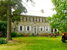 George Wilson Homestead |
February 24, 1982 (#82003776) |
Southwest of Centennial on Pennsylvania Route 550 40°45′19″N 78°04′05″W |
Halfmoon Township | |
| 63 | Woodward Inn | 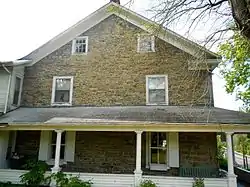 Woodward Inn |
December 18, 1978 (#78002367) |
Pennsylvania Route 45 at Woodward 40°53′55″N 77°21′25″W |
Haines Township |
Former listings
| [3] | Name on the Register | Image | Date listed | Date removed | Location | City or town | Summary |
|---|---|---|---|---|---|---|---|
| 1 | Bellefonte Academy | November 7, 1976 (#76001617) | December 24, 2008 | 225 West Bishop Street 40°54′37″N 77°46′48″W |
Bellefonte | ||
| 2 | James Beck Round Barn | February 17, 1978 (#78002362) | June 27, 1986 | 3.2 miles (5.1 km) east of Centre Hall on Pennsylvania Route 192 |
Potter Township |
See also
| Wikimedia Commons has media related to National Register of Historic Places in Centre County, Pennsylvania. |
References
- The latitude and longitude information provided in this table was derived originally from the National Register Information System, which has been found to be fairly accurate for about 99% of listings. Some locations in this table may have been corrected to current GPS standards.
- "National Register of Historic Places: Weekly List Actions". National Park Service, United States Department of the Interior. Retrieved on January 29, 2021.
- Numbers represent an alphabetical ordering by significant words. Various colorings, defined here, differentiate National Historic Landmarks and historic districts from other NRHP buildings, structures, sites or objects.
- The eight-digit number below each date is the number assigned to each location in the National Register Information System database, which can be viewed by clicking the number.
- Location derived from its NRHP nomination form; the NRIS lists the site as "Address Restricted"
- Location derived from its NRHP nomination form; the NRIS lists the site as "Address Restricted"
- Location derived from its NRHP nomination form; the NRIS lists the site as "Address Restricted"
| Topics |  | |
|---|---|---|
| Lists by county |
| |
| Lists by city | ||
| Other lists | ||
| ||
Municipalities and communities of Centre County, Pennsylvania, United States | ||
|---|---|---|
| Boroughs | | |
| Townships | ||
| CDPs |
| |
| Unincorporated communities | ||
| Regions | ||
| ||
This article is issued from Wikipedia. The text is licensed under Creative Commons - Attribution - Sharealike. Additional terms may apply for the media files.