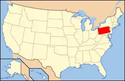
National Register of Historic Places listings in Elk County, Pennsylvania
This is a list of the National Register of Historic Places listings in Elk County, Pennsylvania.
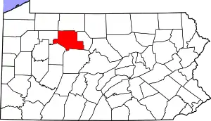
Location of Elk County in Pennsylvania
This is intended to be a complete list of the properties and districts on the National Register of Historic Places in Elk County, Pennsylvania, United States. The locations of National Register properties and districts for which the latitude and longitude coordinates are included below, may be seen in a map.[1]
There are 12 properties and districts listed on the National Register in the county.
- This National Park Service list is complete through NPS recent listings posted February 5, 2021.[2]
Current listings
| [3] | Name on the Register | Image | Date listed[4] | Location | Municipality | Description |
|---|---|---|---|---|---|---|
| 1 | Bonifels |  Bonifels |
December 14, 1978 (#78002396) |
West of Ridgway off Laurel Mill Road 41°25′11″N 78°45′17″W |
Ridgway Township | |
| 2 | Decker's Chapel |  Decker's Chapel |
November 12, 1998 (#98001367) |
Junction of Earth Road and Pennsylvania Route 255 41°24′03″N 78°33′38″W |
St. Marys | |
| 3 | O.B. Grant House | 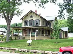 O.B. Grant House |
April 5, 2004 (#04000268) |
610 West Main Street 41°25′17″N 78°44′57″W |
Ridgway | |
| 4 | Irwintown Site |  Irwintown Site |
September 25, 2012 (#12000822) |
Northern bank of the Clarion River, above Hallton[5] 41°24′03″N 78°54′23″W |
Spring Creek Township | |
| 5 | Johnsonburg Commercial Historic District | 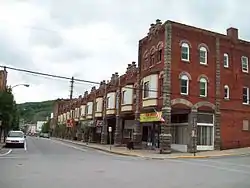 Johnsonburg Commercial Historic District |
October 28, 1999 (#99001290) |
Roughly along Center, Bridge, and Market Streets 41°29′20″N 78°40′31″W |
Johnsonburg | |
| 6 | Lake City School | 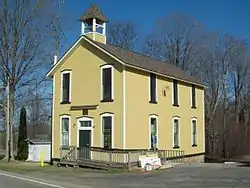 Lake City School |
June 10, 2008 (#08000519) |
27586 Lake City Road in Lake City 41°21′54″N 78°53′07″W |
Spring Creek Township | |
| 7 | Loleta Recreation Area |  Loleta Recreation Area |
November 24, 2015 (#15000828) |
Along Legislative Route 3002 near its junction with Millstone Rd. 41°24′00″N 79°04′55″W |
Millstone Township | Nomination form[6] |
| 8 | Ridgway Armory | 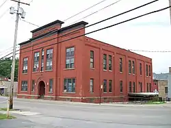 Ridgway Armory |
December 22, 1989 (#89002078) |
72 North Broad Street 41°25′24″N 78°43′48″W |
Ridgway | |
| 9 | Ridgway Historic District | 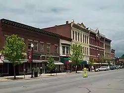 Ridgway Historic District |
January 22, 2003 (#02001180) |
Roughly bounded by the borough limits, the Clarion River, Erie Alley, and Gallagher Run 41°25′12″N 78°43′40″W |
Ridgway | |
| 10 | St. Marys Historic District |  St. Marys Historic District |
November 25, 1998 (#98001368) |
Roughly bounded by Walburga, St. Michael, Fourth, John, and Mill Streets 41°25′43″N 78°33′49″W |
St. Marys | |
| 11 | Swedish Lutheran Parsonage | 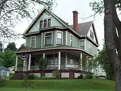 Swedish Lutheran Parsonage |
February 24, 2005 (#05000099) |
230 Kane Street in Wilcox 41°34′34″N 78°41′14″W |
Jones Township | |
| 12 | John E. Weidenboerner House | 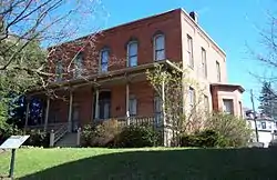 John E. Weidenboerner House |
July 24, 1992 (#92000931) |
North St. Michael Street 41°25′45″N 78°33′43″W |
St. Marys |
See also
| Wikimedia Commons has media related to National Register of Historic Places in Elk County, Pennsylvania. |
References
- The latitude and longitude information provided in this table was derived originally from the National Register Information System, which has been found to be fairly accurate for about 99% of listings. Some locations in this table may have been corrected to current GPS standards.
- "National Register of Historic Places: Weekly List Actions". National Park Service, United States Department of the Interior. Retrieved on February 5, 2021.
- Numbers represent an alphabetical ordering by significant words. Various colorings, defined here, differentiate National Historic Landmarks and historic districts from other NRHP buildings, structures, sites or objects.
- The eight-digit number below each date is the number assigned to each location in the National Register Information System database, which can be viewed by clicking the number.
- Clarion River Water Trail Map and Guide, Pennsylvania Fish and Boat Commission, 2004-04. Accessed 2012-11-06.
- Hinkel, Amanda. "Loleta Recreation Area" (PDF). phmc.pa.gov. PHMC. Archived from the original (PDF) on 31 January 2016. Retrieved 27 January 2016.
This article is issued from Wikipedia. The text is licensed under Creative Commons - Attribution - Sharealike. Additional terms may apply for the media files.

