National Register of Historic Places listings in Northeast Philadelphia
This is a list of the National Register of Historic Places listings in Northeast Philadelphia.

This is intended to be a complete list of the properties and districts on the National Register of Historic Places in Northeast Philadelphia, Pennsylvania, United States. The locations of National Register properties and districts for which the latitude and longitude coordinates are included below, may be seen in an online map.[1]
There are 581 properties and districts listed on the National Register in Philadelphia, including 67 National Historic Landmarks. Northeast Philadelphia includes 65 of these properties and districts, including 1 National Historic Landmark; the city's remaining properties and districts are listed elsewhere. One site is split between Northeast Philadelphia and other parts of the city, and is thus included on multiple lists.
Current listings
| [2] | Name on the Register | Image | Date listed[3] | Location | Neighborhood | Description |
|---|---|---|---|---|---|---|
| 1 | 26th District Police and Patrol Station | 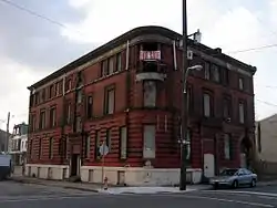 26th District Police and Patrol Station |
July 12, 1984 (#84003550) |
2136–2142 East Dauphin Street 39°58′52″N 75°07′44″W |
Kensington | |
| 2 | Adams Avenue Bridge in Philadelphia | 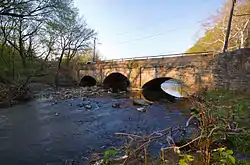 Adams Avenue Bridge in Philadelphia |
June 22, 1988 (#88000851) |
Adams Avenue over Tacony Creek 40°02′31″N 75°06′48″W |
Olney | Extends into North Philadelphia |
| 3 | Albion Carpet Mill |  Albion Carpet Mill |
January 12, 2016 (#15000973) |
1821-1845 E. Hagert St. 39°59′10″N 75°07′48″W |
Kensington | |
| 4 | Ethan Allen School |  Ethan Allen School |
November 18, 1988 (#88002227) |
3001 Robbins Avenue 40°01′47″N 75°03′44″W |
Mayfair | |
| 5 | William W. Axe School | 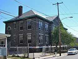 William W. Axe School |
November 18, 1988 (#88002240) |
1709–1733 Kinsey Street 40°00′44″N 75°05′02″W |
Frankford | |
| 6 | Beatty's Mills Factory Building |  Beatty's Mills Factory Building |
August 18, 2004 (#04000881) |
2446–2468 Coral Street 39°59′04″N 75°07′43″W |
Kensington | |
| 7 | Bridesburg School |  Bridesburg School |
April 10, 1989 (#88002285) |
2624 Haworth Street 40°00′10″N 75°04′05″W |
Bridesburg | |
| 8 | William Brown Company Hosiery Mill |  William Brown Company Hosiery Mill |
January 17, 2019 (#100003320) |
3400-3412 J St. 39°59′59″N 75°06′31″W |
Fairhill | |
| 9 | Joseph H. Brown School | 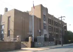 Joseph H. Brown School |
November 18, 1988 (#88002250) |
8118–8120 Frankford Avenue 40°02′36″N 75°01′29″W |
Holmesburg | |
| 10 | Brownhill & Kramer Hosiery Mill |  Brownhill & Kramer Hosiery Mill |
March 31, 2014 (#14000096) |
406-426 Memphis St., 1421-1437 E. Columbia Ave. 39°58′26″N 75°07′56″W |
Fishtown | |
| 11 | H.W. Butterworth and Sons Company Building |  H.W. Butterworth and Sons Company Building |
June 28, 2010 (#10000406) |
2410 East York St. 39°58′39″N 75°07′29″W |
Kensington | |
| 12 | Laura H. Carnell School |  Laura H. Carnell School |
November 18, 1988 (#88002251) |
6101 Summerdale Avenue 40°02′20″N 75°05′03″W |
Oxford Circle | |
| 13 | Charles Carroll Public School | 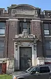 Charles Carroll Public School |
September 25, 2018 (#100002986) |
2700 E Auburn St. 39°58′47″N 75°06′37″W |
||
| 14 | Watson Comly School |  Watson Comly School |
November 18, 1988 (#88002324) |
13250 Trevose Road 40°07′36″N 75°00′46″W |
Somerton | |
| 15 | Russell H. Conwell School |  Russell H. Conwell School |
November 18, 1988 (#88002258) |
1829–1951 East Clearfield Street 39°59′39″N 75°06′54″W |
Port Richmond | |
| 16 | Thomas Creighton School | 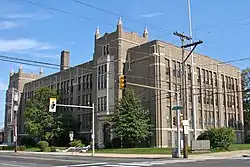 Thomas Creighton School |
November 18, 1988 (#88002260) |
5401 Tabor Road 40°02′04″N 75°06′19″W |
Crescentville | |
| 17 | Kennedy Crossan School | 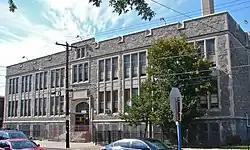 Kennedy Crossan School |
November 18, 1988 (#88002261) |
7341 Palmetto Street 40°03′43″N 75°04′54″W |
Burholme | |
| 18 | Crown Can Company Building |  Crown Can Company Building |
November 20, 2018 (#100003136) |
956 E Erie Ave. 40°00′20″N 75°06′41″W |
Juniata | |
| 19 | The Delaware Station of the Philadelphia Electric Company |  The Delaware Station of the Philadelphia Electric Company |
August 10, 2016 (#16000427) |
1325 Beach St. 39°58′03″N 75°07′40″W |
Fishtown | |
| 20 | Hamilton Disston School |  Hamilton Disston School |
November 18, 1988 (#88002262) |
6801 Cottage Street 40°01′42″N 75°02′50″W |
Tacony | |
| 21 | Mary Disston School | 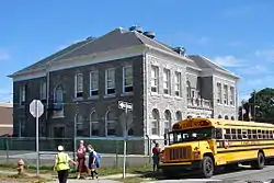 Mary Disston School |
November 18, 1988 (#88002319) |
4521 Longshore Avenue 40°01′42″N 75°02′40″W |
Tacony | |
| 22 | Henry R. Edmunds School |  Henry R. Edmunds School |
November 18, 1988 (#88002266) |
1101–1197 Haworth Street 40°01′30″N 75°05′12″W |
Northwood | |
| 23 | Edward Corner Marine Merchandise Warehouse |  Edward Corner Marine Merchandise Warehouse |
October 6, 2020 (#100005654) |
1100-1102 North Delaware Ave. 39°57′58″N 75°07′54″W |
||
| 24 | Fayette School |  Fayette School |
December 4, 1986 (#86003295) |
Old Bustleton and Welsh Roads 40°04′56″N 75°02′20″W |
Bustleton | |
| 25 | First Federal Savings and Loan Association of Philadelphia, Northeast Branch |  First Federal Savings and Loan Association of Philadelphia, Northeast Branch |
April 5, 2019 (#100003595) |
1907-1925 Cottman Ave. 40°03′07″N 75°04′02″W |
||
| 26 | Edwin Forrest School |  Edwin Forrest School |
November 18, 1988 (#88002273) |
4300 Bleigh Street 40°02′04″N 75°02′10″W |
Mayfair | |
| 27 | Frankford Arsenal | 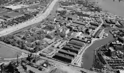 Frankford Arsenal |
March 16, 1972 (#72001153) |
Tacony and Bridge Streets 40°00′28″N 75°04′00″W |
Frankford | Boundary decrease approved December 28, 2017. |
| 28 | Frankford Avenue Bridge | 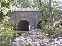 Frankford Avenue Bridge |
June 22, 1988 (#88000803) |
Frankford Avenue over the Pennypack Creek 40°02′37″N 75°01′14″W |
Holmesburg | |
| 29 | Frankford Avenue Bridge |  Frankford Avenue Bridge |
June 22, 1988 (#88000850) |
Frankford Avenue over Poquessing Creek 40°03′53″N 74°58′53″W |
Torresdale | Extends into Bucks County |
| 30 | Benjamin Franklin School |  Benjamin Franklin School |
November 18, 1988 (#88002274) |
5737–5741 Rising Sun Avenue 40°02′33″N 75°06′15″W |
Crescentville | |
| 31 | Franklin Carpet Mill | 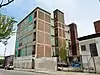 Franklin Carpet Mill |
April 17, 2018 (#100002340) |
2141-2145 E. Huntingdon St. 39°59′02″N 75°07′23″W |
Kensington | |
| 32 | Friends Hospital | 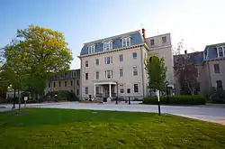 Friends Hospital |
January 20, 1999 (#99000629) |
4641 Roosevelt Boulevard 40°01′36″N 75°06′07″W |
Northwood | First private psychiatric hospital in the U.S., founded 1813 |
| 33 | Glen Foerd on the Delaware | 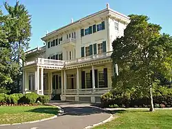 Glen Foerd on the Delaware |
November 20, 1979 (#79002320) |
5001 Grant Avenue 40°03′05″N 74°58′44″W |
Torresdale | Glen Foerd on the Delaware is a historic estate located at the confluence of the Poquessing Creek and Delaware River. It is listed on the National Register of Historic Places and the Historic American Landscape Survey. www.glenfoerd.org |
| 34 | Greenbelt Knoll Historic District |  Greenbelt Knoll Historic District |
December 14, 2010 (#10001030) |
1–19 Longford St., roughly bounded by Holme Ave. and Pennypack Park Greenway 40°03′23″N 75°01′20″W |
Pennypack | |
| 35 | Green Tree Tavern |  Green Tree Tavern |
June 27, 1980 (#80003612) |
260–262 East Girard Avenue 39°58′11″N 75°07′54″W |
Fishtown | |
| 36 | Warren G. Harding Junior High School |  Warren G. Harding Junior High School |
November 18, 1988 (#88002277) |
2000 Wakeling Street 40°00′47″N 75°04′28″W |
Frankford | |
| 37 | Holme Avenue Bridge | 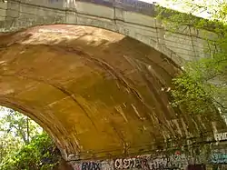 Holme Avenue Bridge |
June 22, 1988 (#88000806) |
Holme Avenue over Wooden Bridge Run 40°03′23″N 75°01′27″W |
Pennypack | |
| 38 | Francis Hopkinson School | 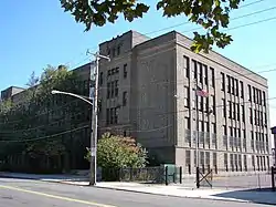 Francis Hopkinson School |
November 18, 1988 (#88002282) |
1301–1331 East Luzerne Avenue 40°00′30″N 75°06′09″W |
Juniata | |
| 39 | George L. Horn School | 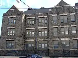 George L. Horn School |
December 4, 1986 (#86003292) |
Frankford and Castor Avenues 39°59′58″N 75°05′55″W |
Port Richmond | |
| 40 | John Paul Jones Junior High School |  John Paul Jones Junior High School |
November 18, 1988 (#88002287) |
2922 Memphis Street 39°59′10″N 75°06′46″W |
Port Richmond | |
| 41 | Kensington High School for Girls |  Kensington High School for Girls |
November 18, 1988 (#88002288) |
2075 East Cumberland Street 39°59′03″N 75°07′35″W |
Kensington | |
| 42 | Knowlton | 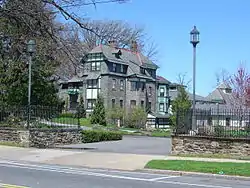 Knowlton |
October 1, 1974 (#74001803) |
8001 Verree Road 40°04′24″N 75°04′28″W |
Fox Chase | |
| 43 | Lawndale School | 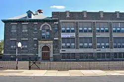 Lawndale School |
November 18, 1988 (#88002254) |
600 Hellerman Street 40°02′59″N 75°05′31″W |
Lawndale | |
| 44 | Henry Longfellow School |  Henry Longfellow School |
November 18, 1988 (#88002294) |
5004–5098 Tacony Street 40°00′31″N 75°04′17″W |
Frankford | |
| 45 | Carl Mackley Houses | 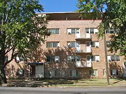 Carl Mackley Houses |
May 6, 1998 (#98000401) |
1401 East Bristol Street 40°00′44″N 75°05′55″W |
Juniata | |
| 46 | John Marshall School | 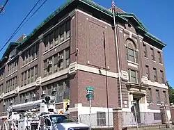 John Marshall School |
November 18, 1988 (#88002298) |
1501–1527 Sellers Street 40°00′53″N 75°05′15″W |
Frankford | |
| 47 | James Martin School | 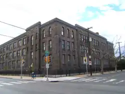 James Martin School |
November 18, 1988 (#88002299) |
3340 Richmond Street 39°59′08″N 75°05′50″W |
Port Richmond | |
| 48 | Mechanicsville School |  Mechanicsville School |
December 1, 1986 (#86003306) |
Mechanicsville Road 40°06′27″N 74°58′02″W |
Parkwood | |
| 49 | Mill-Rae |  Mill-Rae |
January 12, 2017 (#100000502) |
13475 Proctor Rd 40°07′39″N 75°00′31″W |
||
| 50 | Penn Treaty Junior High School | 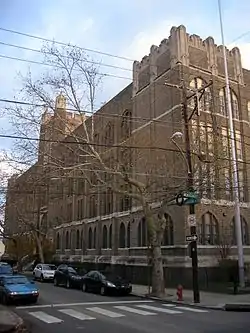 Penn Treaty Junior High School |
November 18, 1988 (#88002311) |
600 East Thompson Street 39°58′22″N 75°07′38″W |
Fishtown | |
| 51 | Thomas Powers School | 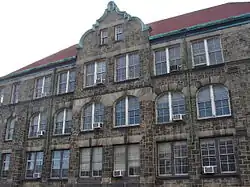 Thomas Powers School |
December 4, 1986 (#86003319) |
Frankford Avenue and Somerset Street 39°59′20″N 75°07′11″W |
Port Richmond | |
| 52 | Richmond School |  Richmond School |
November 18, 1988 (#88002316) |
2942 Belgrade Street 39°59′00″N 75°06′38″W |
Port Richmond | |
| 53 | John Ruan House | 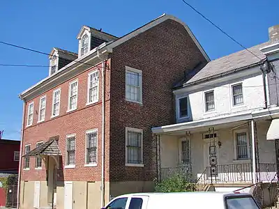 John Ruan House |
October 31, 1985 (#85003410) |
4278–4280 Griscom Street 40°00′40″N 75°05′25″W |
Frankford | |
| 54 | Ryerss Mansion |  Ryerss Mansion |
November 21, 1976 (#76001669) |
Central and Cottman Avenues 40°04′07″N 75°05′19″W |
Fox Chase | |
| 55 | Philip H. Sheridan School | 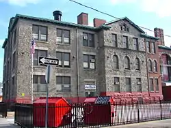 Philip H. Sheridan School |
November 18, 1988 (#88002322) |
800–818 East Ontario Street 39°59′59″N 75°06′51″W |
Kensington | |
| 56 | Franklin Smedley School | 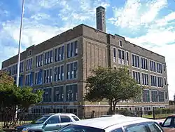 Franklin Smedley School |
November 18, 1988 (#88002323) |
5199 Mulberry Street 40°01′11″N 75°04′26″W |
Frankford | |
| 57 | Stanley |  Stanley |
May 10, 2005 (#05000415) |
8500 Pine Road 40°05′25″N 75°04′29″W |
Fox Chase | Extends into Montgomery County |
| 58 | James J. Sullivan School |  James J. Sullivan School |
November 18, 1988 (#88002327) |
5300 Ditman Street 40°00′58″N 75°04′00″W |
Frankford | |
| 59 | Tacony Disston Community Development Historic District |  Tacony Disston Community Development Historic District |
May 16, 2016 (#16000257) |
Roughly bounded by 4500-4900 blocks of Magee St., Princeton & Tyson Aves., 6900 blk. of Cottage St. 40°02′07″N 75°03′26″W |
Tacony | |
| 60 | Tacony Music Hall |  Tacony Music Hall |
March 9, 1990 (#90000413) |
4815–4819 Longshore Avenue 40°01′29″N 75°02′32″W |
Tacony | |
| 61 | Times Finishing Works |  Times Finishing Works |
July 5, 2016 (#16000428) |
1136-1148 N. American St. 39°58′07″N 75°08′27″W |
||
| 62 | Francis E. Willard School |  Francis E. Willard School |
December 4, 1986 (#86003346) |
Emerald and Orleans Streets 39°59′30″N 75°07′01″W |
Port Richmond | |
| 63 | David Wilmot School |  David Wilmot School |
November 18, 1988 (#88002289) |
1734 Meadow Street 40°00′50″N 75°04′51″W |
Frankford | |
| 64 | Peter Woll and Sons Factory |  Peter Woll and Sons Factory |
August 31, 2020 (#100005520) |
165-173 West Berks St. 39°58′44″N 75°08′10″W |
||
| 65 | Woodrow Wilson Junior High School | Woodrow Wilson Junior High School |
December 4, 1986 (#86003347) |
Cottman Avenue and Loretto Street 40°03′09″N 75°04′08″W |
Castor Gardens[4] |
See also
| Wikimedia Commons has media related to National Register of Historic Places in Northeast Philadelphia. |
References
- The latitude and longitude information provided in this table was derived originally from the National Register Information System, which has been found to be fairly accurate for about 99% of listings. Some locations in this table may have been corrected to current GPS standards.
- Numbers represent an alphabetical ordering by significant words. Various colorings, defined here, differentiate National Historic Landmarks and historic districts from other NRHP buildings, structures, sites or objects.
- The eight-digit number below each date is the number assigned to each location in the National Register Information System database, which can be viewed by clicking the number.
- McMullin, Robert J. (1975). The Neighborhoods of Philadelphia. Philadelphia, Pennsylvania: Office of the Deputy Managing Director for Housing. pp. 118.
Oxford Circle: Oxford Circle of Comly Street to Cottman Avenue, Roosevelt Boulevard to Oxford Avenue and Algon Avenue. ...the Castor Gardens section from about Magee to Cottman is generally more prestigious than the south end.
| Topics |  | |
|---|---|---|
| Lists by county |
| |
| Lists by city | ||
| Other lists | ||
| ||