National Register of Historic Places listings in Montgomery County, Pennsylvania
This is a list of the National Register of Historic Places listings in Montgomery County, Pennsylvania.
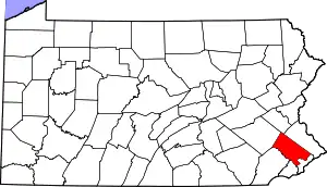
Location of Montgomery County in Pennsylvania
This is intended to be a complete list of the properties and districts on National Register of Historic Places in Montgomery County, Pennsylvania, United States.
There are 158 properties and districts listed on the National Register in the county. Eleven sites are further designated National Historic Landmarks and one is designated a National Historical Park. Another three properties were once listed but have been removed.
- This National Park Service list is complete through NPS recent listings posted January 29, 2021.[1]
Current listings
| [2] | Name on the Register | Image | Date listed[3] | Location | Municipality | Description |
|---|---|---|---|---|---|---|
| 1 | Abington Township High School |  Abington Township High School |
August 2, 1985 (#85001676) |
1801 Susquehanna Road 40°06′51″N 75°07′12″W |
Abington Township | Mostly demolished in 1996; only one small building survives. |
| 2 | Henry Antes House |  Henry Antes House |
May 12, 1975 (#75001657) |
Northeast of Pottstown on Colonial Road 40°17′32″N 75°32′26″W |
Upper Frederick Township | Headquarters of General George Washington, September 23 to 26, 1777.[4] |
| 3 | Augustus Lutheran Church | .jpg.webp) Augustus Lutheran Church |
December 24, 1967 (#67000019) |
7th Avenue, East and Main Street 40°12′05″N 75°28′51″W |
Trappe | |
| 4 | Barley Sheaf Inn |  Barley Sheaf Inn |
December 10, 1980 (#80003580) |
North of Norristown at 420 West Germantown Pike 40°08′55″N 75°20′05″W |
East Norriton Township | |
| 5 | Bauern Freund Print Shop |  Bauern Freund Print Shop |
July 26, 1982 (#82003801) |
Pennsylvania Route 63 40°19′44″N 75°27′09″W |
Marlborough Township | |
| 6 | Bergy Bridge Historic District |  Bergy Bridge Historic District |
October 10, 1973 (#73001644) |
Northwest of Harleysville off Pennsylvania Route 63 40°18′08″N 75°25′21″W |
Upper Salford Township | |
| 7 | Beth Sholom Synagogue | 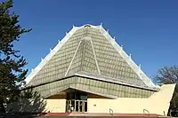 Beth Sholom Synagogue |
March 29, 2007 (#07000430) |
8231 Old York Road 40°05′03″N 75°07′35″W |
Cheltenham Township | Frank Lloyd Wright, architect. |
| 8 | Black Horse Inn |  Black Horse Inn |
July 5, 2005 (#89000144) |
1432 Bethlehem Pike, Flourtown 40°06′13″N 75°12′48″W |
Springfield Township | |
| 9 | Black Rock Bridge | 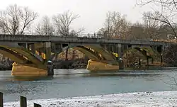 Black Rock Bridge |
June 22, 1988 (#88000735) |
Pennsylvania Route 113 over the Schuylkill River 40°09′32″N 75°30′44″W |
Upper Providence Township | Extends into Chester County |
| 10 | Boyertown Burial Casket Company |  Boyertown Burial Casket Company |
December 21, 2017 (#100001910) |
401 W. 4th St. 40°24′19″N 75°30′25″W |
East Greenville | |
| 11 | Henry W. Breyer Sr. House |  Henry W. Breyer Sr. House |
February 20, 2004 (#04000065) |
8230 Old York Road 40°04′53″N 75°07′41″W |
Cheltenham Township | |
| 12 | Bridge in Franconia Township | 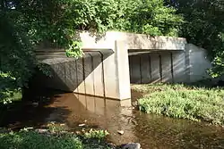 Bridge in Franconia Township |
June 22, 1988 (#88000856) |
Allentown Road over Skippack Creek near Elvoy 40°17′18″N 75°20′20″W |
Franconia Township | |
| 13 | Bridge in Hatfield Township |  Bridge in Hatfield Township |
June 22, 1988 (#88000861) |
Orvilla Road over western branch of the Neshaminy Creek 40°17′02″N 75°16′23″W |
Hatfield Township | |
| 14 | Bridge in Upper Merion Township | 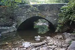 Bridge in Upper Merion Township |
June 22, 1988 (#88000832) |
South Gulph Road over Gulph Creek 40°04′08″N 75°20′28″W |
Upper Merion Township | |
| 15 | Bryn Athyn Historic District | 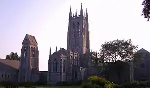 Bryn Athyn Historic District |
October 6, 2008 (#08001087) |
Huntington Pike and Cathedral Road 40°08′21″N 75°03′46″W |
Bryn Athyn | |
| 16 | Bryn Athyn-Lower Moreland Bridge |  Bryn Athyn-Lower Moreland Bridge |
June 22, 1988 (#88000831) |
Byberry Road over a branch of Pennypack Creek 40°09′31″N 75°04′30″W |
Lower Moreland Township | |
| 17 | Bryn Mawr | 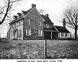 Bryn Mawr |
July 2, 1973 (#73001643) |
500 Harriton Road 40°02′05″N 75°18′41″W |
Lower Merion Township | |
| 18 | Bryn Mawr College Historic District | 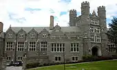 Bryn Mawr College Historic District |
May 4, 1979 (#79002299) |
Morris Avenue, Yarrow Street and New Gulph Road 40°01′35″N 75°18′49″W |
Lower Merion Township | |
| 19 | Bryn Mawr Hotel | 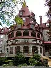 Bryn Mawr Hotel |
April 27, 1979 (#79002300) |
Morris and Montgomery Avenues 40°01′23″N 75°18′46″W |
Lower Merion Township | |
| 20 | Cairnwood | 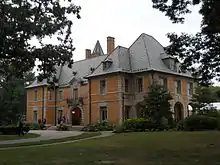 Cairnwood |
March 21, 2002 (#02000223) |
3028 Huntington Pike 40°08′21″N 75°03′46″W |
Bryn Athyn | |
| 21 | Camptown Historic District |  Camptown Historic District |
October 31, 1985 (#85003434) |
Roughly bounded by Penrose Avenue, Graham Lane, Dennis Street, and Cheltenham Avenue 40°03′57″N 75°08′40″W |
Cheltenham Township | |
| 22 | Carson College for Orphan Girls | 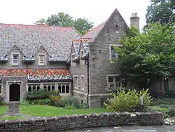 Carson College for Orphan Girls |
March 15, 1991 (#91000227) |
Between West Mill and Wissahickon Roads, Flourtown 40°06′00″N 75°13′16″W |
Springfield Township | |
| 23 | Central Norristown Historic District | 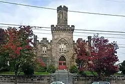 Central Norristown Historic District |
November 23, 1984 (#84000321) |
Roughly bounded by Stoney Creek, Walnut, Lafayette, and Fornace Streets 40°07′04″N 75°20′22″W |
Norristown | |
| 24 | Cold Point Historic District | 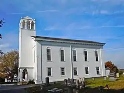 Cold Point Historic District |
September 9, 1983 (#83002261) |
Interstate 276, Butler Pike, Militia Hill and Narcissa Roads 40°06′52″N 75°16′06″W |
Plymouth and Whitemarsh Townships | |
| 25 | Warren Z. Cole House |  Warren Z. Cole House |
March 7, 1973 (#73001653) |
Skippack Pike and Evansburg Road 40°13′16″N 75°23′20″W |
Skippack Township | |
| 26 | Compton and Bloomfield | 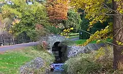 Compton and Bloomfield |
December 22, 1978 (#78002445) |
9414 Meadowbrook Avenue 40°05′21″N 75°13′29″W |
Springfield Township | Bloomfield House is in Northwest Philadelphia |
| 27 | Continental Stove Works |  Continental Stove Works |
January 9, 1986 (#86000040) |
First Street above Main 40°11′04″N 75°32′44″W |
Royersford | |
| 28 | Alan W. Corson Homestead | 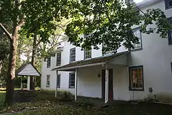 Alan W. Corson Homestead |
June 19, 1973 (#73001649) |
5130 Butler Pike 40°07′00″N 75°15′55″W |
Whitemarsh Township | |
| 29 | County Bridge No. 54 |  County Bridge No. 54 |
June 22, 1988 (#88000837) |
Morris Road, over a branch of Wissahickon Creek that arises near Prospectville 40°08′22″N 75°13′01″W |
Whitemarsh Township | |
| 30 | Curtis Arboretum | 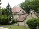 Curtis Arboretum |
March 20, 2002 (#02000229) |
1250 West Church Road 40°05′05″N 75°08′52″W |
Cheltenham Township | |
| 31 | Dawesfield |  Dawesfield |
March 29, 1991 (#91000318) |
565 Lewis Lane, Ambler 40°09′12″N 75°14′53″W |
Whitpain Township | |
| 32 | Elkins Railroad Station, Philadelphia and Reading Railroad |  Elkins Railroad Station, Philadelphia and Reading Railroad |
October 25, 1990 (#90001609) |
Junction of Spring and Park Avenues, Cheltenham Township 40°04′16″N 75°07′42″W |
Cheltenham Township | Cope & Stewardson, architects. |
| 33 | John Englehardt Homestead |  John Englehardt Homestead |
June 4, 1973 (#73001650) |
West of Schwenksville off Pennsylvania Route 73 on Keyser Road 40°16′57″N 75°31′54″W |
Upper Frederick Township | |
| 34 | William and Mordecai Evans House |  William and Mordecai Evans House |
April 20, 2005 (#05000332) |
1206 Main Street, Linfield 40°12′35″N 75°34′19″W |
Limerick Township | |
| 35 | Evansburg Historic District | 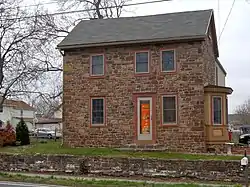 Evansburg Historic District |
June 19, 1972 (#72001139) |
On Germantown Pike, bounded by Cross Key Road, Grange Avenue, Mill Road, and Ridge Pike 40°10′51″N 75°25′20″W |
Lower Providence, Skippack, and Worcester Townships | |
| 36 | Fagleysville Road Bridge Crossing Swamp Creek | 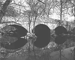 Fagleysville Road Bridge Crossing Swamp Creek |
June 22, 1988 (#88000864) |
Fagleysville Road over Swamp Creek 40°16′28″N 75°29′07″W |
Fagleysville vicinity | |
| 37 | Farmar Mill | 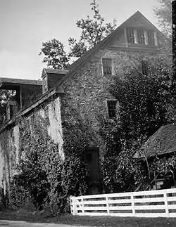 Farmar Mill |
May 19, 1972 (#72001140) |
North of Flourtown at the junction of Bethlehem Pike and Pennsylvania Route 73 40°07′26″N 75°13′10″W |
Whitemarsh Township | |
| 38 | Fetter's Mill | 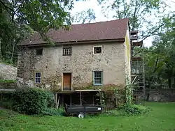 Fetter's Mill |
May 27, 1999 (#99000647) |
2543 Fetter's Mill Drive, Bryn Athyn 40°07′47″N 75°04′20″W |
Lower Moreland Township | |
| 39 | Fetter's Mill Village Historic District | 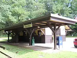 Fetter's Mill Village Historic District |
August 16, 2006 (#05001212) |
Fetter's Mill Road and Pennypack Lane 40°07′55″N 75°04′18″W |
Bryn Athyn and Lower Moreland Township | |
| 40 | Dr. Norman & Doris Fisher House |  Dr. Norman & Doris Fisher House |
March 31, 2014 (#14000095) |
197 E. Mill Rd. 40°10′01″N 75°06′30″W |
Hatboro | Louis I. Kahn, architect |
| 41 | Franklinville School | 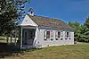 Franklinville School |
December 29, 2014 (#14001102) |
1701 Morris Rd. 40°10′58″N 75°17′00″W |
Whitpain Township | |
| 42 | Gerloff Road Bridge Crossing Swamp Creek | 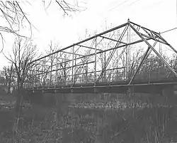 Gerloff Road Bridge Crossing Swamp Creek |
June 22, 1988 (#88000838) |
Gerloff Road over Swamp Creek near Zieglersville 40°17′10″N 75°32′39″W |
Lower Frederick Township vicinity | |
| 43 | Gladwyne Historic District |  Gladwyne Historic District |
December 10, 1980 (#80003577) |
Pennsylvania Route 23 40°02′12″N 75°16′52″W |
Lower Merion Township | |
| 44 | Glencairn | 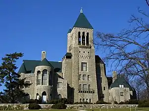 Glencairn |
August 31, 1978 (#78002434) |
1001 Papermill Road 40°08′11″N 75°03′53″W |
Bryn Athyn | |
| 45 | Glenside Memorial Hall | 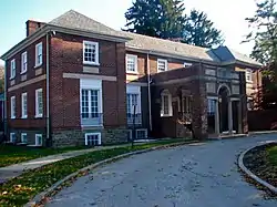 Glenside Memorial Hall |
May 12, 2004 (#04000438) |
185 Keswick Avenue 40°05′51″N 75°09′12″W |
Cheltenham Township | |
| 46 | Globe Knitting Mills |  Globe Knitting Mills |
January 31, 2003 (#02001745) |
660 and 694 East Main Street 40°06′40″N 75°19′54″W |
Norristown | |
| 47 | Graeme Park | 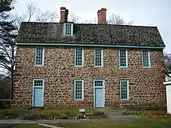 Graeme Park |
October 15, 1966 (#66000672) |
Keith Valley Road 40°12′55″N 75°09′06″W |
Horsham Township | |
| 48 | Green Hill Farms |  Green Hill Farms |
December 15, 2011 (#11000925) |
6 East Lancaster Avenue 39°59′19″N 75°15′20″W |
Lower Merion Township | |
| 49 | Grey Towers |  Grey Towers |
February 14, 1980 (#80003578) |
Easton Road and Limekiln Pike 40°04′53″N 75°09′54″W |
Cheltenham Township | Horace Trumbauer, architect. |
| 50 | Grubb Mansion |  Grubb Mansion |
May 1, 1991 (#91000505) |
1304 High Street 40°14′30″N 75°37′17″W |
Pottstown | |
| 51 | Conrad Grubb Homestead |  Conrad Grubb Homestead |
June 19, 1973 (#73001651) |
Northwest of Schwenksville off Pennsylvania Route 73 on Perkiomenville Road 40°18′10″N 75°30′49″W |
Upper Frederick Township | |
| 52 | Gwynedd Hall |  Gwynedd Hall |
September 24, 1985 (#85002474) |
1244 Meetinghouse Road 40°12′11″N 75°14′43″W |
Lower Gwynedd Township | |
| 53 | Hanging Rock |  Hanging Rock |
December 24, 1997 (#97001251) |
1144 South Gulph Road 40°03′55″N 75°20′31″W |
Upper Merion Township | |
| 54 | Harriton | Harriton |
October 31, 1985 (#85003472) |
1401-1415 Old Gulph Road 40°02′29″N 75°19′19″W |
Lower Merion Township | |
| 55 | Hatfield Borough Substation, Lock Up and Firehouse | 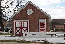 Hatfield Borough Substation, Lock Up and Firehouse |
January 12, 2016 (#15000972) |
Cherry at Diamond and Fretz Sts. 40°16′55″N 75°17′55″W |
Hatfield | |
| 56 | George K. Heller School | 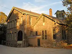 George K. Heller School |
May 2, 2001 (#01000461) |
439 Ashbourne Road, Ashmead Village 40°03′49″N 75°05′58″W |
Cheltenham Township | |
| 57 | High Street Historic District | 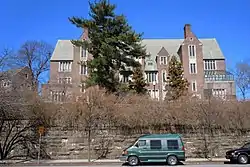 High Street Historic District |
January 28, 1992 (#91001756) |
631-1329 High Street 40°14′34″N 75°37′46″W |
Pottstown | |
| 58 | The Highlands | 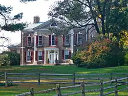 The Highlands |
December 12, 1976 (#76001653) |
West of central Whitemarsh Township at Skippack Pike and Sheaff Lane 40°08′04″N 75°13′56″W |
Whitemarsh Township | |
| 59 | Hope Lodge | .jpg.webp) Hope Lodge |
April 26, 1972 (#72001141) |
553 Bethlehem Pike 40°07′34″N 75°12′59″W |
Whitemarsh Township | |
| 60 | Horsham Friends Meeting | 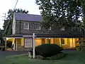 Horsham Friends Meeting |
June 21, 1991 (#91000723) |
Junction of Meeting House and Easton Roads 40°11′00″N 75°07′57″W |
Horsham Township | |
| 61 | Horsham-Montgomery Bridge | 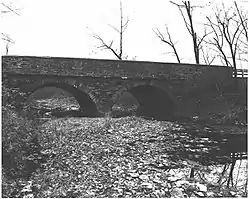 Horsham-Montgomery Bridge |
June 22, 1988 (#88000836) |
Lower State Road over Little Neshaminy Creek 40°14′15″N 75°11′31″W |
Horsham and Montgomery Townships | |
| 62 | Hovenden House, Barn and Abolition Hall | 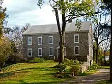 Hovenden House, Barn and Abolition Hall |
February 18, 1971 (#71000713) |
1 East Germantown Pike 40°06′10″N 75°16′41″W |
Whitemarsh Township | |
| 63 | Humane Fire Engine Company No. 1 |  Humane Fire Engine Company No. 1 |
November 25, 2019 (#100004663) |
301 Walnut St. 40°11′00″N 75°32′23″W |
Royersford | |
| 64 | Isaac Hunsberger House |  Isaac Hunsberger House |
June 22, 2000 (#00000719) |
545 West Ridge Pike 40°13′57″N 75°31′38″W |
Limerick Township | |
| 65 | Idlewild Farm Complex |  Idlewild Farm Complex |
January 20, 1984 (#84003505) |
617 Williamson Road 40°02′09″N 75°17′36″W |
Lower Merion Township | |
| 66 | Jefferson Elementary School |  Jefferson Elementary School |
September 30, 2003 (#03000723) |
Beech and Warren Streets 40°14′54″N 75°38′22″W |
Pottstown | |
| 67 | Jenkins Homestead |  Jenkins Homestead |
September 15, 1977 (#77001176) |
137 Jenkins Avenue 40°14′17″N 75°16′56″W |
Lansdale | |
| 68 | Jenkins' Town Lyceum Building |  Jenkins' Town Lyceum Building |
October 16, 1979 (#79002303) |
Old York and Vista Roads 40°05′55″N 75°07′32″W |
Jenkintown | Furness & Evans, architects. |
| 69 | Jenkintown Wyncote Train Station |  Jenkintown Wyncote Train Station |
December 29, 2014 (#14001103) |
3 West Ave. 40°05′36″N 75°08′17″W |
Jenkintown and Cheltenham Township | |
| 70 | Jacob Kastner Loghouse |  Jacob Kastner Loghouse |
July 15, 1996 (#96000708) |
416 Norristown Road, Spring House 40°10′48″N 75°12′50″W |
Lower Gwynedd Township | |
| 71 | Keefe-Mumbower Mill |  Keefe-Mumbower Mill |
August 8, 2008 (#08000784) |
Northeastern corner of the junction of Swedesford and Township Line Roads 40°11′10″N 75°16′45″W |
Upper Gwynedd Township | |
| 72 | Kenderdine Mill Complex |  Kenderdine Mill Complex |
January 22, 1992 (#91002011) |
Junction of Keith Valley and Davis Grove Roads 40°12′32″N 75°10′15″W |
Horsham Township | |
| 73 | Kennedy Mansion |  Kennedy Mansion |
June 21, 1983 (#83002262) |
1050 Valley Forge Road 40°06′15″N 75°25′15″W |
Upper Merion Township | One of five surviving buildings from the demolished village of Port Kennedy. Now part of Valley Forge National Historical Park. |
| 74 | Keswick Theatre | 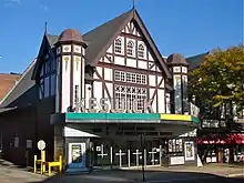 Keswick Theatre |
June 30, 1983 (#83002263) |
291 Keswick Avenue 40°06′23″N 75°08′51″W |
Abington Township | Horace Trumbauer, architect. |
| 75 | King of Prussia Inn |  King of Prussia Inn |
December 23, 1975 (#75001656) |
101 Bill Smith Boulevard 40°05′14″N 75°22′40″W |
Upper Merion Township | |
| 76 | Klein Meetinghouse |  Klein Meetinghouse |
April 13, 1973 (#73001645) |
Maple Avenue 40°17′31″N 75°22′34″W |
Lower Salford Township | |
| 77 | Knapp Farm |  Knapp Farm |
October 22, 1976 (#76001656) |
South of Montgomeryville off Pennsylvania Route 309 40°13′48″N 75°14′49″W |
Montgomery Township | |
| 78 | Knipe-Johnson Farm |  Knipe-Johnson Farm |
November 8, 2000 (#00001346) |
606 DeKalb Pike 40°13′02″N 75°15′04″W |
Upper Gwynedd Township | |
| 79 | Knipe-Moore-Rupp Farm |  Knipe-Moore-Rupp Farm |
November 7, 2003 (#03001124) |
Hancock Road and Prospect Avenue, North Wales 40°13′13″N 75°15′28″W |
Upper Gwynedd Township | |
| 80 | Knurr Log House |  Knurr Log House |
November 5, 1974 (#74001795) |
Meng Road, Delphi 40°16′05″N 75°28′39″W |
Lower Frederick Township | |
| 81 | Dielman Kolb Homestead |  Dielman Kolb Homestead |
August 17, 1973 (#73001647) |
South of Lederach on Kinsey Road, Lederach 40°14′56″N 75°24′06″W |
Lower Salford Township | |
| 82 | Isaac Kulp Farm |  Isaac Kulp Farm |
March 12, 1999 (#99000323) |
Junction of North Swedesford and Hancock Roads 40°12′54″N 75°15′12″W |
Upper Gwynedd Township | |
| 83 | Kuster Mill |  Kuster Mill |
March 24, 1971 (#71000711) |
On Skippack Creek at Mill Road and Water Street Road near Collegeville 40°11′17″N 75°24′33″W |
Skippack Township | |
| 84 | Lady Washington Inn |  Lady Washington Inn |
November 26, 1982 (#82001541) |
2550 Huntington Pike 40°07′28″N 75°03′50″W |
Lower Moreland Township | |
| 85 | Landis Homestead |  Landis Homestead |
October 10, 1973 (#73001654) |
Southwest of Tylersport off Pennsylvania Route 563 on Morwood Road 40°19′11″N 75°24′40″W |
Salford Township | |
| 86 | Lansdale Silk Hosiery Compy-Interstate Hosiery Mills, Inc. | 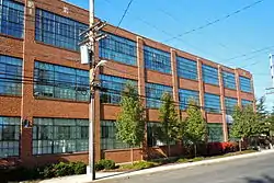 Lansdale Silk Hosiery Compy-Interstate Hosiery Mills, Inc. |
December 3, 2004 (#04001289) |
200 South Line Street 40°14′21″N 75°16′54″W |
Lansdale | |
| 87 | Lee Tire and Rubber Company | 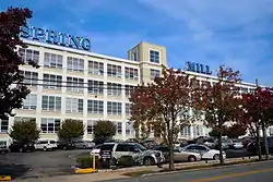 Lee Tire and Rubber Company |
August 23, 1984 (#84003512) |
1100 Hector Street 40°04′34″N 75°17′17″W |
Whitemarsh Township | |
| 88 | Loller Academy | 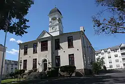 Loller Academy |
August 24, 1978 (#78002435) |
424 South York Road 40°10′16″N 75°06′39″W |
Hatboro | |
| 89 | Long Meadow Farm |  Long Meadow Farm |
June 19, 1973 (#73001652) |
Northwest of Schwenksville on Pennsylvania Route 73 40°18′34″N 75°32′16″W |
New Hanover Township | |
| 90 | Lower Merion Academy-Cynwyd Elementary School-Bala Cynwyd Junior High School Complex |  Lower Merion Academy-Cynwyd Elementary School-Bala Cynwyd Junior High School Complex |
November 27, 2002 (#02001429) |
506 Bryn Mawr Avenue 40°00′48″N 75°14′34″W |
Lower Merion Township | |
| 91 | Merion Cricket Club |  Merion Cricket Club |
February 27, 1987 (#87000759) |
Montgomery Avenue and Grays Ln. 40°00′56″N 75°17′53″W |
Lower Merion Township | Furness & Evans, architects. |
| 92 | Merion Friends Meeting House | %252C_Merion_Station_(Montgomery_County%252C_Pennsylvania).jpg.webp) Merion Friends Meeting House |
August 5, 1998 (#98001194) |
615 Montgomery Avenue 40°00′34″N 75°15′17″W |
Lower Merion Township | |
| 93 | Meyerhoff, Son and Company Building |  Meyerhoff, Son and Company Building |
December 21, 2017 (#100001911) |
300 Cherry St. 40°14′32″N 75°38′53″W |
Pottstown | |
| 94 | Mill Creek Historic District | 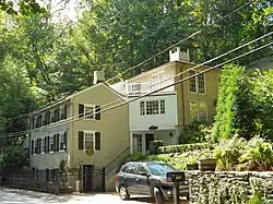 Mill Creek Historic District |
December 10, 1980 (#80003575) |
Near and east of Bryn Mawr; also roughly bounded by the Schuylkill River, Mill Creek, and Righter's Mill, Rose Glen, and Monk's Roads 40°01′32″N 75°17′08″W |
Lower Merion Township | Second set of boundaries represents a boundary increase of August 30, 1996 |
| 95 | Mill Grove | .jpg.webp) Mill Grove |
March 16, 1972 (#72001138) |
Pawling Road 40°07′37″N 75°26′28″W |
Lower Providence Township | |
| 96 | Miller's House at Spring Mill |  Miller's House at Spring Mill |
January 4, 1990 (#89002281) |
North Lane and Hector Street 40°04′30″N 75°17′07″W |
Whitemarsh Township | |
| 97 | Milmoral |  Milmoral |
January 31, 2003 (#02001746) |
1150 Church Road, Wyncote 40°05′02″N 75°08′47″W |
Cheltenham Township | |
| 98 | Edward Morgan Log House |  Edward Morgan Log House |
May 17, 1973 (#73001646) |
Off Pennsylvania Route 363 on Weikel Road near Kulpsville 40°14′42″N 75°18′46″W |
Towamencin Township | |
| 99 | Anthony Morris House |  Anthony Morris House |
December 3, 1980 (#80003581) |
North of Norristown on Stump Hall Road 40°11′13″N 75°22′07″W |
Worcester Township | |
| 100 | Mount Joy |  Mount Joy |
March 11, 1971 (#71000712) |
North Lane and Hector Street 40°04′36″N 75°17′12″W |
Whitemarsh Township | |
| 101 | Henry Melchior Muhlenberg House | 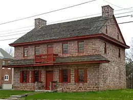 Henry Melchior Muhlenberg House |
February 18, 2000 (#00000060) |
201 West Main Street 40°11′47″N 75°28′13″W |
Trappe | |
| 102 | Narbrook Park Historic District |  Narbrook Park Historic District |
November 7, 2003 (#03001122) |
Narbrook Road and Windsor Avenue 40°00′26″N 75°16′00″W |
Narberth | |
| 103 | Normandy Farmstead | 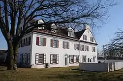 Normandy Farmstead |
May 10, 2001 (#01000502) |
1411 Morris Rd. near Blue Bell 40°10′50″N 75°16′45″W |
Whitpain Township | |
| 104 | Oak Park Historic District |  Oak Park Historic District |
July 23, 1998 (#98000897) |
Roughly along Oak Park Road, Park Avenue, Oak Boulevard, Forest Avenue, and Squirrel Lane 40°15′11″N 75°17′57″W |
Hatfield Township | |
| 105 | Old Norriton Presbyterian Church | 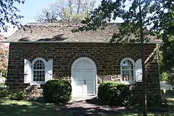 Old Norriton Presbyterian Church |
April 3, 1979 (#79002304) |
Northwest of Norristown on Germantown Pike 40°09′30″N 75°22′25″W |
East Norriton Township | |
| 106 | Old Pottstown Historic District |  Old Pottstown Historic District |
September 5, 1985 (#85001955) |
Roughly bounded by South, Race, Bailey, Adams, Lincoln, Beech, and Manatawny Streets 40°14′44″N 75°38′48″W |
Pottstown | |
| 107 | Pennypacker Mansion |  Pennypacker Mansion |
November 7, 1976 (#76001657) |
5 Haldeman Road 40°15′15″N 75°27′28″W |
Perkiomen Township | |
| 108 | Perkiomen Bridge | .jpg.webp) Perkiomen Bridge |
June 22, 1988 (#88000826) |
Ridge Pike over Perkiomen Creek 40°11′03″N 75°26′54″W |
Collegeville and Lower Providence Township | |
| 109 | Perkiomen Bridge Hotel |  Perkiomen Bridge Hotel |
January 3, 1985 (#85000037) |
Main Street and Route 29 40°11′05″N 75°26′59″W |
Collegeville | |
| 110 | Plymouth Friends Meetinghouse |  Plymouth Friends Meetinghouse |
February 18, 1971 (#71000714) |
Corner of Germantown and Butler Pikes 40°06′08″N 75°16′48″W |
Plymouth Township | |
| 111 | Plymouth Meeting Historic District | 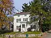 Plymouth Meeting Historic District |
February 18, 1971 (#71000715) |
Plymouth Meeting and Whitemarsh Townships 40°06′02″N 75°16′39″W |
Plymouth and Whitemarsh Townships | |
| 112 | Poplar Lane |  Poplar Lane |
May 22, 1978 (#78002436) |
1000 Boxwood Court, near King of Prussia 40°04′14″N 75°20′17″W |
Upper Merion Township | |
| 113 | Pottsgrove Mansion |  Pottsgrove Mansion |
January 18, 1974 (#74001796) |
West of Pottstown on Benjamin Franklin Highway (High Street) 40°14′52″N 75°39′35″W |
Pottstown | |
| 114 | Pottstown Roller Mill |  Pottstown Roller Mill |
October 10, 1974 (#74001797) |
South and Hanover Streets 40°14′36″N 75°39′08″W |
Pottstown | |
| 115 | Quaker Manor House |  Quaker Manor House |
November 21, 1976 (#76001654) |
1165 Pinetown Road 40°08′43″N 75°11′20″W |
Upper Dublin Township | |
| 116 | Reading Railroad Pottstown Station |  Reading Railroad Pottstown Station |
January 12, 1984 (#84003514) |
High Street between Hanover and York Streets 40°14′41″N 75°39′09″W |
Pottstown | Clark Dillenbeck, architect. |
| 117 | Red Hill Historic District |  Red Hill Historic District |
October 31, 1985 (#85003428) |
148, 152, and 200-600 Main Street, 98-226 and 21-231 West Sixth Street, and 532-550 Adams Street 40°22′33″N 75°29′02″W |
Red Hill | |
| 118 | Andreas Rieth Homestead |  Andreas Rieth Homestead |
September 19, 1973 (#73001648) |
Southeast of Pennsburg on Geryville Pike 40°22′11″N 75°27′33″W |
Marlborough Township | |
| 119 | David Rittenhouse Junior High School |  David Rittenhouse Junior High School |
June 28, 1996 (#96000717) |
1705 Locust Street 40°07′47″N 75°19′53″W |
Norristown | |
| 120 | Roberts and Mander Stove Company Buildings |  Roberts and Mander Stove Company Buildings |
August 7, 2005 (#05000799) |
Roughly along Jacksonville Road, Tanner Avenue, and Lincoln Avenue 40°10′59″N 75°05′54″W |
Hatboro | |
| 121 | Rowland House |  Rowland House |
October 25, 1979 (#79002301) |
300 Ashbourne Road 40°03′34″N 75°05′47″W |
Cheltenham Township | |
| 122 | Sanatoga Union Sunday School | 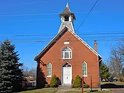 Sanatoga Union Sunday School |
August 4, 2004 (#04000805) |
2341 East High Street 40°14′42″N 75°35′40″W |
Lower Pottsgrove Township | |
| 123 | William and Caroline Schall House |  William and Caroline Schall House |
October 11, 2007 (#07001079) |
100 Main Street 40°20′19″N 75°28′19″W |
Green Lane | |
| 124 | Schuylkill Navigation Canal, Oakes Reach Section | 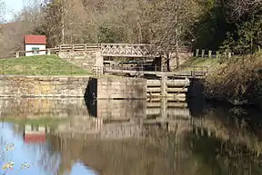 Schuylkill Navigation Canal, Oakes Reach Section |
May 6, 1988 (#88000462) |
Northern and eastern bank of the Schuylkill River from Pennsylvania Route 113 to Lock 61 40°07′57″N 75°30′10″W |
Upper Providence Township | Extends into Chester County |
| 125 | Seville Theatre | 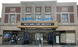 Seville Theatre |
December 28, 2005 (#05001491) |
822-826 West Lancaster Avenue 40°01′24″N 75°19′08″W |
Lower Merion Township | |
| 126 | Joseph Sinnott Mansion | 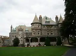 Joseph Sinnott Mansion |
August 29, 1980 (#80003582) |
Montgomery and Lendover Avenues 40°02′00″N 75°19′46″W |
Lower Merion Township | Hazelhurst & Huckel, architects; now on Rosemont College campus |
| 127 | Skippack Bridge | .jpg.webp) Skippack Bridge |
December 2, 1970 (#70000551) |
East of Evansburg on Pennsylvania Route 422 40°10′49″N 75°25′20″W |
Lower Providence Township | |
| 128 | Souderton Historic District | 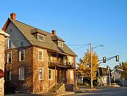 Souderton Historic District |
June 10, 2011 (#10001107) |
Roughly bounded by Railroad Avenue, East Broad Street, Noble Street, Spruce Alley, South Front Street, and Washington Avenue 40°18′42″N 75°19′31″W |
Souderton | |
| 129 | Springfield Mill |  Springfield Mill |
May 13, 1976 (#76001652) |
On Northwestern Avenue between Germantown Avenue and Bethlehem Pike in Erdenheim 40°05′27″N 75°13′51″W |
Springfield Township | |
| 130 | St. Paul's Episcopal Church |  St. Paul's Episcopal Church |
April 22, 1982 (#82003800) |
Old York and Ashbourne Roads 40°04′16″N 75°00′47″W |
Cheltenham Township | Horace Trumbauer, architect. |
| 131 | Stanley |  Stanley |
May 10, 2005 (#05000415) |
8500 Pine Road, Philadelphia 40°05′25″N 75°04′29″W |
Abington Township | Extends into Northeast Philadelphia |
| 132 | Gen. Thomas J. Stewart Memorial Armory |  Gen. Thomas J. Stewart Memorial Armory |
July 12, 1991 (#91000904) |
340 Harding Boulevard 40°07′28″N 75°20′41″W |
Norristown | |
| 133 | Walter and Gertrude May Stewart Farmstead |  Walter and Gertrude May Stewart Farmstead |
May 19, 2015 (#15000241) |
2600 Line Lexington Rd. 40°16′26″N 75°16′23″W |
Hatfield Township | |
| 134 | Stotesbury Club House |  Stotesbury Club House |
March 7, 1985 (#85000468) |
7830 Eastern Avenue 40°04′58″N 75°11′44″W |
Springfield Township | |
| 135 | Strawbridge and Clothier Store |  Strawbridge and Clothier Store |
December 22, 1988 (#88003047) |
Old York Road north of Rydal Road 40°06′06″N 75°07′32″W |
Jenkintown | |
| 136 | Sunnybrook |  Sunnybrook |
August 11, 2005 (#05000855) |
50 Sunnybrook Road 40°14′55″N 75°36′39″W |
Lower Pottsgrove Township | |
| 137 | Sunrise Mill | 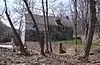 Sunrise Mill |
April 11, 1977 (#77001177) |
3 miles (4.8 km) west of Schwenksville on Neiffer Road 40°16′24″N 75°31′13″W |
Upper Frederick Township | |
| 138 | Sutch Road Bridge in Marlborough Township |  Sutch Road Bridge in Marlborough Township |
June 22, 1988 (#88000859) |
Sutch Road over Unami Creek near Milford 40°22′04″N 75°25′24″W |
Marlborough Township | |
| 139 | Swamp Creek Road Bridge | 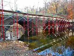 Swamp Creek Road Bridge |
June 22, 1988 (#88000860) |
Swamp Creek Road over Unami Creek near Sumneytown 40°20′03″N 75°26′59″W |
Marlborough Township | |
| 140 | M. Carey Thomas Library, Bryn Mawr College |  M. Carey Thomas Library, Bryn Mawr College |
July 17, 1991 (#91002052) |
Bounded by Morris, Yarrow, Wyndon and New Gulph Roads, Bryn Mawr College campus 40°01′36″N 75°18′52″W |
Lower Merion Township | Cope & Stewardson, architects. |
| 141 | Union Library Company |  Union Library Company |
November 20, 1980 (#80003579) |
243 South York Road 40°10′31″N 75°06′24″W |
Hatboro | |
| 142 | Union School |  Union School |
August 11, 1980 (#80003576) |
516-518 Bethlehem Pike 40°07′43″N 75°13′06″W |
Whitemarsh Township | |
| 143 | Upper Roxborough Historic District | 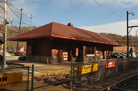 Upper Roxborough Historic District |
May 2, 2001 (#01000463) |
Roughly bounded by Shawmont Avenue, Hagy's Mill Road, and the Schuylkill River 40°03′29″N 75°15′06″W |
Springfield and Whitemarsh Townships | Extends into Northwest Philadelphia |
| 144 | Valley Forge National Historical Park | 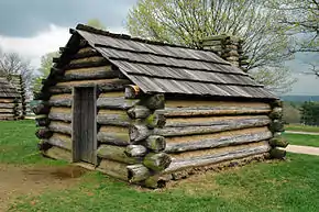 Valley Forge National Historical Park |
October 15, 1966 (#66000657) |
Valley Forge State Park 40°05′48″N 75°26′55″W |
Lower Providence and Upper Merion Townships | Extends into Chester County |
| 145 | Wall House | 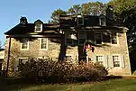 Wall House |
June 28, 1979 (#79002302) |
Wall Park Drive 40°04′42″N 75°07′44″W |
Cheltenham Township | |
| 146 | Washington Hose and Steam Fire Engine Company, No. 1 | 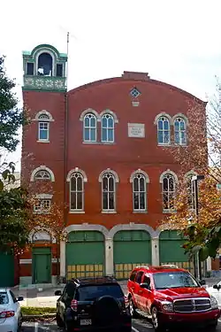 Washington Hose and Steam Fire Engine Company, No. 1 |
November 20, 1975 (#75001655) |
15 West Hector Street 40°04′24″N 75°18′28″W |
Conshohocken | |
| 147 | Washington's Headquarters | 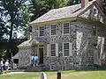 Washington's Headquarters |
February 11, 1973 (#73001655) |
Valley Creek Road near junction of Pennsylvania Routes 23 and 252 40°06′05″N 75°27′43″W |
Upper Merion Township | |
| 148 | Washington Memorial Chapel | 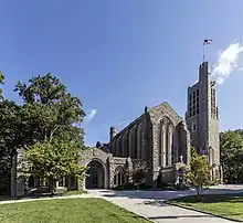 Washington Memorial Chapel |
May 1, 2017 (#100000943) |
N. side of Pennsylvania Route 23, approx. 1.25 mi. W. of the jct. with County Line Rd. 40°06′16″N 75°26′17″W |
Upper Merion Township | |
| 149 | General Wayne Inn | 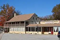 General Wayne Inn |
January 1, 1976 (#76001655) |
625 Montgomery Avenue 40°00′33″N 75°15′13″W |
Lower Merion Township | |
| 150 | John Welsh House |  John Welsh House |
September 5, 1990 (#90001415) |
8765 Stenton Avenue 40°05′02″N 75°12′19″W |
Springfield Township | |
| 151 | Peter Wentz Homestead |  Peter Wentz Homestead |
May 8, 1973 (#73001656) |
Schultz Road 40°11′56″N 75°20′02″W |
Worcester Township | |
| 152 | West Laurel Hill Cemetery | 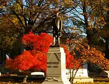 West Laurel Hill Cemetery |
August 14, 1992 (#92000991) |
227 Belmont Avenue, Bala Cynwyd 40°00′53″N 75°13′23″W |
Lower Merion Township | |
| 153 | West Norristown Historic District |  West Norristown Historic District |
November 23, 1984 (#84000323) |
Roughly bounded by Stoney Creek, Selma and Elm Streets 40°07′18″N 75°21′09″W |
Norristown | |
| 154 | Whitehall Apartments | 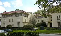 Whitehall Apartments |
December 28, 1983 (#83004238) |
410 West Lancaster Avenue 40°00′48″N 75°18′10″W |
Lower Merion Township | |
| 155 | Whitpain Public School |  Whitpain Public School |
December 20, 2006 (#06001150) |
799 Skippack Pike 40°08′23″N 75°16′30″W |
Whitpain Township | |
| 156 | Woodmont | 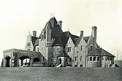 Woodmont |
August 5, 1998 (#98001192) |
1622 Spring Mill Road 40°04′03″N 75°17′39″W |
Lower Merion Township | Will Price, architect. |
| 157 | Wyncote Historic District |  Wyncote Historic District |
October 16, 1986 (#86002884) |
Roughly bounded by Glenview Avenue, SEPTA railroad line, Webster Avenue, and Church Road 40°05′23″N 75°08′33″W |
Cheltenham Township | |
| 158 | Yeakle and Miller Houses |  Yeakle and Miller Houses |
January 22, 1992 (#91002009) |
500 and 502 Bethlehem Pike and 9 Hillcrest Avenue, Erdenheim 40°05′19″N 75°12′49″W |
Springfield Township |
Former listings
| [2] | Name on the Register | Image | Date listed | Date removed | Location | City or town | Summary |
|---|---|---|---|---|---|---|---|
| 1 | Anselm Hall | Unknown (#74002330) | 1974 | 915 Spring Ave. |
Ronaele Manor. Demolished in 1974. | ||
| 2 | Valentine Nungesser House | Unknown (#74002332) | 1974 | Skippack Rd. |
Woxall | ||
| 3 | Upper House, Episcopal Academy | 1974 (#74002335) | 1974 | City Line Ave. and Berwick Rd. |
Merion | Also known as Yorklynne. Demolished in 1974.[5] |
See also
| Wikimedia Commons has media related to National Register of Historic Places in Montgomery County, Pennsylvania. |
References
- "National Register of Historic Places: Weekly List Actions". National Park Service, United States Department of the Interior. Retrieved on January 29, 2021.
- Numbers represent an alphabetical ordering by significant words. Various colorings, defined here, differentiate National Historic Landmarks and historic districts from other NRHP buildings, structures, sites or objects.
- The eight-digit number below each date is the number assigned to each location in the National Register Information System database, which can be viewed by clicking the number.
- General Orders, 23 September 1777 from the National Archives.
| Topics | 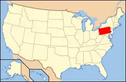 | |
|---|---|---|
| Lists by county |
| |
| Lists by city | ||
| Other lists | ||
| ||
This article is issued from Wikipedia. The text is licensed under Creative Commons - Attribution - Sharealike. Additional terms may apply for the media files.