National Register of Historic Places listings in Lebanon County, Pennsylvania
This is a list of the National Register of Historic Places listings in Lebanon County, Pennsylvania.
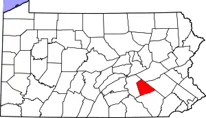
Location of Lebanon County in Pennsylvania
This is intended to be a complete list of the properties and districts on the National Register of Historic Places in Lebanon County, Pennsylvania, United States. The locations of National Register properties and districts for which the latitude and longitude coordinates are included below, may be seen in a map.[1]
There are 31 properties and districts listed on the National Register in the county. Four sites are further designated as National Historic Landmarks.
- This National Park Service list is complete through NPS recent listings posted January 29, 2021.[2]
Current listings
| [3] | Name on the Register | Image | Date listed[4] | Location | Municipality | Description |
|---|---|---|---|---|---|---|
| 1 | Alden Villa | 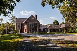 Alden Villa |
April 20, 2011 (#11000203) |
1012 Alden Way 40°16′25″N 76°25′48″W |
Cornwall | |
| 2 | Annville Historic District | 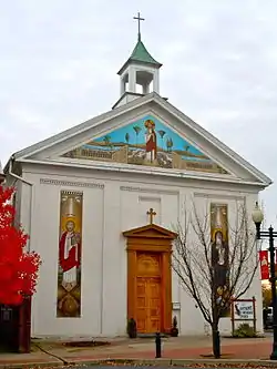 Annville Historic District |
April 30, 1979 (#79002285) |
Roughly bounded by the Quittapahilla Creek and Lebanon, Saylor, and Marshall Streets in Annville 40°19′42″N 76°30′58″W |
Annville Township | |
| 3 | Biever House | 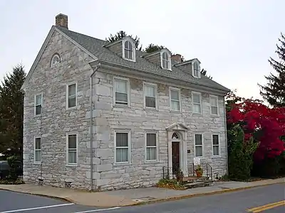 Biever House |
February 14, 1978 (#78002423) |
49 South White Oak Street in Annville 40°19′41″N 76°30′56″W |
Annville Township | |
| 4 | Bindnagles Evangelical Lutheran Church | 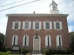 Bindnagles Evangelical Lutheran Church |
July 7, 1975 (#75001651) |
North of Palmyra at the junction of Legislative Route 38003 and Township 330 40°20′38″N 76°37′01″W |
North Londonderry Township | |
| 5 | Bomberger's Distillery | 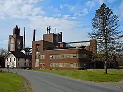 Bomberger's Distillery |
June 26, 1975 (#75001649) |
7 miles (11 km) southwest of Newmanstown off Pennsylvania Route 501 40°16′37″N 76°19′13″W |
Heidelberg Township | |
| 6 | Brendle Farms |  Brendle Farms |
July 24, 1972 (#72001130) |
Junction of Pennsylvania Routes 501 and 897 40°17′45″N 76°18′12″W |
Schaefferstown | |
| 7 | Chestnut Street Log House | 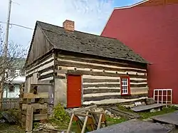 Chestnut Street Log House |
November 20, 1978 (#78002424) |
1110 Chestnut Street 40°20′15″N 76°25′46″W |
Lebanon | |
| 8 | Colebrook Iron Master's House | 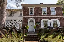 Colebrook Iron Master's House |
June 28, 2010 (#10000405) |
5200 Elizabethtown Rd. 40°14′21″N 76°30′46″W |
South Londonderry Township | |
| 9 | Cornwall & Lebanon Railroad Station | 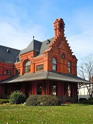 Cornwall & Lebanon Railroad Station |
December 4, 1974 (#74001790) |
161 North 8th Street 40°20′32″N 76°25′32″W |
Lebanon | |
| 10 | Cornwall Iron Furnace | 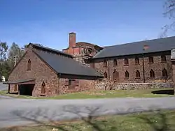 Cornwall Iron Furnace |
November 13, 1966 (#66000671) |
Rexmont Road and Boyd Street 40°16′07″N 76°24′27″W |
Cornwall | |
| 11 | Philip Erpff House | 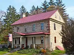 Philip Erpff House |
November 20, 1979 (#79002287) |
South Market Street 40°17′47″N 76°17′37″W |
Schaefferstown | |
| 12 | Josiah Funck Mansion | 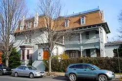 Josiah Funck Mansion |
January 31, 1980 (#80003545) |
450 Cumberland Street 40°20′22″N 76°25′10″W |
Lebanon | |
| 13 | Gloninger Estate | 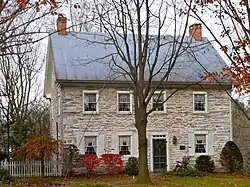 Gloninger Estate |
December 10, 1980 (#80003546) |
2511 West Oak Street, southwest of Lebanon 40°19′25″N 76°27′12″W |
North Cornwall Township | |
| 14 | House of Miller at Millbach |  House of Miller at Millbach |
April 23, 1973 (#73001640) |
Southwest of Newmanstown off Pennsylvania Route 419 40°19′49″N 76°14′19″W |
Millcreek Township | |
| 15 | John Immel House | April 17, 1980 (#80003548) |
East of Myerstown on Flanagan Road 40°22′08″N 76°16′21″W |
Jackson Township | ||
| 16 | Landis Shoe Company Building | 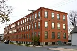 Landis Shoe Company Building |
August 29, 1980 (#80003550) |
North Chestnut and East Broad Streets 40°18′37″N 76°35′50″W |
Palmyra | |
| 17 | Lebanon Veterans Administration Hospital Historic District | 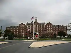 Lebanon Veterans Administration Hospital Historic District |
July 23, 2013 (#13000539) |
1700 South Lincoln Avenue 40°19′04″N 76°23′52″W |
South Lebanon Township | |
| 18 | Isaac Meier Homestead | 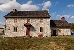 Isaac Meier Homestead |
April 2, 1973 (#73001639) |
5200 South College Street 40°22′09″N 76°18′19″W |
Myerstown | |
| 19 | Pennsylvania Chautauqua Historic District | 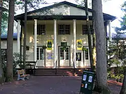 Pennsylvania Chautauqua Historic District |
August 18, 2015 (#15000535) |
Roughly bounded by State Game Lands, Pennsylvania Route 117, Pinch Rd., and Lancaster and Pennsylvania Aves. 40°14′50″N 76°28′18″W |
Mount Gretna | |
| 20 | Mt. Gretna Campmeeting Historic District |  Mt. Gretna Campmeeting Historic District |
September 4, 2012 (#12000608) |
Roughly bounded by PA 117, Pinch Rd., Bell Ave., & 1st St. (West Cornwall Township) 40°14′56″N 76°28′05″W |
Mount Gretna Heights | |
| 21 | Reading Railroad Station |  Reading Railroad Station |
July 17, 1975 (#75001647) |
North 8th Street 40°20′35″N 76°25′29″W |
Lebanon | |
| 22 | Rex House | 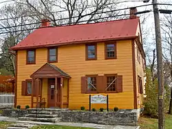 Rex House |
August 11, 1980 (#80003551) |
North Market Street 40°17′53″N 76°17′36″W |
Schaefferstown | |
| 23 | St. Lukes Episcopal Church | 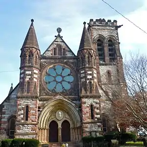 St. Lukes Episcopal Church |
September 4, 1974 (#74001791) |
6th and Chestnut Streets 40°20′17″N 76°25′16″W |
Lebanon | |
| 24 | Salem Evangelical Lutheran Church | 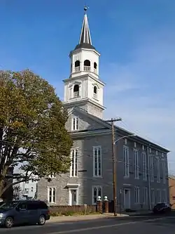 Salem Evangelical Lutheran Church |
June 28, 2010 (#10000402) |
119 N Eighth St. 40°20′28″N 76°25′31″W |
Lebanon | |
| 25 | Schaeffer House | 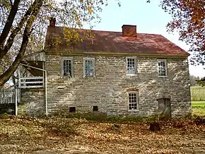 Schaeffer House |
July 25, 2011 (#11000630) |
213 S. Carpenter St. 40°17′47″N 76°18′01″W |
Schaefferstown | |
| 26 | Dr. B. Stauffer House | 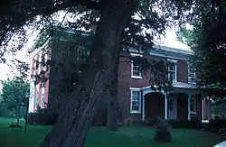 Dr. B. Stauffer House |
June 22, 1979 (#79002286) |
192 West Main Street in Campbelltown 40°16′37″N 76°35′28″W |
South Londonderry Township | |
| 27 | Tabor Reformed Church |  Tabor Reformed Church |
June 27, 1980 (#80003547) |
10th and Walnut Streets 40°20′13″N 76°25′39″W |
Lebanon | |
| 28 | Tulpehocken Manor Plantation |  Tulpehocken Manor Plantation |
May 12, 1975 (#75001648) |
2 miles (3.2 km) west of Myerstown on U.S. Route 422 40°21′48″N 76°20′25″W |
Jackson Township | |
| 29 | Union Canal Tunnel | 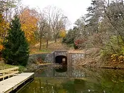 Union Canal Tunnel |
October 1, 1974 (#74001792) |
West of Lebanon off Pennsylvania Route 72 40°20′58″N 76°27′42″W |
North Lebanon Township | |
| 30 | Waterville Bridge | 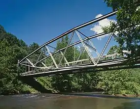 Waterville Bridge |
November 14, 1988 (#88002171) |
Appalachian Trail over Swatara Creek in Swatara State Park 40°28′49″N 76°31′55″W |
Union Township | |
| 31 | Heinrich Zeller House | 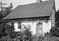 Heinrich Zeller House |
May 12, 1975 (#75001650) |
West of Newmanstown off Pennsylvania Route 419 40°20′57″N 76°13′33″W |
Millcreek Township |
See also
| Wikimedia Commons has media related to National Register of Historic Places in Lebanon County, Pennsylvania. |
References
- The latitude and longitude information provided in this table was derived originally from the National Register Information System, which has been found to be fairly accurate for about 99% of listings. Some locations in this table may have been corrected to current GPS standards.
- "National Register of Historic Places: Weekly List Actions". National Park Service, United States Department of the Interior. Retrieved on January 29, 2021.
- Numbers represent an alphabetical ordering by significant words. Various colorings, defined here, differentiate National Historic Landmarks and historic districts from other NRHP buildings, structures, sites or objects.
- The eight-digit number below each date is the number assigned to each location in the National Register Information System database, which can be viewed by clicking the number.
| Topics | 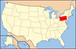 | |
|---|---|---|
| Lists by county |
| |
| Lists by city | ||
| Other lists | ||
| ||
Municipalities and communities of Lebanon County, Pennsylvania, United States | ||
|---|---|---|
| City | | |
| Boroughs | ||
| Townships | ||
| CDPs | ||
| Unincorporated communities | ||
| ||
This article is issued from Wikipedia. The text is licensed under Creative Commons - Attribution - Sharealike. Additional terms may apply for the media files.