Interstate 20 in Georgia
In the U.S. state of Georgia, Interstate 20 (I-20) travels from the Alabama state line to the Savannah River, which is the South Carolina state line. The highway enters the state near Tallapoosa. It travels through the Atlanta metropolitan area and exits the state in Augusta. The highway also travels through the cities of Bremen, Douglasville, Conyers, Covington, and Madison. I-20 has the unsigned state highway designation of State Route 402 (SR 402).
| |||||||
|---|---|---|---|---|---|---|---|

I-20 highlighted in red | |||||||
| Route information | |||||||
| Maintained by GDOT | |||||||
| Length | 202.61 mi[1][2] (326.07 km) | ||||||
| Existed | 1963[3]–present | ||||||
| Major junctions | |||||||
| West end | |||||||
| East end | |||||||
| Location | |||||||
| Counties | Haralson, Carroll, Douglas, Cobb, Fulton, DeKalb, Rockdale, Newton, Walton, Morgan, Greene, Taliaferro, Warren, McDuffie, Columbia, Richmond | ||||||
| Highway system | |||||||
| |||||||

Route description
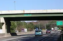
I-20 is the main east-west interstate in Georgia. It is four lanes wide in much of the state. In the Atlanta metropolitan area, the highway ranges from six lanes wide in the most outlying counties to 10 lanes wide in downtown Atlanta. As with all Interstate Highways, all of I-20 in Georgia is included as part of the National Highway System, a system of routes determined to be the most important for the nation's economy, mobility, and defense.[4][5][6]
Haralson County
I-20 enters Georgia from Alabama south-southwest of Tallapoosa. The state line is the Central–Eastern time zone boundary. It travels to the east-northeast and crosses over Williams Creek. It passes the Georgia Visitor Information Center. The highway crosses over Walton Creek just before briefly entering the city limits of Tallapoosa. Immediately after it leaves the city limits, it has an interchange with SR 100. Within the interchange, I-20 enters the city limits of Tallapoosa twice more. After crossing over Blalock Creek, it curves to the east. After it curves back to the east-northeast, it crosses over Walker Creek twice. It curves to the east-southeast and travels along the southern edge of Waco, where it has an interchange with Waco Road. The interstate then enters Bremen. Almost immediately, it then enters Carroll County.
Carroll County
I-20 curves to the east and has an interchange with US 27/SR 1. It leaves Bremen and travels southeast of the city. It curves back to the east-northeast and crosses over Buck Creek. Right after the creek, the westbound lanes have a weigh station. The highway travels south of Spence Lake. It curves to the northeast and crosses over Allen Creek. It enters the city limits of Temple and crosses over Bethel Creek. After a crossing of Webster Creek, the highway curves to the east-northeast and has an interchange with SR 113 (Carrollton Street). It curves to the east-southeast and leaves Temple. It crosses the Little Tallapoosa River and then curves back to the east-northeast. It curves to the east and enters Villa Rica. It travels just south of Villa Rica High School. Immediately, it has an interchange with SR 61/SR 101. It curves to the east-northeast and passes the Glanton–Hindsman Elementary School. It then enters Douglas County.
Douglas and Cobb counties
After I-20 starts curving to the east-southeast, it has an interchange with Liberty Road. It leaves the city limits of Villa Rica and curves to the east. It crosses over Keaton Creek. It curves back to the east-southeast and has an interchange with Post Road southwest of Winston. It curves to the east-northeast and crosses over Mobley Creek. It enters Douglasville. It has an interchange with SR 5 (Bill Arp Road). It then passes the Arbor Place Mall on its northern side. It crosses over Anneewakee Creek and then has an interchange with Chapel Hill Road. The highway curves to the northeast and passes the WellStar Douglas Hospital on its eastern side. After crossing over Slater Mill Creek, it has an interchange with SR 92 (Fairburn Road). Within the interchange, I-20 crosses over Little Anneewakee Creek. It then travels along the Lithia Springs–Douglasville city line before briefly re-entering Douglasville proper. It then very briefly travels along the Lithia Springs–Dawsonville city line. There, it has an interchange with Lee Road and crosses over Beaver Creek. Immediately after the interchange begins, the interstate enters Lithia Springs proper. It briefly leaves the city limits of Lithia Springs and crosses over Sweetwater Creek on the Blair Bridge. Upon re-entering the city, it curves to the east-southeast and has an interchange with SR 6 (Thornton Road). Right after leaving the interchange, it leaves Lithia Springs again and enters Cobb County. I-20 then has an interchange with both the northern terminus of Riverside Parkway and the eastern terminus of Six Flags Drive. Almost immediately is a partial interchange with Six Flags Parkway. This interchange is only accessible from the westbound lanes. At this interchange, the highway begins to travel along the southern edge of Mableton. It then crosses over the Chattahoochee River on the Debra Mills Commemorative Bridge. This marks the eastern end of Mableton, as well as the Fulton County line.
Fulton County
I-20 then has an interchange with SR 70 (Fulton Industrial Boulevard). It curves to the east-northeast and finally enters Atlanta proper, on the Adamsville–Old Gordon neighborhood line in the western part of the city. At a bridge over SR 139, the highway begins traveling along the Adamsville–Fairburn Heights neighborhood line. After passing Collier Heights Park, it curves to the southeast and has an interchange with I-285 (Atlanta Bypass). This interchange is just south of the Basoline E. Usher Elementary School and on the southwestern edge of Harwell Heights Park. Right after the I-285 interchange, the highway briefly travels on the Westhaven–Collier Heights neighborhood line. It crosses over Sandy Creek and then has an interchange with SR 280 (Holmes Drive). At this interchange, it begins to briefly travel on the Westhaven–Dixie Hills neighborhood line. Just southeast of this interchange, it travels along the Florida Heights–Dixie Hills neighborhood line. At a crossing of Fairfield Place NW, I-20 begins to parallel SR 139. Just north of Westview Cemetery, it travels along the southern edge of the Penelope Neighbors neighborhood. The highway curves to the east-northeast and has an interchange with Martin Luther King Jr. Drive. It immediately curves back to the southeast and begins to travel along the southern edge of the Mozley Park neighborhood. Upon traveling under a bridge that carries Westview Drive SW, it begins traveling along the Westview–Mozley Park neighborhood line. Upon reaching a partial interchange with Langhorn Street SW, which is only accessible from the westbound lanes, it enters the West End neighborhood. Upon crossing over Lawton Street SW, it begins to briefly travel on the West End–Harris Chiles neighborhood line. The interstate curves to the east-southeast and has an interchange with Lowery Boulevard. It passes The Mall West End at a partial interchange with Lee Street, which is only accessible from the westbound lanes. At this interchange, I-20 begins to very briefly travel along the West End–Atlanta University Center neighborhood line. Upon crossing over US 29/SR 14/SR 154, it briefly travels through the Adair Park neighborhood. Upon crossing over US 19/US 41/SR 3, the highway slips through the northern part of the Pittsburgh neighborhood. It curves to the northeast and – almost immediately – enters the Mechanicsville neighborhood. It has an interchange with McDaniel Street SW that leads to US 19/US 29. At this interchange, it begins to travel along the Mechanicsville–Castleberry Hill neighborhood line. At an interchange with Windsor and Spring streets, it begins traveling along the Mechanicsville–Downtown line. I-20 then has an interchange with I-75/I-85 (Downtown Connector). On the east side of this interchange, it begins to travel along the Summerhill–Capitol Gateway neighborhood line. It briefly travels on the Grant Park–Capitol Gateway neighborhood line before entering Grant Park proper. It has a partial interchange with Capitol Avenue, which is only accessible from the westbound lanes. Right after that is a partial interchange with Hill Street, which is also only accessible from the westbound lanes. It then has an interchange with Boulevard. It very briefly travels along the Grant Park–Reynoldstown neighborhood line. Then, it travels along the Glenwood Park–Reynoldstown neighborhood line. There, it has a partial interchange that leads to Memorial Drive and Glenwood Avenue. This interchange feeds into Bill Kennedy Way SE. Then, it briefly travels along the North Ormewood Park–Reynoldstown neighborhood line. It has an interchange with US 23/SR 42 (Moreland Avenue). At this interchange, the highway enters DeKalb County.
DeKalb County
I-20 enters the eastern part of the city of Atlanta. It begins to travel on the East Atlanta–Edgewood neighborhood line. Just before a partial interchange with Maynard Terrace, which is only accessible from the eastbound lanes, the highway begins to travel along the East Atlanta–Kirkwood neighborhood line and begins to parallel Sugar Creek. It curves to the southeast and has an interchange with SR 260 (Glenwood Avenue). At this interchange, the highway temporarily leaves the city limits of Atlanta. It curves to the south-southwest, veering away from Sugar Creek. It briefly re-enters the East Atlanta neighborhood of Atlanta. Here, it has a partial interchange with Flat Shoals Road, which is only accessible from the eastbound lanes, travels under a bridge carrying Fayetteville Road, and begins to curve back to the southeast. It then travels along the northern edge of Gresham Park. It crosses over Sugar Creek and has an interchange with Gresham Road and Flat Shoals Road. Within this interchange, it curves to a due east direction. On the east side of the interchange, it begins to travel along the Panthersville–Candler-McAfee line. It passes McNair Middle School to the south and then curves to the east-northeast. It has an interchange with SR 155 (Candler Road). It travels just to the south of Misty Waters Park. It begins to curve to the east-southeast and has a partial interchange with Columbia Drive, which is only accessible from the eastbound lanes. Almost immediately is a second interchange with I-285 (Atlanta Bypass). At the east end of the interchange is a side access road, which leads to an interchange with Wesley Chapel and Snapfinger roads, and a crossing of Cobbs Creek and Fowler Branch. The interstate crosses over Wesley Chapel Road and curves to the southeast. It crosses over Snapfinger Creek and begins to curve to the east-northeast. At the curve, it travels just to the south of Walden Lake. It crosses over Panthers Branch and then has an interchange with Panola Road. It then passes DeKalb Medical – Hillandale on its south side. It then passes Hillandale Memorial Gardens just before an interchange with Evans Mill Road and Lithonia Industrial Boulevard. Within this interchange, the highway curves to the east-southeast and crosses over Pole Bridge Creek. It then crosses over Honey Creek just before passing the Mall at Stonecrest just to its north. Just to the northeast of the mall, I-20 has an interchange with US 278/SR 12 and the western terminus of SR 124. At this interchange, SR 124 ends, and US 278/SR 12 begins a concurrency with I-20. The three highways curve to the southeast and enter Rockdale County.
Rockdale and Newton counties
I-20/US 278/SR 12 has an interchange with Sigman Road. The three highways cross over Almand Creek and then enter the city limits of Conyers. They have an interchange with West Avenue. Within this interchange, they cross over Tanyard Branch. They pass the Rockdale Tennis Center just to its north and then have an interchange with SR 20/SR 138. They cross over Snapping Shoals Creek and then have an interchange with SR 162 (Salem Road). At this interchange, they leave the city limits of Conyers. After curving to the east-southeast, they enter Newton County. I-20/US 278/SR 12 curves back to the southeast. Just after beginning to curve back to the east-southeast, the three highways meet Almon Road on the southeastern edge of Almon. They cross over the Yellow River and then curve to the southeast. They pass Lawnwood Memorial Park to its north and then enter the city limits of Covington. At the first interchange in the city, US 278/SR 12 leaves I-20, and the interstate begins to curve to the northeast. It travels on a bridge over Old Atlanta Highway and some railroad tracks of CSX. After traveling under a bridge that carries SR 81, it very briefly cuts across the extreme southeastern corner of Oxford and then re-enters Covington. It crosses over Dried Indian Creek and curves to a nearly due east direction. It has an interchange with Alcovy Road. Just after this interchange, it temporarily leaves the city limits of Covington again and curves to the east-southeast. After an interchange with SR 142 (Hazelbrand Road), it re-enters Covington. It crosses over the Alcovy River before leaving Covington for its third and final time. The highway curves to the east-northeast and then has an interchange with SR 11. It curves to the east-southeast and crosses over Nelson Creek. Right after crossing over the Little River, it has another interchange with US 278/SR 12. At this interchange, it enters Walton County.
Walton and Morgan counties
I-20 immediately begins traveling along the southern edge of Social Circle. The highway has a crossing of Dennis Creek and then leaves Social Circle and enters Morgan County. I-20's eastbound lanes have a rest area. Then, the highway crosses over Hunnicut Creek. It curves to the southeast and has an interchange with Newborn Road. After the westbound lanes have a rest area, the highway curves to the east-northeast. It crosses over Big Indian Creek and then curves to the southeast. It enters the city limits of Madison. The highway crosses over Little Indian Creek just before an interchange with SR 83 (Monticello Road). It travels on a bridge over Fourmile Branch and some railroad tracks of Norfolk Southern Railway. It curves to a nearly due east direction and has an interchange with US 129/US 441/SR 24 (Eatonton Road). I-20 leaves the city limits of Madison and crosses over the South Sugar Creek. After a crossing of North Sugar Creek It curves to a southeasterly direction and has an interchange with Seven Island Road It travels just south of the Chattahoochee-Oconee National Forest and curves to the east-northeast. A crossing of Lake Oconee marks the Greene County line.
Greene County
I-20 crosses over Richland Creek and then has an interchange with SR 44. It briefly travels through the southwestern part of Greensboro. Just after traveling under a bridge that carries Veazey Road, the highway travels along the southeastern edge of Greensboro. The highway crosses over Beaverdam Creek and curves to the east-southeast. It has crossings of Oliver Creek, Bowden Creek, and SR 15, before entering Siloam. There, it has an interchange with SR 77, which drivers can take to get to SR 15. The highway curves to the northeast and leaves the city limits of Siloam. It curves back to the east-southeast and crosses over the South Fork Ogeechee River. It then enters Taliaferro County.
Taliaferro and Warren counties
This is where the Augusta metro area starts. I-20 begins to parallel Beaverdam Creek. It curves to the east-northeast and crosses over the creek. It curves to the east-southeast and crosses over the North Fork Ogeechee River before an interchange with SR 22. It crosses over Mile Branch. The highway curves to the southeast and then enters Warren County. Almost immediately, I-20 crosses over Red Lick Creek. It curves to the east-northeast and has another interchange with US 278/SR 12 (Atlanta Highway). It begins to parallel Williams Creek before crossing over it. It begins to curve to the southeast before it has an interchange with Cadley Road. After crossing over Hart Creek, the highway curves to the east-northeast. It crosses over Middle Creek and then crosses over some railroad tracks of CSX before an interchange with SR 80 (Washington Highway). It crosses over Childers Creek just before entering McDuffie County.
McDuffie County
After an interchange with Three Points Road, that directs drivers to Thomson, I-20 crosses over Mattox Creek. It then has an interchange with US 78/SR 10/SR 17 (Washington Road). At the east end of this interchange, it travels under a bridge that carries SR 17 Bypass (Thomson Bypass). It crosses over Little Germany Creek before curving to the east-southeast. It crosses over Germany Creek on the southern edge of Upper Folly Lake. Almost immediately is an interchange with SR 150 (Cobbham Road). It crosses over Greenbrier Creek just before entering Columbia County.
Columbia County
I-20 crosses over Kiokee Creek before the eastbound lanes have a rest area. Right after crossing over Hawes Branch, the westbound lanes have a rest area. The highway then has an interchange with US 221/SR 47 (Appling–Harlem Road). It then crosses over Little Kiokee Creek. First, the eastbound lanes and then, the westbound lanes have a weigh station just to the south of Baker Place Elementary School, Columbia Middle School, and Grovetown High School. It crosses over Euchee Creek and Mill Branch before an interchange with SR 388 (Horizon South Parkway/Lewiston Road). This interchange is the main access point for Grovetown. Almost immediately, it crosses over Tudor Branch. After crossing over Walton Branch, the interstate begins to travel along the southern edge of Evans. It curves to the east-northeast and crosses over Crawford Creek. It then has an interchange with SR 383 (South Belair Road). Here, it leaves Evans and begins to travel along the southern edge of Martinez. It has an interchange with Wheeler Road. Within this interchange, it leaves Martinez and enters Richmond County.
Richmond County
Immediately, I-20 enters the city limits of Augusta. It travels just to the north of Doctors Hospital just before an interchange with the eastern terminus of SR 232 and the western terminus of I-520 (both parts of Bobby Jones Expressway). The westbound interchange has access for Walton Way Extension. After crossing over Cranes Creek, it travels south of Warren Road Elementary School. It curves to the northeast and has an interchange with SR 28 (Washington Road). The highway travels to the east of Westside High School. It crosses over some railroad tracks of CSX before an interchange with SR 104 (Riverwatch Parkway). The westbound lanes meet the Georgia Visitor Information Center. It crosses over the Augusta Canal and then the Savannah River. Here, the hidden SR 402 designation reaches its eastern terminus, while I-20 enters South Carolina.
Named sections
Several stretches of I-20 are named for various people and reasons:
- From the Alabama state line to I-285 on the west side of Atlanta, I-20 is named the Tom Murphy Freeway, after the former speaker of the Georgia House of Representatives.[7][8]
- Between both the west and east sides of I-285, I-20 was named the Ralph David Abernathy Freeway in 1991 after the late civil rights activist.[9]
- From I-285 in Dekalb County to US 129/US 441/SR 24 in the southern part of Madison, I-20 is named the Purple Heart Highway for military veterans who either died or were injured in combat while in service on or after April 15, 1917.[10]
- From US 129/US 441/SR 24 to the South Carolina state line, I-20 is named the Carl Sanders Highway after the former Georgia governor who was born in Augusta.[11]
History
I-20's path through Atlanta was designed in the late 1950s, during the era of segregation, to separate the city's white and African-American populations.[12] The first segment opened between 1960 and 1963 from downtown Atlanta to Conyers.[13][3] It was under construction from just south of Douglasville to downtown Atlanta, from Conyers to a point south of Social Circle, and from Evans to Augusta.[3] By 1966, the highway was proposed from the Alabama state line to SR 5 in Douglasville, was open from Douglasville to the western part of Atlanta, under construction in the western part of Atlanta, was open from downtown Atlanta to US 278/SR 12 near Social Circle, was under construction from that point to SR 83 in Madison; proposed from Madison to the Warren–McDuffie county line, under construction from there to the South Carolina state line.[3][14] Later that year, I-20 was open from Douglasville to the Social Circle area and from SR 383 on the Evans–Martinez city line to the South Carolina state line.[14][15] In 1967, it was under construction from the Social Circle area to Siloam. It was open from US 221/SR 47 south of Appling to the South Carolina state line.[15][16] In 1968, it was open from Douglasville to Madison and from just north of Thomson to the South Carolina state line.[16][17] In 1969, the highway was open from Douglasville to US 129/US 441/SR 24 in Madison.[17][18] In 1970, it was under construction from Madison to the Thomson area.[18][19] In 1971, I-20 was open from Douglasville to SR 44 in Greensboro.[19][20] In 1972, the highway was open from Douglasville to the South Carolina state line.[20][21] In 1973, it was under construction from US 27/SR 1 in Bremen to Douglasville.[21][22] In 1974, it was under construction from the Alabama state line to Douglasville.[22][23] In 1975, it was open from Villa Rica to Douglasville.[23][24] The last part of Interstate 20 opened in 1977 between the Alabama state line and Villa Rica.[25][26]
Until 2000, the state of Georgia used the sequential interchange numbering system on all of its Interstate Highways. The first exit on each highway would begin with the number "1" and increase numerically with each exit. In 2000, the Georgia Department of Transportation switched to a mileage-based exit system, in which the exit number corresponded to the nearest milepost.[27][28][29]
From a period of late 2014 to mid-2015, I-20 was widened from the Alabama state line eastward to Villa Rica, GA. Most of that length had the roadway widened from four to six lanes, with ultimate plans to widen to at least six lanes from Birmingham, Alabama to Atlanta. Phase 1, which detailed resurfacing the roadway for future expansion preparation, has been completed as of January 2017. Phase 2 is being prepared to add the additional lanes.
On April 17, 2017, an abandoned gas pipeline exploded under Interstate 20.[30]
Exit list
| County | Location | mi | km | Old exit | New exit | Destinations | Notes | |
|---|---|---|---|---|---|---|---|---|
| Haralson | | 0.00 | 0.00 | Continuation into Alabama | ||||
| | 1.32 | 2.12 | Georgia Visitor Information Center; accessible from eastbound lanes only | |||||
| Tallapoosa | 4.67 | 7.52 | 1 | 5 | ||||
| | 8.95 | 14.40 | 2 | 9 | Waco Road – West Georgia Technical College | |||
| Carroll | | 11.11 | 17.88 | 3 | 11 | |||
| | 14.99 | 24.12 | Weigh station; accessible from westbound lanes only | |||||
| Temple | 18.70 | 30.09 | 4 | 19 | ||||
| Villa Rica | 23.81 | 38.32 | 5 | 24 | Southern terminus of SR 101; former US 78S and US 78 Alt. | |||
| Douglas | | 26.05 | 41.92 | 6 | 26 | Liberty Road – Villa Rica | Signed as SR 8 Conn. on the exit ramp, but not on I-20 | |
| | 30.00 | 48.28 | 7 | 30 | Post Road | |||
| Douglasville | 34.15 | 54.96 | 8 | 34 | ||||
| 35.62 | 57.32 | 9 | 36 | Chapel Hill Road | ||||
| 37.39 | 60.17 | 10 | 37 | |||||
| Douglasville–Lithia Springs line | 41.26 | 66.40 | 11 | 41 | Lee Road – Lithia Springs | |||
| | 43.47 | 69.96 | Blair Bridge over Sweetwater Creek | |||||
| Lithia Springs | 44.00 | 70.81 | 12 | 44 | ||||
| Cobb | | 46.60 | 75.00 | 13 | 46 | Riverside Parkway south/Six Flags Drive west – Six Flags Park | Signed as exits 46A (Riverside Parkway) and 46B (Six Flags Drive) westbound; northern terminus of Riverside Parkway; eastern terminus of Six Flags Drive | |
| Mableton | 47.10 | 75.80 | 13C | 47 | Six Flags Parkway – Six Flags Park | Westbound exit and eastbound entrance | ||
| Chattahoochee River | 47.84 | 76.99 | Debra Mills Commemorative Bridge | |||||
| Fulton | | 48.57 | 78.17 | 14 | 49 | |||
| Atlanta | 50.57 | 81.38 | 15 | 51 | I-285 exits 10A-B; signed as exits 51A (south) and 51B (north) | |||
| 52.07 | 83.80 | 16 | 52 | Signed as exits 52A (south) and 52B (north) westbound | ||||
| 53.63 | 86.31 | 17 | 53 | |||||
| 54.52 | 87.74 | 18 | 54 | Langhorn Street to Cascade Road | Westbound exit and eastbound entrance | |||
| 55.34 | 89.06 | 19 | 55A | Lowery Boulevard – West End | ||||
| 55.55 | 89.40 | 20 | 55B | Lee Street – Atlanta University Center, Fort McPherson | Westbound exit and eastbound entrance | |||
| 56.19 | 90.43 | 21 | 56A | Eastbound exit and westbound entrance | ||||
| 56.54 | 90.99 | 22 | 56B | Windsor Street / Spring Street – Turner Field | ||||
| 57.01 | 91.75 | 23 | 57 | I-75/I-85 exit 247 | ||||
| 57.15 | 91.97 | 24 | 58A | Capitol Avenue – Downtown | Westbound exit and eastbound entrance | |||
| 57.65 | 92.78 | 25 | 58B | Hill Street – Georgia State Stadium | Westbound exit and eastbound entrance | |||
| 58.29 | 93.81 | 26 | 59A | Boulevard – Zoo Atlanta, Cyclorama | ||||
| 58.86 | 94.73 | 27 | 59B | To Memorial Drive / Glenwood Avenue | Eastbound exit and westbound entrance | |||
| Fulton–DeKalb county line | 59.39 | 95.58 | 28 | 60 | Signed as exits 60A (south) and 60B (north) eastbound | |||
| DeKalb | 60.25 | 96.96 | 29 | 61A | Maynard Terrace | Eastbound exit and westbound entrance | ||
| 60.73 | 97.74 | 30 | 61B | |||||
| 61.74 | 99.36 | 31 | 62 | Flat Shoals Road | Eastbound exit and westbound entrance | |||
| Gresham Park–Panthersville– Candler-McAfee tripoint | 62.92– 63.22 | 101.26– 101.74 | 32 | 63 | Flat Shoals Road / Gresham Road | |||
| Panthersville–Candler-McAfee line | 65.18 | 104.90 | 33 | 65 | ||||
| 66.33 | 106.75 | 34 | 66 | Columbia Drive | Eastbound exit and westbound entrance | |||
| 66.95 | 107.75 | 35 | 67 | I-285 exit 46 southbound, 46A-B northbound; signed as exits 67A (south) & 67B (north) westbound; Pierre Howard Interchange | ||||
| | 68.37 | 110.03 | 36 | 68 | Wesley Chapel Road / Snapfinger Road | |||
| | 71.21 | 114.60 | 37 | 71 | Panola Road | |||
| | 73.49– 74.32 | 118.27– 119.61 | 38 | 74 | Evans Mill Road / Lithonia Industrial Boulevard – Lithonia | |||
| | 75.97 | 122.26 | 39 | 75 | Western end of US 278/SR 12 concurrency; western terminus of SR 124 | |||
| Rockdale | | 77.86 | 125.30 | 40 | 78 | Sigman Road | ||
| Conyers | 80.29 | 129.21 | 41 | 80 | West Avenue – Conyers | |||
| 81.88 | 131.77 | 42 | 82 | |||||
| | 83.91 | 135.04 | 43 | 84 | ||||
| Newton | | 87.53 | 140.87 | 44 | 88 | Almon Road – Porterdale | ||
| Covington | 90.22 | 145.20 | 45 | 90 | Eastern end of US 278/SR 12 concurrency | |||
| 92.14 | 148.28 | 45A | 92 | Alcovy Road | ||||
| | 93.30 | 150.15 | 46 | 93 | ||||
| | 97.63 | 157.12 | 47 | 98 | ||||
| Social Circle | 100.56 | 161.84 | 48 | 101 | ||||
| Walton |
No major junctions | |||||||
| Morgan | | 102.78 | 165.41 | Rest area; accessible from eastbound lanes only | ||||
| | 104.70 | 168.50 | 49 | 105 | Rutledge, Newborn, Hard Labor Creek State Park | Newborn Road | ||
| | 107.92 | 173.68 | Rest area; accessible from westbound lanes only | |||||
| Madison | 112.77 | 181.49 | 50 | 113 | ||||
| 114.27 | 183.90 | 51 | 114 | |||||
| | 121.04 | 194.79 | 52 | 121 | Buckhead, Lake Oconee | Seven Island Road | ||
| Greene | Greensboro | 130.14 | 209.44 | 53 | 130 | |||
| Siloam | 137.41 | 221.14 | 54 | 138 | ||||
| Taliaferro | | 147.49 | 237.36 | 55 | 148 | |||
| Warren | | 154.10 | 248.00 | 56 | 154 | |||
| | 159.38 | 256.50 | 57 | 160 | Norwood | Cadley Road | ||
| | 165.04 | 265.61 | 58 | 165 | ||||
| McDuffie | | 168.73 | 271.54 | — | 169 | Thomson | Three Points Road | |
| | 171.80 | 276.49 | 59 | 172 | ||||
| | 175.02 | 281.67 | 60 | 175 | ||||
| Columbia | | 181.46 | 292.03 | Rest area; accessible from eastbound lanes only | ||||
| | 181.91 | 292.76 | Rest area; accessible from westbound lanes only | |||||
| | 182.66 | 293.96 | 61 | 183 | Future roundabout interchange | |||
| | 187.20 | 301.27 | Weigh station; accessible from eastbound lanes only | |||||
| | 187.47 | 301.70 | Weigh station; accessible from westbound lanes only | |||||
| | 189.42 | 304.84 | 62 | 190 | Future diverging diamond interchange | |||
| Evans–Martinez line | 193.38 | 311.21 | 63 | 194 | SR 383's name change is just south of I-20. | |||
| Columbia–Richmond county line | Martinez–Augusta line | 194.79 | 313.48 | 63A | 195 | Wheeler Road | ||
| Richmond | Augusta | 196.20– 196.47 | 315.75– 316.19 | 64 | 196 | I-520 exit 1 westbound, 1A-B eastbound; signed as exits 196A (east), 196B (west), 196C (Walton Way Ext) ; eastern terminus of SR 232; western terminus of I-520; SR 540 via I-520; westbound lanes has access for Walton Way Extension; I-20 Eastbound has no access to Walton Way Extension; Walton Way Extension has no access to I-20 Westbound. | ||
| 198.93 | 320.15 | 65 | 199 | |||||
| 199.89 | 321.69 | 66 | 200 | |||||
| 200.50 | 322.67 | Georgia Visitor Information Center; accessible from westbound lanes only | ||||||
| 201.21 | 323.82 | Continuation into South Carolina | ||||||
1.000 mi = 1.609 km; 1.000 km = 0.621 mi
| ||||||||
Auxiliary routes
Interstate 520
| |
|---|---|
| Location | Augusta, Georgia–North Augusta, South Carolina |
| Length | 23.34 mi[31] (37.56 km) |
| Existed | 1980–present |
Interstate 520 (I-520) is a 23.34-mile-long (37.56 km) auxiliary route from Augusta, Georgia to North Augusta, South Carolina. Approximately 16.14 miles (25.97 km) of the highway is in Georgia. It is also known as the Bobby Jones Expressway in Georgia and the Palmetto Parkway in South Carolina. The Georgia part of the highway has an unsigned designation of State Route 415 (SR 415). Despite its odd first number, both of its endpoints are at I-20 (albeit in two different states), as it loops around the Augusta/North Augusta area to the south.
Interstate 420
| |
|---|---|
| Location | Atlanta |
| Length | 5.40 mi (8.69 km) |
| Existed | 1983–1986 |
Interstate 420 (I-420) was an auxiliary Interstate Highway that was planned to bypass south of Atlanta. It is now known as Arthur B. Langford Jr. Parkway. If built, it would have had the unsigned designation State Route 414 (SR 414). It was not built because of opposition from communities in its path.
See also
 U.S. roads portal
.svg.png.webp) Georgia (U.S. state) portal
Georgia (U.S. state) portal- Transportation in Atlanta
- Transportation in Augusta, Georgia
- Central Savannah River Area
References
- Adderly, Kevin (January 27, 2016). "Table 1: Main Routes of the Dwight D. Eisenhower National System of Interstate and Defense Highways as of December 31, 2015". Route Log and Finder List. Federal Highway Administration. Retrieved July 17, 2016.
- "Interstate 20". Interstate-Guide.com. Interstate Guide. Retrieved February 15, 2008.
- State Highway Department of Georgia (1963). State Highway System and Other Principal Connecting Roads (PDF) (Map). Scale not given. Atlanta: State Highway Department of Georgia. OCLC 5673161. Retrieved July 10, 2016. (Corrected to June 1, 1963.)
- National Highway System: Georgia (PDF) (Map). Federal Highway Administration. May 8, 2019. Retrieved August 10, 2019.
- National Highway System: Atlanta, GA (PDF) (Map). Federal Highway Administration. May 9, 2019. Retrieved August 10, 2019.
- National Highway System: Augusta-Richmond County, GA--SC (PDF) (Map). Federal Highway Administration. May 9, 2019. Retrieved August 10, 2019.
- "Tom Murphy (1924–2007)". New Georgia Encyclopedia. Retrieved December 21, 2016.
- "Tom Murphy Freeway: Designated" (PDF). Georgia Department of Transportation. July 18, 1991. Retrieved October 18, 2014.
- "Ralph David Abernathy Freeway: Designated" (PDF). Georgia Department of Transportation. April 18, 1991. Retrieved October 19, 2014.
- "Purple Heart Highway: Designated" (PDF). Georgia Department of Transportation. April 8, 1996. Retrieved October 18, 2014.
- "Carl Sanders Highway: Designated" (PDF). Georgia Department of Transportation. February 15, 1996. Retrieved October 18, 2014.
- Kruse, Kevin (August 14, 2019). "What does a traffic jam in Atlanta have to do with segregation? Quite a lot". The New York Times Magazine.
- State Highway Department of Georgia (1960). State Highway System and Other Principal Connecting Roads (PDF) (Map) (1960–1961 ed.). Scale not given. Atlanta: State Highway Department of Georgia. OCLC 5673161. Retrieved December 25, 2016. (Corrected to June 1, 1960.)
- State Highway Department of Georgia (January 1966). Official Highway Map (PDF) (Map). Scale not given. Atlanta: State Highway Department of Georgia. Retrieved December 25, 2016.
- State Highway Department of Georgia (January 1967). Official Highway Map (PDF) (Map). Scale not given. Atlanta: State Highway Department of Georgia. Retrieved December 25, 2016.
- State Highway Department of Georgia (January 1968). Official Highway Map (PDF) (Map). Scale not given. Atlanta: State Highway Department of Georgia. Retrieved December 25, 2016.
- State Highway Department of Georgia (January 1969). Official Highway Map (PDF) (Map). Scale not given. Atlanta: State Highway Department of Georgia. Retrieved December 25, 2016.
- State Highway Department of Georgia (January 1970). Official Highway Map (PDF) (Map). Scale not given. Atlanta: State Highway Department of Georgia. Retrieved December 25, 2016.
- State Highway Department of Georgia (January 1971). Official Highway Map (PDF) (Map). Scale not given. Atlanta: State Highway Department of Georgia. Retrieved December 25, 2016.
- State Highway Department of Georgia (January 1972). Official Highway Map (PDF) (Map). Scale not given. Atlanta: State Highway Department of Georgia. Retrieved December 25, 2016.
- Georgia Department of Transportation (January 1973). Official Highway Map (PDF) (Map). Scale not given. Atlanta: Georgia Department of Transportation. Retrieved December 25, 2016.
- Georgia Department of Transportation (January 1974). Official Highway Map (PDF) (Map) (1974–1975 ed.). Scale not given. Atlanta: Georgia Department of Transportation. Retrieved December 25, 2016.
- Georgia Department of Transportation (January 1975). Official Highway Map (PDF) (Map) (1975–1976 ed.). Scale not given. Atlanta: Georgia Department of Transportation. Retrieved December 25, 2016.
- Georgia Department of Transportation (January 1976). Official Highway Map (PDF) (Map) (1976–1977 ed.). Scale not given. Atlanta: Georgia Department of Transportation. Retrieved December 25, 2016.
- Georgia Department of Transportation (January 1977). Official Highway Map (PDF) (Map) (1977–1978 ed.). Scale not given. Atlanta: Georgia Department of Transportation. Retrieved December 25, 2016.
- Georgia Department of Transportation (January 1977). Official Highway Map (PDF) (Map) (1977–1978 ed.). Scale not given. Atlanta: Georgia Department of Transportation. Retrieved December 25, 2016.
- Phillips, Noelle (November 29, 1999). "State Will Change Interstate Exit Numbers in January". SavannahNOW. Retrieved October 18, 2014.
- Phillips, Noelle (December 1, 1999). "Interstate Exit Signs to Get New Numbers in Georgia". The Florida Times-Union. Retrieved October 18, 2014.
- Deck, Ben (January 16, 2000). "DOT to Change Interstate Exit Numbers". Athens Banner-Herald. Retrieved October 18, 2014.
- Eldridge, Ellen; Stirgus, Eric. "2 Lanes on I-20 West Open After Highway Buckles; Repairs Underway". Atlanta Journal Constitution. Retrieved April 17, 2017.
- "Table 2: Auxiliary Routes of the Dwight D. Eisenhower National System Of Interstate and Defense Highways as of December 31, 2015". Federal Highway Administration. Retrieved December 21, 2016.
External links
![]() Media related to Interstate 20 in Georgia (U.S. state) at Wikimedia Commons
Media related to Interstate 20 in Georgia (U.S. state) at Wikimedia Commons
- Georgia @ AARoads.com - Interstate 20
- Georgia @ SouthEastRoads.com - Interstate 20
- Georgia Navigator — Georgia DOT site with real-time traffic information; includes traffic cameras within metro Atlanta area
| Previous state: Alabama |
Georgia | Next state: South Carolina |
1Cancelled | ||