National Register of Historic Places listings in Lafayette Parish, Louisiana
This is a list of the National Register of Historic Places listings in Lafayette Parish, Louisiana.
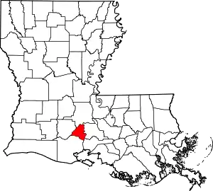
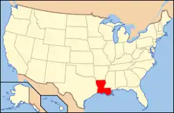
Location of Lafayette Parish in Louisiana
This is intended to be a complete list of the properties and districts on the National Register of Historic Places in Lafayette Parish, Louisiana, United States. The locations of National Register properties and districts for which the latitude and longitude coordinates are included below, may be seen in a map.[1]
There are 39 properties and districts listed on the National Register in the parish.
- This National Park Service list is complete through NPS recent listings posted January 29, 2021.[2]
Current listings
| [3] | Name on the Register[4] | Image | Date listed[5] | Location | City or town | Description |
|---|---|---|---|---|---|---|
| 1 | Alesia | March 14, 1983 (#83000514) |
108 North Morgan Avenue 30°08′55″N 91°57′49″W |
Broussard | ||
| 2 | Bank of Scott | 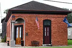 Bank of Scott |
September 19, 2016 (#16000671) |
1102 Saint Mary Street 30°14′09″N 92°05′41″W |
Scott | |
| 3 | Billeaud House | March 14, 1983 (#83000515) |
303 West Main Street 30°08′53″N 91°57′59″W |
Broussard | ||
| 4 | Martial Billeaud Jr. House | March 14, 1983 (#83000516) |
118 North Morgan Avenue 30°08′56″N 91°57′50″W |
Broussard | ||
| 5 | Brandt House | 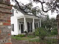 Brandt House |
June 20, 2002 (#02000654) |
614 Madison St. 30°13′39″N 92°01′12″W |
Lafayette | |
| 6 | Valsin Broussard House | March 14, 1983 (#83000517) |
408 West Main Street 30°08′57″N 91°58′02″W |
Broussard | ||
| 7 | Comeaux House | March 14, 1983 (#83000518) |
101 East 2nd Street 30°09′05″N 91°57′41″W |
Broussard | ||
| 8 | Daigle House | June 14, 1984 (#84001298) |
1012 South Washington Street 30°13′21″N 92°01′20″W |
Lafayette | A Creole cottage, built c.1880 in Greek Revival style. | |
| 9 | Downtown Lafayette Civic Center | October 16, 2019 (#100004510) |
705 Jefferson St., 731 Jefferson St., 735 Jefferson St., 124 E. Main St. 30°13′22″N 92°01′07″W |
Lafayette | ||
| 10 | Ducrest Building | 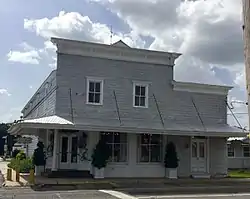 Ducrest Building |
March 14, 1983 (#83000519) |
100 West Main Street 30°08′54″N 91°57′51″W |
Broussard | |
| 11 | Dupleix House | October 4, 1984 (#84000013) |
106 Lafayette Street 30°05′56″N 91°59′24″W |
Youngsville | ||
| 12 | Elrose | 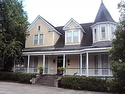 Elrose |
June 14, 1984 (#84001305) |
217 West University Avenue 30°13′05″N 92°01′15″W |
Lafayette | |
| 13 | Evangeline Hotel | 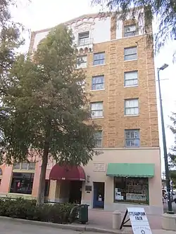 Evangeline Hotel |
March 17, 1994 (#94000235) |
302 Jefferson Street 30°13′38″N 92°01′01″W |
Lafayette | |
| 14 | First United Methodist Church | 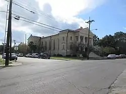 First United Methodist Church |
June 21, 1984 (#84001307) |
703 Lee Avenue 30°13′21″N 92°01′02″W |
Lafayette | |
| 15 | Freetown-Port Rico Historic District | February 2, 2016 (#15000694) |
Roughly bounded by East University Avenue, Lee Avenue, Garfield Street, Taft Street, Drain Street, East Pinhook Road, Guidry Street, Refinery Street, Lucille Avenue, Jefferson Street and Coolidge Street 30°13′05″N 92°00′52″W |
Lafayette | ||
| 16 | Gordon Hotel | 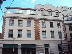 Gordon Hotel |
June 25, 1982 (#82002778) |
100-110 East Vermilion Street 30°13′26″N 92°01′07″W |
Lafayette | |
| 17 | Holy Rosary Institute | 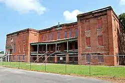 Holy Rosary Institute |
December 3, 1980 (#80001734) |
421 Carmel Street 30°14′07″N 91°59′52″W |
Lafayette | |
| 18 | Hope Lodge No. 145 |  Hope Lodge No. 145 |
January 21, 1983 (#83000520) |
116 East Vermilion Street 30°13′26″N 92°01′05″W |
Lafayette | |
| 19 | Janin Store | March 14, 1983 (#83000521) |
123 North Morgan Avenue 30°08′59″N 91°57′49″W |
Broussard | ||
| 20 | Lafayette Central Business District | October 13, 2020 (#100005680) |
Roughly bounded by East Cypress, Polk, Barry, Lafayette, West Garfield and South Buchanan Sts., Lee Ave., Rue Bibliotheque, and the RR. 30°13′27″N 92°01′00″W |
Lafayette | ||
| 21 | Lafayette Coca-Cola Bottling Plant | October 16, 2018 (#100003025) |
1506 Cameron St. 30°13′56″N 92°01′53″W |
Lafayette | ||
| 22 | Lafayette Elementary School | June 14, 1984 (#84001308) |
1301 West University Avenue 30°13′29″N 92°01′41″W |
Lafayette | ||
| 23 | Lafayette Hardware Store | 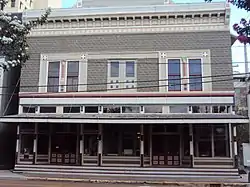 Lafayette Hardware Store |
June 14, 1984 (#84001309) |
121 West Vermilion Street 30°13′26″N 92°01′11″W |
Lafayette | |
| 24 | Alexandre Latiolais House | May 9, 1985 (#85000972) |
900 East Butcher Switch Road 30°17′10″N 92°00′02″W |
Lafayette | ||
| 25 | Main Street Historic District | March 14, 1983 (#83000522) |
203-305 East Main Street 30°08′52″N 91°57′44″W |
Broussard | ||
| 26 | Sidney Martin House | November 8, 1984 (#84000351) |
310 Sidney Martin Road 30°16′42″N 92°00′45″W |
Lafayette | ||
| 27 | Alexandre Mouton House | 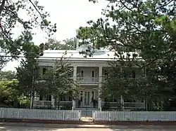 Alexandre Mouton House |
June 18, 1975 (#75000850) |
1122 Lafayette Street 30°13′15″N 92°01′16″W |
Lafayette | |
| 28 | Charles H. Mouton House | 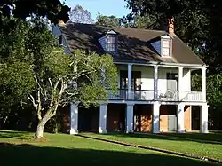 Charles H. Mouton House |
June 9, 1980 (#80001735) |
338 North Sterling Street 30°13′56″N 92°00′36″W |
Lafayette | Also part of Sterling Grove Historic District since its creation on July 26, 1984.[6] |
| 29 | Oil Center Historic District | December 23, 2020 (#100005941) |
Roughly bounded by East St. Mary Blvd., West Pinhook Rd., Travis St., Heyman and Audubon Blvds., Harding and Coolidge Sts. 30°12′23″N 92°00′51″W |
Lafayette | ||
| 30 | Old Guaranty Bank Building | July 12, 1984 (#84001311) |
500 Jefferson Street 30°13′33″N 92°01′07″W |
Lafayette | ||
| 31 | Old Lafayette City Hall | 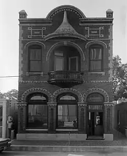 Old Lafayette City Hall |
June 10, 1975 (#75000851) |
217 West Main Street 30°13′21″N 92°01′14″W |
Lafayette | |
| 32 | Our Lady of the Assumption School |  Our Lady of the Assumption School |
November 29, 2001 (#01001267) |
410 North Michaud Street 30°19′33″N 92°02′34″W |
Carencro | |
| 33 | J. Arthur Roy House | June 14, 1984 (#84001314) |
1204 Johnston Street 30°13′03″N 92°01′11″W |
Lafayette | ||
| 34 | Roy-LeBlanc House | March 14, 1983 (#83000523) |
105 South St. Pierre Street 30°08′52″N 91°57′54″W |
Broussard | ||
| 35 | St. Cecilia School | March 14, 1983 (#83000524) |
302 West Main Street 30°08′56″N 91°57′58″W |
Broussard | ||
| 36 | St. John's Cathedral | 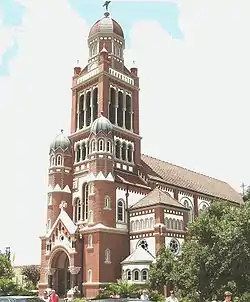 St. John's Cathedral |
July 27, 1979 (#79001067) |
515 Cathedral Street 30°13′22″N 92°01′25″W |
Lafayette | |
| 37 | St. Julien House | March 14, 1983 (#83000525) |
203 East 2nd Street 30°09′03″N 91°57′39″W |
Broussard | ||
| 38 | Sterling Grove Historic District | July 26, 1984 (#84001320) |
Roughly bounded by Evangeline Throughway, East Simcoe Street, North Sterling Street and Chopin Street 30°13′58″N 92°00′39″W |
Lafayette | ||
| 39 | Vermilion Inn | 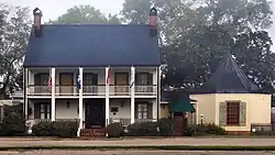 Vermilion Inn |
July 13, 1983 (#83000526) |
1304 Pinhook Road 30°12′02″N 92°00′59″W |
Lafayette |
Former listings
| [3] | Name on the Register | Image | Date listed | Date removed | Location | City or town | Summary |
|---|---|---|---|---|---|---|---|
| 1 | Salles House and Office | July 19, 1984 (#84001316) | June 12, 2017 | 512-514 South Buchanan Street 30°13′34″N 92°01′10″W |
Lafayette | Buildings delisted after being moved to Acadian Village, about 5.6 miles (9.0 km) to the southwest.[7] |
See also
| Wikimedia Commons has media related to National Register of Historic Places in Lafayette Parish, Louisiana. |
References
- The latitude and longitude information provided in this table was derived originally from the National Register Information System, which has been found to be fairly accurate for about 99% of listings. Some locations in this table may have been corrected to current GPS standards.
- "National Register of Historic Places: Weekly List Actions". National Park Service, United States Department of the Interior. Retrieved on January 29, 2021.
- Numbers represent an alphabetical ordering by significant words. Various colorings, defined here, differentiate National Historic Landmarks and historic districts from other NRHP buildings, structures, sites or objects.
- "National Register Information System". National Register of Historic Places. National Park Service. March 13, 2009.
- The eight-digit number below each date is the number assigned to each location in the National Register Information System database, which can be viewed by clicking the number.
- National Register staff, Division of Historic Preservation, State of Louisiana. "Sterling Grove Historic District" (PDF). State of Louisiana's Division of Historic Preservation. Archived from the original (PDF) on July 9, 2018. Retrieved July 9, 2018.CS1 maint: multiple names: authors list (link) with four photos and three maps Archived 2018-07-09 at the Wayback Machine.
- National Register staff. "National Register of Historic Places Removal: Salles House and Office" (PDF). State of Louisiana's Division of Historic Preservation. Retrieved July 9, 2018.
Municipalities and communities of Lafayette Parish, Louisiana, United States | ||
|---|---|---|
| Cities | | |
| Town | ||
| CDPs | ||
| Other unincorporated communities | ||
| Footnotes | ‡This populated place also has portions in an adjacent parish or parishes | |
| ||
This article is issued from Wikipedia. The text is licensed under Creative Commons - Attribution - Sharealike. Additional terms may apply for the media files.