Ninh Bình
Ninh Bình (![]() listen) is a small city in the Red River Delta of northern Vietnam. It is the capital of Ninh Bình Province.
listen) is a small city in the Red River Delta of northern Vietnam. It is the capital of Ninh Bình Province.
Ninh Bình
Thành phố Ninh Bình | |
|---|---|
| Ninh Bình City | |
 | |
 Seal | |

| |
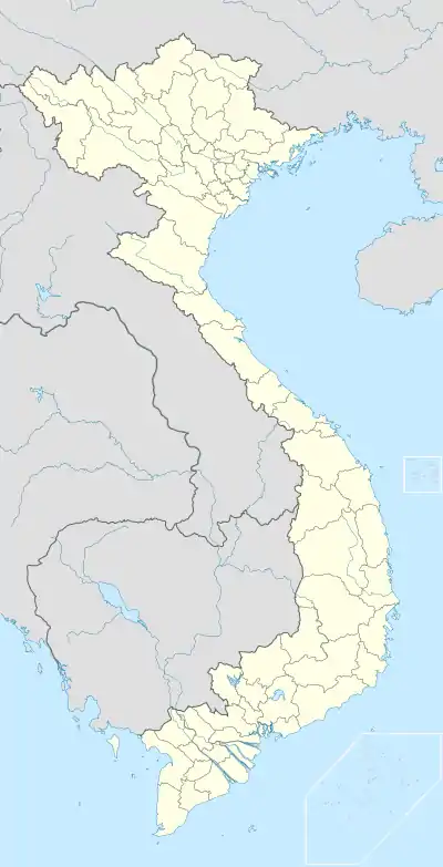 Ninh Bình Location of Ninh Bình in Vietnam | |
| Coordinates: 20°15′14″N 105°58′30″E | |
| Country | |
| Province | Ninh Binh |
| Area | |
| • Total | 48.3649 km2 (18.6738 sq mi) |
| Population (2014) | |
| • Total | 160,166 |
| • Density | 3,311.6/km2 (8,577/sq mi) |
| Climate | Cwa |
Geography
Ninh Bình Province is located in northern Vietnam comprising 48 square kilometres; the 2007 city population was 130,517.
It takes 2 hours by coach to travel from Hanoi to Ninh Bình.
French colonial period

During the period of undeclared hostilities in Tonkin that preceded the outbreak of the Sino-French War in August 1884, the allegiance of Ninh Bình was of considerable importance to the French, as artillery mounted in its lofty citadel controlled river traffic to the Gulf of Tonkin. Although the Vietnamese authorities in Ninh Bình made no attempt to hinder the passage of an expedition launched by Henri Rivière in March 1883 to capture Nam Định, they were known to be hostile towards the French. In November 1883, on the eve of the Sơn Tây Campaign, the French occupied the citadel of Ninh Bình without resistance and installed a garrison.
Climate
Ninh Bình experiences a humid subtropical climate with mild winters and hot, humid summers. The coldest month is January with a mean temperature of 16.6 °C (61.9 °F) and the warmest month is July with a mean temperature of 29.3 °C (84.7 °F).
| Climate data for Ninh Bình | |||||||||||||
|---|---|---|---|---|---|---|---|---|---|---|---|---|---|
| Month | Jan | Feb | Mar | Apr | May | Jun | Jul | Aug | Sep | Oct | Nov | Dec | Year |
| Record high °C (°F) | 32.4 (90.3) |
33.3 (91.9) |
36.6 (97.9) |
38.8 (101.8) |
40.4 (104.7) |
40.1 (104.2) |
39.3 (102.7) |
37.9 (100.2) |
36.6 (97.9) |
34.1 (93.4) |
33.4 (92.1) |
33.0 (91.4) |
40.4 (104.7) |
| Average high °C (°F) | 19.6 (67.3) |
19.8 (67.6) |
22.4 (72.3) |
26.7 (80.1) |
30.9 (87.6) |
32.5 (90.5) |
32.8 (91.0) |
31.8 (89.2) |
30.4 (86.7) |
28.1 (82.6) |
25.0 (77.0) |
21.7 (71.1) |
26.8 (80.2) |
| Daily mean °C (°F) | 16.6 (61.9) |
17.1 (62.8) |
19.7 (67.5) |
23.6 (74.5) |
27.2 (81.0) |
28.8 (83.8) |
29.3 (84.7) |
28.5 (83.3) |
27.3 (81.1) |
24.8 (76.6) |
21.6 (70.9) |
18.3 (64.9) |
23.6 (74.5) |
| Average low °C (°F) | 14.6 (58.3) |
15.4 (59.7) |
18.0 (64.4) |
21.5 (70.7) |
24.5 (76.1) |
26.1 (79.0) |
26.5 (79.7) |
26.0 (78.8) |
24.9 (76.8) |
22.5 (72.5) |
19.2 (66.6) |
15.9 (60.6) |
21.3 (70.3) |
| Record low °C (°F) | 5.7 (42.3) |
5.7 (42.3) |
7.5 (45.5) |
12.6 (54.7) |
17.7 (63.9) |
19.1 (66.4) |
21.6 (70.9) |
21.9 (71.4) |
16.8 (62.2) |
13.4 (56.1) |
10.6 (51.1) |
5.8 (42.4) |
5.7 (42.3) |
| Average precipitation mm (inches) | 24 (0.9) |
29 (1.1) |
48 (1.9) |
78 (3.1) |
165 (6.5) |
232 (9.1) |
224 (8.8) |
317 (12.5) |
369 (14.5) |
244 (9.6) |
68 (2.7) |
32 (1.3) |
1,829 (72.0) |
| Average precipitation days | 9.1 | 13.2 | 16.1 | 12.9 | 12.6 | 13.8 | 12.9 | 15.6 | 15.1 | 12.1 | 7.9 | 6.1 | 147.5 |
| Average relative humidity (%) | 85.1 | 88.1 | 90.4 | 89.4 | 85.1 | 82.7 | 81.6 | 85.3 | 85.2 | 82.7 | 80.8 | 81.3 | 84.8 |
| Mean monthly sunshine hours | 76 | 46 | 46 | 93 | 192 | 181 | 208 | 173 | 170 | 167 | 135 | 124 | 1,611 |
| Source: Vietnam Institute for Building Science and Technology[1] | |||||||||||||
Districts of the Red River Delta | ||
|---|---|---|
| Hanoi city |
|  |
| Haiphong city |
| |
| Bắc Ninh Province | ||
| Hà Nam Province | ||
| Hải Dương Province |
| |
| Hưng Yên Province | ||
| Nam Định Province | ||
| Ninh Bình Province | ||
| Thái Bình Province | ||
| Vĩnh Phúc Province |
| |
※ denotes provincial seat. | ||
References
- "Vietnam Building Code Natural Physical & Climatic Data for Construction" (PDF). Vietnam Institute for Building Science and Technology. Archived from the original (PDF) on 22 July 2018. Retrieved 31 July 2018.
External links
| Wikimedia Commons has media related to Ninh Binh City. |
 Ninh Binh travel guide from Wikivoyage