Kiến Tường
Kiến Tường is a district-level town in Long An Province, Vietnam. The administrative area is centered around a town called Mộc Hóa. Its population in 2013 was reported to be 64,589.[2]
Kiến Tường
Thị xã Kiến Tường | |
|---|---|
| Kiến Tường Town | |
 | |

| |
 Kiến Tường Location of Kiến Tường in Vietnam | |
| Coordinates: 10.78°N 105.94°E | |
| Country | Vietnam |
| Province | Long An |
| Created | 18 March 2013 |
| Government | |
| • People's Council Chair | Đỗ Văn Thiệt |
| • People's Committee Chair | Nguyễn Văn Vũ |
| Area | |
| • Town (Class-4) | 204.28 km2 (78.87 sq mi) |
| • Urban | 25.4876 km2 (9.8408 sq mi) |
| Population | |
| • Estimate (2013) | 64,589 |
| • Density | 316/km2 (820/sq mi) |
| • Urban | 40,991 |
| • Urban density | 1,608/km2 (4,160/sq mi) |
| Time zone | UTC+7 (Indochina Time) |
| Website | Official website |
Geography
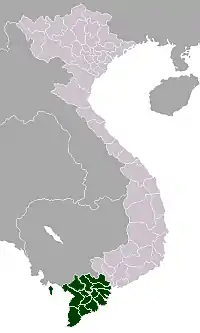
Kiến Tường is located about 80 kilometres (50 mi) west of Ho Chi Minh City, on the Vàm Cỏ Tây River in the heart of the Đồng Tháp Mười wetland.[1] It covers an area of 204.28 square kilometres (78.87 sq mi), and borders the districts of Mộc Hóa to the east, Tân Thạnh to the south, Tân Hưng to the west and Vĩnh Hưng to the northwest. To its north is Kampong Rou District of Svay Rieng Province in Cambodia.[1]
Climate
| Climate data for Kiến Tường (Mộc Hóa) | |||||||||||||
|---|---|---|---|---|---|---|---|---|---|---|---|---|---|
| Month | Jan | Feb | Mar | Apr | May | Jun | Jul | Aug | Sep | Oct | Nov | Dec | Year |
| Record high °C (°F) | 34.8 (94.6) |
35.8 (96.4) |
37.2 (99.0) |
38.2 (100.8) |
38.6 (101.5) |
37.0 (98.6) |
35.4 (95.7) |
35.0 (95.0) |
34.3 (93.7) |
33.5 (92.3) |
33.5 (92.3) |
33.7 (92.7) |
38.6 (101.5) |
| Average high °C (°F) | 31.4 (88.5) |
32.4 (90.3) |
33.9 (93.0) |
34.9 (94.8) |
33.9 (93.0) |
32.6 (90.7) |
32.1 (89.8) |
31.6 (88.9) |
31.2 (88.2) |
30.8 (87.4) |
30.8 (87.4) |
30.6 (87.1) |
32.2 (90.0) |
| Daily mean °C (°F) | 25.9 (78.6) |
26.3 (79.3) |
27.5 (81.5) |
28.7 (83.7) |
28.5 (83.3) |
27.7 (81.9) |
27.3 (81.1) |
27.5 (81.5) |
27.8 (82.0) |
27.6 (81.7) |
27.2 (81.0) |
26.1 (79.0) |
27.3 (81.1) |
| Average low °C (°F) | 22.2 (72.0) |
22.4 (72.3) |
23.4 (74.1) |
24.8 (76.6) |
25.3 (77.5) |
24.9 (76.8) |
24.5 (76.1) |
24.9 (76.8) |
25.2 (77.4) |
25.2 (77.4) |
24.4 (75.9) |
22.5 (72.5) |
24.1 (75.4) |
| Record low °C (°F) | 16.4 (61.5) |
18.0 (64.4) |
16.2 (61.2) |
22.3 (72.1) |
21.7 (71.1) |
21.9 (71.4) |
21.3 (70.3) |
21.6 (70.9) |
22.1 (71.8) |
21.3 (70.3) |
18.7 (65.7) |
15.7 (60.3) |
15.7 (60.3) |
| Average precipitation mm (inches) | 14 (0.6) |
7 (0.3) |
13 (0.5) |
60 (2.4) |
185 (7.3) |
165 (6.5) |
180 (7.1) |
173 (6.8) |
253 (10.0) |
317 (12.5) |
152 (6.0) |
40 (1.6) |
1,557 (61.3) |
| Average precipitation days | 2.4 | 1.0 | 2.2 | 6.8 | 16.3 | 16.9 | 19.7 | 18.1 | 20.4 | 21.1 | 12.8 | 5.0 | 142.6 |
| Average relative humidity (%) | 76.8 | 77.0 | 76.3 | 76.5 | 82.0 | 84.6 | 85.0 | 84.6 | 83.8 | 82.4 | 79.2 | 76.7 | 80.4 |
| Mean monthly sunshine hours | 266 | 251 | 279 | 247 | 225 | 184 | 195 | 186 | 186 | 200 | 226 | 240 | 2,686 |
| Source: Vietnam Institute for Building Science and Technology[3] | |||||||||||||
History
The town of Kiến Tường was originally known as Mộc Hóa, and the general area has been continuously inhabited since the 18th century.[4] On 22 October 1956, the government of South Vietnam established the province of Kiến Tường with Mộc Hóa as its capital. After the Fall of Saigon, this province was incorporated into Long An Province in 1976.[5] The town of Mộc Hóa and surrounding areas were split from the rest of Mộc Hóa District in 2013 to create the current district-level town of Kiến Tường.[2]
Administration
Kiến Tường is divided into three wards numbered 1 through 3, and five rural communes: Bình Hiệp, Bình Tân, Thạnh Hưng, Thạnh Trị and Tuyên Thạnh.[1] The People's Council Chair of the town is Đỗ Văn Thiệt[6] and the People's Committee Chair is Nguyễn Văn Vũ.[7]
Economy
Kiến Tường is planned to become the economic centre of the Đồng Tháp Mười region.[1] Agriculture is currently the main economic activity, accounting for 70% of employment in the administrative district.[4] Fishing and traditional handicrafts also form part of the local economy.[4]
Infrastructure
National Route 62 enters the district from the southeast, connecting Tân Thạnh District with the town of Kiến Tường. From there it turns north and ends at the Bình Hiệp border crossing to Cambodia.[1]
References
- "Kien Tuong Town". Province of Long An. 17 March 2015. Retrieved 22 February 2017.
- "Tỉnh Long An có thêm thị xã Kiến Tường". Thanh Niên. 18 March 2013. Retrieved 22 February 2017.
- "Vietnam Building Code Natural Physical & Climatic Data for Construction" (PDF) (in Vietnamese). Vietnam Institute for Building Science and Technology. Archived from the original (PDF) on 22 July 2018. Retrieved 5 August 2018.
- "Truyền thống văn hóa". Town of Kiến Tường. Retrieved 22 February 2017.
- "Lịch sử". Town of Kiến Tường. Retrieved 22 February 2017.
- "Hội đồng nhân dân". Town of Kiến Tường. Retrieved 22 February 2017.
- "Ủy ban nhân dân". Town of Kiến Tường. Retrieved 22 February 2017.