Cao Bằng
Cao Bằng ([kāːw ɓàŋ] (![]() listen)) is a city in northern Vietnam.[2] It is the capital and largest settlement of Cao Bằng Province. It is located on the bank of the Bằng Giang river, and is around 30 kilometres (19 mi) away from the border with China's Guangxi region.
listen)) is a city in northern Vietnam.[2] It is the capital and largest settlement of Cao Bằng Province. It is located on the bank of the Bằng Giang river, and is around 30 kilometres (19 mi) away from the border with China's Guangxi region.
Cao Bằng
Thành phố Cao Bằng | |
|---|---|
| Cao Bằng City | |
 | |
| |
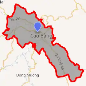
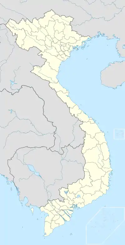 Cao Bằng Location of in Vietnam | |
| Coordinates: 22°40′00″N 106°15′30″E | |
| Country | |
| Province | Cao Bằng |
| Area | |
| • Total | 107.6281 km2 (41.5554 sq mi) |
| Population (2012)[1] | |
| • Total | 84,421 |
| • Density | 784.3/km2 (2,031/sq mi) |
| Time zone | UTC+7 (ICT) |
| Climate | Cwa |
History
The area, Cao Bằng (高平; 'high plateau'), was the stronghold of the last years of the Mạc dynasty after their 1592 defeat at the hands of the Trịnh lords. During the 19th century the area was resistant to the Nguyễn government.[3]
The city is also known for the Battle of Cao Bằng, the first major decisive victory of the Việt Minh against the French Army.[4]
Climate
| Climate data for Cao Bằng | |||||||||||||
|---|---|---|---|---|---|---|---|---|---|---|---|---|---|
| Month | Jan | Feb | Mar | Apr | May | Jun | Jul | Aug | Sep | Oct | Nov | Dec | Year |
| Record high °C (°F) | 32.3 (90.1) |
35.9 (96.6) |
37.1 (98.8) |
38.3 (100.9) |
39.9 (103.8) |
40.5 (104.9) |
38.7 (101.7) |
38.3 (100.9) |
37.8 (100.0) |
36.9 (98.4) |
33.7 (92.7) |
32.3 (90.1) |
40.5 (104.9) |
| Average high °C (°F) | 18.4 (65.1) |
19.3 (66.7) |
23.1 (73.6) |
27.5 (81.5) |
31.0 (87.8) |
32.0 (89.6) |
32.3 (90.1) |
32.1 (89.8) |
31.2 (88.2) |
28.2 (82.8) |
24.3 (75.7) |
20.8 (69.4) |
26.7 (80.1) |
| Daily mean °C (°F) | 13.8 (56.8) |
15.1 (59.2) |
18.8 (65.8) |
22.9 (73.2) |
25.9 (78.6) |
27.0 (80.6) |
27.0 (80.6) |
26.7 (80.1) |
25.4 (77.7) |
22.5 (72.5) |
18.5 (65.3) |
15.1 (59.2) |
21.6 (70.9) |
| Average low °C (°F) | 10.9 (51.6) |
12.3 (54.1) |
15.9 (60.6) |
19.6 (67.3) |
22.3 (72.1) |
23.7 (74.7) |
24.0 (75.2) |
23.5 (74.3) |
21.9 (71.4) |
19.1 (66.4) |
15.2 (59.4) |
11.5 (52.7) |
18.3 (64.9) |
| Record low °C (°F) | −0.9 (30.4) |
1.8 (35.2) |
3.1 (37.6) |
6.6 (43.9) |
13.7 (56.7) |
15.6 (60.1) |
18.2 (64.8) |
16.7 (62.1) |
14.2 (57.6) |
7.2 (45.0) |
3.6 (38.5) |
−1.3 (29.7) |
−1.3 (29.7) |
| Average precipitation mm (inches) | 25 (1.0) |
25 (1.0) |
49 (1.9) |
87 (3.4) |
184 (7.2) |
236 (9.3) |
272 (10.7) |
260 (10.2) |
138 (5.4) |
83 (3.3) |
43 (1.7) |
21 (0.8) |
1,423 (56.0) |
| Average precipitation days | 8.6 | 9.2 | 10.0 | 11.5 | 14.8 | 16.9 | 18.9 | 18.2 | 12.4 | 10.3 | 7.2 | 5.6 | 143.6 |
| Average relative humidity (%) | 80.5 | 80.3 | 79.8 | 79.8 | 79.6 | 82.1 | 84.2 | 85.4 | 83.4 | 81.9 | 81.2 | 79.8 | 81.5 |
| Mean monthly sunshine hours | 65 | 58 | 78 | 115 | 161 | 156 | 176 | 184 | 170 | 141 | 117 | 113 | 1,534 |
| Source: Vietnam Institute for Building Science and Technology[5] | |||||||||||||
References
- Thành lập thành phố Cao Bằng.
- http://baodientu.chinhphu.vn/Home/Thanh-lap-thanh-pho-Cao-Bang/20129/149871.vgp
- Bradley Camp Davis, States of banditry: The Nguyen government, bandit rule, and the ... University of Washington - 2008 Page 345 "..much of Lạng Son and Cao Bằng until his death in 1890. His organization, Which connected the aims of the Cần Vương with the tactics of borderlands banditry, Survived him."
- "UQAM | Guerre d'Indochine | CAO BẰNG, BATTLE OF". indochine.uqam.ca. Retrieved 2018-11-16.
- "Vietnam Building Code Natural Physical & Climatic Data for Construction" (PDF). Vietnam Institute for Building Science and Technology. Archived from the original (PDF) on 22 July 2018. Retrieved 3 August 2018.
| Bắc Giang Province |  | |
|---|---|---|
| Bắc Kạn Province | ||
| Cao Bằng Province | ||
| Hà Giang Province | ||
| Lạng Sơn Province | ||
| Phú Thọ Province | ||
| Quảng Ninh Province |
| |
| Thái Nguyên Province | ||
| Tuyên Quang Province | ||
※ denotes provincial seat. | ||
| Authority control |
|---|
This article is issued from Wikipedia. The text is licensed under Creative Commons - Attribution - Sharealike. Additional terms may apply for the media files.