Đông Hà
Đông Hà (![]() listen) is the capital of Quảng Trị Province, Vietnam. Đông Hà is situated at the crossroads of National Highway 1A and Route 9, part of the East–West Economic Corridor (EWEC). It lies on the North–South Railway (Reunification Express) and is served by Đông Hà Railway Station. EWEC is an economic development program which includes northeast Thailand, Southern Laos, and central Vietnam.
listen) is the capital of Quảng Trị Province, Vietnam. Đông Hà is situated at the crossroads of National Highway 1A and Route 9, part of the East–West Economic Corridor (EWEC). It lies on the North–South Railway (Reunification Express) and is served by Đông Hà Railway Station. EWEC is an economic development program which includes northeast Thailand, Southern Laos, and central Vietnam.
Đông Hà
Thành phố Đông Hà | |
|---|---|
| Đông Hà City | |

| |
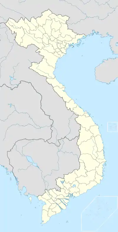 Đông Hà Location of in Vietnam | |
| Coordinates: 16°49′49″N 107°5′50″E | |
| Country | |
| Province | Quảng Trị |
| Area | |
| • Total | 72.96 km2 (28.17 sq mi) |
| Population (2009) | |
| • Total | 93,800 |
| Climate | Am |
History
Vietnam War
During the Vietnam War, Đông Hà was the northernmost town in South Vietnam and was the location of a strategically important United States Marine Corps Đông Hà Combat Base, to support Marine positions along the Vietnamese Demilitarized Zone (DMZ).[1] The 3rd Marine Division had overall command and control of this operational area.[2] Large numbers of NVA operated in the DMZ area. 3rd Marine Division intelligence estimated the combat strength of NVA and VC forces in the DMZ area in January 1968 was 40,943 troops.[3] Đông Hà was overrun on March 31, 1972, during the initial assaults of the North Vietnamese Easter Offensive.
Tourists come to Đông Hà nowadays, especially ex-servicemen from the U.S. and Vietnam, who nearly always include a DMZ tour in their programs. The contemporary Vietnamese singer Như Quỳnh was born in Đông Hà in 1970.
Climate
| Climate data for Đông Hà | |||||||||||||
|---|---|---|---|---|---|---|---|---|---|---|---|---|---|
| Month | Jan | Feb | Mar | Apr | May | Jun | Jul | Aug | Sep | Oct | Nov | Dec | Year |
| Record high °C (°F) | 34.6 (94.3) |
37.9 (100.2) |
39.8 (103.6) |
42.1 (107.8) |
41.7 (107.1) |
41.4 (106.5) |
39.7 (103.5) |
39.4 (102.9) |
38.9 (102.0) |
34.7 (94.5) |
34.6 (94.3) |
33.0 (91.4) |
42.1 (107.8) |
| Average high °C (°F) | 23.5 (74.3) |
24.1 (75.4) |
27.4 (81.3) |
31.4 (88.5) |
33.9 (93.0) |
34.5 (94.1) |
34.7 (94.5) |
33.8 (92.8) |
31.5 (88.7) |
28.7 (83.7) |
25.8 (78.4) |
23.4 (74.1) |
29.4 (84.9) |
| Daily mean °C (°F) | 20.1 (68.2) |
20.5 (68.9) |
22.9 (73.2) |
25.9 (78.6) |
28.3 (82.9) |
29.6 (85.3) |
29.5 (85.1) |
28.8 (83.8) |
27.1 (80.8) |
25.2 (77.4) |
22.8 (73.0) |
20.4 (68.7) |
25.1 (77.2) |
| Average low °C (°F) | 17.7 (63.9) |
18.3 (64.9) |
20.2 (68.4) |
22.8 (73.0) |
24.9 (76.8) |
26.3 (79.3) |
26.2 (79.2) |
25.7 (78.3) |
24.3 (75.7) |
22.9 (73.2) |
20.6 (69.1) |
18.3 (64.9) |
22.4 (72.3) |
| Record low °C (°F) | 10.0 (50.0) |
11.2 (52.2) |
9.4 (48.9) |
15.8 (60.4) |
17.4 (63.3) |
21.5 (70.7) |
22.2 (72.0) |
22.7 (72.9) |
18.6 (65.5) |
16.9 (62.4) |
13.3 (55.9) |
9.8 (49.6) |
9.4 (48.9) |
| Average precipitation mm (inches) | 48 (1.9) |
33 (1.3) |
30 (1.2) |
60 (2.4) |
122 (4.8) |
92 (3.6) |
73 (2.9) |
174 (6.9) |
389 (15.3) |
661 (26.0) |
398 (15.7) |
171 (6.7) |
2,250 (88.6) |
| Average precipitation days | 12.2 | 11.5 | 9.9 | 9.8 | 10.3 | 8.9 | 7.2 | 10.7 | 16.5 | 20.5 | 20.3 | 16.9 | 154.7 |
| Average relative humidity (%) | 87.9 | 86.9 | 86.8 | 84.1 | 78.1 | 72.5 | 70.5 | 74.4 | 83.8 | 87.6 | 87.9 | 87.6 | 82.6 |
| Mean monthly sunshine hours | 118 | 96 | 140 | 175 | 232 | 222 | 238 | 206 | 167 | 136 | 95 | 87 | 1,910 |
| Source: Vietnam Institute for Building Science and Technology[4] | |||||||||||||
References
- Keith W. Nolan The Story of an Armored Cavalry Squadron in Vietnam: 1-1 Cav, 1967-1968 ... Just north of Đông Hà on April 6 the correspondent, Brummett, and Nguyễn Ngọc Lương, the paper's interpreter, waited for a possible tank battle"
- Pike, COL Thomas F., Military Records, February 1968, 3rd Marine Division: The Tet Offensive, Charleston: Creatspace, ISBN 978-1-481219-46-4
- Pike, COL Thomas F., Military Records, February 1968, 3rd Marine Division: The Tet Offensive, p. 115, ISBN 978-1-481219-46-4. NVA and VC Order of Battle information is located on pages 114-127.
- "Vietnam Building Code Natural Physical & Climatic Data for Construction" (PDF). Vietnam Institute for Building Science and Technology. Archived from the original (PDF) on 22 July 2018. Retrieved 31 July 2018.
See also
 Dong Ha travel guide from Wikivoyage
| Wikimedia Commons has media related to Dong Ha. |
Districts of Vietnam North Central Coast | ||
|---|---|---|
| Hà Tĩnh Province | 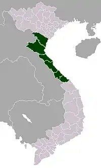 | |
| Nghệ An Province | ||
| Quảng Bình Province |
| |
| Quảng Trị Province |
| |
| Thanh Hóa Province | ||
| Thừa Thiên Huế Province |
| |
※ denotes provincial seat. | ||