Point Lepreau
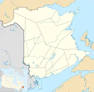
Point Lepreau is a cape in southwestern New Brunswick, Canada.
It is at the southern tip of a 10 km-long (6.2 mi) peninsula that extends into the Bay of Fundy. This peninsula contains the boundary between Saint John County to the east and Charlotte County to the west, although the southernmost tip at Point Lepreau is within Charlotte County.
Point Lepreau forms the eastern limit of Maces Bay.
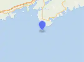
The Point Lepreau Nuclear Generating Station in Saint John County is a CANDU nuclear reactor operated by NB Power approximately 2 km (1.2 mi) northeast from the point.
Point Lepreau Lighthouse
 New Brunswick | |
| |
| Location | Point Lepreau New Brunswick Canada |
|---|---|
| Coordinates | 45°3′31.88″N 66°27′31.28″W |
| Year first constructed | 1831 (first) 1899 (second) |
| Year first lit | 1959 (current) |
| Deactivated | 1898 (first) 1958 (second) |
| Foundation | concrete base |
| Construction | concrete tower |
| Tower shape | octagonal frustum tower with balcony and lantern |
| Markings / pattern | white and red horizontal band tower, red lantern |
| Tower height | 17.5 metres (57 ft) |
| Focal height | 25.5 metres (84 ft) |
| Light source | mains power |
| Range | 14 nautical miles (26 km; 16 mi)[1] |
| Characteristic | Fl W 5s. |
| Fog signal | three 2s. blasts every 60s. |
| Admiralty number | H4108 |
| CHS number | CCG 90 |
| NGA number | 11160 |
| ARLHS number | CAN-390 |
| Managing agent | NB Power [2][1] |
The point hosts a light station owned by the Canadian Coast Guard and managed by NB Power.[3]
References
- List of Lights, Pub. 110: Greenland, The East Coasts of North and South America (Excluding Continental U.S.A. Except the East Coast of Florida) and the West Indies (PDF). List of Lights. United States National Geospatial-Intelligence Agency. 2015.
- New Brunswick The Lighthouse Directory. University of North Carolina at Chapel Hill. Retrieved 21 February 2017
- Point Lepreau, NB Lighthouses Friends. Retrieved 21 February 2017
External links
- Aids to Navigation Canadian Coast Guard
This article is issued from Wikipedia. The text is licensed under Creative Commons - Attribution - Sharealike. Additional terms may apply for the media files.