List of lighthouses in New Brunswick
Lighthouses
| Name | Image | Year built [1] [2] | Location & coordinates | Class of Light [3] | Focal height [3] | NGA number [3] or ARLHS | Admiralty number [3] or CCG | Range nml [3] |
|---|---|---|---|---|---|---|---|---|
| Bathurst Range Front Light[1] | 1871 est. | Bathurst 47°39′07″N 65°37′23″W | Q R | 8 metres (26 ft) | 7204 | H1600 | 8 | |
| Bathurst Range Rear Light[1] | 1871 est. | Bathurst 47°38′51″N 65°37′35″W | Iso R 4s. | 18 metres (59 ft) | 7208 | H1600.1 | 16 | |
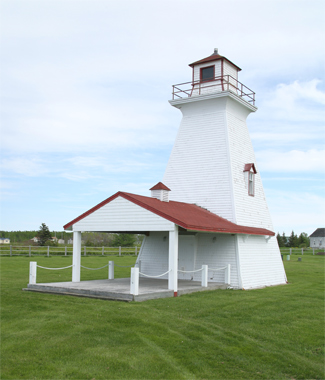
| Bayswater Light[4] | Image | 1914 | Grand Bay–Westfield 45°21′02″N 66°08′01″W | inactive since 2005 | 8 metres (26 ft) (tower) | ARLHS CAN-025 | --- | --- |
| Belledune Point Light[5] | Image | 1972 | Sea Side (relocated) 47°57′31″N 66°08′31″W | inactive since 2002 | 8 metres (26 ft) (tower) | ARLHS CAN-705 | --- | --- |
| Belyea's Point Light[6] | Image | 1930s | Grand Bay–Westfield 45°22′41″N 66°12′58″W | Fl G 5s. | 13.6 metres (45 ft) | ARLHS CAN-031 | CCG 122 | 5 |
| Big Shippegan Light[7] | Image | 1872 | Lamèque Island 47°43′20″N 64°39′38″W | Fl Y 5s. | 16 metres (52 ft) | 7392 | H1530 | 15 |
| Black Point Light[8] | Image | 1967 | Black Point 47°53′07″N 64°37′24″W | Oc (2) Y 10s. | 18 metres (59 ft) | 7360 | H1556 | 12 |
| Bliss Island Light[9] | Image | 1964 | Bliss Island 45°01′07″N 66°51′01″W | Fl R 4s. | 15 metres (49 ft) | 11200 | H4118 | 5 |
| Bouctouche Bar Light[10] | Image | 1902 est. | Bouctouche 46°27′40″N 64°36′46″W | Fl W 4s. | 11 metres (36 ft) | 7680 | H1362 | 7 |
| Campbellton Range Rear Light[11] | Image | 1985 | Campbellton 48°00′36″N 66°40′19″W | inactive (F Y) | 17 metres (56 ft) | ex-7132 | ex-H 1632.1 | --- |
| Cape Enrage Light |  | 1838 | Cape Enrage 45°35′38″N 64°46′48″W | Fl G 6s. | 41 metres (135 ft) | 11064 | H4060 | 10 |
| Cape Jourimain Light[12] |  | 1870 | Bayfield 46°09′27″N 63°48′24″W | inactive since 1997 | 16 metres (52 ft) (tower) | ARLHS CAN-706 | ex- H1318 | --- |
| Cape Spencer Light[13] | Image | 1983 | Saint John 45°11′43″N 65°54′35″W | Fl W 11s. | 62 metres (203 ft) | 11088 | H4078 | 14 |
| Cape Tormentine Outer Wharf Light[14] |  | 1940s | Cape Tormentine 46°08′06″N 63°46′20″W | Iso R 2s. | 12 metres (39 ft) | 7824 | H1308 | 5 |
| Caraquet Island Light[15] |  | 1950s | Caraquet Island 47°49′22″N 64°54′16″W | Fl W 4s. | 22 metres (72 ft) | 7272 | H1588 | 9 |
| Caraquet Range Front Light[16] | Image | 1903 | Caraquet 47°48′30″N 64°50′28″W | F Y | 8 metres (26 ft) | 7276 | H1580 | 13 |
| Caraquet Range Rear Light[17] | Image | 1903 | Bas-Caraquet (relocated) 47°48′16″N 64°49′29″W | inactive since 2000 | 12.5 metres (41 ft) (tower) | ARLHS CAN-707 | ex-H1580.1 | --- |
| Cassie Point Light[18] | Image | 1872 | Grande-Digue 46°19′11″N 64°30′45″W | L Fl (2) Y 12s. | 14 metres (46 ft) | 7724 | H1350 | 11 |
| Chance Harbour Light [19] | Image | 1969 | Chance Harbour 45°07′07″N 66°20′51″W | L Fl W 12s. | 12 metres (39 ft) | 11152 | H4100 | 7 |
| Chiasson Office [20] | - | Chiasson Office | Fl Y 5s. | 54 ft | _ | _ | _ | |
| Cocagne Range Front Light[21] | Image | 1907 | Cocagne 46°20′07″N 64°36′54″W | F Y | 8 metres (26 ft) | 7708 | H1354 | 13 |
| Courtenay Bay Breakwater Light[22] | Image | 1927 | Saint John 45°15′26″N 66°02′42″W | Fl R 4s. | 13 metres (43 ft) | 11112 | H4083 | 5 |
| Dalhousie Island Light[1] | 1886 est. | Dalhousie 48°04′20″N 66°21′51″W | Fl W 5s, | 21 metres (69 ft) | 7152 | H1620 | 15 | |
| Dalhousie Wharf Light[23] | Image | 1909 | Charlo (relocated) 48°00′13″N 66°20′21″W | inactive since 1960 | 6 metres (20 ft) (tower) | ARLHS CAN-724 | --- | --- |
| Dixon Point Range Front Light[24] |  | 1919 | Saint-Louis-de-Kent 46°27′24″N 64°39′03″W | FL W 5s. | 10 metres (33 ft) | 7686 | H1382 | 12 |
| Dixon Point Range Rear Light[25] |  | 1919 | Saint-Louis-de-Kent 46°27′24″N 64°39′03″W | inactive | 9 metres (30 ft) (tower) | 7686 | H1369.1 | --- |
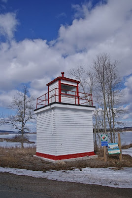
| Fort Monckton Light[1] |  | 1971 | Port Elgin 46°02′36″N 64°04′15″W | Fl W 3s. (seasonal) | 7 metres (23 ft) (tower) | 7844 | H-1304 | 7 |
| Gagetown Light[26] | Image | 1934 | Gagetown 45°46′07″N 66°08′25″W | F G | 11.9 metres (39 ft) | ARLHS CAN-190 | CCG 135 | 8 |
| Gannet Rock Lighthouse |  | 1831 | Bay of Fundy 44°30′37″N 66°46′54″W | Fl W 5s. | 28 metres (92 ft) | 11416 | H4188 | 19 |
| Grand Dune Flats Range Front Light[27] | Image | 1916 | Burnt Church 47°11′41″N 65°08′07″W | inactive since 1950s | 12 metres (39 ft) (tower) | ARLHS CAN-726 | --- | --- |
| Grand Dune Flats Range Rear Light[1] | 1916 est. | Alniwick Parish 47°08′34″N 65°14′35″W | F W | 26 metres (85 ft) | 7504 | H1472.1 | 11 | |
| Grand Dune Outer Range Rear Light[1] | n/a | Black River-Hardwicke 47°06′24″N 64°59′53″W | Iso W 4s. | 32 metres (105 ft) | 7499 | H1452.1 | 17 | |
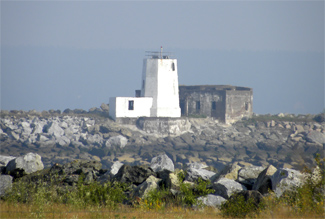
| Grand Harbour Lighthouse[28] |  | 1879 | Grand Manan Island 44°40′02″N 66°44′59″W | inactive since 1963 | 12 metres (39 ft) | ARLHS CAN-709 | --- | --- |
| Grande-Digue Light[29] | Image | 1912 | Grande-Digue 46°17′41″N 64°33′38″W | inactive since 1950s | 6 metres (20 ft) (tower) | --- | --- | --- |
| Grant Beach Range Front Light[30] | Image | 1903 | Lower Newcastle-Russellville (relocated) 47°04′56″N 65°23′08″W | inactive since 1972 | 12 metres (39 ft) (tower) | ARLHS CAN-727 | --- | --- |
| Grant Beach Range Rear Light[1] | n/a | Lower Newcastle-Russellville 47°05′07″N 65°23′11″W | Iso R 4s. | 41 metres (135 ft) | 7536 | H1491.1 | 16 | |
| Grant Beach Range Rear Light[31] | Image | 1903 | The Willows 47°06′43″N 65°17′31″W | inactive since 1972 | 12 metres (39 ft) (tower) | ARLHS CAN-728 | --- | --- |
| Great Duck Island Light[32] | Image | 1966 | Grand Manan Island 44°41′04″N 66°41′36″W | Fl W 10s. emergency light | 15 metres (49 ft) | 11384 | H4174 | 18 |
| Green's Point Light[33] | Image | 1903 | L'Etete 45°02′20″N 66°53′31″W | inactive since 1999 | 12 metres (39 ft) (tower) | 11208 | H4120 | --- |
| Grindstone Island Light[34] | Image | 1911 | Harvey, Albert County 45°43′19″N 64°37′15″W | inactive since 2001 | 20.5 metres (67 ft) tower | ARLHS CAN-711 | ex-H4046 | --- |
| Hampstead Wharf Light[35] | Image | 1900 | Hampstead 45°37′30″N 66°05′05″W | inactive since 1994 | 5.5 metres (18 ft) (tower) | ARLHS CAN-221 | --- | ---- |
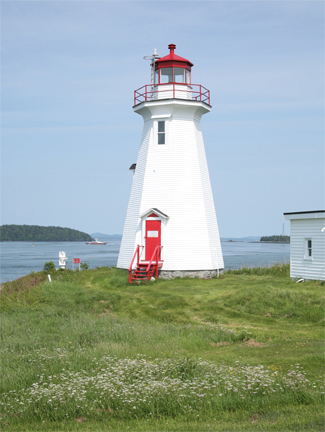
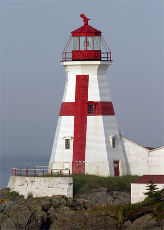
| Head Harbour Light[36] | Image | 1829 | Bay of Fundy 44°57′28″N 66°54′00″W | F R | 18 metres (59 ft) | 11332 | H4154 | 13 |
| Hendry Farm Light[37] | Image | 1893 | Cambridge-Narrows 45°43′59″N 66°02′54″W | inactive since 1995 | 8 metres (26 ft) (tower) | ARLHS CAN-520 | --- | --- |
| Inch Arran Point Range Front Light[38] |  | 1870 | Dalhousie 48°03′40″N 66°21′03″W | Iso W 6s. | 14 metres (46 ft) | 7164 | H1616 | 11 |
| Leonardville Light[39] | Image | 1914 | Deer Island 44°58′06″N 66°57′18″W | F W | 20 metres (66 ft) | 11264 | H4146 | 10 |
| Lighthouse Point Lighthouse[40] | Image | 1984 | Beaver Harbour 45°03′47″N 66°43′59″W | Iso W 6s. | 14 metres (46 ft) | 11184 | H4112 | 12 |
| Long Eddy Point Light | Image | 1966 | Grand Manan Island 44°47′59″N 66°47′08″W | Fl R 8s. | 38 metres (125 ft) | 11360 | H4166 | 14 |
| Long Point Light[41] |  | 1966 | White Head Island 44°36′50″N 66°42′35″W | Iso W 12s. | 28 metres (92 ft) | 11416 | H4188 | 12 |
| Lower Jemseg Light [42] | 1884 est. | Lower Jemseg 45°46′47″N 66°06′24″W | F R 4s. | 9 metres (30 ft) | ARLHS CAN-917 | CCG 136 | --- | |
| Lower Musquash Island Light[43] | Image | 1893 | Wickham 45°42′29″N 66°03′58″W | inactive since 1994 | 12 metres (39 ft) (tower) | ARLHS CAN-333 | --- | --- |
| Lower Neguac Wharf Range Rear Light[44] | Image | 1892 | Neguac 47°15′41″N 65°03′13″W | inactive since 2003 | 8 metres (26 ft) (tower) | ARLHS CAN-289 | ex-H1518.1 | --- |
| Machias Seal Island Light[45] | Image | 1915 | Machias Seal Island 44°30′07″N 67°06′07″W | Fl W 3s. | 25 metres (82 ft) | 11444 | H4192 | 17 |
| Maisonnette Point Light[1] | 1915 | Maisonnette 47°50′15″N 65°00′13″W | Fl W 2.4s. | 18 metres (59 ft) | 7264 | H1590 | 15 | |
| McColgan Point Light[46] | Image | 1914 | Grand Bay–Westfield 45°19′56″N 66°06′34″W | Fl W 10s. | 11.3 metres (37 ft) | ARLHS CAN-309 | CCG 119 | 6 |
| Miscou Island Lighthouse | .jpg.webp) | 1930s | Miscou Island 48°00′34″N 64°29′35″W | Fl G 5s. | 14 metres (46 ft) | 7368 | H1552 | 12 |
| Mulholland Point Light[47] | Image | 1885 | Welshpol 44°51′47″N 66°58′47″W | inactive since 1963 | 13.5 metres (44 ft) | ARLHS CAN-326 | --- | --- |
| Musquash Head Light[48] | Image | 1959 | Musquash 45°08′37″N 66°14′14″W | Fl W 3s. | 35 metres (115 ft) | 11148 | H4096 | 20 |
| Oak Point Light[49] | Image | 1902 | Oak Point 45°30′27″N 66°04′48″W | Fl G 10s. | 15.7 metres (52 ft) | ARLHS CAN-358 | CCG 125 | 8 |
| Oak Point Range Front Light[50] |  | 1904 | Miramichi (relocated) 47°03′03″N 65°28′06″W | inactive since 1960s | 10 metres (33 ft) (tower) | ARLHS CAN-732 | --- | --- |
| Partridge Island Light[51] | Image | 1961 | Saint John 45°14′21″N 66°03′14″W | FL W 7.5s. | 35 metres (115 ft) | 11100 | H4082 | 19 |
| Pea Point Light[52] | Image | 1965 | Blacks Harbour 45°02′21″N 66°48′28″W | F W | 17 metres (56 ft) | 11192 | H4114 | |
| Petit Rocher Light[1] | 1879 est. | Petit-Rocher 47°46′55″N 65°42′27″W | Fl Y 10s. | 8 metres (26 ft) | 7196 | H1606 | 15 | |
| Point Escuminac Light[53] |  | 1966 | Point Escuminac 47°04′23″N 64°47′53″W | Fl W 3s. | 22 metres (72 ft) | 7580 | H1424 | 13 |
| Point Lepreau Light[54] | Image | 1959 | Point Lepreau 45°03′32″N 66°27′31″W | Fl W 5s. | 26 metres (85 ft) | 11160 | H4108 | 14 |
| Pointe à Brideau Range Front Light[1] | n/a | Caraquet 47°47′47″N 64°56′13″W | F W | 8 metres (26 ft) | 7305 | H1585 | 19 | |
| Pointe à Brideau Range Rear Light[55] | Image | 1978 | Caraquet 47°47′42″N 64°56′30″W | F W | 14 metres (46 ft) | 7306 | H1586.1 | 19 |
| Pointe du Chêne Range Front Light[56] | Image | 1898 | Shediac 46°14′27″N 64°30′42″W | F R | 8 metres (26 ft) | 7736 | H1328 | 11 |
| Pointe du Chêne Range Rear Light[57] | Image | 1898 | Shediac 46°14′22″N 64°30′43″W | F R | 14 metres (46 ft) | 7740 | H1328.1 | 11 |
| Pointe à Jérôme Range Front Light[58] | Image | 1916 | Bouctouche 46°29′12″N 64°40′46″W | F W (seasonal) | 6 metres (20 ft) | 7692 | H1368 | 13 |
| Pointe à Jérôme Range Rear Light[59] | Image | 1916 | Bouctouche 46°29′21″N 64°40′58″W | F W (seasonal) | 18 metres (59 ft) | 7696 | H1368.1 | 13 |
| Pointe Sapin Range Rear Light[60] | Image | 1910 | Pointe-Sapin 46°57′50″N 64°49′50″W | inactive since 2016 | 7.5 metres (25 ft) (tower) | ex-7596 | ex-H1418.1 | --- |
| Pokesudie Island Light[1] | 1881 est. | Pokesudie Island 47°49′10″N 64°45′16″W | Iso W 4s. | 13 metres (43 ft) | 7308 | H1566 | 10 | |
| Portage Channel Range Rear Light[1] | 1986 | Black River-Hardwicke 47°07′43″N 65°02′31″W | F W | 19 metres (62 ft) | 7484 | H1446.1 | 18 | |
| Portage Island Range Rear Light[61] |  | 1908 | Shippagan (relocated) 47°44′53″N 64°42′33″W | inactive since 1986 | 13 metres (43 ft) (tower) | ARLHS CAN-733 | ex-H1444.1 | --- |
| Quaco Head Light[62] | Image | 1976 | St. Martins 45°19′26″N 65°32′07″W | L Fl R 6s. | 26 metres (85 ft) | 11080 | H4076 | 21 |
| Richibucto Head Light[63] |  | 1865 est. | Richibucto 46°40′11″N 64°42′42″W | Fl W 5s. | 18 metres (59 ft) | 7660 | H1376 | 14 |
| Richibucto Town Range Rear Light[1] | n/a | Richibucto 46°40′42″N 64°51′55″W | F Y | 23 metres (75 ft) | 7652 | H1402.1 | 11 | |
| Saint John Harbour Range Front Light[2] | Image | n/a | Saint John 45°16′22″N 66°04′07″W | F G | 21 metres (69 ft) | 11104 | H4089 | 20 |
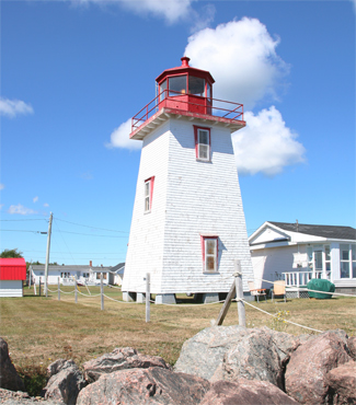
| Sand Point Light[64] | Image | 1898 | Grand Bay–Westfield 45°20′33″N 66°11′56″W | F R | 22.7 metres (74 ft) | ARLHS CAN-445 | CCG 121 | 7 |
| Shediac Harbour Range Rear Light[1] | 1914 est. | Shediac 46°14′26″N 64°31′50″W | Iso Y 4s. | 12 metres (39 ft) | 7748 | H1332.1 | 22 | |
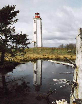
| Southwest Head Light | Image | 1959 | Grand Manan Island 44°36′04″N 66°54′20″W | Fl W 10s. | 48 metres (157 ft) | 11436 | H4186 | 16 |
| Southwest Wolf Island Light[65] | Image | 1982 | Pennfield Parish 44°56′12″N 66°44′00″W | Fl W 10s. | 38 metres (125 ft) | 11172 | H4110 | 7 |
| St. Andrews North Point Light[66] |  (old lighthouse) | 1833 (first) | St. Andrews 45°04′03″N 67°02′50″W | Fl R 4s. | 7 metres (23 ft) (tower) | 11230 | H4127 | 4 |
| Stonehaven Light[1] | 1885 est. | Stonehaven 47°45′12″N 65°21′42″W | Fl W 4s. | 21.5 metres (71 ft) | 7240 | H1596 | 10 | |
| Swallowtail Lighthouse[2] |  | 1860 | Grand Manan Island 44°45′52″N 66°43′57″W | Oc W 6s. | 37 metres (121 ft) | 11364 | H4168 | 12 |
| Swift Point Light[67] | Image | 1869 | Saint John 45°16′57″N 66°07′17″W | Fl G 12s. | 28 metres (92 ft) | --- | --- | --- |
| The Cedars Light[68] | Image | 1904 | Kingston Peninsula 45°28′42″N 66°04′57″W | inactive since 1994 | 10 metres (33 ft) (tower) | ARLHS CAN-124 | --- | --- |
| Tongue Shoal Light[2] | 1875 est. | Passamaquoddy Bay 45°03′45″N 67°00′46″W | Fl W 4s. | 7 metres (23 ft) | 11232 | H4126 | 7 | |
| Wimot Bluff Light[69] | Image | 1869 | Oromocto 45°52′09″N 66°30′38″W | inactive since 1969 | 13 metres (43 ft) (tower) | ARLHS CAN-734 | --- | --- |
See also
References
- Northern New Brunswick The Lighthouse Directory. University of North Carolina at Chapel Hill. Retrieved 18 February 2017
- Southern New Brunswick The Lighthouse Directory. University of North Carolina at Chapel Hill. Retrieved 18 February 2017
- List of Lights, Pub. 110: Greenland, The East Coasts of North and South America (Excluding Continental U.S.A. Except the East Coast of Florida) and the West Indies (PDF). List of Lights. United States National Geospatial-Intelligence Agency. 2015.
- Gran Harbour (Ross Island), NB Lighthouses Friends. Retrieved 19 March 2017
- Belledune Point, NB Lighthouses Friends. Retrieved 27 February 2017
- Belyeas Point, NB Lighthouses Friends. Retrieved 24 February 2017
- Big Shippegan, NB Lighthouses Friends. Retrieved 20 February 2017
- Black Point, NB Lighthouses Friends. Retrieved 20 February 2017
- Bliss Island, NB Lighthouses Friends. Retrieved 22 February 2017
- Bouctouche Bar, NB Lighthouses Friends. Retrieved 19 February 2017
- Campbellton Range Rear, NB Lighthouses Friends. Retrieved 20 February 2017
- Cape Jourimain, NB Lighthouses Friends. Retrieved 1 March 2017
- Quaco Head, NB Archived 2012-01-25 at the Wayback Machine Lighthouses Friends. Retrieved 20 February 2017
- Cape Tormentine Outer Wharf, NB Lighthouses Friends. Retrieved 20 February 2017
- Caraquet Island, NB Lighthouses Friends. Retrieved 20 February 2017
- Caraquet Range Front, NB Lighthouses Friends. Retrieved 20 February 2017
- Caraquet Range Rear, NB Lighthouses Friends. Retrieved 27 February 2017
- Cassie Point, NB Lighthouses Friends. Retrieved 20 February 2017
- Chance Harbour Light Lighthouse Explorer. Retrieved 21 February 2017
- Lighthouses of the Acadian Peninsula. Retrieved 28 August 2017
- Cocagne Range Front, NB Lighthouses Friends. Retrieved 19 February 2017
- Courtenay Bay Breakwater, NB Lighthouses Friends. Retrieved 20 February 2017
- Dalhousie Wharf, NB Lighthouses Friends. Retrieved 27 February 2017
- Dixon Point Range Front, NB Lighthouses Friends. Retrieved 1 March 2017
- Dixon Point Range Rear, NB Lighthouses Friends. Retrieved 1 March 2017
- Gagetown, NB Lighthouses Friends. Retrieved 24 February 2017
- Grand Dune Flats Range Front, NB Lighthouses Friends. Retrieved 28 February 2017
- Gran Harbour (Ross Island), NB Lighthouse Friends. Retrieved 19 March 2017
- Grande Digue, NB Lighthouses Friends. Retrieved 1 March 2017
- Grant Beach Range Rear, NB Lighthouses Friends. Retrieved 28 February 2017
- Grant Beach Range Rear, NB Lighthouses Friends. Retrieved 28 February 2017
- Great Duck Island, NB Lighthouses Friends. Retrieved 23 February 2017
- Green's Point, NB Lighthouses Friends. Retrieved 19 March 2017
- Grindstone Island, NB Lighthouses Friends. Retrieved 19 March 2017
- Hampstead Wharf, NB Lighthouses Friends. Retrieved 19 March 2017
- Head Harbour, NB Lighthouses Friends. Retrieved 22 February 2017
- Hendry Farm, NB Lighthouses Friends. Retrieved 19 March 2017
- Inch Arran Point Range Front, NB Lighthouses Friends. Retrieved 20 February 2017
- Deer Island, NB Lighthouses Friends. Retrieved 22 February 2017
- Lighthouse Point, NB Lighthouses Friends. Retrieved 21 February 2017
- Image Lighthouses Friends. Retrieved 23 February 2017
- Jemseg Light Lighthouse Explorer. Retrieved 24 February 2017
- Lower Musquash Island, NB Lighthouses Friends. Retrieved 19 March 2017
- Lower Neguac Wharf Range Rear, NB Lighthouses Friends. Retrieved 28 February 2017
- Machias Seal Island, NB Lighthouses Friends. Retrieved 24 February 2017
- McColgan Point, NB Lighthouses Friends. Retrieved 24 February 2017
- Mulholland Point, NB Lighthouses Friends. Retrieved 19 March 2017
- Musquash Head, NB Lighthouses Friends. Retrieved 21 February 2017
- Oak Point, NB Lighthouses Friends. Retrieved 24 February 2017
- Oak Point Range Front, NB Lighthouses Friends. Retrieved 28 February 2017
- Partridge Island, NB Lighthouses Friends. Retrieved 20 February 2017
- Pea Point, NB Lighthouses Friends. Retrieved 21 February 2017
- Point Escuminac, NB Archived 2014-06-25 at the Wayback Machine Lighthouses Friends. Retrieved 19 February 2017
- Point Lepreau, NB Lighthouses Friends. Retrieved 21 February 2017
- Pointe à Brideau Range Rear, NB Lighthouses Friends. Retrieved 20 February 2017
- Pointe du Chêne Range Front, NB Lighthouses Friends. Retrieved 20 February 2017
- Pointe du Chêne Range Rear, NB Lighthouses Friends. Retrieved 20 February 2017
- Pointe à Jérôme Range Front, NB Lighthouses Friends. Retrieved 1 March 2017
- Pointe à Jérôme Range Rear, NB Lighthouses Friends. Retrieved 1 March 2017
- Oak Point Range Front, NB Lighthouses Friends. Retrieved 28 February 2017
- Portage Island Range Rear, NB Lighthouses Friends. Retrieved 27 February 2017
- Quaco Head, NB Lighthouses Friends. Retrieved 20 February 2017
- Richibucto Head, NB Lighthouses Friends. Retrieved 19 February 2017
- Sand Point, NB Lighthouses Friends. Retrieved 24 February 2017
- Southwest Wolf Island, NB Lighthouses Friends. Retrieved 22 February 2017
- St. Andrews, NB Lighthouses Friends. Retrieved 19 March 2017
- Swift Point, NB Lighthouses Friends. Retrieved 20 February 2017
- The Cedars, NB Lighthouses Friends. Retrieved 19 March 2017
- Wilmot Bluff, NB Lighthouses Friends. Retrieved 19 March 2017
External links
| Wikimedia Commons has media related to Lighthouses in New Brunswick. |
- New Brunswick Lighthouses Lighthouses Friends. Retrieved 18 February 2017
- List of Lights, Buoys and Fog Signals Canadian Coast Guard. Retrieved 18 February 2017
| |
This article is issued from Wikipedia. The text is licensed under Creative Commons - Attribution - Sharealike. Additional terms may apply for the media files.