Point Prim Lighthouse
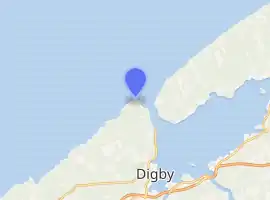
The current Point Prim Lighthouse is the fourth in a line of lighthouses built at Point Prim since 1804. It is located at the mouth of the Digby Gut, which connects the Bay of Fundy with the Annapolis Basin.[2] It is located approximately 8.5 km outside Digby.[3]
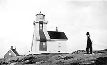 The Point Prim Lighthouse in 1874 | |
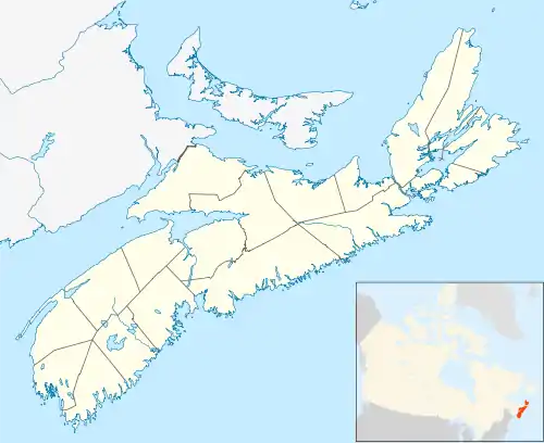 Nova Scotia | |
| |
| Location | Digby, Nova Scotia Canada |
|---|---|
| Coordinates | 44°41′28″N 65°47′11.1″W |
| Year first constructed | 1804 (first) 1817 (second) 1874 (third) |
| Year first lit | 1964 (current) |
| Automated | 1984 |
| Construction | concrete tower |
| Tower shape | square tower with balcony and lantern |
| Markings / pattern | white tower with red vertical stripes on each side, red lantern |
| Tower height | 14 metres (46 ft) |
| Focal height | 25 metres (82 ft) |
| Range | 13 nautical miles (24 km; 15 mi) |
| Characteristic | white flash 3s. on 3s. off |
| Fog signal | 3s. blast every 30s. |
| Admiralty number | H3890 |
| CHS number | CCG 201 |
| NGA number | 10908 |
| ARLHS number | CAN-391 |
| Managing agent | Friends of Point Prim[1] |
| Heritage | heritage lighthouse, Municipally Registered Property |
Around the lighthouse is a small public park with trails and information boards about the history of the lighthouse and the geologic area. The park offers views of the Bay of Fundy and the Digby Gut. It is operated by The Friends of Point Prim and they have slowly gained support from local contributors who have donated two picnic tables and a donation box built by Robert Wilson, son of former light keeper Frank Wilson. They have also applied for a grant from Heritage Canada to help with repairs and upkeep of the lighthouse and surrounding parkland.[4] There is also a beautiful view, and interesting rock formations.[5]
See also
The current Point Prim Lighthouse is the fourth in a line of lighthouses built at Point Prim since 1804. It is located at the mouth of the Digby Gut, which connects the Bay of Fundy with the Annapolis Basin.[2] It is located approximately 8.5 km outside Digby.[3]
References
- Rowlett, Russ. "Lighthouses of Western Nova Scotia". The Lighthouse Directory. University of North Carolina at Chapel Hill. Retrieved January 4, 2016.
- Unknown, Author. "Point Prim Lighthouse". Lighthouse Friends. Retrieved 19 February 2013.
- "Point Prim Lighthouse - Digby". digbyhostel.com. Retrieved 2016-12-01.
- Riley, Jonathan (24 July 1012). "Prettying Up Point Prim". The Digby County Courier. Retrieved 19 February 2013.
- "Point Prim Lighthouse - Digby". digbyhostel.com. Retrieved 2016-12-01.
The current Point Prim Lighthouse is the fourth in a line of lighthouses built at Point Prim since 1804. It is located at the mouth of the Digby Gut, which connects the Bay of Fundy with the Annapolis Basin.[2] It is located approximately 8.5 km outside Digby.[3]
External links
- Aids to Navigation Canadian Coast Guard
| Wikimedia Commons has media related to Prim Point lighthouse. |