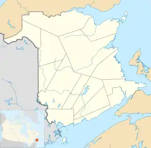
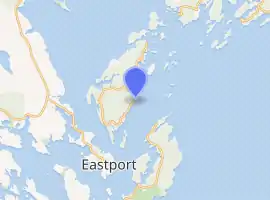
Deer Island (New Brunswick)
Deer Island is one of the Fundy Islands in the Bay of Fundy, Canada. It is at the entrance to Passamaquoddy Bay.
 | |
 New Brunswick | |
| |
| Location | New Brunswick, Canada |
|---|---|
| Coordinates | 44°58′5.63″N 66°57′18.37″W |
| Year first constructed | 1914 |
| Foundation | concrete base |
| Construction | wooden tower |
| Tower shape | square frustun tower with balcony and lantern |
| Markings / pattern | white tower, red lantern roof |
| Tower height | 8 metres (26 ft) |
| Focal height | 20 metres (66 ft) |
| Range | 10 nautical miles (19 km; 12 mi) |
| Characteristic | F W |
| Admiralty number | H4146 |
| CHS number | CCG 46 |
| NGA number | 11264 |
| ARLHS number | CAN-274 |
| Managing agent | Canadian Coast Guard[1][2] |
The island was first settled by colonists around 1770.[3] Administratively it is in Charlotte County, New Brunswick, At 45 km2, it is the largest in the West Isles Parish (census division) which had a 2001 population of 851. It has three communities: Fairhaven, Leonardville, and Lords Cove.[4] There is a primary school on the island, while older pupils attend Fundy High School on the mainland.
The economy is primarily fishing and aquaculture based although tourism is growing. The Old Sow, the largest tidal whirlpool in the western hemisphere[5] can be viewed from Deer Island Point Park.[6]
The major route is New Brunswick Route 772. The year round L'Etete to Deer Island Ferries run by the government, Deer Island Princess II and Abnaki II, connect Deer Island with L'Etete, New Brunswick on the mainland. During the summer, privately operated ferries, through East Coast Ferries Ltd, operate the Cummings Cove to Welshpool Ferry, Hopper II, to Campobello Island. The Cummings Cove to Eastport Ferry, Fundy Trail II to Maine, has been defunct since 2014.
Gallery
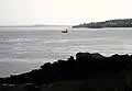 Ferry crossing between Deer Island (N.B.) and Eastport (ME).
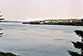 High tide at Deer Island Point.
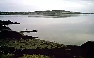
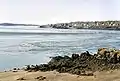 Low tide at Deer Island Point with the Old Sow in action.
 Cargo ship sailing by Deer Island Point.
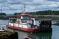 Deer Island Ferry
References
- Southern New Brunswick The Lighthouse Directory. University of North Carolina at Chapel Hill. Retrieved 25 February 2017
- List of Lights, Pub. 110: Greenland, The East Coasts of North and South America (Excluding Continental U.S.A. Except the East Coast of Florida) and the West Indies (PDF). List of Lights. United States National Geospatial-Intelligence Agency. 2016.
- "Deer Island History and Little Known Facts". Retrieved 2 January 2017.
- "LETETE - DEER ISLAND FERRY". Retrieved 2 January 2017.
- "Old Sow Whirlpool". Retrieved 2 January 2017.
- "Public Parks Recreation Areas Hiking Trails". Quoddy Loop. Retrieved 2 January 2017.
External links
| Wikimedia Commons has media related to Deer Island. |
- Aids to Navigation Canadian Coast Guard
| Subdivisions | |
|---|---|
| Cities | |
| Towns | |
| |