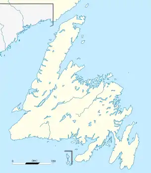
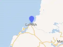
Garnish, Newfoundland and Labrador
Garnish, a town located on the west coast of the Burin Peninsula, was well known for its lumbering and now for its lobstering operations. Located on Route 213, it is 25 km along route 220 north west of Grand Bank and 18 km along Route 220 east of Marystown. The Way Office was established in 1852 and the first Waymaster was Henry Campe. Other notable people include Mayor Gregory Day and Brian Marshall. In 2016 the town had a population of 568.
Garnish | |
|---|---|
Town | |
 Garnish Location of Garnish in Newfoundland | |
| Coordinates: 47°14′N 55°22′W | |
| Country | |
| Province | |
| Population (2016) | |
| • Total | 568 |
| Time zone | UTC-3:30 (Newfoundland Time) |
| • Summer (DST) | UTC-2:30 (Newfoundland Daylight) |
| Area code(s) | 709 |
| Highways | |
| Website | www.townofgarnish.com |
| |
| Location | Garnish Newfoundland Canada |
|---|---|
| Coordinates | 47°14′11.4″N 55°21′29.9″W |
| Year first constructed | 1885 (first) |
| Year first lit | 1991 (current) |
| Automated | 1991 |
| Deactivated | 1991 (first) |
| Construction | aluminium skeletal tower |
| Tower shape | square prism skeletal tower with light |
| Markings / pattern | three side daymark painted red the upper part, white the lower part |
| Tower height | 3.5 metres (11 ft) |
| Focal height | 8 metres (26 ft) |
| Light source | solar power |
| Range | 6 nautical miles (11 km; 6.9 mi) |
| Characteristic | Q R |
| Admiralty number | H0318 |
| CHS number | CCG 112 |
| NGA number | 2264 |
| ARLHS number | CAN-685 |
| Managing agent | Garnish Heritage Society[1][2] |
See also
- List of lighthouses in Canada
- List of cities and towns in Newfoundland and Labrador
References
- Southeastern Newfoundland The Lighthouse Directory University of North Carolina at Chapel Hill. Retrieved 12 February 2017
- List of Lights, Pub. 110: Greenland, The East Coasts of North and South America (Excluding Continental U.S.A. Except the East Coast of Florida) and the West Indies (PDF). List of Lights. United States National Geospatial-Intelligence Agency. 2016.
External links
- Town of Garnish
- Garnish - Encyclopedia of Newfoundland and Labrador, vol. 2, p. 483-484.
- Aids to Navigation Canadian Coast Guard
This article is issued from Wikipedia. The text is licensed under Creative Commons - Attribution - Sharealike. Additional terms may apply for the media files.