Qala e Naw
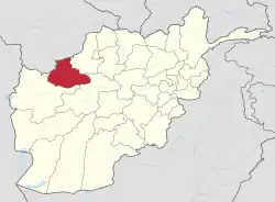
Qala-e-Naw (Dari: قلعه نو) is a town in Qala e Naw District and the capital of Badghis Province, of north-west Afghanistan. Its population was estimated 9,000 in 2006, of which 80% are Tajiks, Hazaras and Aimaq Hazara[3] Other significant communities include Pashtuns, Balochs and Uzbeks.
Qala-e-Naw
قلعه نو | |
|---|---|
Town | |
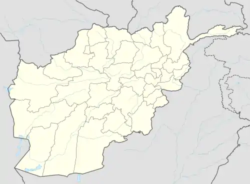 Qala-e-Naw Location in Afghanistan | |
| Coordinates: 34°59′12″N 63°7′45″E | |
| Country | Afghanistan |
| Province | Badghis Province |
| District | Qala e Naw District |
| Elevation | 967 m (3,173 ft) |
| Population (2015) | |
| • Town | 64,125 [1] |
| • Urban | 64,125 [2] |
| Time zone | UTC+4:30 |
| Website | www.naraiman.com |
The city of Qala-e-naw has a population of 64,125 people (2015)[4] with 6 Police districts (nahias) and total land area of 3,752 Hectares.[5] There are 7,125 total number of dwellings in Qala-e-Naw.[6] Qala-e-naw is the provincial capital of Badghis Province.
Qala-e-Naw is a Provincial Centre located in western Afghanistan. Barren land accounts for 49% of total land area[7] and only 28% is classified as built-up.[8] Of the built-up land, 60% is residential.[9] District 4 has a large institutional and transportation land use as a result of the airport located there.[10]
It has a small airport, Qala i Naw Airport.
Climate
Qala i Naw has a cold semi-arid climate (Köppen climate classification BSk) with hot summers and cold winters. Precipitation is low, and mostly falls in winter.
| Climate data for Qala e Naw | |||||||||||||
|---|---|---|---|---|---|---|---|---|---|---|---|---|---|
| Month | Jan | Feb | Mar | Apr | May | Jun | Jul | Aug | Sep | Oct | Nov | Dec | Year |
| Record high °C (°F) | 23.2 (73.8) |
25.4 (77.7) |
32.7 (90.9) |
33.5 (92.3) |
39.1 (102.4) |
42.5 (108.5) |
42.8 (109.0) |
40.0 (104.0) |
37.7 (99.9) |
35.0 (95.0) |
30.5 (86.9) |
26.5 (79.7) |
42.8 (109.0) |
| Average high °C (°F) | 6.3 (43.3) |
7.4 (45.3) |
14.9 (58.8) |
21.9 (71.4) |
29.0 (84.2) |
33.7 (92.7) |
35.8 (96.4) |
33.5 (92.3) |
29.0 (84.2) |
23.0 (73.4) |
16.7 (62.1) |
10.2 (50.4) |
21.8 (71.2) |
| Daily mean °C (°F) | 0.1 (32.2) |
2.4 (36.3) |
3.6 (38.5) |
15.1 (59.2) |
20.8 (69.4) |
25.8 (78.4) |
28.2 (82.8) |
25.3 (77.5) |
20.5 (68.9) |
14.0 (57.2) |
8.6 (47.5) |
3.9 (39.0) |
14.0 (57.2) |
| Average low °C (°F) | −4.0 (24.8) |
−2.4 (27.7) |
2.9 (37.2) |
8.9 (48.0) |
12.0 (53.6) |
15.8 (60.4) |
18.2 (64.8) |
16.1 (61.0) |
10.0 (50.0) |
5.0 (41.0) |
1.8 (35.2) |
−0.8 (30.6) |
7.0 (44.5) |
| Record low °C (°F) | −27.3 (−17.1) |
−26.1 (−15.0) |
−10.9 (12.4) |
−9.0 (15.8) |
2.3 (36.1) |
6.6 (43.9) |
11.2 (52.2) |
6.3 (43.3) |
0.2 (32.4) |
−7.0 (19.4) |
−9.6 (14.7) |
−23.4 (−10.1) |
−27.3 (−17.1) |
| Average precipitation mm (inches) | 63.9 (2.52) |
77.0 (3.03) |
97.5 (3.84) |
47.3 (1.86) |
12.3 (0.48) |
0.0 (0.0) |
0.0 (0.0) |
0.0 (0.0) |
0.6 (0.02) |
6.7 (0.26) |
17.9 (0.70) |
53.4 (2.10) |
376.6 (14.81) |
| Average rainy days | 5 | 7 | 10 | 9 | 3 | 0 | 0 | 0 | 0 | 2 | 4 | 5 | 45 |
| Average snowy days | 6 | 5 | 3 | 0 | 0 | 0 | 0 | 0 | 0 | 0 | 1 | 3 | 18 |
| Average relative humidity (%) | 78 | 75 | 75 | 70 | 53 | 39 | 37 | 37 | 43 | 53 | 60 | 76 | 58 |
| Mean monthly sunshine hours | 127.4 | 120.8 | 170.9 | 162.5 | 264.0 | 344.8 | 367.2 | 334.0 | 310.8 | 197.0 | 175.4 | 110.2 | 2,685 |
| Source: NOAA (1970-1983) [11] | |||||||||||||
References
- "The State of Afghan Cities Report 2015". Archived from the original on 31 October 2015. Retrieved 21 October 2015.
- "The State of Afghan Cities Report 2015". Archived from the original on 31 October 2015. Retrieved 21 October 2015.
- World Gazetteer: Qalʿeh-ye Naw - profile of geographical entity including name variants Archived October 1, 2007, at the Wayback Machine
- "The State of Afghan Cities Report 2015". Archived from the original on 31 October 2015. Retrieved 21 October 2015.
- "The State of Afghan Cities Report 2015". Archived from the original on 31 October 2015. Retrieved 20 October 2015.
- "The State of Afghan Cities Report 2015". Archived from the original on 31 October 2015. Retrieved 20 October 2015.
- "The State of Afghan Cities Report 2015". Archived from the original on 31 October 2015. Retrieved 20 October 2015.
- "The State of Afghan Cities Report 2015". Archived from the original on 31 October 2015. Retrieved 20 October 2015.
- "The State of Afghan Cities Report 2015". Archived from the original on 31 October 2015. Retrieved 20 October 2015.
- "The State of Afghan Cities Report 2015". Archived from the original on 31 October 2015. Retrieved 20 October 2015.
- "Qalai naw Climate Normals 1970-1983". National Oceanic and Atmospheric Administration. Retrieved December 25, 2012.