Quesnel Airport
Quesnel Airport, (IATA: YQZ, ICAO: CYQZ), is located 2 nautical miles (3.7 km; 2.3 mi) north of Quesnel, British Columbia, Canada.
Quesnel Airport | |||||||||||
|---|---|---|---|---|---|---|---|---|---|---|---|
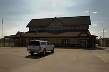 Terminal building | |||||||||||
| Summary | |||||||||||
| Airport type | Public | ||||||||||
| Operator | City of Quesnel | ||||||||||
| Location | Quesnel, British Columbia | ||||||||||
| Time zone | PST (UTC−08:00) | ||||||||||
| • Summer (DST) | PDT (UTC−07:00) | ||||||||||
| Elevation AMSL | 1,788 ft / 545 m | ||||||||||
| Coordinates | 53°01′34″N 122°30′37″W | ||||||||||
| Map | |||||||||||
 CYQZ Location in British Columbia | |||||||||||
| Runways | |||||||||||
| |||||||||||
| Statistics (2010) | |||||||||||
| |||||||||||
Airlines and destinations
| Airlines | Destinations |
|---|---|
| Central Mountain Air | Vancouver |
History
In approximately 1942 the aerodrome was listed as RCAF Aerodrome - Quesnel, British Columbia at 53°01′N 122°30′W with a variation of 27 degrees E and elevation of 1,775 feet (541 m). The aerodrome was listed as "Under construction" with one runway as follows: [4]
| Runway name | Length | Width | Surface |
|---|---|---|---|
| 12/3 | 6,100 feet (1,859 m) | 200 feet (61 m) | Hard surfaced |
See also
References
- Canada Flight Supplement. Effective 0901Z 16 July 2020 to 0901Z 10 September 2020.
- Synoptic/Metstat Station Information Archived June 27, 2013, at the Wayback Machine
- Total aircraft movements by class of operation
- Staff writer (c. 1942). Pilots Handbook of Aerodromes and Seaplane Bases Vol. 2. Royal Canadian Air Force. p. 151.
External links
| Wikimedia Commons has media related to Quesnel Airport. |
- Past three hours METARs, SPECI and current TAFs for Quesnel Airport from Nav Canada as available.
| By name | |
|---|---|
| By location indicator | |
| By province/territory | |
| By area | |
| National Airports System | |
| Related | |
| |
This article is issued from Wikipedia. The text is licensed under Creative Commons - Attribution - Sharealike. Additional terms may apply for the media files.