Shargole
Shargole is a medium-sized village and tehsil in Kargil district of the Indian union territory of Ladakh. The village is located 30 kilometres from district headquarters Kargil.
Shargole
Shargol | |
|---|---|
Tehsil and Village | |
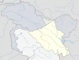 Shargole Location in Ladakh, India  Shargole Shargole (India) | |
| Coordinates: 34.39°N 76.30°E[1] | |
| Country | India |
| Union Territory | Ladakh |
| District | Kargil |
| Tehsil | Shargole[2] |
| Population (2011) | |
| • Total | 486[3] |
| Languages | |
| • Spoken | Ladakhi, Urdu |
| Time zone | UTC+5:30 (IST) |
| PIN | 194109 |
Demographics
According to the 2011 census of India, Shargole has 75 households.[4] The literacy rate of Shargole village is 77.67%. In Shargole, Male literacy stands at 88.39% while the female literacy rate was 65.48%.
| Total | Male | Female | |
|---|---|---|---|
| Population | 486 | 263 | 223 |
| Children aged below 6 years | 65 | 39 | 26 |
| Scheduled caste | 0 | 0 | 0 |
| Scheduled tribe | 486 | 263 | 223 |
| Literacy | 77.67% | 88.39% | 65.48% |
| Workers (all) | 215 | 117 | 98 |
| Main workers (all) | 69 | – | – |
| Marginal workers (total) | 146 | 54 | 92 |
Transport
Road
Shargole is connected to other places in Ladakh by the NH 1.
Rail
The nearest railway station to Shargole is Sopore railway station located at a distance of 250 kilometres. The nearest major railway station to Shargole is Jammu Tawi railway station located at a distance of 517 kilometres.
Air
The nearest airport is at Kargil located at a distance of 28 kilometres but it is currently non-operational. The next nearest major airport is Leh Airport located at a distance of 184 kilometres.
References
- "Shargole (Google Maps)". Google Maps. Retrieved 1 May 2020.
- "Villages in Kargil district". Kargil district website. Retrieved 1 May 2020.
- "Shargole Population". Our Hero. Retrieved 1 May 2020.
- "Shargole Population". Our Hero. Retrieved 1 May 2020.
| History |
| ||||||||||||||||||
|---|---|---|---|---|---|---|---|---|---|---|---|---|---|---|---|---|---|---|---|
| Administration | |||||||||||||||||||
| Geography |
| ||||||||||||||||||
| Human settlements | |||||||||||||||||||
| Culture |
| ||||||||||||||||||
| Tourism and wildlife |
| ||||||||||||||||||
| Transport |
| ||||||||||||||||||
| Infrastructure |
| ||||||||||||||||||
| See also |
| ||||||||||||||||||
