Alamosa River
The Alamosa River is a river in the southern part of the U.S. state of Colorado. It is about 64 miles (103 km) long,[2] flowing roughly east through the San Luis Valley. Its watershed comprises about 148 square miles (380 km2).
| Alamosa River | |
|---|---|
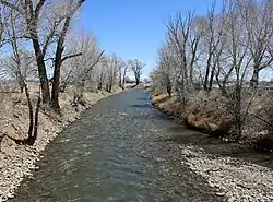 The river at Capulin. | |
| Etymology | "of cottonwood" |
| Location | |
| Country | United States |
| State | Colorado |
| Physical characteristics | |
| Source | |
| • coordinates | 37°21′44″N 106°37′12″W[1] |
| Mouth | Rio Grande |
• location | arid land south of Alamosa |
• coordinates | 37°23′54″N 106°50′20″W[1] |
| Length | 64 mi (103 km), west-east |
| Basin size | 148 sq mi (380 km2) |
The river's name means "shaded with cottonwoods" in Spanish.[3]
The river was affected by the Summitville mine disaster, the worst cyanide spill in United States history.
References
- U.S. Geological Survey Geographic Names Information System: Alamosa River
- U.S. Geological Survey. National Hydrography Dataset high-resolution flowline data. The National Map Archived 2012-04-05 at WebCite, accessed March 31, 2011
- Gannett, Henry (1905). The Origin of Certain Place Names in the United States. U.S. Government Printing Office. pp. 19.
External links

| Authority control |
|
|---|
This article is issued from Wikipedia. The text is licensed under Creative Commons - Attribution - Sharealike. Additional terms may apply for the media files.