Cheyenne Wells, Colorado
Cheyenne Wells is the statutory town that is the county seat and the most populous municipality of Cheyenne County, Colorado, United States.[8] The town population was 846 at the 2010 United States Census.[9]
Cheyenne Wells, Colorado | |
|---|---|
Statutory town | |
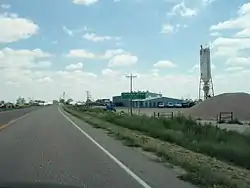 Cheyenne Wells (2011) | |
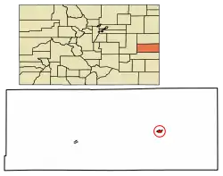 Location of Cheyenne Wells in Cheyenne County, Colorado. | |
| Coordinates: 38°49′09″N 102°21′07″W[1] | |
| Country | |
| State | |
| County | Cheyenne County Seat[2] |
| Incorporated | May 14, 1890[3] |
| Government | |
| • Type | Statutory Town[2] |
| Area | |
| • Total | 1.07 sq mi (2.77 km2) |
| • Land | 1.07 sq mi (2.77 km2) |
| • Water | 0.00 sq mi (0.00 km2) |
| Elevation | 4,291 ft (1,308 m) |
| Population (2010) | |
| • Total | 846 |
| • Estimate (2019)[6] | 828 |
| • Density | 773.83/sq mi (298.90/km2) |
| Time zone | UTC-7 (MST) |
| • Summer (DST) | UTC-6 (MDT) |
| ZIP Code | 80810[7] |
| Area code(s) | 719 |
| FIPS code | 08-14175 |
| GNIS feature ID | 0195261 |
| Website | townofcheyennewells |
History
The community was named for the fact Cheyenne Indians maintained water wells near the original town site.[10]
Geography
Cheyenne Wells is located at 38°49′16″N 102°21′13″W (38.821141, -102.353637).[11] According to the United States Census Bureau, the town has a total area of 1.0 square mile (2.6 km2), all land.
A small area about 10 miles southwest of Cheyenne Wells is antipodal, or globally opposite, to Île Saint-Paul, an island in the southern Indian Ocean.
Demographics
| Historical population | |||
|---|---|---|---|
| Census | Pop. | %± | |
| 1910 | 270 | — | |
| 1920 | 508 | 88.1% | |
| 1930 | 595 | 17.1% | |
| 1940 | 695 | 16.8% | |
| 1950 | 1,154 | 66.0% | |
| 1960 | 1,020 | −11.6% | |
| 1970 | 982 | −3.7% | |
| 1980 | 950 | −3.3% | |
| 1990 | 1,128 | 18.7% | |
| 2000 | 1,010 | −10.5% | |
| 2010 | 846 | −16.2% | |
| 2019 (est.) | 828 | [6] | −2.1% |
| U.S. Decennial Census[12] | |||
As of the census[13] of 2000, there were 1,010 people, 417 households, and 261 families residing in the town. The population density was 974.3 people per square mile (375.0/km2). There were 505 housing units at an average density of 487.2 per square mile (187.5/km2). The racial makeup of the town was 91.19% White, 0.99% African American, 0.79% Native American, 0.10% Asian, 6.44% from other races, and 0.50% from two or more races. Hispanic or Latino of any race were 9.90% of the population.
There were 417 households, out of which 33.3% had children under the age of 18 living with them, 53.5% were married couples living together, 6.5% had a female householder with no husband present, and 37.2% were non-families. 33.3% of all households were made up of individuals, and 13.7% had someone living alone who was 65 years of age or older. The average household size was 2.38 and the average family size was 3.08.
In the town, the population was spread out, with 27.2% under the age of 18, 8.1% from 18 to 24, 27.9% from 25 to 44, 20.8% from 45 to 64, and 15.9% who were 65 years of age or older. The median age was 38 years. For every 100 females, there were 100.0 males. For every 100 females age 18 and over, there were 99.7 males.
The median income for a household in the town was $36,563, and the median income for a family was $45,132. Males had a median income of $32,941 versus $23,077 for females. The per capita income for the town was $18,840. About 7.5% of families and 11.1% of the population were below the poverty line, including 12.4% of those under age 18 and 12.2% of those age 65 or over.
Economy
Tumbleweed Midstream owns the Ladder Creek Helium Plant near Cheyenne Wells. It is only one of fourteen Helium plants in the world.[14]
Infrastructure
Rail
The Union Pacific Railroad passes through Cheyenne Wells.
Highways
![]() U.S. Highway 40 passes through the community and follows roughly parallel to the railway.
U.S. Highway 40 passes through the community and follows roughly parallel to the railway.
Notable people
Notable individuals who were born in or have lived in Cheyenne Wells include:
- Nellie M. Payne (1900-1990), agricultural chemist, entomologist[15]
See also
- Outline of Colorado
- State of Colorado
- Colorado cities and towns
- Colorado municipalities
- Colorado counties
- Colorado cities and towns
References
- "2014 U.S. Gazetteer Files: Places". United States Census Bureau. July 1, 2014. Retrieved January 5, 2015.
- "Active Colorado Municipalities". State of Colorado, Department of Local Affairs. Archived from the original on 2009-12-12. Retrieved 2007-09-01.
- "Colorado Municipal Incorporations". State of Colorado, Department of Personnel & Administration, Colorado State Archives. 2004-12-01. Retrieved 2007-09-02.
- "2019 U.S. Gazetteer Files". United States Census Bureau. Retrieved July 1, 2020.
- "US Board on Geographic Names". United States Geological Survey. 2007-10-25. Retrieved 2008-01-31.
- "Population and Housing Unit Estimates". United States Census Bureau. May 24, 2020. Retrieved May 27, 2020.
- "ZIP Code Lookup". United States Postal Service. Archived from the original (JavaScript/HTML) on September 3, 2007. Retrieved September 5, 2007.
- "Find a County". National Association of Counties. Archived from the original on 2015-05-09. Retrieved 2011-06-07.
- "2010 City Population and Housing Occupancy Status". U.S. Census Bureau. Retrieved June 7, 2012.
- Dawson, John Frank (1954). Place names in Colorado: why 700 communities were so named, 150 of Spanish or Indian origin. Denver, CO: The J. Frank Dawson Publishing Co. p. 13.
- "US Gazetteer files: 2010, 2000, and 1990". United States Census Bureau. 2011-02-12. Retrieved 2011-04-23.
- "Census of Population and Housing". Census.gov. Retrieved June 4, 2015.
- "U.S. Census website". United States Census Bureau. Retrieved 2008-01-31.
- "Rising on the plains: This Colorado plant is one of a handful in the world to produce helium". The Denver Post. February 15, 2020. Archived from the original on February 23, 2020.
- "Nellie M. Payne, ESA Fellow (1940)". Entomological Society of America. Retrieved 2016-06-21.
External links
| Wikimedia Commons has media related to Cheyenne Wells, Colorado. |
Municipalities and communities of Cheyenne County, Colorado, United States | ||
|---|---|---|
| Towns | 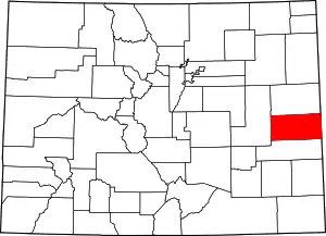 Map of Colorado highlighting Cheyenne County | |
| Unincorporated communities | ||
| ||
