Morgan County, Georgia
Morgan County is a county located in the north central Piedmont region of the U.S. state of Georgia. As of the 2010 census, the population was 21,218.[2] The county seat is Madison.[3]
Morgan County | |
|---|---|
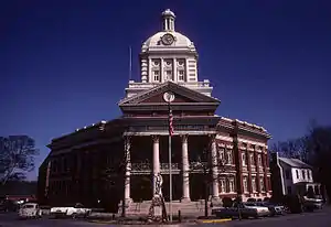 Morgan County Courthouse in Madison | |
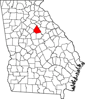 Location within the U.S. state of Georgia | |
 Georgia's location within the U.S. | |
| Coordinates: 33°35′N 83°29′W | |
| Country | |
| State | |
| Founded | December 10, 1807 |
| Seat | Madison |
| Largest city | Madison |
| Area | |
| • Total | 361 sq mi (930 km2) |
| • Land | 345 sq mi (890 km2) |
| • Water | 16 sq mi (40 km2) 4.4%% |
| Population | |
| • Estimate (2018) | 18,893[1] |
| • Density | 63/sq mi (24/km2) |
| Time zone | UTC−5 (Eastern) |
| • Summer (DST) | UTC−4 (EDT) |
| Congressional district | 10th |
Since the early 21st century, the county has had a housing boom. It has proximity to Lake Oconee, a recreation site, as well as to major employment centers such as Atlanta, Athens, and Macon.
History
Morgan County was created on December 10, 1807. It was named for renowned Revolutionary War commander Daniel Morgan. During the American Civil War, the county provided the Panola Guards, which was a part of Cobb's Legion.
Geography
According to the U.S. Census Bureau, the county has a total area of 355 square miles (920 km2), of which 347 square miles (900 km2) is land and 7.3 square miles (19 km2) (2.1%) is water.[4] The entirety of Morgan County is located in the Upper Oconee River sub-basin of the Altamaha River basin.[5]
Major highways
 Interstate 20
 U.S. Route 129
 U.S. Route 129 Bypass
 U.S. Route 278
 U.S. Route 278 Truck
 U.S. Route 441
- U.S. Route 441 Bypass
 State Route 12
- State Route 12 Truck
 State Route 24
 State Route 24 Bypass
 State Route 83
 State Route 186
 State Route 402 (unsigned designation for I-20)
Adjacent counties
- Oconee County (north)
- Greene County (east)
- Putnam County (southeast)
- Jasper County (southwest)
- Newton County (west)
- Walton County (northwest)
National protected area
- Oconee National Forest (part)
Demographics
| Historical population | |||
|---|---|---|---|
| Census | Pop. | %± | |
| 1810 | 8,369 | — | |
| 1820 | 13,520 | 61.5% | |
| 1830 | 12,046 | −10.9% | |
| 1840 | 9,121 | −24.3% | |
| 1850 | 10,744 | 17.8% | |
| 1860 | 9,997 | −7.0% | |
| 1870 | 10,696 | 7.0% | |
| 1880 | 14,032 | 31.2% | |
| 1890 | 16,041 | 14.3% | |
| 1900 | 15,813 | −1.4% | |
| 1910 | 19,717 | 24.7% | |
| 1920 | 20,143 | 2.2% | |
| 1930 | 12,488 | −38.0% | |
| 1940 | 12,713 | 1.8% | |
| 1950 | 11,899 | −6.4% | |
| 1960 | 10,280 | −13.6% | |
| 1970 | 9,904 | −3.7% | |
| 1980 | 11,572 | 16.8% | |
| 1990 | 12,883 | 11.3% | |
| 2000 | 15,457 | 20.0% | |
| 2010 | 17,868 | 15.6% | |
| 2018 (est.) | 18,893 | [6] | 5.7% |
| U.S. Decennial Census[7] 1790-1960[8] 1900-1990[9] 1990-2000[10] 2010-2013[2] | |||
2000 census
As of the census[11] of 2000, there were 15,457 people, 5,558 households, and 4,301 families living in the county. The population density was 17/km2 (44/mi2). There were 6,128 housing units at an average density of 7/km2 (18/mi2). The racial makeup of the county was 69.69% White, 28.53% Black or African American, 0.14% Native American, 0.33% Asian, 0.01% Pacific Islander, 0.41% from other races, and 0.89% from two or more races. 1.60% of the population were Hispanic or Latino of any race.
There were 5,558 households, out of which 34.80% had children under the age of 18 living with them, 58.90% were married couples living together, 14.60% had a female householder with no husband present, and 22.60% were non-families. 19.40% of all households were made up of individuals, and 7.80% had someone living alone who was 65 years of age or older. The average household size was 2.75 and the average family size was 3.15.
In the county, the population was spread out, with 26.60% under the age of 18, 7.80% from 18 to 24, 28.70% from 25 to 44, 24.50% from 45 to 64, and 12.50% who were 65 years of age or older. The median age was 37 years. For every 100 females there were 93.90 males. For every 100 females age 18 and over, there were 89.90 males.
The median income for a household in the county was $40,249, and the median income for a family was $46,146. Males had a median income of $34,634 versus $22,206 for females. The per capita income for the county was $18,823. About 8.90% of families and 10.90% of the population were below the poverty line, including 14.10% of those under age 18 and 9.60% of those age 65 or over.
2010 census
As of the 2010 United States Census, there were 17,868 people, 6,660 households, and 5,073 families living in the county.[12] The population density was 51.4 inhabitants per square mile (19.8/km2). There were 7,472 housing units at an average density of 21.5 per square mile (8.3/km2).[13] The racial makeup of the county was 72.7% white, 23.6% black or African American, 0.6% Asian, 0.3% American Indian, 1.6% from other races, and 1.3% from two or more races. Those of Hispanic or Latino origin made up 2.8% of the population.[12] In terms of ancestry, 16.8% were American, 12.5% were English, 11.4% were Irish, and 9.0% were German.[14]
Of the 6,660 households, 35.4% had children under the age of 18 living with them, 56.7% were married couples living together, 14.7% had a female householder with no husband present, 23.8% were non-families, and 20.7% of all households were made up of individuals. The average household size was 2.66 and the average family size was 3.06. The median age was 41.3 years.[12]
The median income for a household in the county was $45,817 and the median income for a family was $57,724. Males had a median income of $44,101 versus $30,133 for females. The per capita income for the county was $27,732. About 13.5% of families and 15.4% of the population were below the poverty line, including 17.9% of those under age 18 and 14.1% of those age 65 or over.[15]
Communities
Unincorporated
- Godfrey (ghost town)
- Pennington
Politics
| Year | Republican | Democratic | Third parties |
|---|---|---|---|
| 2020 | 70.3% 8,230 | 28.7% 3,355 | 1.0% 122 |
| 2016 | 69.2% 6,559 | 28.1% 2,663 | 2.7% 253 |
| 2012 | 68.4% 6,186 | 30.5% 2,753 | 1.1% 102 |
| 2008 | 65.3% 5,987 | 33.7% 3,091 | 1.0% 87 |
| 2004 | 67.6% 4,902 | 31.8% 2,304 | 0.6% 41 |
| 2000 | 59.7% 3,524 | 37.9% 2,238 | 2.4% 140 |
| 1996 | 45.9% 2,118 | 45.8% 2,111 | 8.3% 383 |
| 1992 | 40.3% 1,797 | 46.2% 2,057 | 13.5% 601 |
| 1988 | 58.1% 2,108 | 41.6% 1,508 | 0.3% 12 |
| 1984 | 57.3% 2,301 | 42.7% 1,714 | |
| 1980 | 36.0% 1,323 | 62.0% 2,276 | 2.0% 72 |
| 1976 | 28.5% 904 | 71.6% 2,274 | |
| 1972 | 75.0% 2,007 | 25.0% 668 | |
| 1968 | 20.7% 616 | 32.7% 973 | 46.7% 1,391 |
| 1964 | 47.3% 1,485 | 52.7% 1,654 | |
| 1960 | 20.0% 373 | 80.0% 1,488 | |
| 1956 | 14.2% 246 | 85.9% 1,492 | |
| 1952 | 13.0% 247 | 87.0% 1,649 | |
| 1948 | 8.2% 115 | 81.6% 1,147 | 9.7% 144 |
| 1944 | 4.2% 51 | 95.5% 1,166 | 0.3% 4 |
| 1940 | 4.7% 24 | 95.3% 484 | |
| 1936 | 3.2% 37 | 96.7% 1,130 | 0.2% 2 |
| 1932 | 7.4% 74 | 91.8% 923 | 0.9% 9 |
| 1928 | 20.6% 208 | 79.4% 803 | |
| 1924 | 16.4% 126 | 77.9% 598 | 5.7% 44 |
| 1920 | 28.1% 176 | 71.9% 450 | |
| 1916 | 7.6% 58 | 84.6% 643 | 7.8% 59 |
| 1912 | 6.2% 37 | 89.8% 537 | 4.0% 24 |
References
- "U.S. Census Bureau QuickFacts: Putnam County, Georgia". Census Bureau QuickFacts. Retrieved July 11, 2018.
- "State & County QuickFacts". United States Census Bureau. Archived from the original on July 17, 2011. Retrieved February 18, 2014.
- "Find a County". National Association of Counties. Retrieved June 7, 2011.
- "US Gazetteer files: 2010, 2000, and 1990". United States Census Bureau. February 12, 2011. Retrieved April 23, 2011.
- "Georgia Soil and Water Conservation Commission Interactive Mapping Experience". Georgia Soil and Water Conservation Commission. Retrieved November 19, 2015.
- "Population and Housing Unit Estimates". Retrieved July 31, 2019.
- "U.S. Decennial Census". United States Census Bureau. Retrieved June 24, 2014.
- "Historical Census Browser". University of Virginia Library. Retrieved June 24, 2014.
- "Population of Counties by Decennial Census: 1900 to 1990". United States Census Bureau. Retrieved June 24, 2014.
- "Census 2000 PHC-T-4. Ranking Tables for Counties: 1990 and 2000" (PDF). United States Census Bureau. Retrieved June 24, 2014.
- "U.S. Census website". United States Census Bureau. Retrieved May 14, 2011.
- "DP-1 Profile of General Population and Housing Characteristics: 2010 Demographic Profile Data". United States Census Bureau. Archived from the original on February 13, 2020. Retrieved December 30, 2015.
- "Population, Housing Units, Area, and Density: 2010 - County". United States Census Bureau. Archived from the original on February 13, 2020. Retrieved December 30, 2015.
- "DP02 SELECTED SOCIAL CHARACTERISTICS IN THE UNITED STATES – 2006-2010 American Community Survey 5-Year Estimates". United States Census Bureau. Archived from the original on February 13, 2020. Retrieved December 30, 2015.
- "DP03 SELECTED ECONOMIC CHARACTERISTICS – 2006-2010 American Community Survey 5-Year Estimates". United States Census Bureau. Archived from the original on February 13, 2020. Retrieved December 30, 2015.
- Leip, David. "Dave Leip's Atlas of U.S. Presidential Elections". uselectionatlas.org. Retrieved March 22, 2018.
Places adjacent to Morgan County, Georgia | ||||||||||
|---|---|---|---|---|---|---|---|---|---|---|
| ||||||||||
Municipalities and communities of Morgan County, Georgia, United States | ||
|---|---|---|
| Cities | Map of Georgia highlighting Morgan County | |
| Towns | ||
| Unincorporated communities | ||
| ||

| Authority control |
|---|