Jivdhan
Jivdhan (or Jeevdhan) is a hill fortress situated 1 km near the modern day town of Ghatghar in Junnar Taluka of Pune district in Maharashtra, India. The fort, which rises 1,145 meters (3,757 feet) above sea level, is located in the Sahyadri mountain range. The fort was looted and destroyed by the British upon siege between 1815 -1818 Jivdhan is a part of the 'Famous 5' trekking destinations among trekking enthusiasts. Chavaand, Hadsar, Shivneri, and Naneghat are the other destinations in the Famous 5 trek. This is a high difficulty grade trek due to the misleading jungle tracks and the necessity and knowledge of using climbing equipment. The rock cut steps are wonderfully carved, which lead to the kalyan gate. There are hooks attached on the walls of the rock cut steps near kalyan gate, which makes it easy for regular climber.
| Jivdhan Fort | |
|---|---|
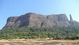 Jivdhan Fort from Naneghat | |
| Highest point | |
| Elevation | 3754 ft. [1] |
| Coordinates | 19°16′39″N 73°41′12″E |
| Naming | |
| English translation | जीवधन |
| Language of name | Marathi |
| Geography | |
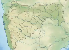 Jivdhan Fort Location of Jivdhan, Maharashtra | |
| Location | Nane Ghat, Maharashtra, India |
| Parent range | Western Ghats |
| Geology | |
| Mountain type | Hill Fort |
History
Forts originated during the Satavahana era. Every entry point on the forts built by Shivaji Maharaj have a 'Kalas' and Lord Ganesh carved on it. The nearby Naneghat (Toll collection booth) was used for commercial purpose by traders to help in easy movements of goods. As this was an important pass joining the seas to the mainland, it was heavily guarded from enemies. The Jivdhan fort stood as an important guard fort to protect the interests of various kingdoms. The last emperor of Adilshahi of Ahmednagar was little Murtaza. He was kept as a prisoner by Mughal at Jivdhan fort. In 1635 the father of Chatrapati Shivaji Mararaj, Shahaji maharaj released him from the prison and declared him as a King of Ahmednagar. Jivdhan to Naneghat has an open field of 2–3 km, which gives any clear indication of enemy approach. The British captured this fort in 1818 and destroyed all approaches. This fort was captured by Col. Prother of the East India company and later destroyed.
Major Features
Storehouses
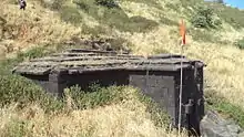
There are some unexplored storehouse atop the fort which can explored with proper precautions. There is a temple of Goddess at the top. The Main Gate and Kalyan gate are in good condition.
Water Tanks
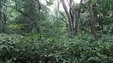
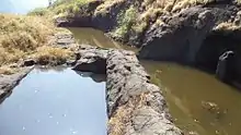
There are a few water tanks atop the fort, water from the tanks near Store house is not potable as they are open all the year round. The water from the rock cut cistern near the Kalyan Gate is potable. One should use caution while using this water for cooking food or drinking. The entire fort is covered with Prickly shrubs of Lepidagathis cuspidata or called as Kate adulsa in Marathi. The Malabar Giant squirrel or " Shekhru" is found in the forest at the foothills.
Pinnacle near the fort
This is about 385 feet high. When you approach the fort it looks smaller in size but as you move closer to the fort you can actually get a feel of how high the pinnacle is. This pinnacle is known as 'Vanderlingi'. This is surmountable with use of proper rock climbing equipment. It may take a day or 2 to climb the pinnacle. One needs to scout the area for beehives in order to climb with complete control.
North front
Once you are at the top of the fort you can view various hilltops and forts nearby. You will clearly see forts like Harishchandragad, Chavaand, Ratangad, Naneghat,Hadsar fort,Nimgiri fort, Manikdoh Dam and the entire Junnar plateau.
